Deanburn

Settlement in Midlothian

Scotland

Deanburn

River North Esk at Valleyfield, Penicuik Looking upstream where the river bends on its way alongside the housing development at Valleyfield, a former mill site.
River North Esk at Valleyfield, Penicuik Credit: Jim Barton

Deanburn is a small village located in Midlothian, Scotland. Situated approximately 12 miles south of Edinburgh, Deanburn is nestled in the beautiful countryside of the region. It is a quaint and peaceful village, known for its picturesque surroundings and close-knit community.

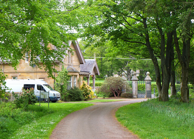
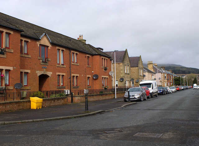
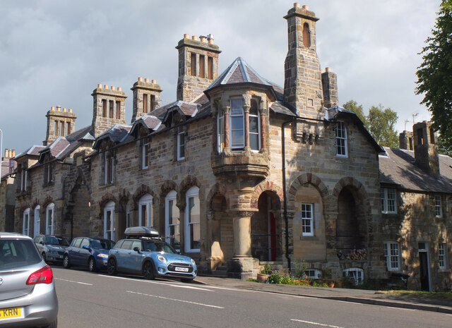
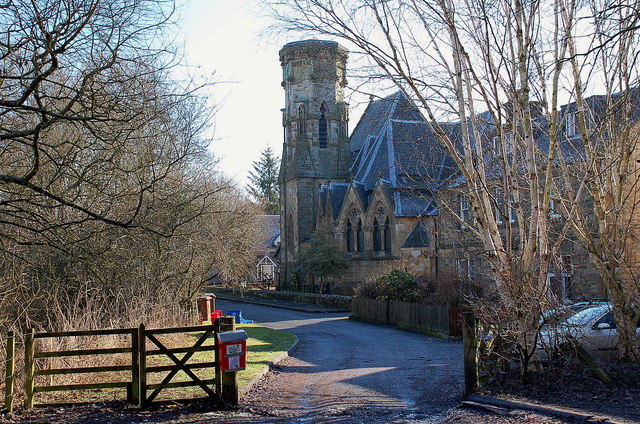
The village is primarily residential, with a small number of houses and cottages dotting the landscape. Most of the properties in Deanburn are traditional, reflecting the village's historical roots. The streets are lined with charming stone buildings, many of which have been well-preserved over the years.

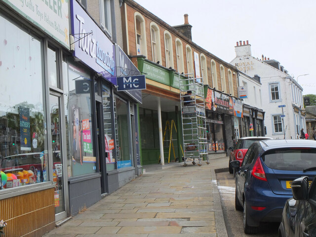
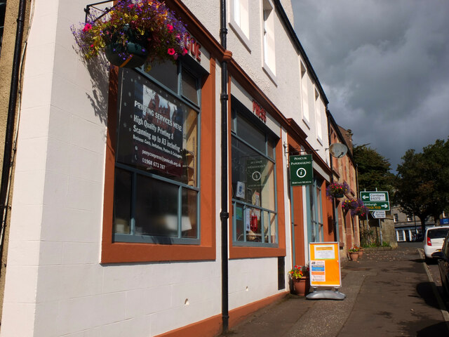
Despite its small size, Deanburn offers a range of amenities to its residents. There is a local convenience store where villagers can purchase daily necessities, as well as a post office for mailing and receiving packages. The village also has a community center which hosts various events and activities throughout the year, fostering a strong sense of community spirit.

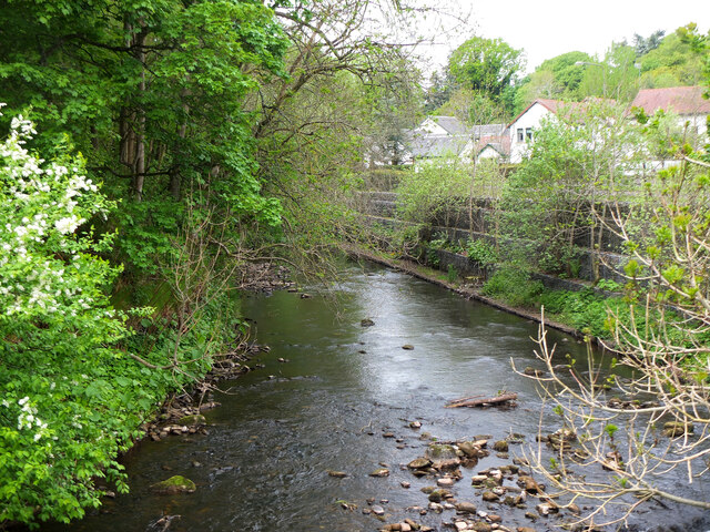
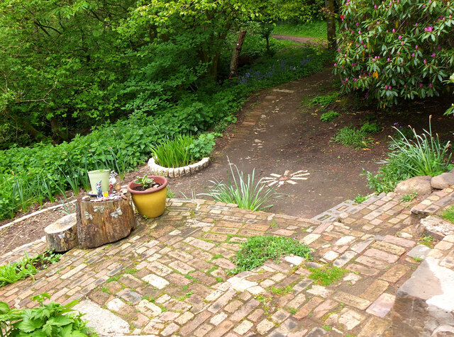
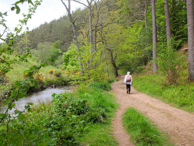
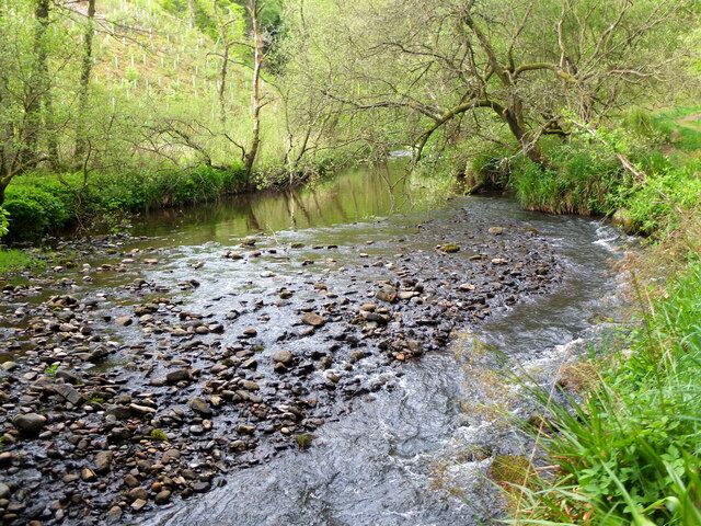
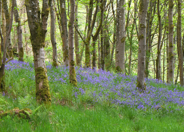
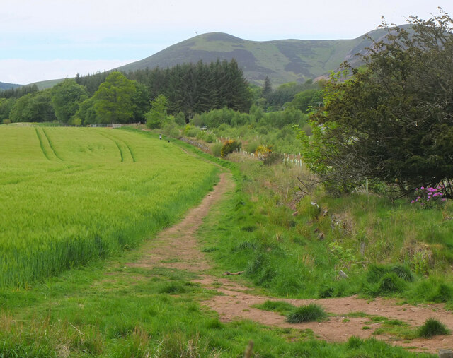
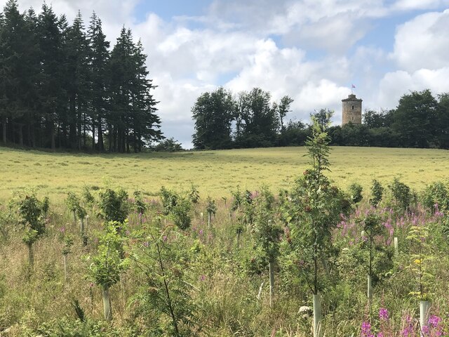
Nature lovers will find plenty to explore in and around Deanburn. The village is surrounded by rolling hills, lush green fields, and enchanting woodland areas. There are several walking and cycling trails that wind through the countryside, providing opportunities to soak in the area's natural beauty.

Overall, Deanburn is a charming village that offers a peaceful and idyllic lifestyle. Its close proximity to Edinburgh allows residents to enjoy the tranquility of rural living while still having access to the city's amenities and employment opportunities.

If you have any feedback on the listing, please let us know in the comments section below.

Deanburn Images

Images are sourced within 2km of 55.837948/-3.225947 or Grid Reference NT2361. Thanks to Geograph Open Source API. All images are credited.

River North Esk at Valleyfield, Penicuik Looking upstream where the river bends on its way alongside the housing development at Valleyfield, a former mill site.
River North Esk at Valleyfield, Penicuik
Looking upstream where the river bends on its way alongside the housing development at Valleyfield, a former mill site.
Decorated space, path to Penicuik Estate Brick steps and plant pots on the path by the North Esk from the A701 to Penicuik Estate grounds.
Decorated space, path to Penicuik Estate
Brick steps and plant pots on the path by the North Esk from the A701 to Penicuik Estate grounds.
Path by the North Esk, Penicuik A path on the north side of the river to the surroundings of Penicuik House.
Path by the North Esk, Penicuik
A path on the north side of the river to the surroundings of Penicuik House.
River North Esk near Penicuik The North Esk rises in the Pentland Hills above Carlops. It joins the South Esk, which starts life in the Lammermuir Hills, at Dalkeith.
River North Esk near Penicuik
The North Esk rises in the Pentland Hills above Carlops. It joins the South Esk, which starts life in the Lammermuir Hills, at Dalkeith.
Bluebells in Serpentine Wood, Penicuik
Farmland on Penicuik Estate South Black Hill is in the background.
Farmland on Penicuik Estate
South Black Hill is in the background.
Spear Gate Lodge, Penicuik Estate A lodge house where one of the estate access roads meets the A766.
Spear Gate Lodge, Penicuik Estate
A lodge house where one of the estate access roads meets the A766.
Shopfront refurbishment, Penicuik High Street The Penicuik Storehouse undergoing renovation as part of a programme to improve the appearance of shops in the town.
Shopfront refurbishment, Penicuik High Street
The Penicuik Storehouse undergoing renovation as part of a programme to improve the appearance of shops in the town.
Vaucluse Place, Penicuik A block of flats in Jackson Street.
Vaucluse Place, Penicuik
A block of flats in Jackson Street.
Field, Penicuik Estate The roadside conifers are long gone allowing a view of the folly.
Field, Penicuik Estate
The roadside conifers are long gone allowing a view of the folly.
Pen-y-Coe Press, Penicuik A long-established stationery and printing shop with an adjoining museum of papermaking in Bridge Street. In the early 19th century Penicuik became an important centre for papermaking, with mills along the River North Esk.
Pen-y-Coe Press, Penicuik
A long-established stationery and printing shop with an adjoining museum of papermaking in Bridge Street. In the early 19th century Penicuik became an important centre for papermaking, with mills along the River North Esk.
Parkend, Penicuik A striking corner terrace by the architect Thomas Pilkington c. 1860. He also designed the nearby Penicuik South Kirk and terraced cottages in the mill village of Walkerburn - see <a href="https://www.geograph.org.uk/photo/2231809">NT3537 : Millworkers' cottages, Walkerburn</a>.
Parkend, Penicuik
A striking corner terrace by the architect Thomas Pilkington c. 1860. He also designed the nearby Penicuik South Kirk and terraced cottages in the mill village of Walkerburn - see NT3537 : Millworkers' cottages, Walkerburn.
Demolition and rebuilding, Penicuik Old premises on Bridge Street are being demolished and construction appears to be the next step. The flag is flying from the Belgian Consulate on the corner with West Street - see also <a href="https://www.geograph.org.uk/photo/3332421">NT2359 : Belgian Consulate, Penicuik</a>.
Demolition and rebuilding, Penicuik
Old premises on Bridge Street are being demolished and construction appears to be the next step. The flag is flying from the Belgian Consulate on the corner with West Street - see also NT2359 : Belgian Consulate, Penicuik.
Papermaking Museum, Penicuik The museum is next door to the Pen-y-Coe Press on Bridge Street.  It is currently open on Saturday afternoons or at other times by arrangement for groups and entry is free. See the museum's website at <span class="nowrap"><a title="https://penicuikcdt.co.uk/index.php/penicuik-papermaking-heritage-museum/" rel="nofollow ugc noopener" href="https://penicuikcdt.co.uk/index.php/penicuik-papermaking-heritage-museum/">Link</a><img style="margin-left:2px;" alt="External link" title="External link - shift click to open in new window" src="https://s1.geograph.org.uk/img/external.png" width="10" height="10"/></span>.
Papermaking Museum, Penicuik
The museum is next door to the Pen-y-Coe Press on Bridge Street. It is currently open on Saturday afternoons or at other times by arrangement for groups and entry is free. See the museum's website at LinkExternal link.
Making paper by hand (1) Visitors to the Papermaking Museum at Penicuik have a chance to help make a sheet of paper. Pulp is caught on a rectangular mesh and carefully removed and transferred to the screw press to squeeze out the excess water.
Making paper by hand (1)
Visitors to the Papermaking Museum at Penicuik have a chance to help make a sheet of paper. Pulp is caught on a rectangular mesh and carefully removed and transferred to the screw press to squeeze out the excess water.
Making paper by hand (2) The process of making a sheet of paper from pulp being demonstrated at the Papermaking Museum, Penicuik. The sheet is being separated from its carrying cloth and is ready for drying.
Making paper by hand (2)
The process of making a sheet of paper from pulp being demonstrated at the Papermaking Museum, Penicuik. The sheet is being separated from its carrying cloth and is ready for drying.
Printing press demonstration A small press being demonstrated at the Papermaking Museum, Penicuik. The gear wheel carries the makers name 'Josiah Wade Ltd Halifax Eng.' It can be powered by a belt drive or, as here, by the treadle. Cases carrying the type letters can be seen to the right.
Printing press demonstration
A small press being demonstrated at the Papermaking Museum, Penicuik. The gear wheel carries the makers name 'Josiah Wade Ltd Halifax Eng.' It can be powered by a belt drive or, as here, by the treadle. Cases carrying the type letters can be seen to the right.
South Kirk, Penicuik The church has a very distinctive cylindrical tower, seen here from the small car park by the North Esk.
South Kirk, Penicuik
The church has a very distinctive cylindrical tower, seen here from the small car park by the North Esk.
Show me another place!

Deanburn is located at Grid Ref: NT2361 (Lat: 55.837948, Lng: -3.225947)

Unitary Authority: Midlothian

Police Authority: The Lothians and Scottish Borders

What 3 Words

///slid.touches.amphibian. Near Penicuik, Midlothian

Related Wikis

Mauricewood Colliery disaster

The Mauricewood Colliery Disaster, occurred at the Mauricewood pit, near Penicuik, Midlothian, Scotland on 5 September 1889. A total of 63 miners were...

Penicuik Athletic F.C.

Penicuik Athletic Football Club are a Scottish football club. They were formed in 1888 and are based at Montgomery Park (formerly known as Penicuik Park...

Penicuik Town Hall

Penicuik Town Hall, formerly the Cowan Institute, is a municipal building in the High Street, Penicuik, Midlothian, Scotland. The structure, which was...

Esk Bridge railway station

Esk Bridge railway station served the settlement of Esk Bridge, Midlothian, Scotland from 1874 to 1930 on the Penicuik Railway. == History == The station...

Nearby Amenities

Located within 500m of 55.837948,-3.225947
Traffic Signals
Lat/Long: 55.8359601/-3.2202969
Traffic Calming: hump
Lat/Long: 55.8364075/-3.2186719
Atm
Operator: Tesco
Source: survey
Lat/Long: 55.8355378/-3.2203318
Fast Food
The Penny Cook
Addr Housenumber: 3
Addr Postcode: EH26 8NP
Addr Street: Edinburgh Road
Fhrs Id: 158803
Source: survey
Source Addr: FHRS Open Data
Lat/Long: 55.834905/-3.220928
Traffic Calming: hump
Lat/Long: 55.8354441/-3.2259708
Traffic Calming: choker
Lat/Long: 55.8362968/-3.231953
Post Box
Ref: EH26 360
Lat/Long: 55.8377418/-3.2320477
Recycling
Lat/Long: 55.8376547/-3.2263539
Penicuik YMCA-YWCA
Addr City: Penicuick
Addr Housenumber: 58
Addr Postcode: EH26 0JJ
Addr Street: Queensway
Fhrs Id: 159090
Tourism: hostel
Website: http://www.penicuikymca-ywca.co.uk/
Lat/Long: 55.8371942/-3.2259239
Old Phone: +44 1968 876659
Removed Amenity: telephone
Lat/Long: 55.8380037/-3.2261712
Post Box
Post Box Type: lamp
Ref: EH26 266
Lat/Long: 55.8379108/-3.225784
Bus Stop
Royal Court
Bus: yes
Naptan AdministrativeAreaCode: 130
Naptan Area Name: Midlothian
Naptan AtcoAreaCode: 628
Naptan AtcoCode: 6280325280
Naptan Bearing: E
Naptan CommonName: Royal Court
Naptan Indicator: opp
Naptan Landmark: -
Naptan LocalityName: Deanburn
Naptan NaptanCode: 64324367
Naptan NptgLocalityCode: N0071917
Naptan SourceLocalityType: Add
Naptan StopAreaCode: 628G302380
Naptan StopAreaType: GPBS
Naptan StopArea Name: Royal Court
Naptan Street: Rullion Road
Naptan Verified: yes
Public Transport: platform
Source: NaPTAN + Survey
Lat/Long: 55.8378796/-3.2315109
Bus Stop
Royal Court
Bus: yes
Naptan AdministrativeAreaCode: 130
Naptan Area Name: Midlothian
Naptan AtcoAreaCode: 628
Naptan AtcoCode: 6280302380
Naptan Bearing: W
Naptan CommonName: Royal Court
Naptan Indicator: at
Naptan Landmark: -
Naptan LocalityName: Deanburn
Naptan NaptanCode: 64324365
Naptan NptgLocalityCode: N0071917
Naptan SourceLocalityType: Add
Naptan StopAreaCode: 628G302380
Naptan StopAreaType: GPBS
Naptan StopArea Name: Royal Court
Naptan Street: Rullion Road
Naptan Verified: yes
Public Transport: platform
Shelter: yes
Source: NaPTAN + Survey
Lat/Long: 55.8378839/-3.2305333
Fast Food
Jade Palace
Addr Housenumber: 5
Addr Postcode: EH26 8NP
Addr Street: Edinburgh Road
Cuisine: chinese
Fhrs Id: 158804
Phone: +44 1968 678 788
Source Addr: FHRS Open Data
Lat/Long: 55.8349954/-3.2208556
Old Phone: +44 1968 670083
Removed Amenity: telephone
Lat/Long: 55.8351383/-3.2209258
Bus Stop
East Queensway
Bus: yes
Naptan AdministrativeAreaCode: 130
Naptan Area Name: Midlothian
Naptan AtcoAreaCode: 628
Naptan AtcoCode: 6280302370
Naptan Bearing: NW
Naptan CommonName: East Queensway
Naptan Indicator: at
Naptan Landmark: -
Naptan LocalityName: Deanburn
Naptan NaptanCode: 64324293
Naptan NptgLocalityCode: N0071917
Naptan SourceLocalityType: Add
Naptan StopAreaCode: 628G325300
Naptan StopAreaType: GCLS
Naptan StopArea Name: Queensway
Naptan Street: Queensway
Naptan Verified: yes
Public Transport: platform
Source: NaPTAN + Survey
Lat/Long: 55.836328/-3.221719
Bus Stop
Queensway
Bin: yes
Bus: yes
Naptan AdministrativeAreaCode: 130
Naptan Area Name: Midlothian
Naptan AtcoAreaCode: 628
Naptan AtcoCode: 6280325300
Naptan Bearing: NE
Naptan CommonName: Queensway
Naptan Indicator: near
Naptan Landmark: Opp Tesco
Naptan LocalityName: Penicuik
Naptan NaptanCode: 64324358
Naptan NptgLocalityCode: ES002994
Naptan SourceLocalityType: Lo
Naptan StopAreaCode: 628G325300
Naptan StopAreaType: GCLS
Naptan StopArea Name: Queensway
Naptan Street: Edinburgh Road
Naptan Verified: yes
Passenger Information Display: yes
Public Transport: platform
Shelter: yes
Source: NaPTAN + Survey
Lat/Long: 55.8365149/-3.2199555
Deanburn
Place: suburb
Lat/Long: 55.8391412/-3.2293912
Bus Stop
Queensway
Bus: yes
Naptan AdministrativeAreaCode: 130
Naptan Area Name: Midlothian
Naptan AtcoAreaCode: 628
Naptan AtcoCode: 6280302440
Naptan Bearing: SW
Naptan CommonName: Queensway
Naptan Indicator: opp
Naptan Landmark: Tesco
Naptan LocalityName: Penicuik
Naptan NaptanCode: 64324357
Naptan NptgLocalityCode: ES002994
Naptan SourceLocalityType: Lo
Naptan StopAreaCode: 628G325300
Naptan StopAreaType: GCLS
Naptan StopArea Name: Queensway
Naptan Street: Edinburgh Road
Naptan Verified: yes
Passenger Information Display: yes
Public Transport: platform
Shelter: yes
Source: NaPTAN + Survey
Lat/Long: 55.835552/-3.2205137
Restaurant
Little Italy
Cuisine: italian
Lat/Long: 55.8348349/-3.2209871
Crossing
Crossing: uncontrolled
Crossing Island: yes
Kerb: lowered
Tactile Paving: yes
Lat/Long: 55.8353415/-3.2208604
Encee
Shop: hairdresser
Lat/Long: 55.8350917/-3.220782
Addr City: Penicuick
Addr Housenumber: 58
Addr Postcode: EH26 0JJ
Addr Street: Queensway
Entrance: yes
Lat/Long: 55.8372263/-3.226167
Post Box
Collection Times: Mo-Fr 09:00; Sa 07:00
Operator: Royal Mail
Post Box Type: lamp
Ref: EH26 8D
Royal Cypher: GVIR
Royal Cypher Wikidata: Q33102169
Lat/Long: 55.8344855/-3.227482
Pentland Bakery & Newsmarket
Addr City: Penicuik
Addr Country: GB
Addr Housenumber: 80A
Addr Postcode: EH26 0EE
Addr Street: Pentland Terrace
Fhrs Id: 158970
Shop: convenience
Lat/Long: 55.8341872/-3.226739
Post Box
Collection Times: Mo-Fr 17:15; Sa 12:00
Operator: Royal Mail
Post Box Type: pillar
Ref: EH26 144
Royal Cypher: GR
Royal Cypher Wikidata: Q33102273
Lat/Long: 55.8351648/-3.2208194
Car Wash
Payment Coins: yes
Lat/Long: 55.8346786/-3.2211396
Waste Basket
Lat/Long: 55.8355491/-3.2230694
Bus Stop
Terminus
Bin: yes
Bus: yes
Naptan AdministrativeAreaCode: 130
Naptan Area Name: Midlothian
Naptan AtcoAreaCode: 628
Naptan AtcoCode: 6280325290
Naptan Bearing: SE
Naptan CommonName: Terminus
Naptan Indicator: at
Naptan Landmark: Queensway Leisure Centre
Naptan LocalityName: Deanburn
Naptan NaptanCode: 64324287
Naptan NptgLocalityCode: N0071917
Naptan SourceLocalityType: Add
Naptan Street: Queensway
Naptan Verified: yes
Public Transport: platform
Shelter: yes
Source: NaPTAN + Survey
Lat/Long: 55.837984/-3.2261011
Give Way
Lat/Long: 55.8397292/-3.2190482
Give Way
Lat/Long: 55.8396455/-3.2227019
Give Way
Lat/Long: 55.8392471/-3.2218784
Give Way
Lat/Long: 55.8386473/-3.2208682
Give Way
Lat/Long: 55.8387577/-3.2183089
Entrance: service
Lat/Long: 55.8349983/-3.2200868
Crossing
Crossing: uncontrolled
Crossing Island: yes
Lat/Long: 55.8378082/-3.2263903
Give Way
Lat/Long: 55.8374245/-3.2251813
Give Way
Lat/Long: 55.8377667/-3.2260249
Give Way
Lat/Long: 55.8378766/-3.2258484
Give Way
Lat/Long: 55.837588/-3.2248725
Give Way
Lat/Long: 55.8373183/-3.2240216
Give Way
Lat/Long: 55.8370263/-3.2230621
Give Way
Lat/Long: 55.8367401/-3.2221527
Give Way
Lat/Long: 55.8365191/-3.2213343
Give Way
Lat/Long: 55.8363662/-3.2214142
Barrier: bollard
Lat/Long: 55.8357803/-3.2211547
Give Way
Lat/Long: 55.8382714/-3.2257453
Social Facility
Penicuik Family Learning Centre
Addr City: Penicuick
Addr Housenumber: 60
Addr Postcode: EH26 0JJ
Addr Street: Queensway
Fhrs Id: 157866
Old Name: Steping Forward
Operator: Midlothian Sure Start
Social Facility: outreach
Website: http://www.midlothiansurestart.org.uk/peflc/
Lat/Long: 55.8376749/-3.2269684
Addr City: Penicuick
Addr Housenumber: 60
Addr Postcode: EH26 0JJ
Addr Street: Queensway
Lat/Long: 55.8377391/-3.2269244
Traffic Calming: choker
Lat/Long: 55.8368879/-3.233348
Traffic Calming: choker
Lat/Long: 55.8365182/-3.2335264
Give Way
Lat/Long: 55.8373779/-3.231413
Give Way
Lat/Long: 55.8371718/-3.2312438
Give Way
Lat/Long: 55.8366162/-3.2312425
Give Way
Lat/Long: 55.8377999/-3.2314128
Give Way
Lat/Long: 55.8342467/-3.2292509
Give Way
Lat/Long: 55.8346994/-3.2296197
Traffic Calming: hump
Lat/Long: 55.8352431/-3.2274236
Traffic Calming: hump
Lat/Long: 55.8346544/-3.2300464
Traffic Calming: hump
Lat/Long: 55.8348493/-3.2290984
Traffic Calming: hump
Lat/Long: 55.8350422/-3.2281604
Traffic Calming: hump
Lat/Long: 55.8353041/-3.22519
Give Way
Lat/Long: 55.8344235/-3.2273448
Give Way
Lat/Long: 55.8352996/-3.2267057
Give Way
Lat/Long: 55.835316/-3.2254739
Give Way
Lat/Long: 55.8342439/-3.226462
Give Way
Lat/Long: 55.8341318/-3.2265662
Give Way
Lat/Long: 55.8350005/-3.2243599
Give Way
Lat/Long: 55.8339485/-3.2253462
Give Way
Lat/Long: 55.833832/-3.2254569
Give Way
Lat/Long: 55.8336072/-3.2241466
Give Way
Lat/Long: 55.8346939/-3.2231564
Give Way
Lat/Long: 55.8343662/-3.2218408
Traffic Calming: hump
Lat/Long: 55.8349804/-3.2240111
Traffic Calming: hump
Lat/Long: 55.8346881/-3.2229642
Crossing
Crossing: traffic_signals
Tactile Paving: yes
Lat/Long: 55.8360086/-3.2204674
Crossing
Crossing: traffic_signals
Tactile Paving: yes
Lat/Long: 55.8360784/-3.2201886
Crossing
Crossing: traffic_signals
Tactile Paving: yes
Lat/Long: 55.8359086/-3.220125
Crossing
Crossing: traffic_signals
Tactile Paving: yes
Lat/Long: 55.8358586/-3.2203897
Access: no
Door: hinged
Entrance: gate
Wheelchair: no
Lat/Long: 55.8412344/-3.2207295
Barrier: cycle_barrier
Lat/Long: 55.8399888/-3.2192913
The data included in this document is from www.openstreetmap.org. The data is made available under ODbL.

Have you been to Deanburn?

Leave your review of Deanburn below (or comments, questions and feedback).