The Rookery

Wood, Forest in Wiltshire

England

The Rookery

Pasture, Collingbourne Kingston Seen from the byway climbing onto the downs east of Brunton.
Pasture, Collingbourne Kingston Credit: Andrew Smith

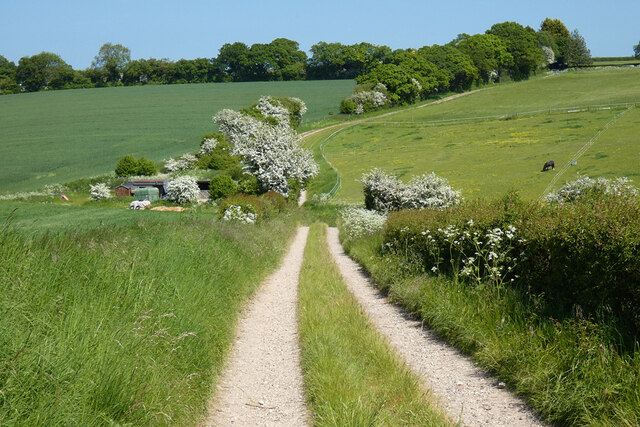
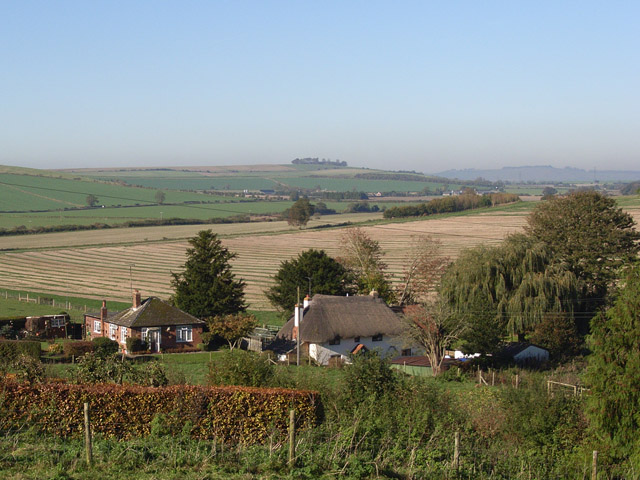
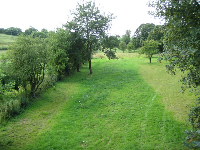
The Rookery, located in Wiltshire, England, is a picturesque woodland area encompassing approximately 100 acres. It is renowned for its dense forest, thriving wildlife, and serene atmosphere. The Rookery is situated within the larger West Woods, renowned for its bluebells that bloom in spring, creating a stunning carpet of vibrant colors.

The woodland is predominantly composed of oak and beech trees, which provide a rich habitat for a diverse range of flora and fauna. The dense canopy creates a shaded, tranquil environment, making it a popular retreat for nature enthusiasts, hikers, and birdwatchers. The Rookery is home to a variety of bird species, including woodpeckers, nightingales, and tawny owls, which can often be heard and spotted during walks along its well-marked trails.

The woodland is managed by the local conservation authority, ensuring the preservation of its natural beauty and biodiversity. Visitors to The Rookery can explore its numerous walking paths, some of which offer panoramic views of the surrounding countryside. The area is also home to a variety of native wildlife, such as deer, foxes, and squirrels, adding to its charm and appeal.

The Rookery is easily accessible, with ample parking facilities and well-maintained footpaths. The tranquility and beauty of this woodland make it an ideal destination for those seeking a peaceful retreat amidst nature. Whether it is simply to enjoy a leisurely stroll or to immerse oneself in the sights and sounds of the forest, The Rookery offers a truly enriching experience for all who visit.

If you have any feedback on the listing, please let us know in the comments section below.

The Rookery Images

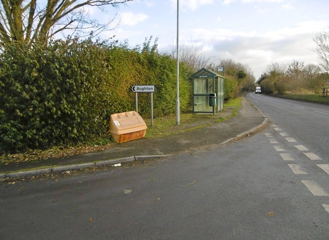
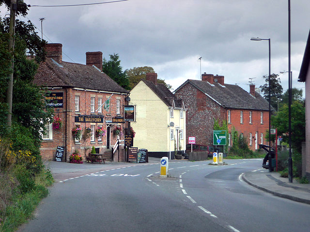
Images are sourced within 2km of 51.30261/-1.6506239 or Grid Reference SU2456. Thanks to Geograph Open Source API. All images are credited.

Pasture, Collingbourne Kingston Seen from the byway climbing onto the downs east of Brunton.
Pasture, Collingbourne Kingston
Seen from the byway climbing onto the downs east of Brunton.
Track and farmland, Collingbourne Ducis A bridleway climbing from Sunton approaches stables and pasture amid mostly arable farmland.
Track and farmland, Collingbourne Ducis
A bridleway climbing from Sunton approaches stables and pasture amid mostly arable farmland.
Collingbourne Kingston Village Hall On the lane to Brunton; complete with playground and playing field: <span class="nowrap"><a title="http://www.collingbournekingston.org.uk/VillageHallB.php" rel="nofollow ugc noopener" href="http://www.collingbournekingston.org.uk/VillageHallB.php">Link</a><img style="margin-left:2px;" alt="External link" title="External link - shift click to open in new window" src="https://s1.geograph.org.uk/img/external.png" width="10" height="10"/></span>
Collingbourne Kingston Village Hall
On the lane to Brunton; complete with playground and playing field: LinkExternal link
Collingbourne Kingston, St. Mary's Parish church overlooking Marlborough Road; dating from C13, listed by Historic England (Grade II*): <span class="nowrap"><a title="http://www.imagesofengland.org.uk/Details/Default.aspx?id=312359&mode=adv" rel="nofollow ugc noopener" href="http://www.imagesofengland.org.uk/Details/Default.aspx?id=312359&mode=adv">Link</a><img style="margin-left:2px;" alt="External link" title="External link - shift click to open in new window" src="https://s1.geograph.org.uk/img/external.png" width="10" height="10"/></span>
Collingbourne Kingston, St. Mary's
Parish church overlooking Marlborough Road; dating from C13, listed by Historic England (Grade II*): LinkExternal link
Collingbourne Kingston, Barleycorn Inn Public house with accommodation on Marlborough Road; early C19, listed by Historic England (Grade II): <span class="nowrap"><a title="http://www.imagesofengland.org.uk/Details/Default.aspx?id=312375&mode=adv" rel="nofollow ugc noopener" href="http://www.imagesofengland.org.uk/Details/Default.aspx?id=312375&mode=adv">Link</a><img style="margin-left:2px;" alt="External link" title="External link - shift click to open in new window" src="https://s1.geograph.org.uk/img/external.png" width="10" height="10"/></span> <span class="nowrap"><a title="http://www.barleycorninn.co.uk/" rel="nofollow ugc noopener" href="http://www.barleycorninn.co.uk/">Link</a><img style="margin-left:2px;" alt="External link" title="External link - shift click to open in new window" src="https://s1.geograph.org.uk/img/external.png" width="10" height="10"/></span>
Collingbourne Kingston, Barleycorn Inn
Public house with accommodation on Marlborough Road; early C19, listed by Historic England (Grade II): LinkExternal link LinkExternal link
Collingbourne Kingston, thatched cottages Norrie Cottage and Mayzells Cottage, on Marlborough Road; C17, listed by Historic England (Grade II): <span class="nowrap"><a title="http://www.imagesofengland.org.uk/Details/Default.aspx?id=312366&mode=adv" rel="nofollow ugc noopener" href="http://www.imagesofengland.org.uk/Details/Default.aspx?id=312366&mode=adv">Link</a><img style="margin-left:2px;" alt="External link" title="External link - shift click to open in new window" src="https://s1.geograph.org.uk/img/external.png" width="10" height="10"/></span>
Collingbourne Kingston, thatched cottages
Norrie Cottage and Mayzells Cottage, on Marlborough Road; C17, listed by Historic England (Grade II): LinkExternal link
Collingbourne Kingston, Mill Drove Lane from Marlborough Road to Parsonage Farm, becoming a byway towards Everleigh.
Collingbourne Kingston, Mill Drove
Lane from Marlborough Road to Parsonage Farm, becoming a byway towards Everleigh.
Collingbourne Kingston, Parsonage Farm Cattle farm on Mill Drove.
Collingbourne Kingston, Parsonage Farm
Cattle farm on Mill Drove.
Collingbourne Kingston, cattle shed At Parsonage Farm.
Collingbourne Kingston, cattle shed
At Parsonage Farm.
Collingbourne Kingston, farm road After Parsonage Farm, Mill Drove continues, to serve a barn, before becoming a byway heading towards Everleigh.
Collingbourne Kingston, farm road
After Parsonage Farm, Mill Drove continues, to serve a barn, before becoming a byway heading towards Everleigh.
Collingbourne Kingston, barn At the end of Mill Drove. Like others nearby, the barn is choc-a-bloc with straw.
Collingbourne Kingston, barn
At the end of Mill Drove. Like others nearby, the barn is choc-a-bloc with straw.
Collingbourne Kingston, byway Byway and farm road, the continuation of Mill Drove, heading towards Everleigh.
Collingbourne Kingston, byway
Byway and farm road, the continuation of Mill Drove, heading towards Everleigh.
Aughton, byway Across the downs, from Falstone Pond to Aughton.
Aughton, byway
Across the downs, from Falstone Pond to Aughton.
Aughton, byway Byway and farm road, across the downs to Aughton; silos at Aughton Farm in the distance.
Aughton, byway
Byway and farm road, across the downs to Aughton; silos at Aughton Farm in the distance.
Aughton, silos At Aughton Farm.
Aughton, silos
At Aughton Farm.
Aughton, bus shelter On A338; served by services from Marlborough to Ludgershall.
Aughton, bus shelter
On A338; served by services from Marlborough to Ludgershall.
Aughton, paddocks
Aughton, paddocks
Old Milestone by the A338, Aughton Carved stone post by the A338, in parish of COLLINGBOURNE KINGSTON (KENNET District), Aughton, northern edge of Collingbourne Kingston, just past lay-by, in bank under hedge, behind tarmac path, on West side of road. Marlborough gable, erected by the Marlborough & Salisbury Turnpike Trust in the 18th century. 

Inscription reads:-
To
Marlbro'
XII Miles
To
Andover XII
Carved bench mark and rivet on top. 

Grade II Listed. List Entry Number: 1180778
<span class="nowrap"><a title="https://historicengland.org.uk/listing/the-list/list-entry/1180778" rel="nofollow ugc noopener" href="https://historicengland.org.uk/listing/the-list/list-entry/1180778">Link</a><img style="margin-left:2px;" alt="External link" title="External link - shift click to open in new window" src="https://s1.geograph.org.uk/img/external.png" width="10" height="10"/></span>

Milestone Society National ID: WI_MLAV08.
Old Milestone by the A338, Aughton
Carved stone post by the A338, in parish of COLLINGBOURNE KINGSTON (KENNET District), Aughton, northern edge of Collingbourne Kingston, just past lay-by, in bank under hedge, behind tarmac path, on West side of road. Marlborough gable, erected by the Marlborough & Salisbury Turnpike Trust in the 18th century. Inscription reads:- To Marlbro' XII Miles To Andover XII Carved bench mark and rivet on top. Grade II Listed. List Entry Number: 1180778 LinkExternal link Milestone Society National ID: WI_MLAV08.
Show me another place!

The Rookery is located at Grid Ref: SU2456 (Lat: 51.30261, Lng: -1.6506239)

Unitary Authority: Wiltshire

Police Authority: Wiltshire

What 3 Words

///nurture.reply.atlas. Near Collingbourne Kingston, Wiltshire

Nearby Locations

The Rookery Brunton

Related Wikis

Brunton House

Brunton House is a Grade II* listed house in Brunton, Wiltshire, England. It dates from the late seventeenth or early eighteenth centuries and is of brick...

Brunton, Wiltshire

Brunton is a hamlet adjacent to the village of Collingbourne Kingston in Wiltshire, England. Records of Brunton's existence date back to the 10th century...

Collingbourne Kingston Halt railway station

Collingbourne Kingston Halt was a small railway station that served the village of Collingbourne Kingston in Wiltshire, England for less than 30 years...

Collingbourne Kingston

Collingbourne Kingston is a village and civil parish about 8 miles (13 km) south of the market town of Marlborough in Wiltshire, England. The village,...

Nearby Amenities

Located within 500m of 51.30261,-1.6506239
Brunton
Place: hamlet
Source: NPE
Wikidata: Q4979586
Lat/Long: 51.3060562/-1.649794
Post Box
Collection Times: Mo-Fr 09:00; Sa 07:00
Operator: Royal Mail
Operator Wikidata: Q638098
Post Box Type: lamp
Ref: SN8 40D
Royal Cypher: EIIR
Royal Cypher Wikidata: Q33102113
Lat/Long: 51.3055365/-1.6517714
Barrier: kissing_gate
Lat/Long: 51.3002113/-1.6566222
The data included in this document is from www.openstreetmap.org. The data is made available under ODbL.

Have you been to The Rookery?

Leave your review of The Rookery below (or comments, questions and feedback).