Wilverley Inclosure

Wood, Forest in Hampshire New Forest

England

Wilverley Inclosure

Signage at Wootton Bridge
Signage at Wootton Bridge Credit: Dave Thompson

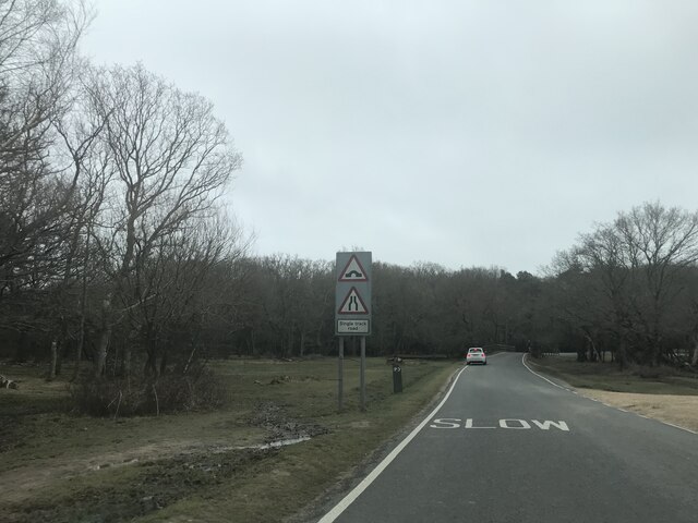
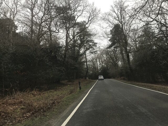
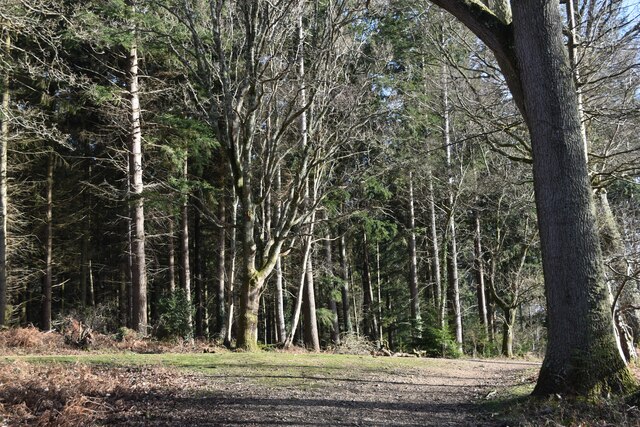
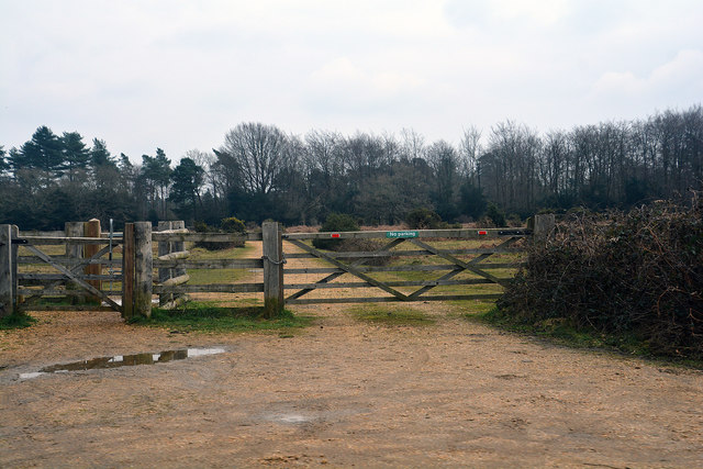
Wilverley Inclosure is a picturesque woodland located in Hampshire, England. Covering an area of approximately 100 hectares, it is a part of the larger New Forest National Park. The woodland is known for its diverse range of tree species, including oak, beech, and silver birch.

The history of Wilverley Inclosure dates back several centuries. It was originally established as a royal hunting ground in the 11th century and was later enclosed to create a managed forest. Today, it is managed by the Forestry Commission and serves as a popular recreational area for locals and tourists alike.

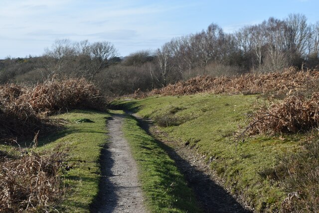
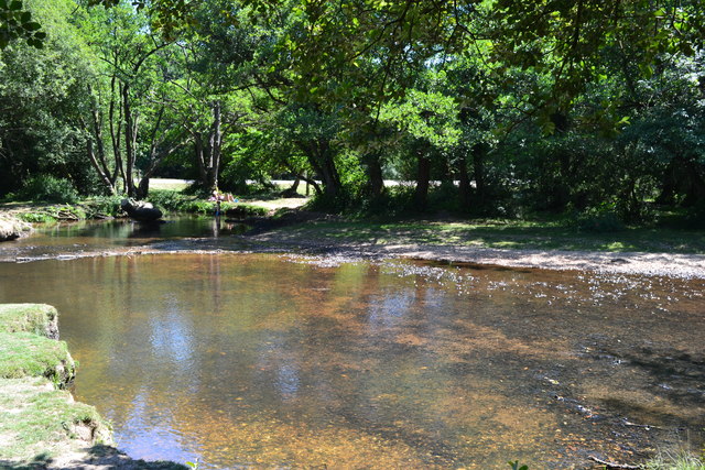
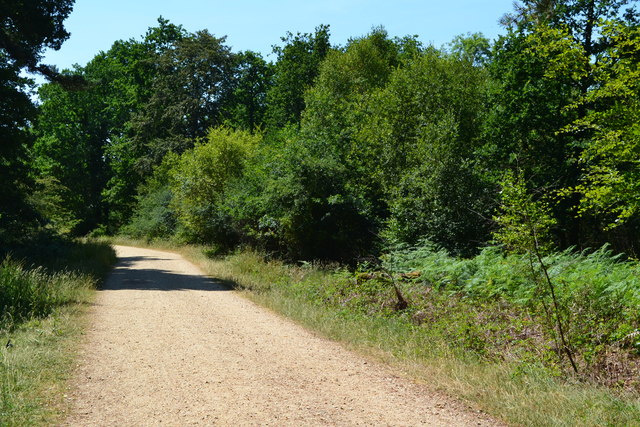
Visitors to Wilverley Inclosure can explore the woodland through a network of well-marked trails. These trails offer opportunities for hiking, cycling, and horse riding, allowing visitors to fully immerse themselves in the natural beauty of the area. The woodland is also home to a variety of wildlife, including deer, foxes, and a wide range of bird species, making it a popular destination for nature enthusiasts.

In addition to its natural beauty, Wilverley Inclosure also boasts several amenities for visitors. There is a large car park at the entrance, as well as picnic areas and toilet facilities. The woodland is also home to a charming café, where visitors can enjoy a hot drink or a light meal after a day of exploring.

Overall, Wilverley Inclosure is a stunning woodland that offers visitors a chance to reconnect with nature and enjoy the tranquility of the New Forest. Whether it's for a leisurely walk or an adventurous bike ride, this woodland provides a perfect escape from the hustle and bustle of everyday life.

If you have any feedback on the listing, please let us know in the comments section below.

Wilverley Inclosure Images

Images are sourced within 2km of 50.808923/-1.6543875 or Grid Reference SU2401. Thanks to Geograph Open Source API. All images are credited.

Signage at Wootton Bridge
Road beside Broadly Inclosure
Track near the campsite in Set Thorns Inclosure
Track out of woodland at Oaken Bottom
New Forest : Gate and Track A track heading off from the A35 and beyond the gate.
New Forest : Gate and Track
A track heading off from the A35 and beyond the gate.
Pool in the Avon Water by Wootton Bridge
Track in Wootton Coppice Inclosure
A35 View Looking along the A35 in the New Forest, Hampshire.
A35 View
Looking along the A35 in the New Forest, Hampshire.
Holmsley Station Holmsley Station was on the Brockenhurst to Wimborne line, part of 'Castleman's Corkscrew' the onetime LSWR main line from Southampton to Weymouth.  After closure in the 1960's the track became a road and the station became the Holmsley Tea Rooms.
Holmsley Station
Holmsley Station was on the Brockenhurst to Wimborne line, part of 'Castleman's Corkscrew' the onetime LSWR main line from Southampton to Weymouth. After closure in the 1960's the track became a road and the station became the Holmsley Tea Rooms.
Railway bridge at Yewtree Bottom An underbridge on the old Brockenhurst to Ringwood railway line at Yewtree Bottom.
Railway bridge at Yewtree Bottom
An underbridge on the old Brockenhurst to Ringwood railway line at Yewtree Bottom.
Bowl barrow on Wilverley Plain (Scales 1m) <span class="nowrap"><a title="https://historicengland.org.uk/listing/the-list/list-entry/1009030?section=official-listing" rel="nofollow ugc noopener" href="https://historicengland.org.uk/listing/the-list/list-entry/1009030?section=official-listing">Link</a><img style="margin-left:2px;" alt="External link" title="External link - shift click to open in new window" src="https://s1.geograph.org.uk/img/external.png" width="10" height="10"/></span>
Bowl barrow on Wilverley Plain
(Scales 1m) LinkExternal link
Bowl barrow west of Holmhill Bog (Scales 1m) <span class="nowrap"><a title="https://historicengland.org.uk/listing/the-list/list-entry/1012553?section=official-listing" rel="nofollow ugc noopener" href="https://historicengland.org.uk/listing/the-list/list-entry/1012553?section=official-listing">Link</a><img style="margin-left:2px;" alt="External link" title="External link - shift click to open in new window" src="https://s1.geograph.org.uk/img/external.png" width="10" height="10"/></span>
Bowl barrow west of Holmhill Bog
(Scales 1m) LinkExternal link
Car Park Entrance
Car Park Entrance
Junction in New Forest
Station Road View The view towards the A35 bridge in Hampshire.
Station Road View
The view towards the A35 bridge in Hampshire.
Benchmark, Markway Hill Detail of the flush bracket benchmark on the concrete Ordnance Survey triangulation pillar on Markway Hill. The flush bracket, benchmark number S2700, is on the southeast face of the pillar and marks a height of 63.8251m above mean sea level (Ordnance Datum Newlyn), last verified in 1959 (location photograph <a href="https://www.geograph.org.uk/photo/7354217">SU2402 : Triangulation Pillar, Markway Hill</a>).
Benchmark, Markway Hill
Detail of the flush bracket benchmark on the concrete Ordnance Survey triangulation pillar on Markway Hill. The flush bracket, benchmark number S2700, is on the southeast face of the pillar and marks a height of 63.8251m above mean sea level (Ordnance Datum Newlyn), last verified in 1959 (location photograph SU2402 : Triangulation Pillar, Markway Hill).
Triangulation Pillar, Markway Hill The concrete Ordnance Survey triangulation pillar on Markway Hill.
The flush bracket benchmark number S2700 on the southeast face of the pillar marks a height of 63.8251m above mean sea level (Ordnance Datum Newlyn) last verified in 1959 (detail photograph <a href="https://www.geograph.org.uk/photo/7354203">SU2402 : Benchmark, Markway Hill</a>).
Triangulation Pillar, Markway Hill
The concrete Ordnance Survey triangulation pillar on Markway Hill. The flush bracket benchmark number S2700 on the southeast face of the pillar marks a height of 63.8251m above mean sea level (Ordnance Datum Newlyn) last verified in 1959 (detail photograph SU2402 : Benchmark, Markway Hill).
Old Milestone by track on Scrape Bottom, Burley parish Carved stone post by the track, in parish of BURLEY (NEW FOREST District), Scrape Bottom, by the road, on North side of road. Burley tombstone, erected by an unknown authority in the 19th century. An earlier photograph can be found here <a title="https://www.geograph.org.uk/photo/6061147" href="https://www.geograph.org.uk/photo/6061147">Link</a>.

Inscription reads:-
TO
RINGWOOD
7
LYMINGTON
7
MILES
BURLEY
2

Milestone Society National ID: HA_RILY07
Old Milestone by track on Scrape Bottom, Burley parish
Carved stone post by the track, in parish of BURLEY (NEW FOREST District), Scrape Bottom, by the road, on North side of road. Burley tombstone, erected by an unknown authority in the 19th century. An earlier photograph can be found here Link. Inscription reads:- TO RINGWOOD 7 LYMINGTON 7 MILES BURLEY 2 Milestone Society National ID: HA_RILY07
Show me another place!

Wilverley Inclosure is located at Grid Ref: SU2401 (Lat: 50.808923, Lng: -1.6543875)

Administrative County: Hampshire

District: New Forest

Police Authority: Hampshire

What 3 Words

///quilt.newer.hologram. Near Burley, Hampshire

Nearby Locations

Wilverley Inclosure

Related Wikis

Holmsley railway station

Holmsley is a closed railway station in the county of Hampshire which served rural settlements in the New Forest. == History == The station was opened...

New Forest West (UK Parliament constituency)

New Forest West is a constituency represented in the House of Commons of the UK Parliament since 1997 by Desmond Swayne, a Conservative. == Constituency... ==

Wootton, New Forest

Wootton is a hamlet in the civil parish of New Milton in Hampshire, England. It is in the south of the New Forest. == Overview == Wootton is just north...

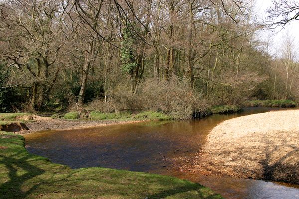
Avon Water, Hampshire

Avon Water is a small river draining some of the southwest of the New Forest in Hampshire to The Solent. West of the upper part of its archetypally dendritic...

Nearby Amenities

Located within 500m of 50.808923,-1.6543875
Lcn Ref: 226
Lat/Long: 50.8093137/-1.6605642
The data included in this document is from www.openstreetmap.org. The data is made available under ODbL.

Have you been to Wilverley Inclosure?

Leave your review of Wilverley Inclosure below (or comments, questions and feedback).