Blindyburn Plantation

Wood, Forest in Durham

England

Blindyburn Plantation

Enclosed ground east of Broomy Holm The farm at Broomy Holm lies north of the village of Edmondsley. The ground could be regarded as being a field but appears to be entirely uncultivated
Enclosed ground east of Broomy Holm Credit: Trevor Littlewood

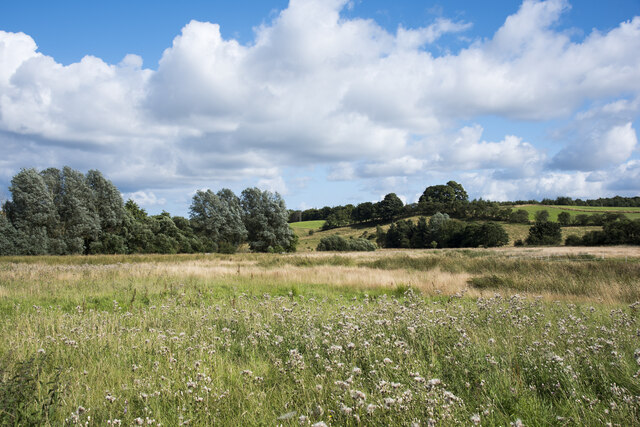
Blindyburn Plantation, located in Durham, England, is a picturesque woodland area known for its natural beauty and diverse ecosystem. Spanning over a vast area, the plantation is a popular destination for nature enthusiasts, hikers, and wildlife lovers.

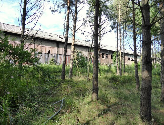
The plantation is predominantly covered by a dense forest, characterized by a variety of tree species, including oak, beech, birch, and pine, among others. These trees create a lush canopy that provides shelter to a plethora of wildlife, making it an ideal habitat for numerous bird species, small mammals, and insects.

Blindyburn Plantation is crisscrossed by a network of well-maintained trails, which allow visitors to explore the area at their own pace. The trails wind through the woodland, offering stunning views of the surrounding landscape and providing opportunities for visitors to immerse themselves in nature. The plantation is also home to a small river, which adds to the overall tranquility and natural charm of the area.

The plantation is well-managed and cared for by the local conservation authorities. Regular maintenance activities, such as tree thinning and controlled burns, are carried out to ensure the health and vitality of the forest. These efforts also help in preserving the diverse ecosystem and promoting the natural regeneration of the woodland.

Blindyburn Plantation is not only a haven for flora and fauna but also an important recreational space for the local community. Its accessibility, combined with its natural beauty, makes it a popular spot for leisurely walks, picnics, and family outings. The plantation truly offers a serene and immersive experience for anyone seeking solace in nature.

If you have any feedback on the listing, please let us know in the comments section below.

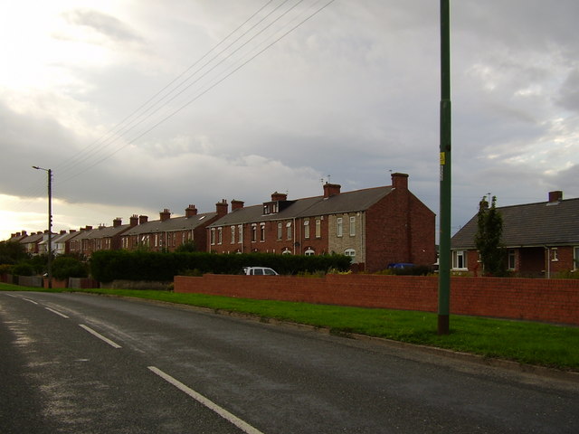
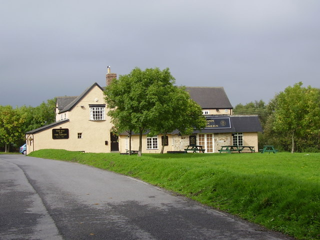
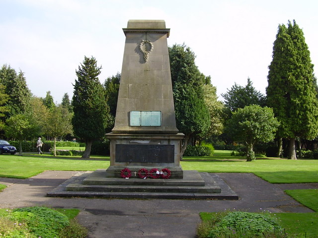
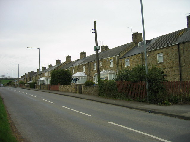
Blindyburn Plantation Images

Images are sourced within 2km of 54.861915/-1.6239122 or Grid Reference NZ2451. Thanks to Geograph Open Source API. All images are credited.

Enclosed ground east of Broomy Holm The farm at Broomy Holm lies north of the village of Edmondsley. The ground could be regarded as being a field but appears to be entirely uncultivated
Enclosed ground east of Broomy Holm
The farm at Broomy Holm lies north of the village of Edmondsley. The ground could be regarded as being a field but appears to be entirely uncultivated
Derelict Warehouse, Stella Gill This very long building was a National Coal Board warehouse. It was formerly part of the Stella Gill Coke Works and was retained when the remaining buildings on the site were demolished. It was subsequently used to store fertiliser but is now derelict and vandalised.
The trees in the foreground are on land previously occupied by railway tracks.
Derelict Warehouse, Stella Gill
This very long building was a National Coal Board warehouse. It was formerly part of the Stella Gill Coke Works and was retained when the remaining buildings on the site were demolished. It was subsequently used to store fertiliser but is now derelict and vandalised. The trees in the foreground are on land previously occupied by railway tracks.
Pelton War Memorial Pelton Parish Council launched a campaign in June 2018 to raise the funds required to create the memorial, which will sit in Pelton Cemetery, there are 28 War Graves Commission burials from the two world wars sited in the cemetery.
Darlington-based master stonemason David France was commissioned to create the memorial, which features a cross, a steel soldier’s helmet and a steel poppy on the front. The monument is made from a 12.5 tonne piece of sandstone taken from the Witton Fell quarry at Leyburn in North Yorkshire.
An official dedication and unveiling ceremony led by Reverend John Lintern, vicar of Pelton Holy Trinity Church took place on 20th October 2019.
The steel helmet is a copy of the Brodie helmet worn by Tommies during World War 1. The helmet was designed by Latvian, Leopold Janno Braude, anglicized to John Leopold Brodie. It was designed to protect the soldier from shrapnel shell projectiles bursting from above the trenches rather than direct rifle shots. By the end of the First World War around nine million of these 'tin hats' has been made.
Pelton War Memorial
Pelton Parish Council launched a campaign in June 2018 to raise the funds required to create the memorial, which will sit in Pelton Cemetery, there are 28 War Graves Commission burials from the two world wars sited in the cemetery. Darlington-based master stonemason David France was commissioned to create the memorial, which features a cross, a steel soldier’s helmet and a steel poppy on the front. The monument is made from a 12.5 tonne piece of sandstone taken from the Witton Fell quarry at Leyburn in North Yorkshire. An official dedication and unveiling ceremony led by Reverend John Lintern, vicar of Pelton Holy Trinity Church took place on 20th October 2019. The steel helmet is a copy of the Brodie helmet worn by Tommies during World War 1. The helmet was designed by Latvian, Leopold Janno Braude, anglicized to John Leopold Brodie. It was designed to protect the soldier from shrapnel shell projectiles bursting from above the trenches rather than direct rifle shots. By the end of the First World War around nine million of these 'tin hats' has been made.
Holy Trinity Church, Pelton Built from 1841-2 by G. Jackson.
Holy Trinity Church, Pelton
Built from 1841-2 by G. Jackson.
Fire Station High Handenhold High Handenhold Fire Station was opened on 9th October 1997 and provides fire and rescue cover for approximately 89 sq km (34.5 sq m) bordering with Tyne and Wear Metropolitan Fire Brigade.
Fire Station High Handenhold
High Handenhold Fire Station was opened on 9th October 1997 and provides fire and rescue cover for approximately 89 sq km (34.5 sq m) bordering with Tyne and Wear Metropolitan Fire Brigade.
Fox and Parrot Wood Nature Reserve This nature reserve is owned by the Woodland Trust
Fox and Parrot Wood Nature Reserve
This nature reserve is owned by the Woodland Trust
Grange Villa, Stone Row
Primitive Methodist Chapel Grange Villa Built in 1877
Primitive Methodist Chapel Grange Villa
Built in 1877
West Pelton, Co. Durham, St Paul's Church
Newfield Inn
Newfield Inn
Bridge carrying CtoC cycle path and underpass the bus is the 809 to Chester le Street
Bridge carrying CtoC cycle path and underpass
the bus is the 809 to Chester le Street
Station Lane from Pelton Front Street
Grange Terrace, Pelton Fell
Inn on the Green Waldridge Village near Chester le Street County Durham
Inn on the Green Waldridge Village
near Chester le Street County Durham
Waldridge Village
Waldridge Village
Eden Hill Vets West Pelton County Durham
Pelton Fell Memorial Park
Cenotaph Pelton Fell Memorial Park
Show me another place!

Blindyburn Plantation is located at Grid Ref: NZ2451 (Lat: 54.861915, Lng: -1.6239122)

Unitary Authority: County Durham

Police Authority: Durham

What 3 Words

///digits.closet.intend. Near Pelton, Co. Durham

Related Wikis

Roseberry College

Roseberry College and Sixth Form was a state-funded secondary school and sixth form in County Durham, England, founded in 1963 and closed in 2014. The...

Newfield, Chester-le-Street

Newfield is a village in County Durham, England. It lies west of the town of Chester-le-Street, and falls partly within the civil parish of Pelton. In...

Grange Villa

Grange Villa is a village situated in County Durham, England. It is located between the towns of Stanley and Chester-le-Street. == History == Grange Villa...

Pelton railway station

Pelton railway station served the village of Pelton, County Durham, England, from 1860 to 1955 on the Stanhope and Tyne Railway. == History == The first...

Pelton Fell

Pelton Fell is a village in County Durham, UK == History == On the place of the current Pelton Fell, the Miner's Institute was built in 1889 and later...

Pelton, County Durham

Pelton is a village and electoral ward in County Durham, in England. The population of the village and ward taken at the 2011 census was 8,250. It is located...
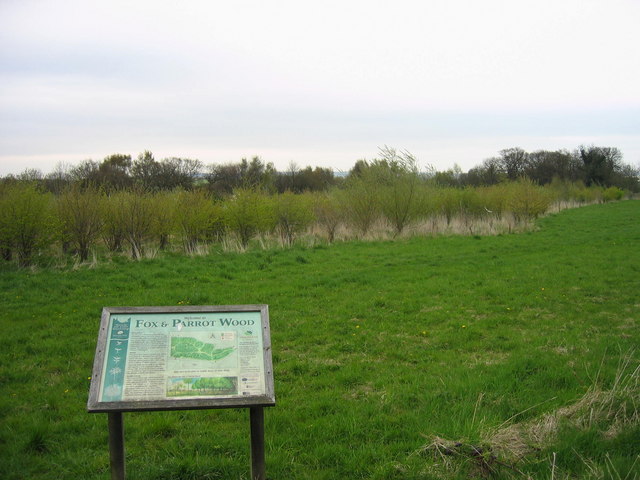
Fox & Parrot Wood

Fox & Parrot Wood is a broadleaf woodland in County Durham, England, about 4 miles (6 km) west of Chester-le-Street. It is situated just north of the B6313...

Perkinsville, County Durham

Perkinsville is a village in County Durham, in England. It is situated immediately to the north of Pelton, to the north-west of Chester-le-Street. There...

Nearby Amenities

Located within 500m of 54.861915,-1.6239122
Bus Stop
North View
Bench: yes
Bin: no
Bus: yes
Lit: yes
Naptan AtcoCode: 13002169D
Naptan Bearing: SE
Naptan CommonName: North View
Naptan Indicator: south east bound
Naptan Landmark: Landmark not known
Naptan NaptanCode: duramgaw
Naptan Notes: Opposite 4 North View- Front Street- Newfield- W of Chester-Le-Street
Naptan Street: Front Street
Naptan Verified: yes
Public Transport: platform
Shelter: yes
Source: naptan_import
Tactile Paving: no
Lat/Long: 54.8641404/-1.6188389
Bus Stop
North View
Bench: yes
Bin: no
Bus: yes
Lit: yes
Naptan AtcoCode: 13002169H
Naptan Bearing: NW
Naptan CommonName: North View
Naptan Indicator: north west bound
Naptan Landmark: Landmark not known
Naptan NaptanCode: duramgda
Naptan Notes: In front of 8 North View- Front Street- Newfield- W of Chester-Le-Street
Naptan Street: Front Street
Naptan Verified: no
Public Transport: platform
Shelter: no
Source: naptan_import
Tactile Paving: no
Lat/Long: 54.864187/-1.6192325
Bus Stop
Inn
Bench: no
Bin: yes
Bus: yes
Lit: yes
Naptan AtcoCode: 13002170D
Naptan Bearing: SE
Naptan CommonName: Inn
Naptan Indicator: south east bound
Naptan Landmark: Landmark not known
Naptan NaptanCode: duramgdg
Naptan Notes: Opposite Newfield Inn (PH) on Front Street- near junction with Pelton Lane- Newfield- W of Ches
Naptan Street: Newfield Terrace
Naptan Verified: no
Public Transport: platform
Shelter: yes
Source: naptan_import
Tactile Paving: no
Lat/Long: 54.8660987/-1.6234494
Bus Stop
Inn
Bench: no
Bin: no
Bus: yes
Lit: yes
Naptan AtcoCode: 13002170H
Naptan Bearing: NW
Naptan CommonName: Inn
Naptan Indicator: north west bound
Naptan Landmark: Landmark not known
Naptan NaptanCode: duramgdj
Naptan Notes: Just N of Newfield Inn (PH) on Front Street- near junction with Pelton Lane- Newfield- W of Che
Naptan Street: Newfield Terrace
Naptan Verified: no
Public Transport: platform
Shelter: no
Source: naptan_import
Tactile Paving: no
Lat/Long: 54.8660624/-1.6236777
Power: pole
Lat/Long: 54.8583342/-1.6208181
Power: pole
Lat/Long: 54.8620063/-1.6176657
Material: wood
Power: pole
Lat/Long: 54.8633028/-1.6165354
Power: pole
Lat/Long: 54.8607438/-1.6187277
Power: pole
Lat/Long: 54.8580912/-1.6249814
Power: pole
Lat/Long: 54.8585594/-1.6237335
Power: pole
Lat/Long: 54.859083/-1.6223953
Power: pole
Lat/Long: 54.8595601/-1.6211098
Power: pole
Lat/Long: 54.860011/-1.619888
Power: pole
Lat/Long: 54.8608473/-1.6191806
Power: pole
Lat/Long: 54.8621/-1.6181175
Material: wood
Power: pole
Lat/Long: 54.8628319/-1.6175045
Material: wood
Power: pole
Lat/Long: 54.8634439/-1.6169528
Noexit: yes
Lat/Long: 54.864703/-1.6186516
Noexit: yes
Lat/Long: 54.8659487/-1.6213137
Traffic Calming: cushion
Lat/Long: 54.8646082/-1.6200955
Traffic Calming: cushion
Lat/Long: 54.8657563/-1.6244317
Traffic Calming: cushion
Lat/Long: 54.8656597/-1.6225866
Traffic Calming: cushion
Lat/Long: 54.8651207/-1.6213135
Fast Food
Hungry Hut
Addr City: Chester-le-Street
Addr Housenumber: 1a
Addr Postcode: DH2 2SY
Addr Street: Hares Buildings
Addr Village: Newfield
Cuisine: sandwich
Fhrs Id: 731130
Image: https://www.geograph.org.uk/photo/6243996
Lat/Long: 54.8658553/-1.6245
Power: pole
Lat/Long: 54.8575454/-1.6251853
Power: pole
Lat/Long: 54.8577924/-1.6240132
Power: pole
Lat/Long: 54.8581267/-1.6224106
Power: pole
Lat/Long: 54.8584656/-1.6207919
Power: pole
Lat/Long: 54.8588068/-1.6191906
Power: pole
Lat/Long: 54.85906/-1.6202152
Power: pole
Lat/Long: 54.8597902/-1.6195929
Newfield
Place: village
Wikidata: Q7017769
Wikipedia: en:Newfield, Chester-le-Street
Lat/Long: 54.8659032/-1.6234661
Generator Method: photovoltaic
Generator Source: solar
Generator Type: solar_photovoltaic_panel
Location: roof
Power: generator
Lat/Long: 54.8657242/-1.6223556
Generator Method: photovoltaic
Generator Source: solar
Generator Type: solar_photovoltaic_panel
Location: roof
Power: generator
Lat/Long: 54.8654433/-1.6225648
Generator Method: photovoltaic
Generator Source: solar
Generator Type: solar_photovoltaic_panel
Location: roof
Power: generator
Lat/Long: 54.8653422/-1.6223368
Generator Method: photovoltaic
Generator Source: solar
Generator Type: solar_photovoltaic_panel
Location: roof
Power: generator
Lat/Long: 54.864771/-1.6214128
Generator Method: photovoltaic
Generator Source: solar
Generator Type: solar_photovoltaic_panel
Location: roof
Power: generator
Lat/Long: 54.8657142/-1.6209246
Generator Method: photovoltaic
Generator Source: solar
Generator Type: solar_photovoltaic_panel
Location: roof
Power: generator
Lat/Long: 54.8656021/-1.6208375
Noexit: yes
Lat/Long: 54.8648282/-1.6212586
Noexit: yes
Lat/Long: 54.8659311/-1.6220431
Noexit: yes
Lat/Long: 54.8658508/-1.6222081
Noexit: yes
Lat/Long: 54.8658485/-1.6203399
Noexit: yes
Lat/Long: 54.8657674/-1.620409
Crossing
Crossing: unmarked
Crossing Island: no
Tactile Paving: yes
Lat/Long: 54.8644936/-1.6194402
Noexit: yes
Lat/Long: 54.8658998/-1.6213062
Post Box
Brand: Royal Mail
Brand Wikidata: Q638098
Collection Times: Mo-Fr 16:15; Sa 10:30
Operator: Royal Mail
Operator Wikidata: Q638098
Ref: DH2 222
Royal Cypher: EIIR
Royal Cypher Wikidata: Q33102113
Lat/Long: 54.8650493/-1.6212767
NPA Motor Factors
Addr City: Chester-le-Street
Addr Postcode: DH2 2SR
Phone: +44 191 3701 1410
Shop: car_parts
Website: https://npamotorfactors.co.uk/
Lat/Long: 54.8657605/-1.6236256
Noexit: yes
Lat/Long: 54.8656528/-1.6248547
Fast Food
The Newfield Sarnie Shop
Addr City: Chester-le-Street
Addr Housenumber: 6
Addr Postcode: DH2 2SL
Addr Street: Front Street
Addr Village: Newfield
Cuisine: sandwich
Fhrs Id: 1422085
Phone: +44 191 370 2231
Lat/Long: 54.8649505/-1.6212022
Addr City: Chester-le-Street
Addr Housenumber: 1
Addr Postcode: DH2 2SL
Addr Street: Front Street
Shop: yes
Lat/Long: 54.8648011/-1.6208267
Noexit: yes
Lat/Long: 54.8658327/-1.6233976
Entrance: main
Lat/Long: 54.8658259/-1.6236285
The data included in this document is from www.openstreetmap.org. The data is made available under ODbL.

Have you been to Blindyburn Plantation?

Leave your review of Blindyburn Plantation below (or comments, questions and feedback).