Birchin Wood

Wood, Forest in Derbyshire Derbyshire Dales

England

Birchin Wood

Footpath steps climbing out of Hurst Clough This is the start of an old field path into Bamford. When Bamford Filters waterworks was constructed, the path had to be diverted around the perimeter. The area is also much more wooded than it once was.
Footpath steps climbing out of Hurst Clough Credit: Ian Calderwood

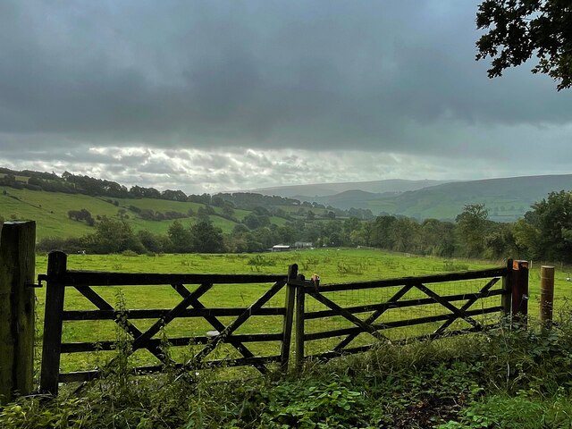
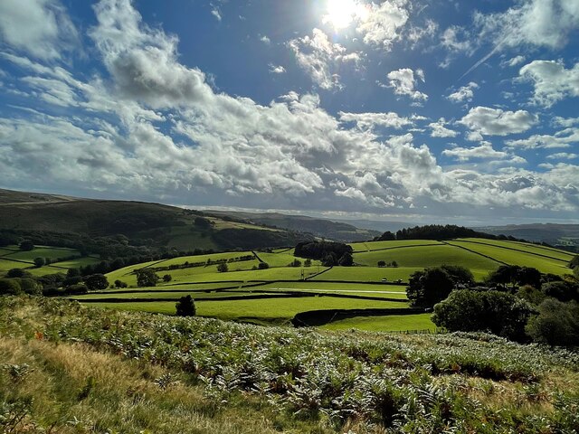
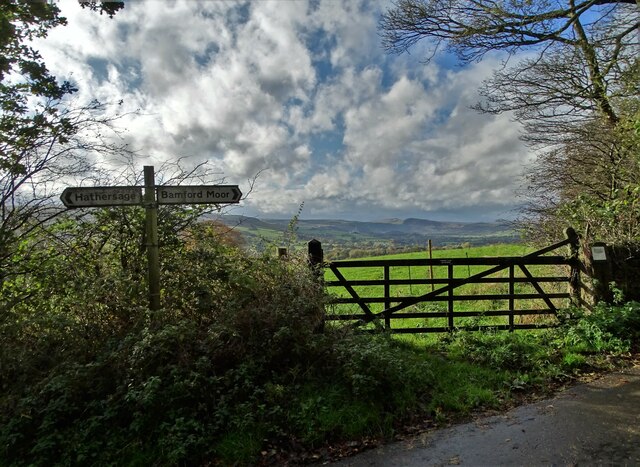
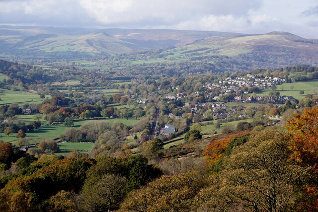
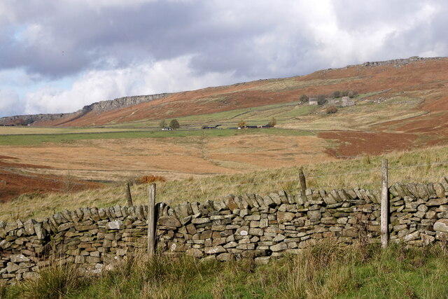
Birchin Wood is a picturesque woodland located in Derbyshire, England. Covering an area of approximately 100 hectares, it is a popular destination for nature lovers and outdoor enthusiasts. The wood is situated in close proximity to the village of Birchinwood and is easily accessible by car or foot.

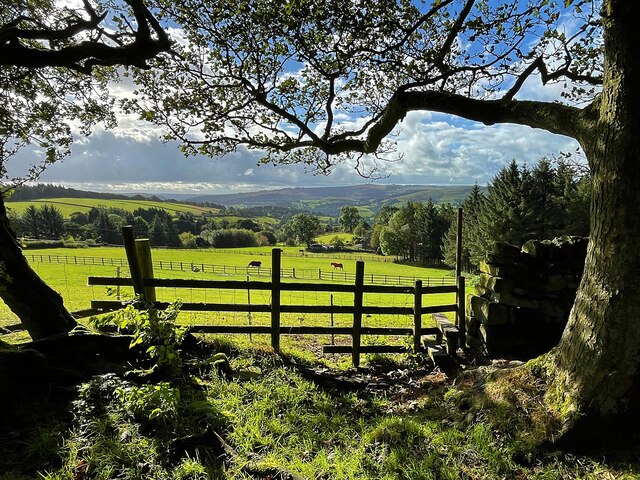
The woodland is predominantly made up of broadleaf trees, including oak, beech, and birch, which create a rich and diverse habitat for a variety of wildlife. Visitors to Birchin Wood can expect to encounter an array of bird species, such as woodpeckers and owls, as well as small mammals like squirrels and hedgehogs.

Wandering through the wood, visitors will find a network of well-maintained footpaths, allowing for peaceful strolls and exploration. There are also designated picnic areas and benches scattered throughout, providing opportunities for visitors to relax and enjoy the natural surroundings.

Birchin Wood is particularly renowned for its stunning display of bluebells in the springtime. The forest floor becomes a vibrant carpet of purple and blue, creating a truly magical atmosphere. This spectacle attracts many photographers and nature enthusiasts who are captivated by the beauty of this natural phenomenon.

Managed by the local authorities, Birchin Wood is carefully maintained to preserve its natural beauty and protect the wildlife that resides within it. The wood is open to the public year-round, providing a tranquil escape from the hustle and bustle of everyday life. Whether it's for a leisurely walk, a picnic, or simply to appreciate the beauty of nature, Birchin Wood offers something for everyone.

If you have any feedback on the listing, please let us know in the comments section below.
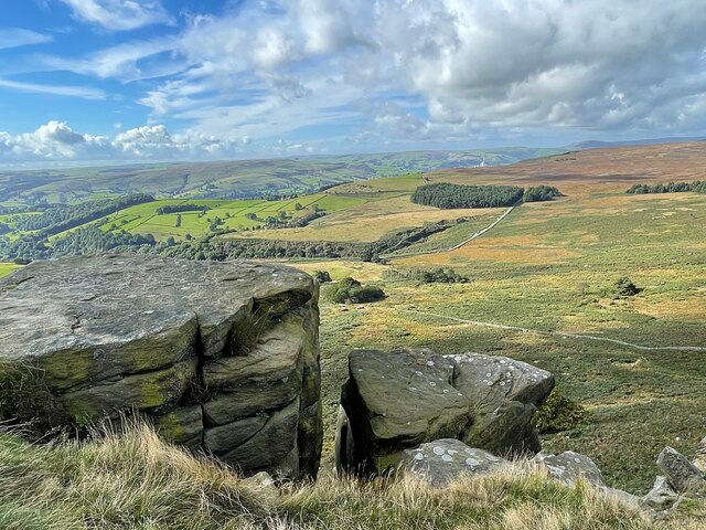
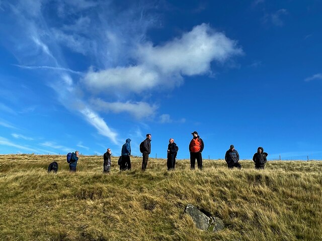
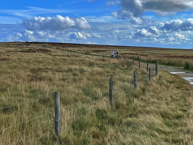
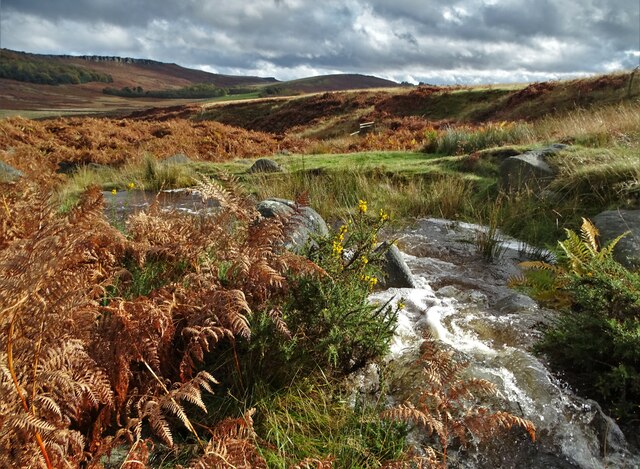
Birchin Wood Images

Images are sourced within 2km of 53.340262/-1.6489273 or Grid Reference SK2382. Thanks to Geograph Open Source API. All images are credited.

Footpath steps climbing out of Hurst Clough This is the start of an old field path into Bamford. When Bamford Filters waterworks was constructed, the path had to be diverted around the perimeter. The area is also much more wooded than it once was.
Footpath steps climbing out of Hurst Clough
This is the start of an old field path into Bamford. When Bamford Filters waterworks was constructed, the path had to be diverted around the perimeter. The area is also much more wooded than it once was.
Derwent Aqueduct access gates and discharge well The Derwent Aqueduct was laid to bring water from the Derwent to Derby, Nottingham and Leicester. Its line is marked by distinctive access gates, like this one, which gives access to a discharge well. There is second gate, half buried in the undergrowth, in the background.
Derwent Aqueduct access gates and discharge well
The Derwent Aqueduct was laid to bring water from the Derwent to Derby, Nottingham and Leicester. Its line is marked by distinctive access gates, like this one, which gives access to a discharge well. There is second gate, half buried in the undergrowth, in the background.
Hirstclough Lane A steep byway open to all traffic to the east of Bamford
Hirstclough Lane
A steep byway open to all traffic to the east of Bamford
Cloudy sky over the Derwent Valley From Hurstclough Lane. Fortunately the grey clouds passed without depositing too much rain.
Cloudy sky over the Derwent Valley
From Hurstclough Lane. Fortunately the grey clouds passed without depositing too much rain.
Looking over the Derwent Valley From a public footpath in Bolehill Wood.
Looking over the Derwent Valley
From a public footpath in Bolehill Wood.
Cloudy blue sky over green fields and trees The glorious view to the east from Bole Hill
Cloudy blue sky over green fields and trees
The glorious view to the east from Bole Hill
View from a path to Stanage Edge The minor road runs over Cattis-side Moor between Stanage Edge and Carrhead Rocks.
View from a path to Stanage Edge
The minor road runs over Cattis-side Moor between Stanage Edge and Carrhead Rocks.
The view from Stanage Edge Looking over Bamford Moor to the Hope Valley.
The view from Stanage Edge
Looking over Bamford Moor to the Hope Valley.
On Stanage Edge A group of walkers are admiring the view.
On Stanage Edge
A group of walkers are admiring the view.
The path to Stanedge Pole
Hood Brook draining through Sheepwash Bank
At the junction of Birley Lane and Coggers Lane Looking towards Hope Cement Works in The Hope Valley.
At the junction of Birley Lane and Coggers Lane
Looking towards Hope Cement Works in The Hope Valley.
Hathersage, from Surprise View, Millstone Edge
Mitchell Field and Callow, near Hathersage
Hope Valley railway at Bamford Preparatory work is now underway to create a new freight passing loop with the main earth moving work scheduled to start by April 2022. The Bamford loop will run from the end of the station platform towards Jaggers Lane bridge in Hathersage, seen here in the distance.
Hope Valley railway at Bamford
Preparatory work is now underway to create a new freight passing loop with the main earth moving work scheduled to start by April 2022. The Bamford loop will run from the end of the station platform towards Jaggers Lane bridge in Hathersage, seen here in the distance.
Hathersage, Cloggers Lane This map reference, according to the OS benchmark database, is the location of a gatepost with a cutmark. Today the field wall has been rebuilt and a new bench seat positioned with a splendid view down the valley. The seat is built on 2 stone supporting blocks. Is this horizontal cut to the rear of the block the remnants of the cutmark?
Hathersage, Cloggers Lane
This map reference, according to the OS benchmark database, is the location of a gatepost with a cutmark. Today the field wall has been rebuilt and a new bench seat positioned with a splendid view down the valley. The seat is built on 2 stone supporting blocks. Is this horizontal cut to the rear of the block the remnants of the cutmark?
Hathersage, Coggers Lane This map reference, according to the OS benchmark database, is the location of a gatepost with a cutmark. Today the field wall has been rebuilt and a new bench seat positioned with a splendid view down the valley. The seat is built on 2 stone supporting blocks. Are the blocks the remnants of the old gateposts?
Hathersage, Coggers Lane
This map reference, according to the OS benchmark database, is the location of a gatepost with a cutmark. Today the field wall has been rebuilt and a new bench seat positioned with a splendid view down the valley. The seat is built on 2 stone supporting blocks. Are the blocks the remnants of the old gateposts?
Over the Wall A view of Overstones Farm and Stanage Edge on New Year's Eve 2021 - the warmest on record with the temperature rising to 15 degrees celsius in this vicinity.
Over the Wall
A view of Overstones Farm and Stanage Edge on New Year's Eve 2021 - the warmest on record with the temperature rising to 15 degrees celsius in this vicinity.
Show me another place!

Birchin Wood is located at Grid Ref: SK2382 (Lat: 53.340262, Lng: -1.6489273)

Administrative County: Derbyshire

District: Derbyshire Dales

Police Authority: Derbyshire

What 3 Words

///tender.wallet.doors. Near Hathersage, Derbyshire

Related Wikis

Hood Brook

Hood Brook is a stream in the Derbyshire Peak District, originating near Stanage Edge, close to Robin Hoods Cave. == Background == Hood Brook flows south...

St Michael and All Angels' Church, Hathersage

St Michael and All Angels’ Church, Hathersage, is a Grade I listed parish church in the Church of England in Hathersage, Derbyshire. == History == The...

St Michael the Archangel Roman Catholic Church, Hathersage

St Michael the Archangel Roman Catholic Church, Hathersage is a Grade II* listed Roman Catholic church in Hathersage, Derbyshire.The building dates back...

Hathersage

Hathersage ( HATHə-sidge) is a village and civil parish in the Peak District in Derbyshire, England. It lies slightly to the north of the River Derwent...

Nearby Amenities

Located within 500m of 53.340262,-1.6489273
Barrier: kissing_gate
Source: survey
Lat/Long: 53.3426353/-1.6499568
Barrier: stile
Material: stone
Source: survey;gps
Stile: squeezer
Lat/Long: 53.3421652/-1.6518064
Barrier: stile
Material: stone
Source: survey;gps
Stile: squeezer
Lat/Long: 53.3426244/-1.6520636
Barrier: stile
Material: wood
Source: survey;gps
Stile: stepover
Lat/Long: 53.3371581/-1.650446
Barrier: kissing_gate
Source: survey;gps
Lat/Long: 53.3410519/-1.6505562
Barrier: stile
Source: survey;gps
Stile: stepover
Lat/Long: 53.3376382/-1.6436838
Barrier: stile
Source: survey;gps
Stile: squeezer
Lat/Long: 53.3381542/-1.6437116
Barrier: cattle_grid
Lat/Long: 53.3444481/-1.6491495
Marker: post
Lat/Long: 53.3369493/-1.6450305
Barrier: stile
Stile: squeezer
Lat/Long: 53.3385377/-1.6435184
The data included in this document is from www.openstreetmap.org. The data is made available under ODbL.

Have you been to Birchin Wood?

Leave your review of Birchin Wood below (or comments, questions and feedback).