Spinney

Wood, Forest in Hampshire Test Valley

England

Spinney

Outdoor Seating Area, Cholderton Farm Shop and Cafe
Outdoor Seating Area, Cholderton Farm Shop and Cafe Credit: Paul Collins

Spinney is a charming village located in the county of Hampshire, England. Situated in the heart of the county, Spinney is known for its abundant woodlands and forests, which give the village its unique character.

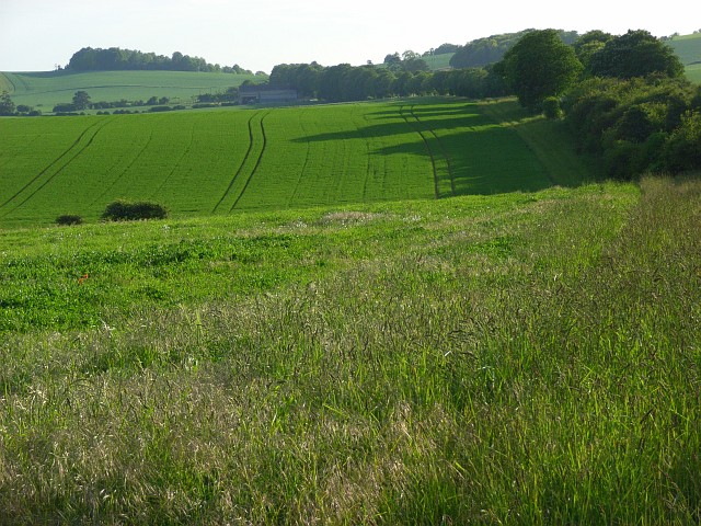
The village is surrounded by lush greenery, with dense woodlands encompassing the area. The woodlands provide a tranquil and picturesque environment, making it an ideal destination for nature lovers and outdoor enthusiasts. The forests offer a range of activities, including hiking, cycling, and wildlife spotting. They are home to a variety of flora and fauna, adding to the natural beauty of the village.

In addition to its natural surroundings, Spinney is also known for its quaint village center. The center is characterized by traditional English architecture, with charming cottages and historic buildings lining the streets. The village boasts a close-knit community, where residents take pride in preserving its rich heritage and maintaining a strong sense of community spirit.

Spinney offers a variety of amenities to its residents and visitors. There are local shops, a village hall, and a primary school, ensuring that the basic needs of the community are well catered for. The village also hosts regular events and festivals, bringing together people from all walks of life to celebrate and enjoy the vibrant community spirit.

In conclusion, Spinney, Hampshire is a picturesque village renowned for its woodlands and forests. With its natural beauty, charming village center, and strong sense of community, Spinney offers a pleasant and welcoming environment for residents and visitors alike.

If you have any feedback on the listing, please let us know in the comments section below.
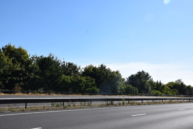
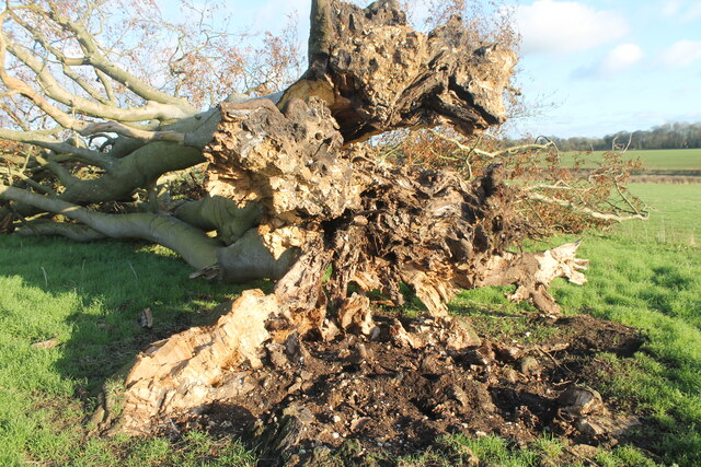
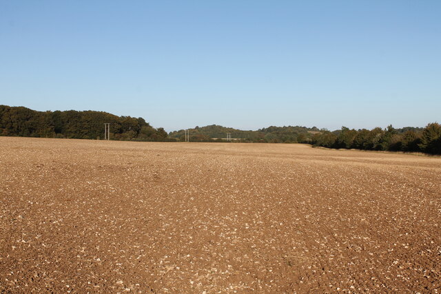
Spinney Images

Images are sourced within 2km of 51.1864/-1.6665548 or Grid Reference SU2343. Thanks to Geograph Open Source API. All images are credited.

Outdoor Seating Area, Cholderton Farm Shop and Cafe
Home Farm, Cholderton The farm boasts the popular Cholderton Farm Shop and Cafe. The shepherd's hut hasn't altered much in 10 years <a href="https://www.geograph.org.uk/photo/2834040">SU2342 : Drive, Home Farm</a>.
Home Farm, Cholderton
The farm boasts the popular Cholderton Farm Shop and Cafe. The shepherd's hut hasn't altered much in 10 years SU2342 : Drive, Home Farm.
A338 Salisbury Road Towards Tidworth.
A338 Salisbury Road
Towards Tidworth.
View towards Thruxton Farm Taken just to the south of the A303.
View towards Thruxton Farm
Taken just to the south of the A303.
A303 Looking across the A303 at the end of the cutting on Thruxton Hill.
A303
Looking across the A303 at the end of the cutting on Thruxton Hill.
Big Cowden field, Cholderton, fallen tree Fallen tree (with arborglyph - see earlier photo <a title="https://www.geograph.org.uk/photo/6054096)" href="https://www.geograph.org.uk/photo/6054096)">Link</a>
Big Cowden field, Cholderton, fallen tree
Fallen tree (with arborglyph - see earlier photo Link
Tin Can Copse, Cholderton Tin Can Copse is a sad remnant of a small copse of trees situated on the boundary of Big Cowden field and the edge of the Bourne valley floodplain. It gets its name from the hollow in the middle being used as a rubbish dump during the mid/late 19th-early/mid 20th century.
Tin Can Copse, Cholderton
Tin Can Copse is a sad remnant of a small copse of trees situated on the boundary of Big Cowden field and the edge of the Bourne valley floodplain. It gets its name from the hollow in the middle being used as a rubbish dump during the mid/late 19th-early/mid 20th century.
Big Cowden field, Cholderton, fallen tree The northern and first to fall of two trees in the middle of Big Cowden field (the tree on the left in <a title="https://www.geograph.org.uk/photo/6054093)" href="https://www.geograph.org.uk/photo/6054093)">Link</a>. The uprooted tree bowl shows the underlying soliflucted chalk overlain by Clay-with-flints still attached to the roots.
Big Cowden field, Cholderton, fallen tree
The northern and first to fall of two trees in the middle of Big Cowden field (the tree on the left in Link. The uprooted tree bowl shows the underlying soliflucted chalk overlain by Clay-with-flints still attached to the roots.
Down Barn Dairy field, Cholderton View across Down Brn Dairy Field after ploughing autumn 2022.
Down Barn Dairy field, Cholderton
View across Down Brn Dairy Field after ploughing autumn 2022.
Down Barn Dairy field, Cholderton during field walking survey Looking west across the combe running through Down Barn Dairy field, during archaeological field walking survey in advance of solar development due to cover the field in the future.
Down Barn Dairy field, Cholderton during field walking survey
Looking west across the combe running through Down Barn Dairy field, during archaeological field walking survey in advance of solar development due to cover the field in the future.
Entrance to Diana Plantation Field, Cholderton Looking across Diana Plantation Field to Hills Copse on Beacon Hill in the distance.
Entrance to Diana Plantation Field, Cholderton
Looking across Diana Plantation Field to Hills Copse on Beacon Hill in the distance.
Big AA Box field, Cholderton Looking across Big AA Box field towards Thruxton Hill. The woodland at the end of the field marks the county boundary marked by a late Bronze Age linear ditch running along the field boundary. The field name derives from the AA box that used to stand in the lay-by of the old A303: the modern dual carriageway runs behind the hedge on the right.
Big AA Box field, Cholderton
Looking across Big AA Box field towards Thruxton Hill. The woodland at the end of the field marks the county boundary marked by a late Bronze Age linear ditch running along the field boundary. The field name derives from the AA box that used to stand in the lay-by of the old A303: the modern dual carriageway runs behind the hedge on the right.
Parkhouse Field, Cholderton Top Parkhouse field, recently ploughed looking across to Parkhouse Cross and beyond Snoddington Down on the horizon.
Parkhouse Field, Cholderton
Top Parkhouse field, recently ploughed looking across to Parkhouse Cross and beyond Snoddington Down on the horizon.
Parkhouse Field, Cholderton Looking across Top Parkhouse Field to Beacon Hill, with tractor and water trough.
Parkhouse Field, Cholderton
Looking across Top Parkhouse Field to Beacon Hill, with tractor and water trough.
Grateley Lodge Grateley Lodge is a lodge at the end of a lane. The lodge is part of Wilbury House (a Grade II listed park and garden), list entry number 1001245 <span class="nowrap"><a title="https://historicengland.org.uk/listing/the-list/list-entry/1001245" rel="nofollow ugc noopener" href="https://historicengland.org.uk/listing/the-list/list-entry/1001245">Link</a><img style="margin-left:2px;" alt="External link" title="External link - shift click to open in new window" src="https://s1.geograph.org.uk/img/external.png" width="10" height="10"/></span>
Grateley Lodge
Grateley Lodge is a lodge at the end of a lane. The lodge is part of Wilbury House (a Grade II listed park and garden), list entry number 1001245 LinkExternal link
Byway towards Grateley Lodge A byway heading towards Grateley Lodge.
Byway towards Grateley Lodge
A byway heading towards Grateley Lodge.
Field south east of Grateley Lodge A field to the south east of Grateley Lodge.
Field south east of Grateley Lodge
A field to the south east of Grateley Lodge.
St Nicholas, Cholderton: September 2023
Show me another place!

Spinney is located at Grid Ref: SU2343 (Lat: 51.1864, Lng: -1.6665548)

Administrative County: Hampshire

District: Test Valley

Police Authority: Hampshire

What 3 Words

///pesky.landscape.pressing. Near Allington, Wiltshire

Nearby Locations

Spinney

Related Wikis

Battle of the Beanfield

The Battle of the Beanfield took place over several hours on 1 June 1985, when Wiltshire Police prevented The Peace Convoy, a convoy of several hundred...

Cholderton

Cholderton, or more properly West Cholderton, is a village and civil parish in the Bourne Valley of Wiltshire, England. The village is about 4 miles (6...

Snoddington

Snoddington is a small hamlet in Hampshire and close to the border of Wiltshire near to Thruxton Aerodrome and first mentioned in the eleventh century...

Wilbury House

Wilbury House or Wilbury Park is an 18th-century Neo-Palladian country house in the parish of Newton Tony, Wiltshire in South West England, about 8.7 miles...

Nearby Amenities

Located within 500m of 51.1864,-1.6665548
Shop: convenience
Lat/Long: 51.1848234/-1.6688008
Cafe
Lat/Long: 51.1848469/-1.6688035
The data included in this document is from www.openstreetmap.org. The data is made available under ODbL.

Have you been to Spinney?

Leave your review of Spinney below (or comments, questions and feedback).