Back Spring Wood

Wood, Forest in Yorkshire Hambleton

England

Back Spring Wood

Cowling, near Burrill This stone wall and metal gatepost is on the east side of the road which runs through the hamlet, Cowling. It is the left hand side of the farmyard entrance. Behind the metal gatepost is a benchmark cut into the corner stone of this farm building.
Cowling, near Burrill Credit: Mel Towler

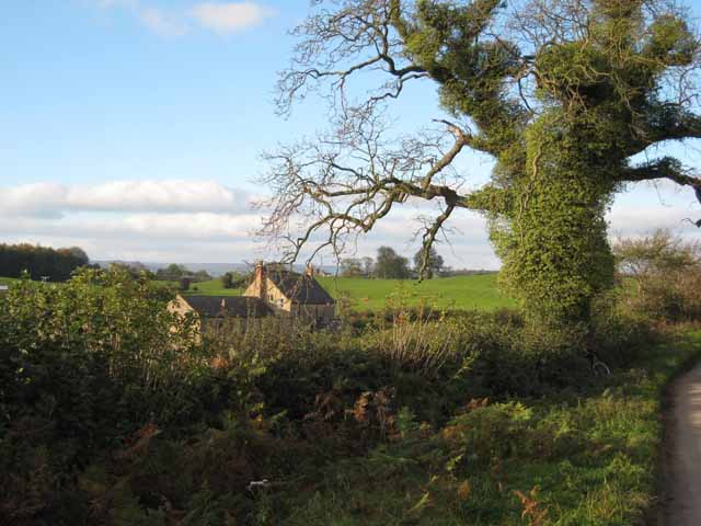
Back Spring Wood is a picturesque woodland located in the county of Yorkshire, England. Covering an area of approximately 50 acres, it is a thriving natural habitat with a diverse range of flora and fauna. Situated in a rural setting, the wood offers visitors a tranquil and peaceful escape from the hustle and bustle of city life.

The wood is primarily composed of deciduous trees, including oak, beech, and birch, which provide a stunning display of colors during the autumn months. The forest floor is carpeted with a rich layer of moss, ferns, and wildflowers, creating a lush and vibrant environment.

Numerous walking trails wind their way through the wood, allowing visitors to explore its beauty at their own pace. These paths are well-maintained and signposted, ensuring a safe and enjoyable experience for all. Along the way, there are several viewpoints that offer breathtaking vistas of the surrounding countryside.

Back Spring Wood is home to a variety of wildlife, including deer, squirrels, and a wide array of bird species. Birdwatchers will be delighted by the opportunity to spot woodpeckers, owls, and other native birds in their natural habitat.

The wood is managed by a dedicated team of conservationists who work tirelessly to preserve its natural beauty and protect its inhabitants. They also organize educational programs and guided tours to raise awareness about the importance of woodland conservation.

Overall, Back Spring Wood is a captivating destination for nature enthusiasts and those seeking solace in the great outdoors. Its serene atmosphere, stunning scenery, and abundant wildlife make it a truly remarkable place to visit.

If you have any feedback on the listing, please let us know in the comments section below.

Back Spring Wood Images

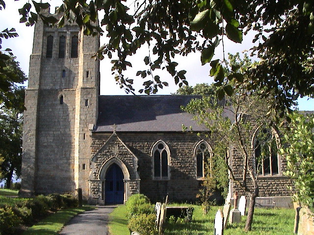
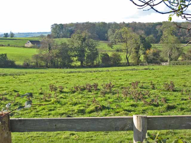
Images are sourced within 2km of 54.269714/-1.6438761 or Grid Reference SE2386. Thanks to Geograph Open Source API. All images are credited.

Cowling, near Burrill This stone wall and metal gatepost is on the east side of the road which runs through the hamlet, Cowling. It is the left hand side of the farmyard entrance. Behind the metal gatepost is a benchmark cut into the corner stone of this farm building.
Cowling, near Burrill
This stone wall and metal gatepost is on the east side of the road which runs through the hamlet, Cowling. It is the left hand side of the farmyard entrance. Behind the metal gatepost is a benchmark cut into the corner stone of this farm building.
Cowling, near Burrill, farm entrance A wider angle showing the farm yard entrance on the east side of the road which runs through the hamlet, Cowling. Behind the metal gatepost is a benchmark cut into the corner stone of the farm building in the front of this photo.
Cowling, near Burrill, farm entrance
A wider angle showing the farm yard entrance on the east side of the road which runs through the hamlet, Cowling. Behind the metal gatepost is a benchmark cut into the corner stone of the farm building in the front of this photo.
Burrill Mission church This is the west facing wall of the Mission church in Burrill. Cut into the 7th and 8th brick courses is a benchmark.
Burrill Mission church
This is the west facing wall of the Mission church in Burrill. Cut into the 7th and 8th brick courses is a benchmark.
Burrill Mission church A wider angle of the church with the bell tower at the east end of the church. On the west facing wall of the Mission church, cut into the 7th and 8th brick courses is a benchmark.
Burrill Mission church
A wider angle of the church with the bell tower at the east end of the church. On the west facing wall of the Mission church, cut into the 7th and 8th brick courses is a benchmark.
Ungated entrance to stubble field from NW side of Burrill Road
Gateway into stubble field from NW side of Burrill Road
Roadworks at T-junction in Burrill
Thornton Watlass Church
Paddock at Thirn village
Slurry tanker near Thirn
Fields and woodland near Thirn
Eastern driveway to Clifton Castle There may have been a castle here once, dating back to the 14th century or earlier. The present "castle" was built in 1806. <span class="nowrap"><a title="http://www.gatehouse-gazetteer.info/English%20sites/2054.html" rel="nofollow ugc noopener" href="http://www.gatehouse-gazetteer.info/English%20sites/2054.html">Link</a><img style="margin-left:2px;" alt="External link" title="External link - shift click to open in new window" src="https://s1.geograph.org.uk/img/external.png" width="10" height="10"/></span>
Eastern driveway to Clifton Castle
There may have been a castle here once, dating back to the 14th century or earlier. The present "castle" was built in 1806. LinkExternal link
Halfpenny Houses A view across the corner of the Clifton Castle estate towards part of this hamlet.
Halfpenny Houses
A view across the corner of the Clifton Castle estate towards part of this hamlet.
Field and farm road near Thirn The farm in the distance is Clifon Grange Farm <a href="https://www.geograph.org.uk/gridref/SE2185">SE2185</a>
Field and farm road near Thirn
The farm in the distance is Clifon Grange Farm SE2185
Low Pond House, near Cowling
Avenue of elms A fine avenue of elm trees on the Thornton Watlass estate.
Avenue of elms
A fine avenue of elm trees on the Thornton Watlass estate.
Thornton Watlass estate Rather unusually, a tract of typical parkland complete with scattered trees and bounding wall has been given over to arable farming.
Thornton Watlass estate
Rather unusually, a tract of typical parkland complete with scattered trees and bounding wall has been given over to arable farming.
Farm at Burrill This is a crop drying installation, quite old by the look of it. For drying wheat, barley etc so that it will store for many months. 14.5% will be the desired moisture content. Grain can be harvested up to 20%. Over this it becomes very expensive to dry. (information supplied by Michael Trolove)
Farm at Burrill
This is a crop drying installation, quite old by the look of it. For drying wheat, barley etc so that it will store for many months. 14.5% will be the desired moisture content. Grain can be harvested up to 20%. Over this it becomes very expensive to dry. (information supplied by Michael Trolove)
Show me another place!

Back Spring Wood is located at Grid Ref: SE2386 (Lat: 54.269714, Lng: -1.6438761)

Division: North Riding

Administrative County: North Yorkshire

District: Hambleton

Police Authority: North Yorkshire

What 3 Words

///stubborn.analogy.mourner. Near Bedale, North Yorkshire

Related Wikis

Thornton Watlass Hall

Thornton Watlass Hall is a large Grade I listed Georgian country house in Thornton Watlass, North Yorkshire, England, some 3 miles (5 km) north of Masham...

Thornton Watlass

Thornton Watlass is a small village and civil parish in North Yorkshire, England. It is located north of Masham and south of Bedale on the eastern slopes...

Burrill

Burrill is a small village in near to Bedale in North Yorkshire, England. It is in the parish of Burrill with Cowling and 1 mile (1.6 km) west of Bedale...

Burrill with Cowling

Burrill with Cowling is a civil parish in the Hambleton District of North Yorkshire, England, including the villages of Burrill and Cowling. It is only...

Thirn

Thirn is a village and civil parish in North Yorkshire, England. It is situated close to the River Ure, about 3 miles (5 km) south-west of Bedale.The hamlet...

Cowling, Hambleton

Cowling is a small village in the Hambleton District of North Yorkshire, England. It is in the parish of Burrill with Cowling and 1 mile west of Bedale...

Clifton-on-Yore

Clifton-on-Yore is a civil parish in the Hambleton district of North Yorkshire, England. The population of the parish was estimated at 40 in 2010. The...

Rookwith

Rookwith is a hamlet and civil parish in the Hambleton district of North Yorkshire, England, about 4 miles (6.4 km) west of Bedale and near the flow of...

Nearby Amenities

Located within 500m of 54.269714,-1.6438761
Power: pole
Lat/Long: 54.2683977/-1.6511996
Power: pole
Lat/Long: 54.2690371/-1.6507229
Power: pole
Lat/Long: 54.2695154/-1.6503191
Power: pole
Lat/Long: 54.2704013/-1.6496142
Power: pole
Lat/Long: 54.2708515/-1.6492401
Power: pole
Lat/Long: 54.2715828/-1.6486196
Power: pole
Lat/Long: 54.2721596/-1.6481611
Power: pole
Lat/Long: 54.2726978/-1.6477322
Power: pole
Lat/Long: 54.2734078/-1.6472782
Power: pole
Lat/Long: 54.2669989/-1.6494728
Power: pole
Lat/Long: 54.2669269/-1.6476045
Power: pole
Lat/Long: 54.2668563/-1.6457065
Power: pole
Lat/Long: 54.2667817/-1.643772
Power: pole
Lat/Long: 54.2667058/-1.6418672
The data included in this document is from www.openstreetmap.org. The data is made available under ODbL.

Have you been to Back Spring Wood?

Leave your review of Back Spring Wood below (or comments, questions and feedback).