Fishpond Wood

Wood, Forest in Yorkshire Harrogate

England

Fishpond Wood

Heatherlands, near High Grantley
Heatherlands, near High Grantley Credit: John Slater

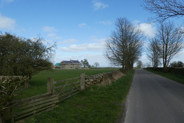
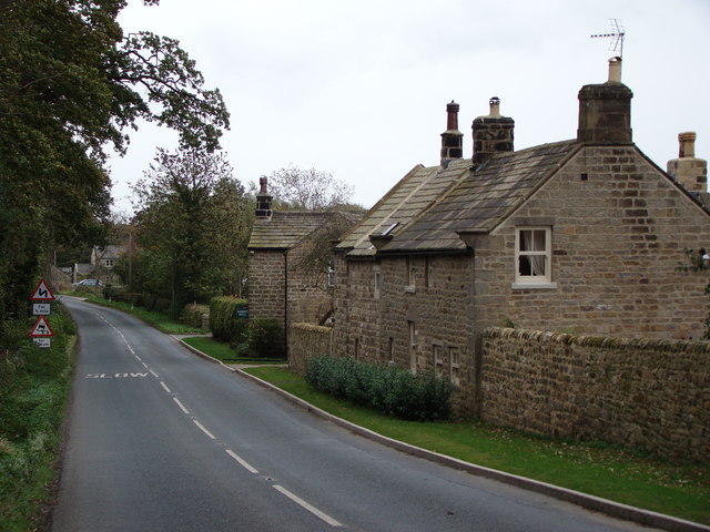
Fishpond Wood is a picturesque woodland located in Yorkshire, England. Covering an area of approximately 50 acres, it is a popular destination for nature enthusiasts and outdoor lovers. The wood is situated on the outskirts of a small village, surrounded by rolling hills and meandering streams.

The woodland is known for its diverse range of flora and fauna, providing a habitat for various wildlife species. The tree canopy is predominantly made up of oak, beech, and birch trees, which create a dense and enchanting environment. Bluebells and wild garlic carpet the forest floor during the spring months, adding a vibrant burst of color to the landscape.

Fishpond Wood is intersected by several well-maintained footpaths, allowing visitors to explore its beauty at their own pace. These paths lead to secluded clearings, tranquil ponds, and hidden glades, providing opportunities for peaceful picnics or quiet contemplation.

The wood is also home to a variety of bird species, including woodpeckers, owls, and finches, making it a haven for birdwatchers. Additionally, small mammals such as squirrels and hedgehogs can be spotted scurrying among the undergrowth.

As a protected area, Fishpond Wood is carefully managed to preserve its natural beauty and biodiversity. Local conservation efforts aim to maintain the delicate balance of the ecosystem and ensure the wood remains a sanctuary for both wildlife and visitors alike.

Overall, Fishpond Wood in Yorkshire offers a tranquil escape into nature, providing a serene environment for exploration, relaxation, and appreciation of the natural world.

If you have any feedback on the listing, please let us know in the comments section below.

Fishpond Wood Images

Images are sourced within 2km of 54.108781/-1.6485594 or Grid Reference SE2368. Thanks to Geograph Open Source API. All images are credited.

Heatherlands, near High Grantley
Road through High Grantley Looking north-westward.
Road through High Grantley
Looking north-westward.
Road at the entrance to Grantley Thwaites Looking westward.
Road at the entrance to Grantley Thwaites
Looking westward.
Eagle-eyed Benchmark Spotter This benchmark is less than 500m away from the entrance to Grantley Thwaites, and it is on a sandstone gatepost midway along an intake field.
It is recorded as being at 623.7ft asl.
Eagle-eyed Benchmark Spotter
This benchmark is less than 500m away from the entrance to Grantley Thwaites, and it is on a sandstone gatepost midway along an intake field. It is recorded as being at 623.7ft asl.
Close Up of the Benchmark near Grantley Thwaites
Road passing Heatherlands The road leads to High Grantley.
Road passing Heatherlands
The road leads to High Grantley.
Gate and Grantley Thwaites Looking along the road to High Grantley.
Gate and Grantley Thwaites
Looking along the road to High Grantley.
Eavestone Lake Strange millstone grit rock formations stand in the woods around this lake
Eavestone Lake
Strange millstone grit rock formations stand in the woods around this lake
Hungate Dyke Looking up the hill to Hungate village
Hungate Dyke
Looking up the hill to Hungate village
Brim Bray Pond The approach to Brim Bray Pond along the track from High Skelding.
Brim Bray Pond
The approach to Brim Bray Pond along the track from High Skelding.
Hilltop Eavestone Hilltop Farm at Eavestone.
Hilltop Eavestone
Hilltop Farm at Eavestone.
High Grantley Village Hall The Village hall in the picturesque village of High Grantley.
High Grantley Village Hall
The Village hall in the picturesque village of High Grantley.
Eavestone Lake A gritstone crag rises above this magical man made lake.
Eavestone Lake
A gritstone crag rises above this magical man made lake.
Grantley Hall In the good old days this was owned by the West Riding County Council, and there was a variety of educational courses including Orchestral and Chamber Music.  This carried on until a few years ago under North Yorkshire County Council (although without the music courses, alas). (Photo taken in 1964)
Grantley Hall
In the good old days this was owned by the West Riding County Council, and there was a variety of educational courses including Orchestral and Chamber Music. This carried on until a few years ago under North Yorkshire County Council (although without the music courses, alas). (Photo taken in 1964)
Risplith A cold dawn at the Winter solstice, 1998. Risplith from Grantley. Looking south-east, at the top of the hill is the T-junction with the Ripon Road, B6265.
Risplith
A cold dawn at the Winter solstice, 1998. Risplith from Grantley. Looking south-east, at the top of the hill is the T-junction with the Ripon Road, B6265.
B6265 over Sawley Moor Long straight stretch between Fellbeck and Risplith, where high speeds are frequently attained - but not by me.  This looks East
B6265 over Sawley Moor
Long straight stretch between Fellbeck and Risplith, where high speeds are frequently attained - but not by me. This looks East
Church at Sawley On a blustery day, this looked quite stark.  I am not certain if this building is used as a place of worship anymore - I saw no noticeboard, and all seemed to be closed up.
An E Mail has assured me this church is still open for business.
Church at Sawley
On a blustery day, this looked quite stark. I am not certain if this building is used as a place of worship anymore - I saw no noticeboard, and all seemed to be closed up. An E Mail has assured me this church is still open for business.
Track by Manor Allotment Looking west along the southern boundary of this plantation
Track by Manor Allotment
Looking west along the southern boundary of this plantation
Show me another place!

Fishpond Wood is located at Grid Ref: SE2368 (Lat: 54.108781, Lng: -1.6485594)

Division: West Riding

Administrative County: North Yorkshire

District: Harrogate

Police Authority: North Yorkshire

What 3 Words

///breathing.violinist.restore. Near Pateley Bridge, North Yorkshire

Nearby Locations

Fishpond Wood

Related Wikis

Eavestone

Eavestone is a hamlet and civil parish in the Harrogate district of North Yorkshire, England. It is situated near Brimham Rocks, 3 miles (4.8 km) east...

Grantley Hall

Grantley Hall is an English country house located in North Yorkshire, England. It is situated near Grantley, about 5 miles (8 km) to the west of Ripon...

Ripon and Pateley Bridge Rural District

Ripon and Pateley Bridge was a rural district in the West Riding of Yorkshire, England from 1937 to 1974. It was created in 1937 by a County Review Order...

Risplith

Risplith is a village in the civil parish of Sawley, in the Harrogate district of North Yorkshire, England. It is about 4 miles (6.4 km) west of Ripon...

Nearby Amenities

Located within 500m of 54.108781,-1.6485594
Place: farm
Lat/Long: 54.1095843/-1.6423849
Power: pole
Lat/Long: 54.1054959/-1.6439018
Power: pole
Lat/Long: 54.1051437/-1.6452
Power: pole
Lat/Long: 54.1047914/-1.6464525
Power: pole
Lat/Long: 54.1044407/-1.6476837
Leisure: picnic_table
Lat/Long: 54.1121268/-1.6503123
The data included in this document is from www.openstreetmap.org. The data is made available under ODbL.

Have you been to Fishpond Wood?

Leave your review of Fishpond Wood below (or comments, questions and feedback).