Waterloo Plantation

Wood, Forest in Wiltshire

England

Waterloo Plantation

Porton Down boundary fence by railway The boundary fence of Porton Down, next to the West of England main railway line. This very small section of SU2439 isn't inside the boundary fence.
Porton Down boundary fence by railway Credit: Oscar

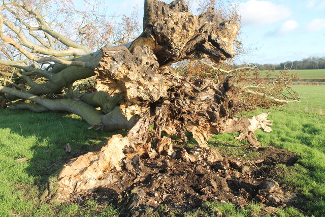
Waterloo Plantation, located in Wiltshire, England, is a magnificent woodland area that spans over a vast expanse of land. Covering an area of approximately 200 acres, the plantation is known for its dense and thriving forest, making it a haven for nature enthusiasts and outdoor adventurers.

The plantation is named after the historic Battle of Waterloo, which took place in 1815, as it is believed that the area was once part of a larger estate owned by a prominent figure involved in the battle. Today, Waterloo Plantation stands as a testament to the rich history of the region.

The woodland is predominantly composed of native tree species, including oak, beech, and ash, which provide a lush and vibrant canopy that shelters a diverse array of flora and fauna. The forest floor is adorned with a carpet of bluebells and wildflowers during the spring months, creating a picturesque and serene atmosphere.

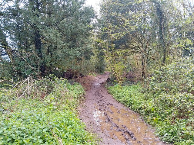
Visitors to Waterloo Plantation can explore a network of well-maintained footpaths and trails that meander through the woodland, offering opportunities for hiking, walking, and even cycling. The plantation is also a popular destination for birdwatching, with numerous species of birds, including woodpeckers and owls, making their homes within the forest.

In addition to its natural beauty, Waterloo Plantation offers educational opportunities, with guided tours and workshops that delve into the ecosystem and history of the area. The plantation also serves as an important conservation site, actively working to preserve and protect the biodiversity of the woodland.

Overall, Waterloo Plantation in Wiltshire is a captivating destination that seamlessly blends history, natural beauty, and outdoor recreation, making it a cherished gem for both locals and tourists alike.

If you have any feedback on the listing, please let us know in the comments section below.

Waterloo Plantation Images

Images are sourced within 2km of 51.160546/-1.672218 or Grid Reference SU2340. Thanks to Geograph Open Source API. All images are credited.

Porton Down boundary fence by railway The boundary fence of Porton Down, next to the West of England main railway line. This very small section of SU2439 isn't inside the boundary fence.
Porton Down boundary fence by railway
The boundary fence of Porton Down, next to the West of England main railway line. This very small section of SU2439 isn't inside the boundary fence.
West of England Main Line near Porton Down The West of England Main Line, next to the boundary fence of Porton Down.
West of England Main Line near Porton Down
The West of England Main Line, next to the boundary fence of Porton Down.
Portway footpath A footpath called Portway near the West of England main railway line.
Portway footpath
A footpath called Portway near the West of England main railway line.
Quarley Parish Boundary Marker The boundary stone marks the south-west corner of Quarley parish. It is inscribed on the west face "QM 1807".
Quarley Parish Boundary Marker
The boundary stone marks the south-west corner of Quarley parish. It is inscribed on the west face "QM 1807".
Quarley Parish Boundary Marker Stone boundary marker, east face, inscribed with Ordnance Survey benchmark and with metal stud set in the top surface.
Quarley Parish Boundary Marker
Stone boundary marker, east face, inscribed with Ordnance Survey benchmark and with metal stud set in the top surface.
Big Cowden field, Cholderton, fallen tree Fallen tree (with arborglyph - see earlier photo <a title="https://www.geograph.org.uk/photo/6054096)" href="https://www.geograph.org.uk/photo/6054096)">Link</a>
Big Cowden field, Cholderton, fallen tree
Fallen tree (with arborglyph - see earlier photo Link
Tin Can Copse, Cholderton Tin Can Copse is a sad remnant of a small copse of trees situated on the boundary of Big Cowden field and the edge of the Bourne valley floodplain. It gets its name from the hollow in the middle being used as a rubbish dump during the mid/late 19th-early/mid 20th century.
Tin Can Copse, Cholderton
Tin Can Copse is a sad remnant of a small copse of trees situated on the boundary of Big Cowden field and the edge of the Bourne valley floodplain. It gets its name from the hollow in the middle being used as a rubbish dump during the mid/late 19th-early/mid 20th century.
Big Cowden field, Cholderton, fallen tree The northern and first to fall of two trees in the middle of Big Cowden field (the tree on the left in <a title="https://www.geograph.org.uk/photo/6054093)" href="https://www.geograph.org.uk/photo/6054093)">Link</a>. The uprooted tree bowl shows the underlying soliflucted chalk overlain by Clay-with-flints still attached to the roots.
Big Cowden field, Cholderton, fallen tree
The northern and first to fall of two trees in the middle of Big Cowden field (the tree on the left in Link. The uprooted tree bowl shows the underlying soliflucted chalk overlain by Clay-with-flints still attached to the roots.
Grateley Lodge Grateley Lodge is a lodge at the end of a lane. The lodge is part of Wilbury House (a Grade II listed park and garden), list entry number 1001245 <span class="nowrap"><a title="https://historicengland.org.uk/listing/the-list/list-entry/1001245" rel="nofollow ugc noopener" href="https://historicengland.org.uk/listing/the-list/list-entry/1001245">Link</a><img style="margin-left:2px;" alt="External link" title="External link - shift click to open in new window" src="https://s1.geograph.org.uk/img/external.png" width="10" height="10"/></span>
Grateley Lodge
Grateley Lodge is a lodge at the end of a lane. The lodge is part of Wilbury House (a Grade II listed park and garden), list entry number 1001245 LinkExternal link
Byway towards Grateley Lodge A byway heading towards Grateley Lodge.
Byway towards Grateley Lodge
A byway heading towards Grateley Lodge.
Field south east of Grateley Lodge A field to the south east of Grateley Lodge.
Field south east of Grateley Lodge
A field to the south east of Grateley Lodge.
Long Walk Plantation track A track through Long Walk Plantation.
Long Walk Plantation track
A track through Long Walk Plantation.
Farmland east of Long Walk Plantation Farmland to the east of Long Walk Plantation.
Farmland east of Long Walk Plantation
Farmland to the east of Long Walk Plantation.
Bridleway sign at Long Walk Plantation A bridleway sign on the edge of Long Walk Plantation, fixed to a telegraph pole.
Bridleway sign at Long Walk Plantation
A bridleway sign on the edge of Long Walk Plantation, fixed to a telegraph pole.
Long Walk Plantation track A track through Long Walk Plantation.
Long Walk Plantation track
A track through Long Walk Plantation.
West of England Main Line The West of England main railway line, from Hampshire Gap bridge.
West of England Main Line
The West of England main railway line, from Hampshire Gap bridge.
West of England Main Line The West of England main railway line, from Hampshire Gap bridge.
West of England Main Line
The West of England main railway line, from Hampshire Gap bridge.
Hampshire Gap bridge Hampshire Gap bridge is a bridge over the West of England main railway line, for access between Long Walk Plantation and Portway to a disused gate of Porton Down.
Hampshire Gap bridge
Hampshire Gap bridge is a bridge over the West of England main railway line, for access between Long Walk Plantation and Portway to a disused gate of Porton Down.
Show me another place!

Waterloo Plantation is located at Grid Ref: SU2340 (Lat: 51.160546, Lng: -1.672218)

Unitary Authority: Wiltshire

Police Authority: Wiltshire

What 3 Words

///disengage.strike.seasonal. Near Allington, Wiltshire

Related Wikis

Newton Tony

Newton Tony (formerly Newton Toney) is a rural English village and civil parish in the county of Wiltshire, close to the border with Hampshire. Situated...

Wilbury House

Wilbury House or Wilbury Park is an 18th-century Neo-Palladian country house in the parish of Newton Tony, Wiltshire in South West England, about 8.7 miles...

Cholderton

Cholderton, or more properly West Cholderton, is a village and civil parish in the Bourne Valley of Wiltshire, England. The village is about 4 miles (6...

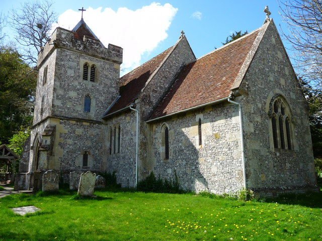
St John the Baptist's Church, Allington

St John the Baptist's Church in the village of Allington, south-east of Amesbury in Wiltshire, England, is a redundant Anglican parish church which was...

Allington, Salisbury

Allington is a village and civil parish in Wiltshire, England, about 3 miles (5 km) southeast of Amesbury and 7 miles (11 km) northeast of Salisbury. The...

Palestine, Hampshire

Palestine is a village which lies in the civil parish of Over Wallop, approximately 7 miles (11 km) south-west of Andover, in Hampshire, England. It consists...

Porton Down SSSI

Porton Down SSSI is a 1,559-hectare (3,850-acre) biological Site of Special Scientific Interest which spans the border between Hampshire and Wiltshire...

Boscombe, Wiltshire

Boscombe is a small village and former civil parish, now in the parish of Allington, Wiltshire, England. It lies about 3 miles (5 km) southeast of Amesbury...

Have you been to Waterloo Plantation?

Leave your review of Waterloo Plantation below (or comments, questions and feedback).