Jacob Plantation

Wood, Forest in Yorkshire

England

Jacob Plantation

Approaching "Strines Inn"
Approaching "Strines Inn" Credit: Neil Theasby

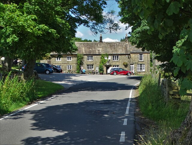
Jacob Plantation is a picturesque and serene woodland located in Yorkshire, England. Nestled within the heart of the county, this plantation can be found in close proximity to the charming village of Wood. With its lush greenery and dense foliage, Jacob Plantation stands as a haven for nature enthusiasts and adventurers alike.

Covering an extensive area, the plantation is renowned for its diverse range of tree species, including oak, beech, and birch. The towering trees create a majestic canopy, filtering sunlight and casting a tranquil shade over the forest floor. This enchanting woodland also boasts a rich variety of flora, with wildflowers, ferns, and mosses carpeting the forest floor, adding a burst of color and texture to the landscape.

Jacob Plantation is teeming with wildlife, making it a prime spot for animal enthusiasts. Visitors may catch sight of deer gracefully darting between the trees or hear the melodic songs of various bird species echoing through the woodland. Additionally, the plantation is home to a host of smaller creatures, such as squirrels, rabbits, and foxes, adding to the vibrant ecosystem that exists within the forest.

The plantation offers a range of activities for visitors to enjoy. Nature trails wind through the woodland, providing an opportunity for leisurely walks, bird-watching, or photography. For those seeking a more immersive experience, camping facilities are available, allowing visitors to spend the night under the starry Yorkshire skies. Additionally, the plantation hosts educational programs and guided tours, providing a deeper understanding of the local flora and fauna.

Jacob Plantation, nestled within the idyllic Yorkshire countryside, offers a captivating and tranquil escape for nature lovers, providing a sanctuary where one can immerse themselves in the beauty and serenity of the natural world.

If you have any feedback on the listing, please let us know in the comments section below.

Jacob Plantation Images

Images are sourced within 2km of 53.396908/-1.6578609 or Grid Reference SK2288. Thanks to Geograph Open Source API. All images are credited.
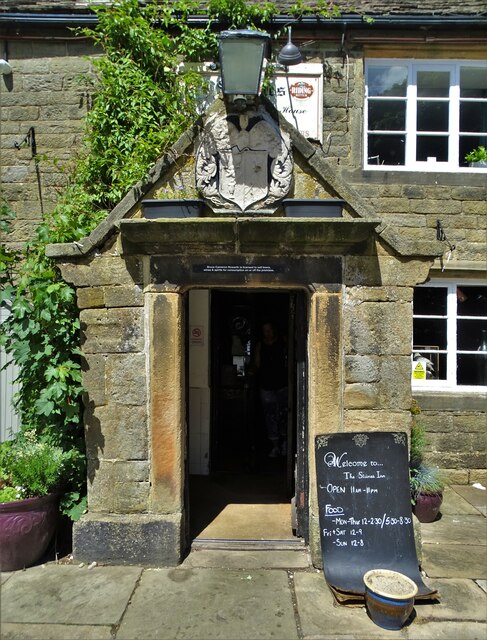
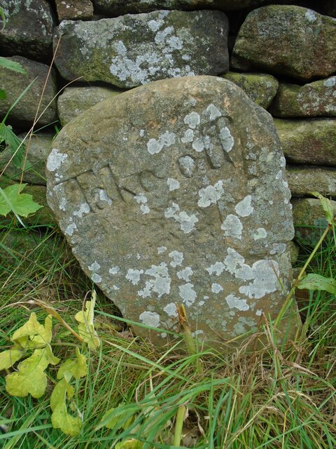
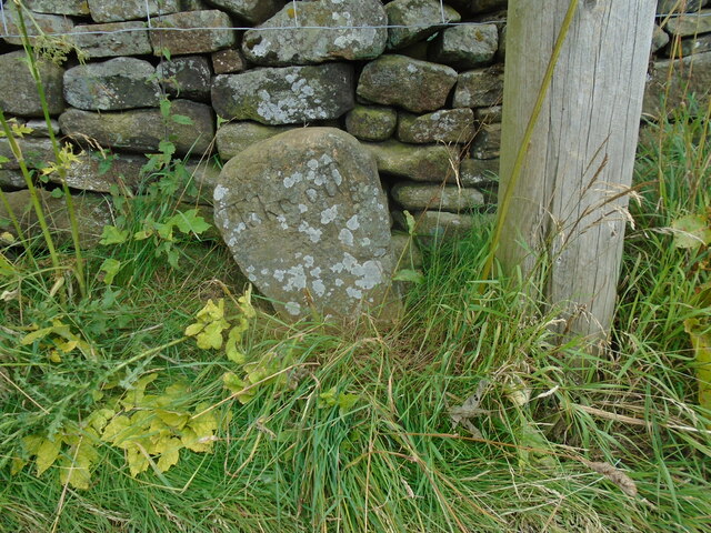
Approaching "Strines Inn"
Entrance to "The Strines Inn" "The building that now houses The Strines Inn was originally a manor house built in 1275. Over the years it was extended and eventually converted into an inn in 1771." - copied from the pub's website.
Entrance to "The Strines Inn"
"The building that now houses The Strines Inn was originally a manor house built in 1275. Over the years it was extended and eventually converted into an inn in 1771." - copied from the pub's website.
View to Dale Dike Reservoir from West Shaw Lane
Dale Dike Reservoir The water level is very low, leaving a lot of the upper reaches bone dry.
Dale Dike Reservoir
The water level is very low, leaving a lot of the upper reaches bone dry.
Horse stone The Mortimer Road Turnpike first enacted in 1771, renewed 1792, failed by 1813.   Named after Hans Winthrop Mortimer, Lord of the Manor of Bamford.   It failed because it didn't make any money and didn't become an important route.   But it was very hilly!   Extra horses were needed and had to be paid for to help carts and carriages up very steep hills, so a stone such as this 'Take off' was placed at the top.   This one is about 30m north of the 16thC Strines Inn which is 1015ft above sea level.  
The stone is Grade II listed 1203771.
Horse stone
The Mortimer Road Turnpike first enacted in 1771, renewed 1792, failed by 1813. Named after Hans Winthrop Mortimer, Lord of the Manor of Bamford. It failed because it didn't make any money and didn't become an important route. But it was very hilly! Extra horses were needed and had to be paid for to help carts and carriages up very steep hills, so a stone such as this 'Take off' was placed at the top. This one is about 30m north of the 16thC Strines Inn which is 1015ft above sea level. The stone is Grade II listed 1203771.
Horse stone Standing away from the 'Take off' stone near The Strines Inn, its position near a telegraph pole on the east side of Mortimer Road can be seen.  The story of this road can be read in 'The Mortimer Road' by Howard Smith. ISBN 978-1-5272-3446-8.
Horse stone
Standing away from the 'Take off' stone near The Strines Inn, its position near a telegraph pole on the east side of Mortimer Road can be seen. The story of this road can be read in 'The Mortimer Road' by Howard Smith. ISBN 978-1-5272-3446-8.
The Strines Inn Pictured on a superb midweek afternoon in mid April.
The Strines Inn
Pictured on a superb midweek afternoon in mid April.
Brogging (disused)
Brogging (disused)
Strines Reservoir Strines Reservoir with the valley of the stream,  Dales Dike beyond as seen from the minor road crossing Strines Moor.
Strines Reservoir
Strines Reservoir with the valley of the stream, Dales Dike beyond as seen from the minor road crossing Strines Moor.
Path south of Dale Dike Reservoir at Holes Clough You can see part of the reservoir in the middle distance. It was this reservoir that burst its dam on a rainy night in March 1864 - causing The Great Sheffield Flood in which over 240 lives were lost.
Path south of Dale Dike Reservoir at Holes Clough
You can see part of the reservoir in the middle distance. It was this reservoir that burst its dam on a rainy night in March 1864 - causing The Great Sheffield Flood in which over 240 lives were lost.
Brogging by Strines Reservoir Brogging is the name of the disused house you can see to the right of this picture.
Brogging by Strines Reservoir
Brogging is the name of the disused house you can see to the right of this picture.
Old Boundary Marker Turnpike Horse Marker by the UC road, in parish of Bradfield (Sheffield District), Strines, 30m North of Strines Inn, opposite side of road.

Inscription reads:-
Take off
 
Grade II listed.
List Entry Number: 1203771 <span class="nowrap"><a title="https://historicengland.org.uk/listing/the-list/list-entry/1203771" rel="nofollow ugc noopener" href="https://historicengland.org.uk/listing/the-list/list-entry/1203771">Link</a><img style="margin-left:2px;" alt="External link" title="External link - shift click to open in new window" src="https://s1.geograph.org.uk/img/external.png" width="10" height="10"/></span>

Surveyed

Milestone Society National ID: YW_MSTRhs
Old Boundary Marker
Turnpike Horse Marker by the UC road, in parish of Bradfield (Sheffield District), Strines, 30m North of Strines Inn, opposite side of road. Inscription reads:- Take off Grade II listed. List Entry Number: 1203771 LinkExternal link Surveyed Milestone Society National ID: YW_MSTRhs
Cut Mark: Strines Inn Old B.M. on S.E. angle of Strines P.H. [2GL] =?= CUT MARK: STRINES INN PH S FACE 5.2M SE ANG (309.3324m ODN, 0.9m AGL, verified 1961).
Cut Mark: Strines Inn
Old B.M. on S.E. angle of Strines P.H. [2GL] =?= CUT MARK: STRINES INN PH S FACE 5.2M SE ANG (309.3324m ODN, 0.9m AGL, verified 1961).
Door of Strines Inn - OS Cut Mark on the left hand side Old B.M. on S.E. angle of Strines P.H. [2GL] =?= CUT MARK: STRINES INN PH S FACE 5.2M SE ANG (309.3324m ODN, 0.9m AGL, verified 1961).
Door of Strines Inn - OS Cut Mark on the left hand side
Old B.M. on S.E. angle of Strines P.H. [2GL] =?= CUT MARK: STRINES INN PH S FACE 5.2M SE ANG (309.3324m ODN, 0.9m AGL, verified 1961).
Sheffield Country Walk towards Strines Reservoir
Sheffield Country Walk towards Dale Dike Reservoir
Show me another place!

Jacob Plantation is located at Grid Ref: SK2288 (Lat: 53.396908, Lng: -1.6578609)

Division: West Riding

Unitary Authority: Sheffield

Police Authority: South Yorkshire

What 3 Words

///storm.fails.locked. Near Bradfield, South Yorkshire

Nearby Locations

Jacob Plantation

Related Wikis

Moscar Cross

Moscar Cross is the name of a standing stone (or "guide stoop") and surrounding area in the Peak District on the border between Derbyshire and Sheffield...

Sugworth Hall

Sugworth Hall is an English country house on Sugworth Road in Bradfield Dale, near Sheffield, England. It is situated approximately 8 miles (13 km) west...

Strines Reservoir

Strines Reservoir is a water storage reservoir situated at 53.4099°N 1.6557°W / 53.4099; -1.6557 (Strines_Reservoir), 8 miles (13 km) west of the centre...

Hollow Meadows

Hollow Meadows is a hamlet in the civil parish of Bradfield, west of Sheffield in South Yorkshire, England. It lies along the A57 road, between Moscar...

Related Videos

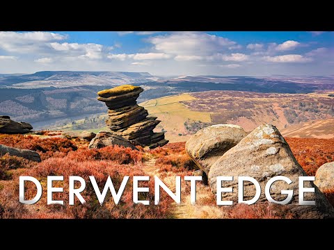
DERWENT EDGE - The BEST HIKING views in the PEAK DISTRICT?

In this episode, Hay and Kyle take you on a tour of Derwent Edge and the incredible sights and sounds that are to be had there.

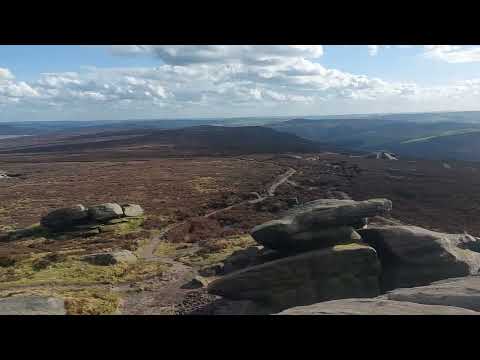
#hiking Easter Bank Holiday weekend 2024. 🐣

Trig point / viewpoint of Howden, Derwent Dams with views towards Bradfield Dale. #sheffield north onto Dukes Walk.

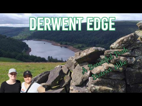
Hiking at The Beautiful Derwent Edge | The Peak District

We share a snippet of our 9 mile hike at the beautiful Derwent Edge in the Peak District. This was one of those 'wow' factor walks ...

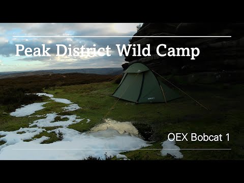
Peak District Wild Camp

Armed with my new camera, I headed over to the Peak District for a wild camp. I apologise for the rough quality of the audio, as I'm ...

Nearby Amenities

Located within 500m of 53.396908,-1.6578609
Barrier: stile
Steps: 2
Stile: stepover
Lat/Long: 53.3936086/-1.6624023
Barrier: stile
Steps: 2
Stile: stepover
Lat/Long: 53.393093/-1.6548385
Barrier: stile
Material: stone
Source: survey;gps
Stile: stepover
Lat/Long: 53.3991795/-1.6526476
Parking
Access: yes
Fee: no
Parking: street_side
Lat/Long: 53.3935759/-1.6627478
Material: wood
Power: pole
Lat/Long: 53.3993171/-1.6631759
Material: wood
Power: pole
Lat/Long: 53.3981093/-1.6627207
Material: wood
Power: pole
Lat/Long: 53.396802/-1.6622049
Material: wood
Power: pole
Lat/Long: 53.3954748/-1.661695
Material: wood
Power: pole
Lat/Long: 53.3934747/-1.6609406
Material: wood
Power: pole
Lat/Long: 53.3951858/-1.6621958
Material: wood
Power: pole
Lat/Long: 53.3959319/-1.6620215
Material: wood
Power: pole
Lat/Long: 53.3965365/-1.6618713
Power: pole
Lat/Long: 53.3972186/-1.6621234
Material: wood
Power: pole
Lat/Long: 53.3978927/-1.6623715
Material: wood
Power: pole
Lat/Long: 53.3985911/-1.6626429
Material: wood
Power: pole
Lat/Long: 53.3992955/-1.6629097
Power: pole
Lat/Long: 53.400045/-1.6627016
Material: wood
Power: pole
Lat/Long: 53.3944941/-1.6613363
The data included in this document is from www.openstreetmap.org. The data is made available under ODbL.

Have you been to Jacob Plantation?

Leave your review of Jacob Plantation below (or comments, questions and feedback).