Nancy's Wood

Wood, Forest in Durham

England

Nancy's Wood

River Wear at Page Bank A rural scene today, but in the early 1900s there was a colliery with associated coke works and brick works alongside a colliery village at Page Bank, served by a branch line from Spennymoor.
River Wear at Page Bank Credit: David Robinson

Nancy's Wood, located in Durham, is a picturesque forest that offers visitors a serene and enchanting natural escape. Covering an area of approximately 50 acres, this woodland is widely recognized for its diverse flora and fauna, making it a popular destination for nature enthusiasts and hikers.

The wood is primarily composed of broadleaf trees, including oak, beech, and ash, which create a lush and vibrant canopy in the summer months. A network of well-maintained trails winds through the forest, allowing visitors to explore its beauty at their own pace. These pathways are suitable for all levels of fitness, making Nancy's Wood an accessible destination for families and individuals alike.

Wildlife thrives within the wood, with sightings of various bird species, such as woodpeckers and owls, being a common occurrence. The forest floor is also teeming with life, with a rich undergrowth of ferns, bluebells, and wild garlic. In spring, the wood transforms into a sea of vibrant colors as flowers bloom, creating a stunning visual spectacle.

Nancy's Wood offers a tranquil retreat from the hustle and bustle of city life, providing visitors with the opportunity to connect with nature and enjoy the peaceful ambiance of the forest. The wood is open to the public year-round, and there are designated picnic areas where visitors can relax and enjoy the surroundings. Whether it's for a leisurely walk, birdwatching, or simply to take in the breathtaking scenery, Nancy's Wood is a must-visit destination for nature lovers in Durham.

If you have any feedback on the listing, please let us know in the comments section below.

Nancy's Wood Images

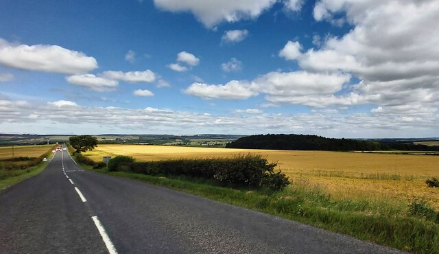
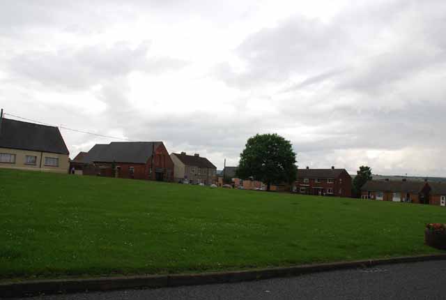
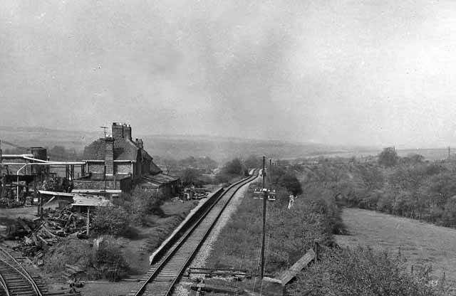
Images are sourced within 2km of 54.704328/-1.6482757 or Grid Reference NZ2234. Thanks to Geograph Open Source API. All images are credited.

River Wear at Page Bank A rural scene today, but in the early 1900s there was a colliery with associated coke works and brick works alongside a colliery village at Page Bank, served by a branch line from Spennymoor.
River Wear at Page Bank
A rural scene today, but in the early 1900s there was a colliery with associated coke works and brick works alongside a colliery village at Page Bank, served by a branch line from Spennymoor.
River Wear Near Page Bank
River Wear Near Byers Green
Lowfield Farm
Lowfield Farm
Cattle At The Grange
Auckland Way Railway Path The Auckland Way uses the former railway alignment between Bishop Auckland and Spennymoor. The earliest part of the railway opened in 1841, linking Byers Green to the Clarence Railway's route to Teesside at Ferryhill. The Clarence Railway was en early competitor to the Stockton & Darlington Railway, active in the transportation of coal from Durham collieries to ports on the Tees. The North Eastern Railway extended the line in 1885, infilling the gap between Bishop Auckland and Byers Green. The last part to open was the first to lose its passenger service in 1939, the remaining services to Spennymoor were withdrawn in 1952.
Auckland Way Railway Path
The Auckland Way uses the former railway alignment between Bishop Auckland and Spennymoor. The earliest part of the railway opened in 1841, linking Byers Green to the Clarence Railway's route to Teesside at Ferryhill. The Clarence Railway was en early competitor to the Stockton & Darlington Railway, active in the transportation of coal from Durham collieries to ports on the Tees. The North Eastern Railway extended the line in 1885, infilling the gap between Bishop Auckland and Byers Green. The last part to open was the first to lose its passenger service in 1939, the remaining services to Spennymoor were withdrawn in 1952.
Footpath To Hagg Plantation
Hagg Lane Track linking Byers Green and Whitworth, also a public footpath.
Hagg Lane
Track linking Byers Green and Whitworth, also a public footpath.
Track Crossing Burton Beck
Farmland near Binchester
Gated field near Binchester Crag Farm
Whitworth Hall Hotel Grounds With fallow deer and the Bobby Shafto memorial beyond
Whitworth Hall Hotel Grounds
With fallow deer and the Bobby Shafto memorial beyond
Whitworth Parish Church View of the west gable which has two shelters for medieval effigies of a lady and a knight
Whitworth Parish Church
View of the west gable which has two shelters for medieval effigies of a lady and a knight
Footpath to the River Wear Footpath to the River Wear near Willington.
Footpath to the River Wear
Footpath to the River Wear near Willington.
Former Road Bridge Abutment On the south bank of the River Wear for the Jubilee Bridge. A new Jubilee Bridge has been built a little up river.
Former Road Bridge Abutment
On the south bank of the River Wear for the Jubilee Bridge. A new Jubilee Bridge has been built a little up river.
Outbuildings at Lowfield Farm The Weardale Way long distance footpath squeezes between the river and the farmyard at Lowfield, near Willington
Outbuildings at Lowfield Farm
The Weardale Way long distance footpath squeezes between the river and the farmyard at Lowfield, near Willington
Lowfield Farm The field to the west of Lowfield Farm is difficult to negotiate due to much bog and mud, through which the Weardale Way ploughs through. Although it looks benign in the photograph.
Advisable to keep to the riverbank instead.
Lowfield Farm
The field to the west of Lowfield Farm is difficult to negotiate due to much bog and mud, through which the Weardale Way ploughs through. Although it looks benign in the photograph. Advisable to keep to the riverbank instead.
Weardale Way passing by Lowfield Farm The long distance path follows a wide farm track, squeezed between farm outbuildings and the riverbank
Weardale Way passing by Lowfield Farm
The long distance path follows a wide farm track, squeezed between farm outbuildings and the riverbank
Show me another place!

Nancy's Wood is located at Grid Ref: NZ2234 (Lat: 54.704328, Lng: -1.6482757)

Unitary Authority: County Durham

Police Authority: Durham

What 3 Words

///corrode.owes.heap. Near Spennymoor, Co. Durham

Nearby Locations

Byers Green Nancy's Wood

Related Wikis

Byers Green

Byers Green is a village and former civil parish, now in the parish of Spennymoor, in the County Durham district, in the ceremonial county of Durham, England...

Whitworth, County Durham

Whitworth was a civil parish in County Durham, in England, centred on Whitworth Hall. It was one of several parishes abolished in 1937 to create the parish...

Whitworth Hall Country Park

Whitworth Hall Country Park is a parkland based set in 73 acres (300,000 m2) 8 miles (13 km) from Durham in England, which rests on the outskirts of the...

Whitworth Hall, County Durham

Whitworth Hall which stands in Whitworth Hall Country Park, near Spennymoor, County Durham England, is a country house, formerly the home of the Shafto...

Page Bank

Page Bank is a village in County Durham, in England. It is situated on the north bank of the River Wear to the east of Willington and to the north-west...

Todhills, County Durham

Todhills is a village in County Durham, in England. It is situated a few miles to the north of Bishop Auckland, between Newfield and Byers Green. ��2...

Byers Green railway station

Byers Green railway station was one of three railway stations that served in the village of Byers Green in County Durham, Northeast England. == History... ==

Middlestone Moor

Middlestone Moor is a village in County Durham, England. It is situated to the south west of Spennymoor - within the town council's limits. On 12 February...

Nearby Amenities

Located within 500m of 54.704328,-1.6482757
Barrier: entrance
Lat/Long: 54.7033959/-1.6423579
The data included in this document is from www.openstreetmap.org. The data is made available under ODbL.

Have you been to Nancy's Wood?

Leave your review of Nancy's Wood below (or comments, questions and feedback).