Blackman's Wood
Wood, Forest in Durham
England
Blackman's Wood
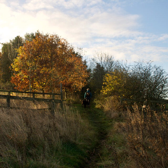
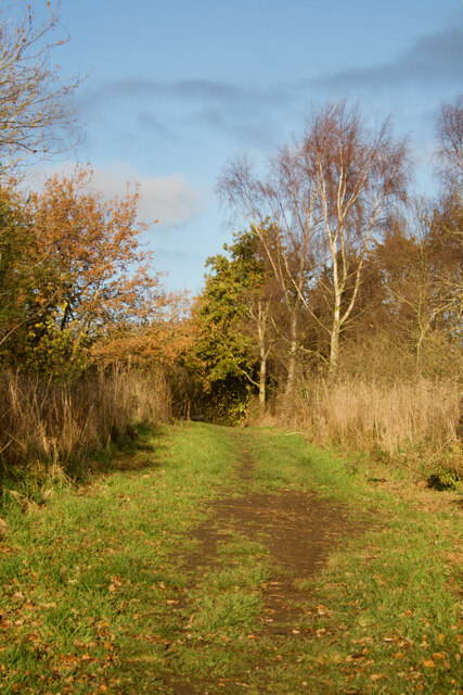
Blackman's Wood is a picturesque woodland located in Durham, England. Covering an area of approximately 20 acres, it is a popular destination for nature lovers and outdoor enthusiasts. The wood is situated near the village of Esh Winning and is easily accessible, making it a convenient escape from the bustling city life.
This ancient woodland is characterized by a diverse range of flora and fauna. The canopy is dominated by a mixture of broadleaf trees such as oak, birch, and ash, creating a dense and verdant environment. The forest floor is carpeted with ferns, bluebells, and other wildflowers, adding a splash of color to the surroundings.
Blackman's Wood is known for its tranquil atmosphere and peaceful ambiance. Visitors can take leisurely walks along the well-maintained footpaths, immersing themselves in the serenity of nature. The wood also features a small stream that meanders through its heart, providing a soothing soundtrack as visitors explore the area.
For wildlife enthusiasts, Blackman's Wood offers a chance to spot a variety of species. It is home to a diverse range of birds, including woodpeckers, owls, and various songbirds. Squirrels are a common sight, playfully darting between the trees. Patient visitors may even catch a glimpse of elusive mammals such as foxes and deer.
Overall, Blackman's Wood is a hidden gem in Durham, offering a tranquil and scenic retreat for those seeking solace in nature. Whether it's a peaceful walk, birdwatching, or simply enjoying the beauty of the woodland, this enchanting forest has something to offer to everyone.
If you have any feedback on the listing, please let us know in the comments section below.
Blackman's Wood Images
Images are sourced within 2km of 54.917332/-1.6471552 or Grid Reference NZ2258. Thanks to Geograph Open Source API. All images are credited.

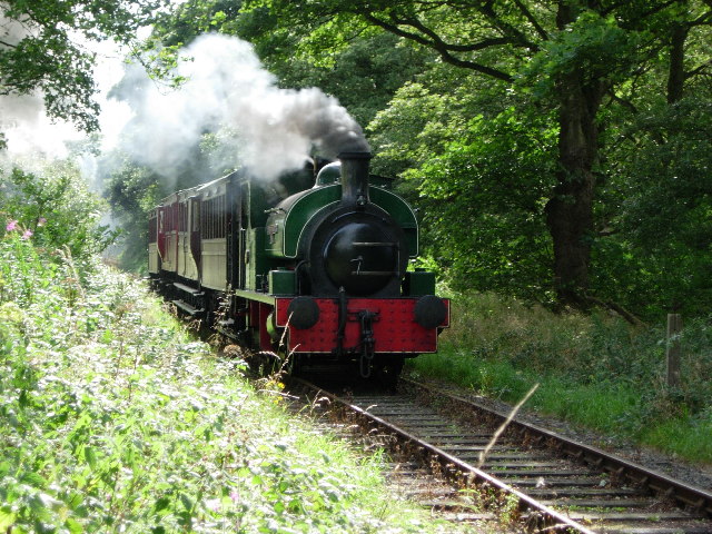
![Course of the former Pontop & Jarrow Railway Re-named as the Bowes Railway in 1932.
Wikipedia Contributors (2021). Bowes Railway. [online] Wikipedia. Available at: <span class="nowrap"><a title="https://en.wikipedia.org/wiki/Bowes_Railway" rel="nofollow ugc noopener" href="https://en.wikipedia.org/wiki/Bowes_Railway">Link</a><img style="margin-left:2px;" alt="External link" title="External link - shift click to open in new window" src="https://s1.geograph.org.uk/img/external.png" width="10" height="10"/></span> [Accessed 2 Dec. 2021].](https://s1.geograph.org.uk/geophotos/07/03/40/7034025_4df437cc.jpg)


Blackman's Wood is located at Grid Ref: NZ2258 (Lat: 54.917332, Lng: -1.6471552)
Unitary Authority: Gateshead
Police Authority: Northumbria
What 3 Words
///exact.urban.brush. Near Lamesley, Tyne & Wear
Nearby Locations
Related Wikis
Ravensworth Castle, Lamesley
Ravensworth Castle is a ruinous Grade II* listed building and a Scheduled Ancient Monument situated at Lamesley, Tyne and Wear, England. The building has...
Tanfield Railway
The Tanfield Railway is a 4 ft 8+1⁄2 in (1,435 mm) standard gauge heritage railway in Gateshead and County Durham, England. Running on part of a former...
Kibblesworth
Kibblesworth is a village 2 miles (3.2 km) west of Birtley, Tyne and Wear, England. Kibblesworth was a mainly rural community until the development of...
Marley Hill
Marley Hill is a former colliery village about six miles to the south west of Gateshead, near the border between Tyne and Wear and County Durham. It has...

Emmanuel College, Gateshead
Emmanuel College is a secondary school and sixth form college (years 7-13) based in Gateshead, England. It was founded in 1990 as a City Technology College...

Sunniside, Gateshead
Sunniside is a village in the Metropolitan Borough of Gateshead, which is located around 5.5 miles (9 km) from Newcastle upon Tyne. Prior to the creation...

Team Valley
Team Valley is a trading estate located in Gateshead. It is home to the Retail World retail park, with many large, international companies based in the...

Lamesley
Lamesley is a village and civil parish in the Metropolitan Borough of Gateshead, Tyne and Wear, England. The population of the civil parish at the 2011...
Nearby Amenities
Located within 500m of 54.917332,-1.6471552Have you been to Blackman's Wood?
Leave your review of Blackman's Wood below (or comments, questions and feedback).