Oak Plantation

Wood, Forest in Durham

England

Oak Plantation

Footpath to Hedley Lane
Footpath to Hedley Lane Credit: Mick Garratt

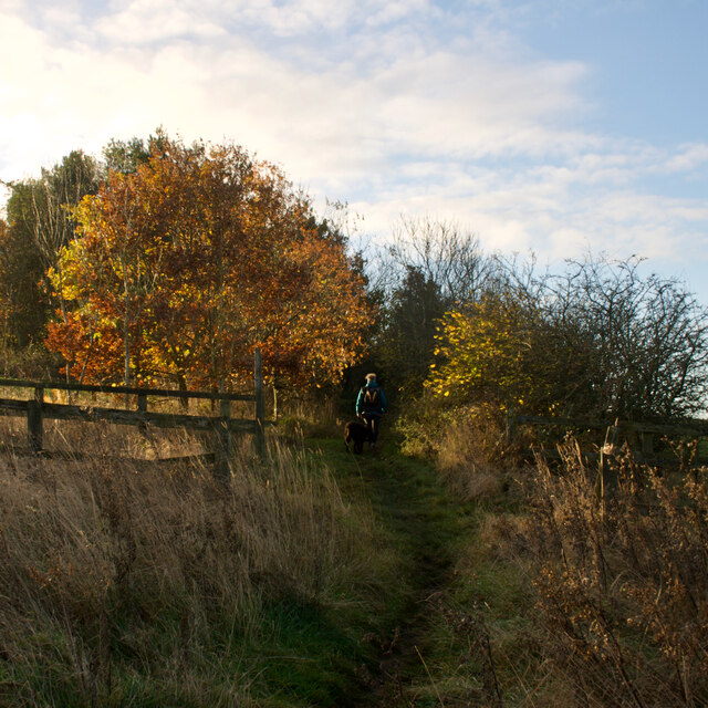
Oak Plantation in Durham is a picturesque woodland area known for its abundance of majestic oak trees. Located in the northeastern part of the county, this enchanting forest covers an expansive area of approximately 500 acres. The plantation is a popular destination for nature enthusiasts, hikers, and those seeking tranquility amidst the beauty of nature.

The woodland is characterized by its dense canopy of towering oak trees, creating a serene and shaded atmosphere throughout. These ancient oaks, some of which are estimated to be over 200 years old, provide a habitat for a diverse range of flora and fauna. The forest floor is carpeted with a rich undergrowth of ferns, wildflowers, and mosses, adding to the enchanting ambiance of the plantation.

Oak Plantation boasts well-maintained trails that wind their way through the forest, allowing visitors to explore its natural beauty. These trails cater to various skill levels, from leisurely strolls to more challenging hikes. The plantation also offers designated picnic areas, making it an ideal spot for a family day out or a peaceful lunch surrounded by nature.

Wildlife is abundant in Oak Plantation, with numerous bird species, including woodpeckers and owls, making their homes among the trees. Squirrels can be spotted playfully darting through the branches, while deer and foxes are occasionally seen grazing in the quieter parts of the woodland.

Oak Plantation is not only a haven for nature enthusiasts but also an important ecological site. The preservation and conservation efforts in place ensure that this natural treasure will continue to thrive for generations to come.

If you have any feedback on the listing, please let us know in the comments section below.

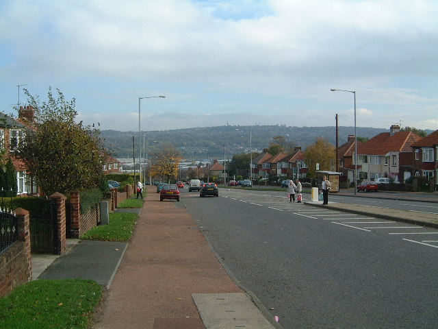
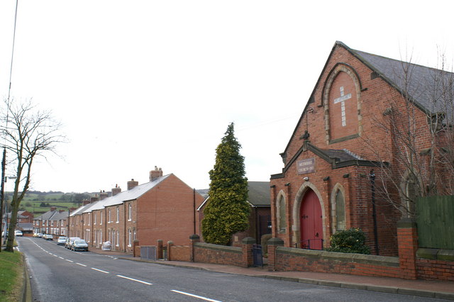
Oak Plantation Images

Images are sourced within 2km of 54.919126/-1.6494016 or Grid Reference NZ2258. Thanks to Geograph Open Source API. All images are credited.

Footpath to Hedley Lane
Site of former reservoir
Course of the former Pontop & Jarrow Railway Re-named as the Bowes Railway in 1932.

Wikipedia Contributors (2021). Bowes Railway. [online] Wikipedia. Available at: <span class="nowrap"><a title="https://en.wikipedia.org/wiki/Bowes_Railway" rel="nofollow ugc noopener" href="https://en.wikipedia.org/wiki/Bowes_Railway">Link</a><img style="margin-left:2px;" alt="External link" title="External link - shift click to open in new window" src="https://s1.geograph.org.uk/img/external.png" width="10" height="10"/></span> [Accessed 2 Dec. 2021].
Course of the former Pontop & Jarrow Railway
Re-named as the Bowes Railway in 1932. Wikipedia Contributors (2021). Bowes Railway. [online] Wikipedia. Available at: LinkExternal link [Accessed 2 Dec. 2021].
Marley Hill signal box The signal box is on the eastern side of the Tanfield Railway north of  the Andrews House Station; it's seen here from the bridge over the line between those two locations.
Marley Hill signal box
The signal box is on the eastern side of the Tanfield Railway north of the Andrews House Station; it's seen here from the bridge over the line between those two locations.
Tanfield Railway, Marley Hill Just north of Andrews House station the line passes Marley Hill signal cabin just before the connection to Marley Hill sheds. At one time another mineral line crossed here at right angles.
Tanfield Railway, Marley Hill
Just north of Andrews House station the line passes Marley Hill signal cabin just before the connection to Marley Hill sheds. At one time another mineral line crossed here at right angles.
Signals at Marley Hill These signals on the Tanfield Railway control the passing loop at Andrews House station. Behind them is Marley Hill signal cabin.
Signals at Marley Hill
These signals on the Tanfield Railway control the passing loop at Andrews House station. Behind them is Marley Hill signal cabin.
Tanfield Railway, Sunniside The ground frame controls the points at the southern end of Sunniside station - the northern terminus of the Tanfield Railway.
Tanfield Railway, Sunniside
The ground frame controls the points at the southern end of Sunniside station - the northern terminus of the Tanfield Railway.
Sunniside Station Although it is the terminus of the Tanfield Railway, the station at Sunniside is very basic and many passengers probably don't bother to alight. A few that have watch the guard carry the tail lamp to the back of the train in preparation for the return journey to East Tanfield.
Sunniside Station
Although it is the terminus of the Tanfield Railway, the station at Sunniside is very basic and many passengers probably don't bother to alight. A few that have watch the guard carry the tail lamp to the back of the train in preparation for the return journey to East Tanfield.
No 49 at Sunniside The former National Coal Board locomotive has run round its train in readiness for the return journey from Sunniside, the Tanfield Railway's northern terminus, to East Tanfield.
No 49 at Sunniside
The former National Coal Board locomotive has run round its train in readiness for the return journey from Sunniside, the Tanfield Railway's northern terminus, to East Tanfield.
Sunniside Station A Tanfield Railway train, with its vintage rolling stock, awaits departure from the northern terminus at Sunniside to East Tanfield at the other end of the line.
Sunniside Station
A Tanfield Railway train, with its vintage rolling stock, awaits departure from the northern terminus at Sunniside to East Tanfield at the other end of the line.
A corner of the Team Valley Retail Park
The Tanfield Railway, Marley Hill Marley Hill Signalbox is placed at an angle to the track due to having previously controlled a flat crossing between the Tanfield Railway and the Bowes Railway, the latter passing in front of the signalbox.  The flat crossing was removed in 2012, many years after the Bowes Railway had been closed.
The green building on the left is the Tanfield Railway's carriage shed, built to house the historic carriages used on the railway.
The Tanfield Railway, Marley Hill
Marley Hill Signalbox is placed at an angle to the track due to having previously controlled a flat crossing between the Tanfield Railway and the Bowes Railway, the latter passing in front of the signalbox. The flat crossing was removed in 2012, many years after the Bowes Railway had been closed. The green building on the left is the Tanfield Railway's carriage shed, built to house the historic carriages used on the railway.
Team Valley Retail World A view of the retail park with low, dark, swirling cloud
Team Valley Retail World
A view of the retail park with low, dark, swirling cloud
Old Ravensworth Farm A view of the entrance to the farm with the sprawl of southern Gateshead in the distance.
Old Ravensworth Farm
A view of the entrance to the farm with the sprawl of southern Gateshead in the distance.
Blackburn Fell A view of the fell from the Tyne-Wear Trail.
Blackburn Fell
A view of the fell from the Tyne-Wear Trail.
Silverhills Newly built farm buildings on the Lamesley-Sunniside road
Silverhills
Newly built farm buildings on the Lamesley-Sunniside road
The Marquis Of Granby The pub is on the Lobley Hill to Sunniside road.
The Marquis Of Granby
The pub is on the Lobley Hill to Sunniside road.
The Birches The Birches housing estate, just off Pennyfine Road in Sunniside.
The Birches
The Birches housing estate, just off Pennyfine Road in Sunniside.
Show me another place!

Oak Plantation is located at Grid Ref: NZ2258 (Lat: 54.919126, Lng: -1.6494016)

Unitary Authority: Gateshead

Police Authority: Northumbria

What 3 Words

///tides.print.vine. Near Lamesley, Tyne & Wear

Related Wikis

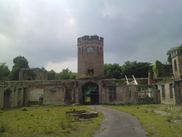
Ravensworth Castle, Lamesley

Ravensworth Castle is a ruinous Grade II* listed building and a Scheduled Ancient Monument situated at Lamesley, Tyne and Wear, England. The building has...
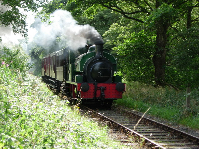
Tanfield Railway

The Tanfield Railway is a 4 ft 8+1⁄2 in (1,435 mm) standard gauge heritage railway in Gateshead and County Durham, England. Running on part of a former...

Marley Hill

Marley Hill is a former colliery village about six miles to the south west of Gateshead, near the border between Tyne and Wear and County Durham. It has...

Emmanuel College, Gateshead

Emmanuel College is a secondary school and sixth form college (years 7-13) based in Gateshead, England. It was founded in 1990 as a City Technology College...

Sunniside, Gateshead

Sunniside is a village in the Metropolitan Borough of Gateshead, which is located around 5.5 miles (9 km) from Newcastle upon Tyne. Prior to the creation...

Lobley Hill

Lobley Hill is located in the west of the old County Borough of Gateshead within the Metropolitan Borough of Gateshead in Tyne and Wear, North East England...

Kibblesworth

Kibblesworth is a village 2 miles (3.2 km) west of Birtley, Tyne and Wear, England. Kibblesworth was a mainly rural community until the development of...

Team Valley

Team Valley is a trading estate located in Gateshead. It is home to the Retail World retail park, with many large, international companies based in the...

Nearby Amenities

Located within 500m of 54.919126,-1.6494016
Power: tower
Lat/Long: 54.9195761/-1.6425531
Power: tower
Lat/Long: 54.9213474/-1.6452234
Power: tower
Lat/Long: 54.9234591/-1.6484068
The data included in this document is from www.openstreetmap.org. The data is made available under ODbL.

Have you been to Oak Plantation?

Leave your review of Oak Plantation below (or comments, questions and feedback).