Coxclose Wood

Wood, Forest in Durham

England

Coxclose Wood

Blackburn Fell A view of the fell from the Tyne-Wear Trail.
Blackburn Fell Credit: Steve McShane

Coxclose Wood, located in Durham, England, is a picturesque woodland area known for its natural beauty and diverse wildlife. Covering an area of approximately 20 acres, this ancient woodland is a popular destination for nature enthusiasts and provides a tranquil escape from the bustling city life.

The wood is primarily composed of broadleaf trees, including oak, ash, and beech, which form a dense canopy overhead, creating a cool and shaded environment. The forest floor is covered in a rich carpet of moss, ferns, and wildflowers, which adds to the enchanting atmosphere of the wood.

Coxclose Wood is home to a variety of wildlife, making it a haven for nature lovers. Birdwatchers can spot a range of species, including woodpeckers, owls, and warblers, while small mammals such as squirrels, rabbits, and foxes can be seen darting through the underbrush. The wood is also home to a diverse population of insects, including butterflies and dragonflies, which thrive in the woodland's moist and sheltered environment.

Visitors to Coxclose Wood can enjoy a network of well-maintained trails that wind through the forest, providing ample opportunities for walking, jogging, or simply immersing oneself in nature's tranquility. The wood's accessibility and peaceful ambiance make it an ideal location for a family outing or a peaceful retreat.

Overall, Coxclose Wood in Durham offers a serene and idyllic setting for individuals seeking a connection with nature. Its ancient trees, diverse wildlife, and well-maintained trails make it a true gem in the region, attracting visitors from all walks of life who are eager to experience the beauty and tranquility of this enchanting woodland.

If you have any feedback on the listing, please let us know in the comments section below.

Coxclose Wood Images

Images are sourced within 2km of 54.933712/-1.6496962 or Grid Reference NZ2259. Thanks to Geograph Open Source API. All images are credited.

Blackburn Fell A view of the fell from the Tyne-Wear Trail.
Blackburn Fell
A view of the fell from the Tyne-Wear Trail.
Silverhills Newly built farm buildings on the Lamesley-Sunniside road
Silverhills
Newly built farm buildings on the Lamesley-Sunniside road
The Marquis Of Granby The pub is on the Lobley Hill to Sunniside road.
The Marquis Of Granby
The pub is on the Lobley Hill to Sunniside road.
The Birches The Birches housing estate, just off Pennyfine Road in Sunniside.
The Birches
The Birches housing estate, just off Pennyfine Road in Sunniside.
Coach Road Looking north along the Coach Road that runs between the A1 and Ravensworth Castle
Coach Road
Looking north along the Coach Road that runs between the A1 and Ravensworth Castle
Woodland Ravensworth
Field at Ravensworth Park Farm Looking towards Team Valley
Field at Ravensworth Park Farm
Looking towards Team Valley
Satellite dishes at Virgin Media, Team Valley
Hill Head Looking towards Gateshead and Newcastle from Hill Head Farm near Sunniside.
Hill Head
Looking towards Gateshead and Newcastle from Hill Head Farm near Sunniside.
Ravensworth Castle A derelict castle on a private estate.It was used as a location for the ITV Robson Green vehicle 'Wire In The Blood'
Ravensworth Castle
A derelict castle on a private estate.It was used as a location for the ITV Robson Green vehicle 'Wire In The Blood'
Sixth Avenue, Team Valley Trading Estate
High Park Wood
High Park Wood
South Lodge On a coach road; the lodge is the entrance to Ravensworth Castle.
South Lodge
On a coach road; the lodge is the entrance to Ravensworth Castle.
Ravensworth Castle At one time Ravensworth castle was the oldest fortified house in Durham county But Now all that remains of the castle are the two towers the rest of the castle Was Demolished in 1952 from the 1920 to 1930 it had been used as a girls Boarding School but for hundreds of years prior to that had been the home of the Liddell Family in its heyday the estate employed a fleet of servants including a Woodcutter and coachman all of whom were housed on the estate more recently the House has been brought to public attention after being featured in the BBC Programme restoration the castle is grade II listed  date listed 18 November 1985 a castle has existed at this in Lamesley since the 14th century and the Present castle thought to have been built circa 1808 by sir Thomas Liddell where The family lived until 1910
Ravensworth Castle
At one time Ravensworth castle was the oldest fortified house in Durham county But Now all that remains of the castle are the two towers the rest of the castle Was Demolished in 1952 from the 1920 to 1930 it had been used as a girls Boarding School but for hundreds of years prior to that had been the home of the Liddell Family in its heyday the estate employed a fleet of servants including a Woodcutter and coachman all of whom were housed on the estate more recently the House has been brought to public attention after being featured in the BBC Programme restoration the castle is grade II listed date listed 18 November 1985 a castle has existed at this in Lamesley since the 14th century and the Present castle thought to have been built circa 1808 by sir Thomas Liddell where The family lived until 1910
Ravensworth Castle Liked this one tree growing up the chimney breast
Ravensworth Castle
Liked this one tree growing up the chimney breast
Ravensworth Castle North-west corner of stable-block with bell tower
Ravensworth Castle
North-west corner of stable-block with bell tower
Ravensworth Castle Looking at the clock tower and the north and south medieval tower from the stable yard
Ravensworth Castle
Looking at the clock tower and the north and south medieval tower from the stable yard
Ravensworth Castle Steps to the underground bit is heavily chained.
Ravensworth Castle
Steps to the underground bit is heavily chained.
Show me another place!

Coxclose Wood is located at Grid Ref: NZ2259 (Lat: 54.933712, Lng: -1.6496962)

Unitary Authority: Gateshead

Police Authority: Northumbria

What 3 Words

///chief.raft.struck. Near Whickham, Tyne & Wear

Related Wikis

Emmanuel College, Gateshead

Emmanuel College is a secondary school and sixth form college (years 7-13) based in Gateshead, England. It was founded in 1990 as a City Technology College...

Lobley Hill

Lobley Hill is located in the west of the old County Borough of Gateshead within the Metropolitan Borough of Gateshead in Tyne and Wear, North East England...

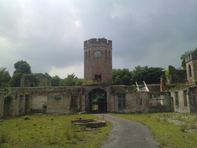
Ravensworth Castle, Lamesley

Ravensworth Castle is a ruinous Grade II* listed building and a Scheduled Ancient Monument situated at Lamesley, Tyne and Wear, England. The building has...

Dunston Hill Hospital

Dunston Hill Hospital was a hospital in Gateshead, Tyne and Wear. It was managed by Gateshead Health NHS Foundation Trust. == History == The hospital had...

Kingsmeadow Community Comprehensive School

Kingsmeadow Community Comprehensive School is a coeducational secondary school and sixth form based in Dunston, Metropolitan Borough of Gateshead. It was...

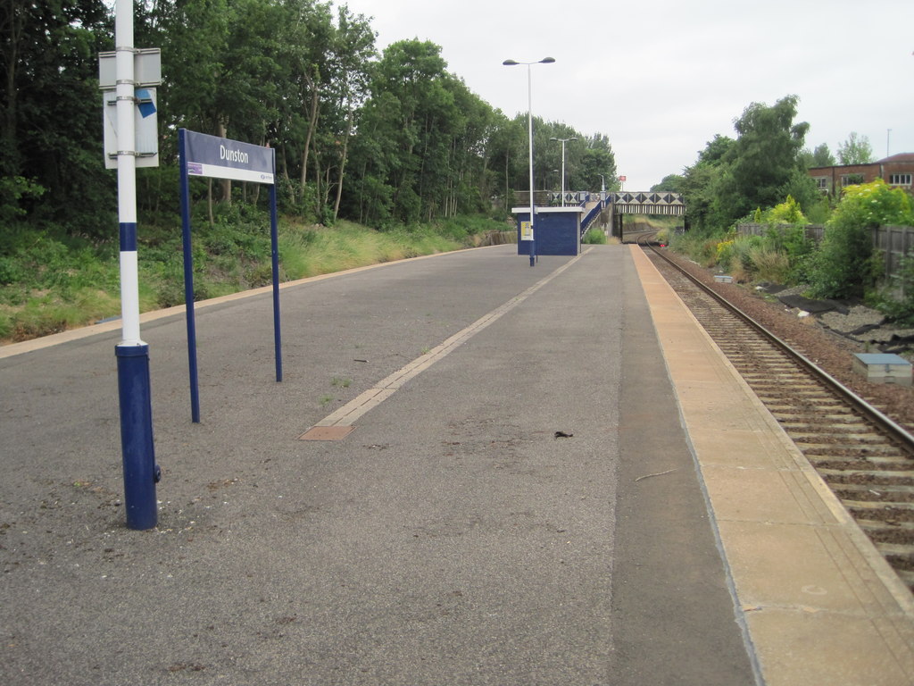
Dunston railway station

Dunston is a railway station on the Tyne Valley Line, which runs between Newcastle and Carlisle via Hexham. The station, situated 2 miles 23 chains (2...
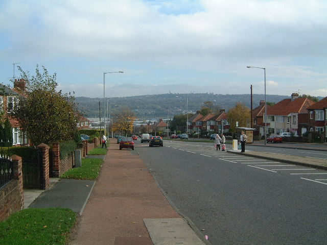
Whickham

Whickham is a village in Tyne and Wear, North East England. It is in the Metropolitan Borough of Gateshead. The village is on high ground overlooking...

Team Valley

Team Valley is a trading estate located in Gateshead. It is home to the Retail World retail park, with many large, international companies based in the...

Nearby Amenities

Located within 500m of 54.933712,-1.6496962
Bus Stop
WATERGATE BANK-LODGE-W/B
Local Ref: S
Naptan AtcoCode: 410000021001
Naptan Bearing: S
Naptan CommonName: WATERGATE BANK-LODGE-W/B
Naptan Indicator: S
Naptan Landmark: OUTSIDE WATERGATE LODGE
Naptan NaptanCode: twrdpgjd
Naptan PlusbusZoneRef: NWCSTLE
Naptan Street: WATERGATE BANK
Naptan Verified: no
Source: naptan_import
Lat/Long: 54.932331/-1.6541924
Bus Stop
Watergate Bank-Lodge
Bench: no
Bus: yes
Local Ref: NE
Naptan AtcoCode: 410000021014
Naptan Bearing: NE
Naptan Indicator: NE-Bound
Naptan Landmark: Opposite Watergate Lodge
Naptan NaptanCode: twrdpgpa
Naptan PlusbusZoneRef: NWCSTLE
Naptan Street: Watergate Bank
Naptan Verified: no
Public Transport: platform
Shelter: no
Source: naptan_import
Tactile Paving: no
Lat/Long: 54.9322164/-1.6549893
Power: pole
Lat/Long: 54.931371/-1.6552444
Material: wood
Power: pole
Lat/Long: 54.9318064/-1.6561799
Power: pole
Lat/Long: 54.9313411/-1.655379
Material: wood
Power: pole
Lat/Long: 54.9318524/-1.6560805
Power: pole
Lat/Long: 54.9325066/-1.65718
Power: pole
Lat/Long: 54.9307448/-1.6552089
Power: pole
Lat/Long: 54.930777/-1.6550814
Waterway: weir
Lat/Long: 54.9345569/-1.6524438
Floating Rocks
Artist Name: Colin Rose
Artwork Type: sculpture
Material: stone
Tourism: artwork
Website: https://www.geograph.org.uk/photo/6220317
Lat/Long: 54.9344382/-1.6522689
Out of the Darkness
Artist Name: Jim Roberts
Artwork Type: sculpture
Image: https://www.geograph.org.uk/photo/6220291
Material: steel
Tourism: artwork
Lat/Long: 54.9349452/-1.6527906
The data included in this document is from www.openstreetmap.org. The data is made available under ODbL.

Have you been to Coxclose Wood?

Leave your review of Coxclose Wood below (or comments, questions and feedback).