Nether Hall Plantation

Wood, Forest in Derbyshire Derbyshire Dales

England

Nether Hall Plantation

Hazelford Hall above The Hope Valley
Hazelford Hall above The Hope Valley Credit: Neil Theasby

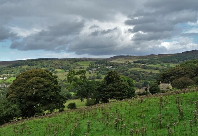
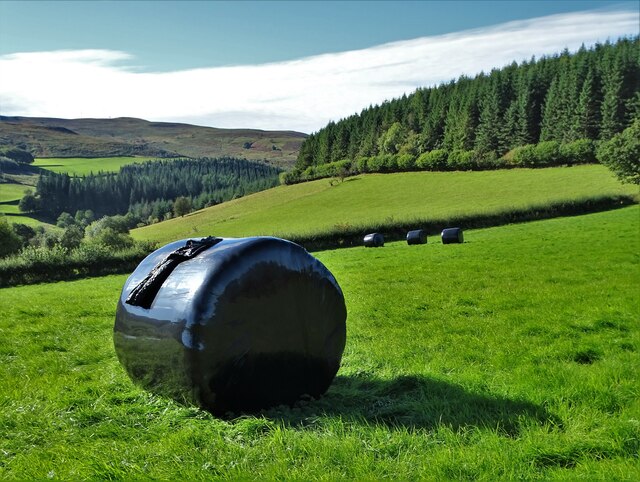
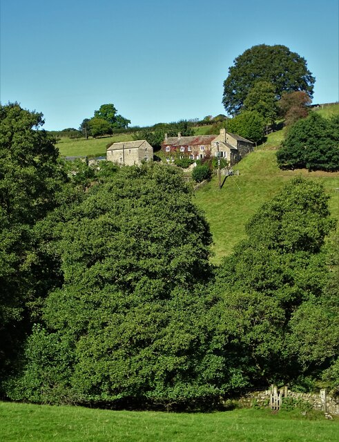
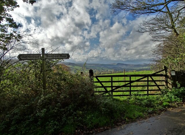
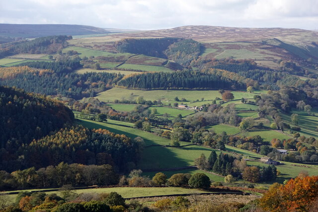
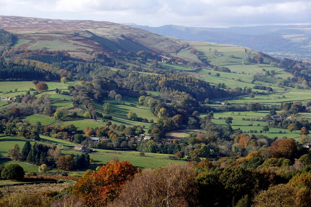
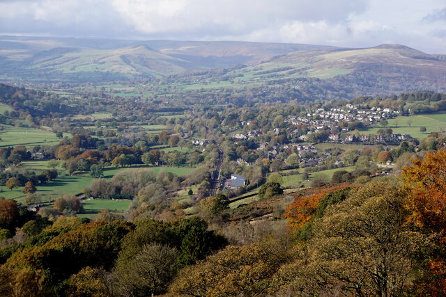
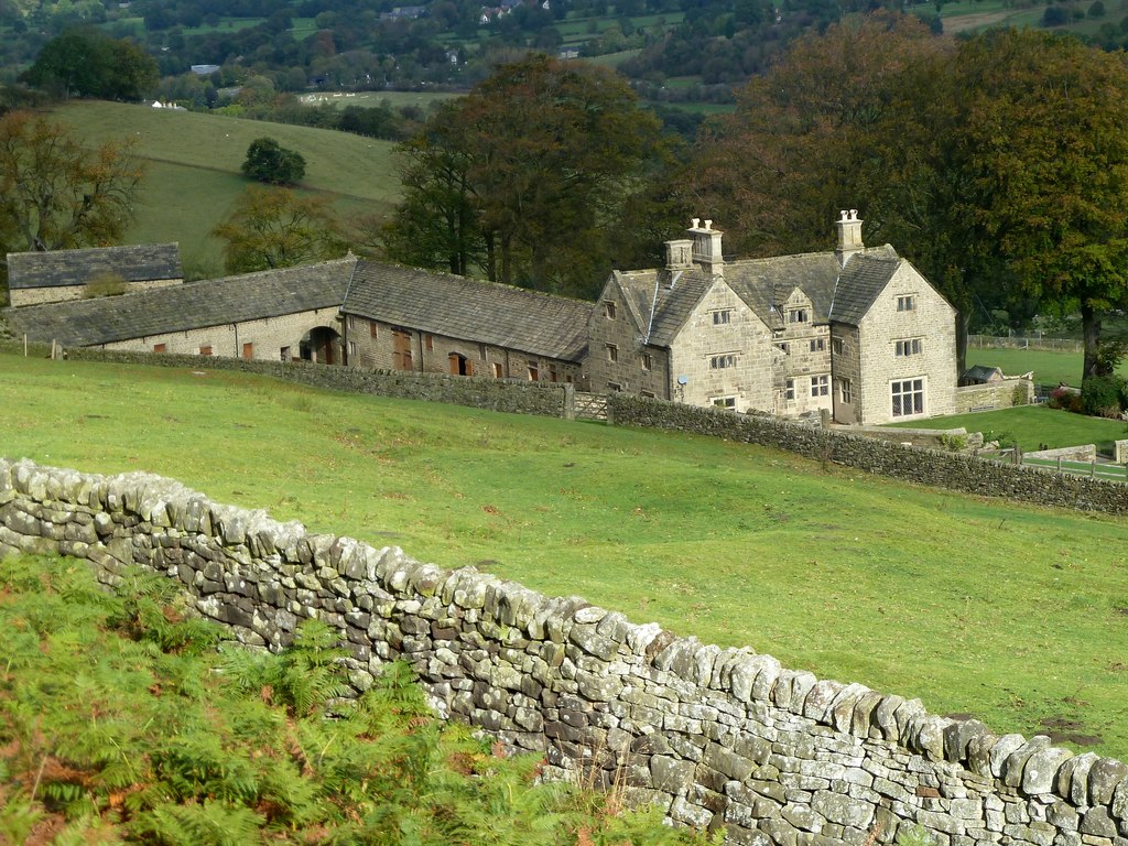
Nether Hall Plantation is a picturesque woodland located in Derbyshire, England. Covering an expansive area of approximately 300 acres, it is a popular destination for nature enthusiasts and outdoor enthusiasts alike. The plantation is situated near the village of Chinley, nestled within the stunning Peak District National Park.

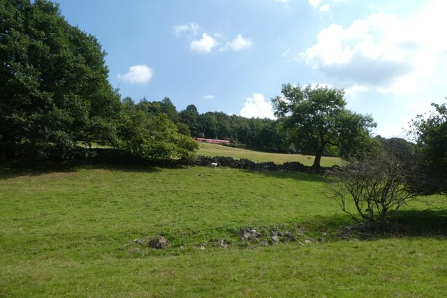
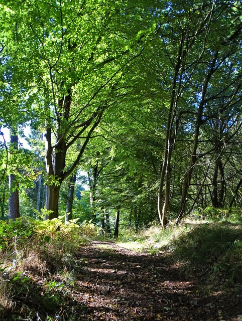
The woodland is primarily composed of a diverse mix of broadleaf trees, including oak, beech, birch, and ash. This rich variety of tree species provides a habitat for a wide range of wildlife, including deer, foxes, badgers, and numerous bird species. The dense canopy created by the trees offers a sense of tranquility and seclusion for visitors, making it an ideal spot for walking, hiking, and nature observation.

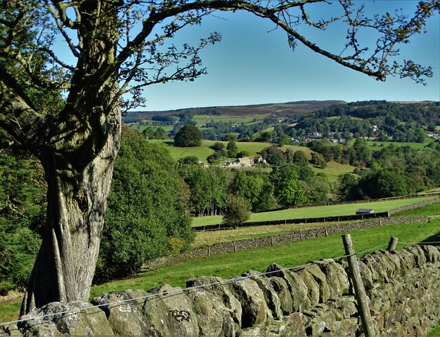
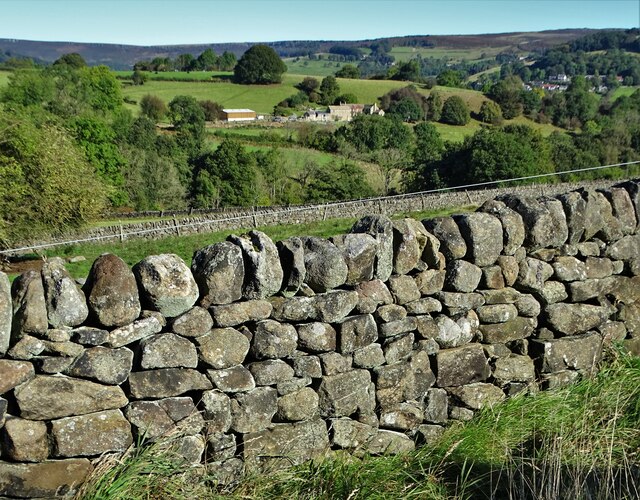
Nether Hall Plantation is crisscrossed by a network of well-maintained footpaths, allowing visitors to explore the beauty of the woodland at their own pace. These paths lead to various points of interest, such as a charming stream that meanders through the plantation, providing a serene backdrop to the surroundings.

The plantation is particularly enchanting during the spring, when the forest floor is carpeted with bluebells and other wildflowers in full bloom. This creates a vibrant and colorful display, attracting photographers and nature lovers who seek to capture the beauty of the woodland.

Overall, Nether Hall Plantation is a haven of natural beauty and tranquility, offering visitors a chance to escape the hustle and bustle of daily life and immerse themselves in the wonders of Derbyshire's woodlands.

If you have any feedback on the listing, please let us know in the comments section below.

Nether Hall Plantation Images

Images are sourced within 2km of 53.326874/-1.6630903 or Grid Reference SK2281. Thanks to Geograph Open Source API. All images are credited.

Hazelford Hall above The Hope Valley
View to Broadhay from Highlow Wood Broadhay is the farm you can see in the centre of this photograph with Hathersage beyond
View to Broadhay from Highlow Wood
Broadhay is the farm you can see in the centre of this photograph with Hathersage beyond
Drystone wall  with view to Broadhay
Drystone wall with view to Broadhay
Towards the railway A DB class 66 hauls a train towards Grindleford on the Hope Valley Line.
Towards the railway
A DB class 66 hauls a train towards Grindleford on the Hope Valley Line.
B6001 above the Derwent Looking along the road between Grindleford and Hathersage.
B6001 above the Derwent
Looking along the road between Grindleford and Hathersage.
Road between two woods An unnamed minor road with Mill Wood to the left and Oaks Wood to the right.
Road between two woods
An unnamed minor road with Mill Wood to the left and Oaks Wood to the right.
River Derwent and Millstone Edge from Leadmill Bridge, Derbyshire A view in the Derwent Valley of the Derbyshire Peak District, near to the village of Hathersage.  Technically the Millstone Edge (the line of cliffs in the background) are located within the city of Sheffield, South Yorkshire.  Sheffield is the only British city to have part of a national park within its boundaries.
River Derwent and Millstone Edge from Leadmill Bridge, Derbyshire
A view in the Derwent Valley of the Derbyshire Peak District, near to the village of Hathersage. Technically the Millstone Edge (the line of cliffs in the background) are located within the city of Sheffield, South Yorkshire. Sheffield is the only British city to have part of a national park within its boundaries.
Derwent Aqueduct access gates and discharge well The Derwent Aqueduct was laid to bring water from the Derwent to Derby, Nottingham and Leicester. Its line is marked by distinctive access gates, like this one, which gives access to a discharge well. There is second gate, half buried in the undergrowth, in the background.
Derwent Aqueduct access gates and discharge well
The Derwent Aqueduct was laid to bring water from the Derwent to Derby, Nottingham and Leicester. Its line is marked by distinctive access gates, like this one, which gives access to a discharge well. There is second gate, half buried in the undergrowth, in the background.
It's not that deep Overtaking on the stepping stones
It's not that deep
Overtaking on the stepping stones
Hirstclough Lane A steep byway open to all traffic to the east of Bamford
Hirstclough Lane
A steep byway open to all traffic to the east of Bamford
Hay bales wrapped in plastic With Birch Low to the right. One wonders how much plastic is used in this way in The British Isles each year. Farmers never used to use it.
Hay bales wrapped in plastic
With Birch Low to the right. One wonders how much plastic is used in this way in The British Isles each year. Farmers never used to use it.
Broadhay Not to be confused with nearby Broadhay Farm
Broadhay
Not to be confused with nearby Broadhay Farm
In Callow Wood
In Callow Wood
Pheasant feeder near Broadhay
At the junction of Birley Lane and Coggers Lane Looking towards Hope Cement Works in The Hope Valley.
At the junction of Birley Lane and Coggers Lane
Looking towards Hope Cement Works in The Hope Valley.
Leadmill, from Surprise View, Millstone Edge
Derwent Valley from Surprise View, Millstone Edge
Hathersage, from Surprise View, Millstone Edge
Show me another place!

Nether Hall Plantation is located at Grid Ref: SK2281 (Lat: 53.326874, Lng: -1.6630903)

Administrative County: Derbyshire

District: Derbyshire Dales

Police Authority: Derbyshire

What 3 Words

///surprised.disengage.calculating. Near Hathersage, Derbyshire

Related Wikis

Hathersage

Hathersage ( HATHə-sidge) is a village and civil parish in the Peak District in Derbyshire, England. It lies slightly to the north of the River Derwent...

Hathersage railway station

Hathersage railway station serves the village of Hathersage in the Derbyshire Peak District, in England. == History == The station was opened on 25 June...

St Michael and All Angels' Church, Hathersage

St Michael and All Angels’ Church, Hathersage, is a Grade I listed parish church in the Church of England in Hathersage, Derbyshire. == History == The...

Hood Brook

Hood Brook is a stream in the Derbyshire Peak District, originating near Stanage Edge, close to Robin Hoods Cave. == Background == Hood Brook flows south...

Offerton, Derbyshire

Offerton is a hamlet and civil parish in the Derbyshire Dales district, in Derbyshire, England. It lies on the River Derwent. The village features Offerton...
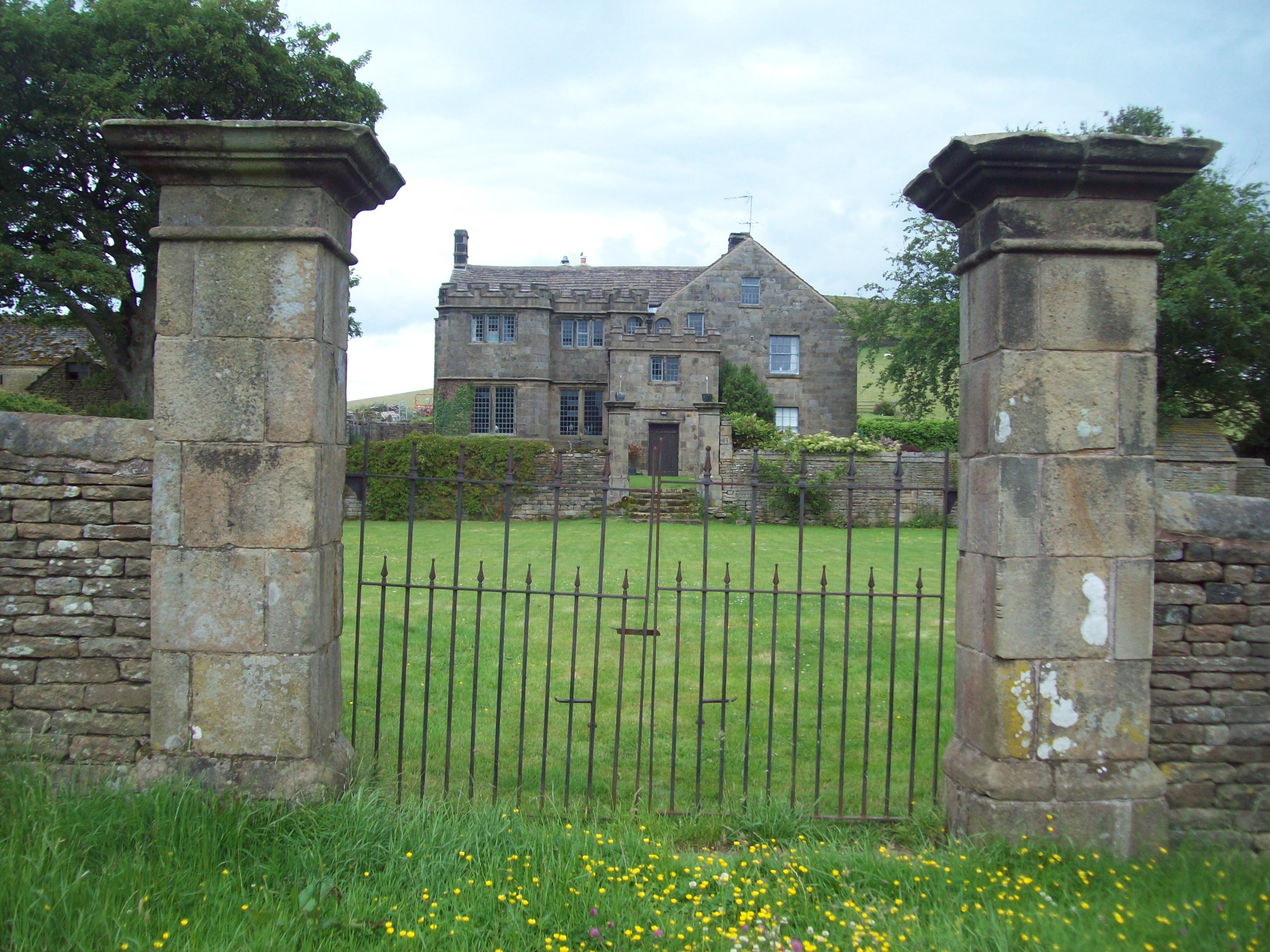
Highlow Hall

Highlow Hall is a historic Elizabethan manor house in Highlow civil parish, near Hathersage, Derbyshire, England. It was owned by the Eyre family from...

Bretton Brook

Bretton Brook is a stream flowing through Bretton in the Derbyshire Peak District. The stream is a tributary of the Highlow Brook, which is a direct...

Highlow Brook

Highlow Brook is a stream in the civil parish of Highlow in the Derbyshire Peak District. The stream is a tributaries of the River Derwent, flowing southeast...

Nearby Amenities

Located within 500m of 53.326874,-1.6630903
Bus Stop
Hathersage Bridge
Bus: yes
Ele: 147.4467773
Public Transport: platform
Lat/Long: 53.3293535/-1.660399
Post Box
Collection Times: Mo-Fr 09:00; Sa 07:00
Ele: 169.7972412
Post Box Type: wall
Ref: S32 336
Royal Cypher: EVIIR
Royal Cypher Wikidata: Q33102324
Source Type: Geograph
Lat/Long: 53.3306462/-1.6619186
Bus Stop
Hathersage Bridge
Bus: yes
Ele: 148.6484375
Naptan AtcoCode: 1000DHMR3734
Naptan NaptanCode: dbsapgmj
Public Transport: platform
Lat/Long: 53.32942/-1.659545
Maxheight: 14'3"
Source Maxheight: survey
Lat/Long: 53.3292567/-1.660892
Barrier: stile
Material: wood
Source: survey;gps
Stile: ladder
Lat/Long: 53.3309986/-1.6660955
Barrier: stile
Material: stone
Source: survey;gps
Stile: squeezer
Lat/Long: 53.3312866/-1.6640748
YHA Hathersage
Addr City: Hope Valley
Addr Postcode: S32 1EH
Addr Street: Castleton Road
Addr Suburb: Hathersage
Brand: YHA
Brand Wikidata: Q8059214
Contact Website: https://www.yha.org.uk/hostel/yha-hathersage
Tourism: hostel
Lat/Long: 53.3299521/-1.6586931
Hathersage Bridge
Bus: yes
Public Transport: stop_position
Lat/Long: 53.3294667/-1.6595715
Hathersage Bridge
Bus: yes
Public Transport: stop_position
Lat/Long: 53.329319/-1.6603598
Generator Method: photovoltaic
Generator Output Electricity: yes
Generator Source: solar
Generator Type: solar_photovoltaic_panel
Location: roof
Power: generator
Lat/Long: 53.3312805/-1.6626632
Generator Method: photovoltaic
Generator Output Electricity: yes
Generator Source: solar
Generator Type: solar_photovoltaic_panel
Location: roof
Power: generator
Lat/Long: 53.3308272/-1.6629288
Generator Method: photovoltaic
Generator Output Electricity: yes
Generator Source: solar
Generator Type: solar_photovoltaic_panel
Location: roof
Power: generator
Lat/Long: 53.3277785/-1.6558662
Generator Method: photovoltaic
Generator Output Electricity: yes
Generator Source: solar
Generator Type: solar_photovoltaic_panel
Location: roof
Power: generator
Lat/Long: 53.3283808/-1.6566145
Generator Method: photovoltaic
Generator Output Electricity: yes
Generator Source: solar
Generator Type: solar_photovoltaic_panel
Location: roof
Power: generator
Lat/Long: 53.3285987/-1.6563651
Bicycle Parking
Bicycle Parking: stands
Capacity: 2
Covered: no
Note: 2 sheffield stands but so close to the wall you can't really put one bike either side
Lat/Long: 53.3300175/-1.6587596
Entrance: main
Lat/Long: 53.3299266/-1.6587067
Entrance: yes
Lat/Long: 53.3299953/-1.6587434
Entrance: yes
Lat/Long: 53.3299813/-1.6586486
Bench: yes
Leisure: picnic_table
Lat/Long: 53.3298284/-1.6586362
Bicycle Repair Station
Fee: no
Service Bicycle Pump: yes
Service Bicycle Repair: yes
Service Bicycle Repair Stand: yes
Service Bicycle Stand: yes
Lat/Long: 53.3300711/-1.6589559
Leisure: picnic_table
Lat/Long: 53.3298557/-1.658557
Leisure: picnic_table
Lat/Long: 53.3297829/-1.6586789
Bench
Backrest: yes
Lat/Long: 53.3307311/-1.6617784
Waste Basket
Lat/Long: 53.3284381/-1.6571572
The data included in this document is from www.openstreetmap.org. The data is made available under ODbL.

Have you been to Nether Hall Plantation?

Leave your review of Nether Hall Plantation below (or comments, questions and feedback).