Cuckoo Clump

Wood, Forest in Wiltshire

England

Cuckoo Clump

Outdoor Seating Area, Cholderton Farm Shop and Cafe
Outdoor Seating Area, Cholderton Farm Shop and Cafe Credit: Paul Collins

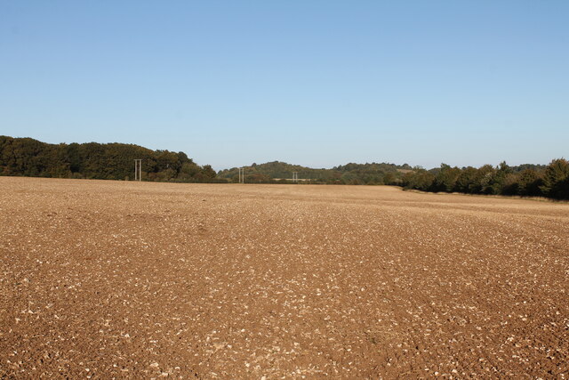
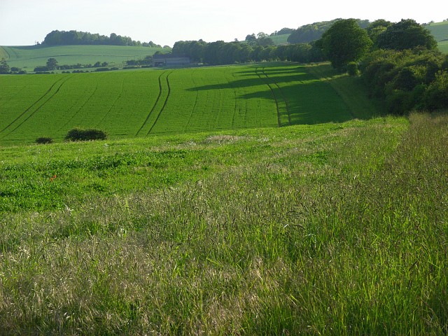
Cuckoo Clump is a picturesque woodland located in the county of Wiltshire, England. Situated near the village of Avebury, this charming forest covers an area of approximately 25 acres and is known for its rich biodiversity and tranquil atmosphere.

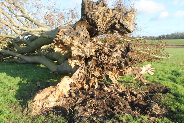
The woodland is predominantly composed of mixed broadleaf trees, including oak, beech, and ash, which create a dense canopy overhead. The forest floor is carpeted with ferns, bluebells, and other wildflowers, adding to the natural beauty of the area. Cuckoo Clump is also home to various wildlife species, such as deer, foxes, badgers, and a diverse range of bird species, making it a popular spot among nature enthusiasts and birdwatchers.

The forest offers several walking trails and paths, allowing visitors to explore its enchanting surroundings. The main trail takes visitors through the heart of the woodland, offering glimpses of ancient trees with twisted branches and moss-covered trunks. The sound of birdsong fills the air, creating a serene ambiance that provides a welcome escape from the hustle and bustle of daily life.

Cuckoo Clump is a place of natural beauty and tranquility, providing a haven for both wildlife and visitors alike. With its stunning woodland scenery, diverse flora and fauna, and peaceful ambiance, it is a must-visit destination for anyone seeking a connection with nature in the heart of Wiltshire.

If you have any feedback on the listing, please let us know in the comments section below.

Cuckoo Clump Images

Images are sourced within 2km of 51.182633/-1.6797015 or Grid Reference SU2242. Thanks to Geograph Open Source API. All images are credited.

Outdoor Seating Area, Cholderton Farm Shop and Cafe
Home Farm, Cholderton The farm boasts the popular Cholderton Farm Shop and Cafe. The shepherd's hut hasn't altered much in 10 years <a href="https://www.geograph.org.uk/photo/2834040">SU2342 : Drive, Home Farm</a>.
Home Farm, Cholderton
The farm boasts the popular Cholderton Farm Shop and Cafe. The shepherd's hut hasn't altered much in 10 years SU2342 : Drive, Home Farm.
Big Cowden field, Cholderton, fallen tree Fallen tree (with arborglyph - see earlier photo <a title="https://www.geograph.org.uk/photo/6054096)" href="https://www.geograph.org.uk/photo/6054096)">Link</a>
Big Cowden field, Cholderton, fallen tree
Fallen tree (with arborglyph - see earlier photo Link
Tin Can Copse, Cholderton Tin Can Copse is a sad remnant of a small copse of trees situated on the boundary of Big Cowden field and the edge of the Bourne valley floodplain. It gets its name from the hollow in the middle being used as a rubbish dump during the mid/late 19th-early/mid 20th century.
Tin Can Copse, Cholderton
Tin Can Copse is a sad remnant of a small copse of trees situated on the boundary of Big Cowden field and the edge of the Bourne valley floodplain. It gets its name from the hollow in the middle being used as a rubbish dump during the mid/late 19th-early/mid 20th century.
Big Cowden field, Cholderton, fallen tree The northern and first to fall of two trees in the middle of Big Cowden field (the tree on the left in <a title="https://www.geograph.org.uk/photo/6054093)" href="https://www.geograph.org.uk/photo/6054093)">Link</a>. The uprooted tree bowl shows the underlying soliflucted chalk overlain by Clay-with-flints still attached to the roots.
Big Cowden field, Cholderton, fallen tree
The northern and first to fall of two trees in the middle of Big Cowden field (the tree on the left in Link. The uprooted tree bowl shows the underlying soliflucted chalk overlain by Clay-with-flints still attached to the roots.
Down Barn Dairy field, Cholderton View across Down Brn Dairy Field after ploughing autumn 2022.
Down Barn Dairy field, Cholderton
View across Down Brn Dairy Field after ploughing autumn 2022.
Down Barn Dairy field, Cholderton during field walking survey Looking west across the combe running through Down Barn Dairy field, during archaeological field walking survey in advance of solar development due to cover the field in the future.
Down Barn Dairy field, Cholderton during field walking survey
Looking west across the combe running through Down Barn Dairy field, during archaeological field walking survey in advance of solar development due to cover the field in the future.
Entrance to Diana Plantation Field, Cholderton Looking across Diana Plantation Field to Hills Copse on Beacon Hill in the distance.
Entrance to Diana Plantation Field, Cholderton
Looking across Diana Plantation Field to Hills Copse on Beacon Hill in the distance.
Dairy Cottages Field, Cholderton View across Dairy Cottages field looking towards Thruxton Hill on the skyline during archaeological field walking survey in advance of solar development.
Dairy Cottages Field, Cholderton
View across Dairy Cottages field looking towards Thruxton Hill on the skyline during archaeological field walking survey in advance of solar development.
Big AA Box field, Cholderton Looking across Big AA Box field towards Thruxton Hill. The woodland at the end of the field marks the county boundary marked by a late Bronze Age linear ditch running along the field boundary. The field name derives from the AA box that used to stand in the lay-by of the old A303: the modern dual carriageway runs behind the hedge on the right.
Big AA Box field, Cholderton
Looking across Big AA Box field towards Thruxton Hill. The woodland at the end of the field marks the county boundary marked by a late Bronze Age linear ditch running along the field boundary. The field name derives from the AA box that used to stand in the lay-by of the old A303: the modern dual carriageway runs behind the hedge on the right.
Parkhouse Field, Cholderton Top Parkhouse field, recently ploughed looking across to Parkhouse Cross and beyond Snoddington Down on the horizon.
Parkhouse Field, Cholderton
Top Parkhouse field, recently ploughed looking across to Parkhouse Cross and beyond Snoddington Down on the horizon.
Parkhouse Field, Cholderton Looking across Top Parkhouse Field to Beacon Hill, with tractor and water trough.
Parkhouse Field, Cholderton
Looking across Top Parkhouse Field to Beacon Hill, with tractor and water trough.
Grateley Lodge Grateley Lodge is a lodge at the end of a lane. The lodge is part of Wilbury House (a Grade II listed park and garden), list entry number 1001245 <span class="nowrap"><a title="https://historicengland.org.uk/listing/the-list/list-entry/1001245" rel="nofollow ugc noopener" href="https://historicengland.org.uk/listing/the-list/list-entry/1001245">Link</a><img style="margin-left:2px;" alt="External link" title="External link - shift click to open in new window" src="https://s1.geograph.org.uk/img/external.png" width="10" height="10"/></span>
Grateley Lodge
Grateley Lodge is a lodge at the end of a lane. The lodge is part of Wilbury House (a Grade II listed park and garden), list entry number 1001245 LinkExternal link
Byway towards Grateley Lodge A byway heading towards Grateley Lodge.
Byway towards Grateley Lodge
A byway heading towards Grateley Lodge.
Field south east of Grateley Lodge A field to the south east of Grateley Lodge.
Field south east of Grateley Lodge
A field to the south east of Grateley Lodge.
St Nicholas, Cholderton: September 2023
St Nicholas, Cholderton: CWGC grave For Jackman's service record see <span class="nowrap"><a title="https://www.cwgc.org/find-records/find-war-dead/casualty-details/2709902/harold-bartholomew-jackman/" rel="nofollow ugc noopener" href="https://www.cwgc.org/find-records/find-war-dead/casualty-details/2709902/harold-bartholomew-jackman/">Link</a><img style="margin-left:2px;" alt="External link" title="External link - shift click to open in new window" src="https://s1.geograph.org.uk/img/external.png" width="10" height="10"/></span>
St Nicholas, Cholderton: CWGC grave
For Jackman's service record see LinkExternal link
St Nicholas, Cholderton: "spire"
Show me another place!

Cuckoo Clump is located at Grid Ref: SU2242 (Lat: 51.182633, Lng: -1.6797015)

Unitary Authority: Wiltshire

Police Authority: Wiltshire

What 3 Words

///influencing.levels.breeze. Near Allington, Wiltshire

Related Wikis

Cholderton

Cholderton, or more properly West Cholderton, is a village and civil parish in the Bourne Valley of Wiltshire, England. The village is about 4 miles (6...

Wilbury House

Wilbury House or Wilbury Park is an 18th-century Neo-Palladian country house in the parish of Newton Tony, Wiltshire in South West England, about 8.7 miles...

Battle of the Beanfield

The Battle of the Beanfield took place over several hours on 1 June 1985, when Wiltshire Police prevented The Peace Convoy, a convoy of several hundred...

Snoddington

Snoddington is a small hamlet in Hampshire and close to the border of Wiltshire near to Thruxton Aerodrome and first mentioned in the eleventh century...

Newton Tony

Newton Tony (formerly Newton Toney) is a rural English village and civil parish in the county of Wiltshire, close to the border with Hampshire. Situated...
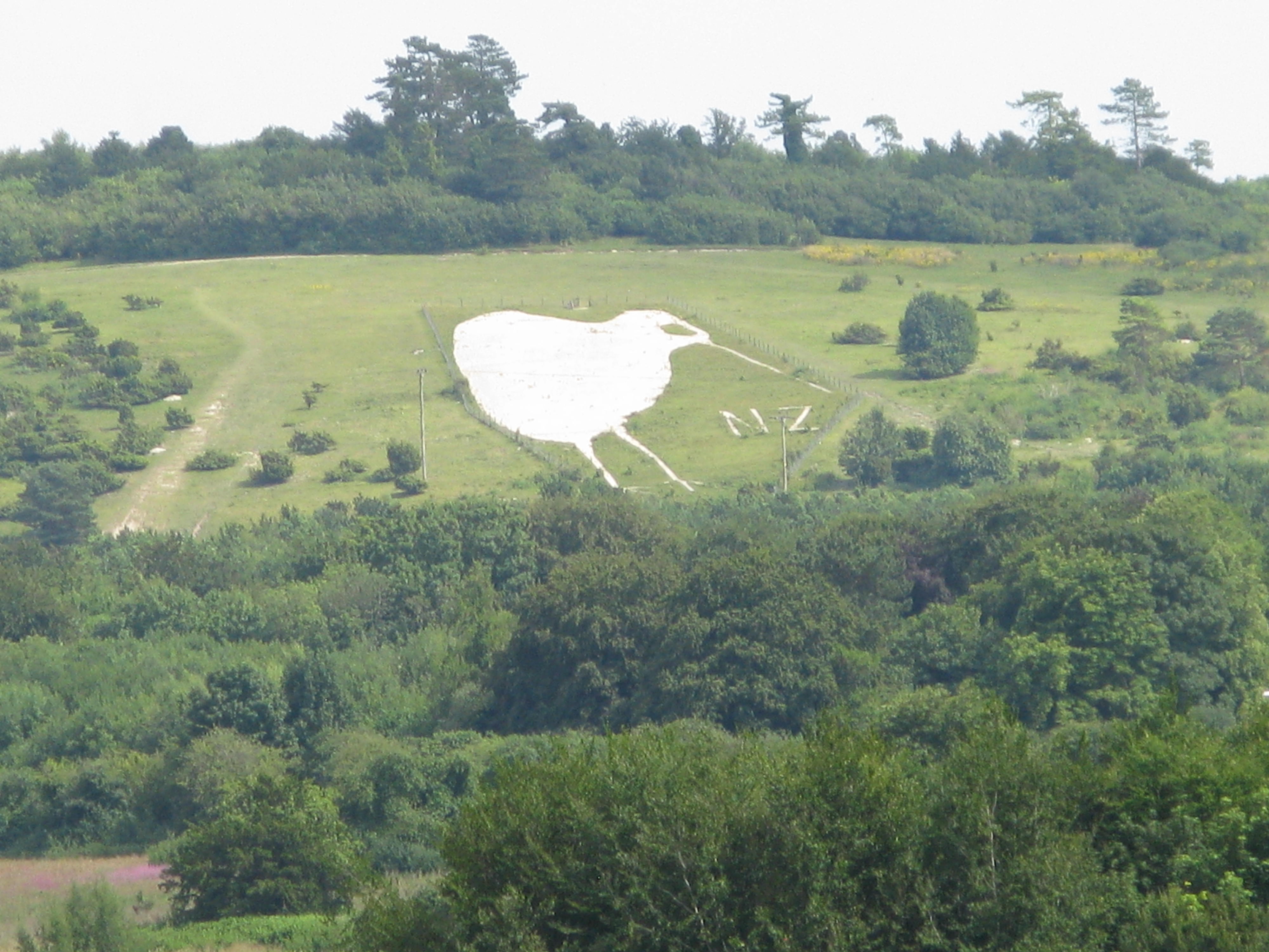
Bulford Kiwi

The Bulford Kiwi is a large depiction of a kiwi, carved in the chalk on Beacon Hill above the military town of Bulford on Salisbury Plain in Wiltshire...

Sling Camp

Sling Camp was a World War I camp occupied by New Zealand soldiers beside the then-military town of Bulford on the Salisbury Plain in Wiltshire, England...

Shipton Bellinger

Shipton Bellinger is a village and civil parish in Hampshire, England. Shipton Bellinger is about 5 miles (8 km) north-east of the town of Amesbury and...

Nearby Amenities

Located within 500m of 51.182633,-1.6797015
Maxspeed: 30 mph
Traffic Sign: maxspeed
Lat/Long: 51.183223/-1.6745012
Cholderton
Place: village
Source: NPE
Lat/Long: 51.180001/-1.6779242
Mini Roundabout
Direction: clockwise
Lat/Long: 51.1792111/-1.6786486
Place Of Worship
Stone circle
Religion: shamanic
Lat/Long: 51.178556/-1.6792886
circle
Lat/Long: 51.1785888/-1.6792645
Post Box
Operator: Royal Mail
Post Box Type: lamp
Ref: SP4 269
Royal Cypher: EIIR
Royal Cypher Wikidata: Q33102113
Lat/Long: 51.1814641/-1.6776252
Playground: multi_play
Lat/Long: 51.1796505/-1.6782501
Historic: memorial
Memorial: war_memorial
Lat/Long: 51.1803835/-1.6789672
Telephone
Booth: K6
Covered: booth
Man Made: telephone_box
Lat/Long: 51.1804087/-1.6786042
The data included in this document is from www.openstreetmap.org. The data is made available under ODbL.

Have you been to Cuckoo Clump?

Leave your review of Cuckoo Clump below (or comments, questions and feedback).