Brooklands Spinney

Wood, Forest in Warwickshire

England

Brooklands Spinney

Berkswell Quarry, eastern end This part of the quarry working is shown on the current OS map as still being woods; some of the woods remain, visible on the left hand side of the photo.  The photo was taken facing north-west from  a bend on Mercote Hall Lane.
Berkswell Quarry, eastern end Credit: Simon Jobson

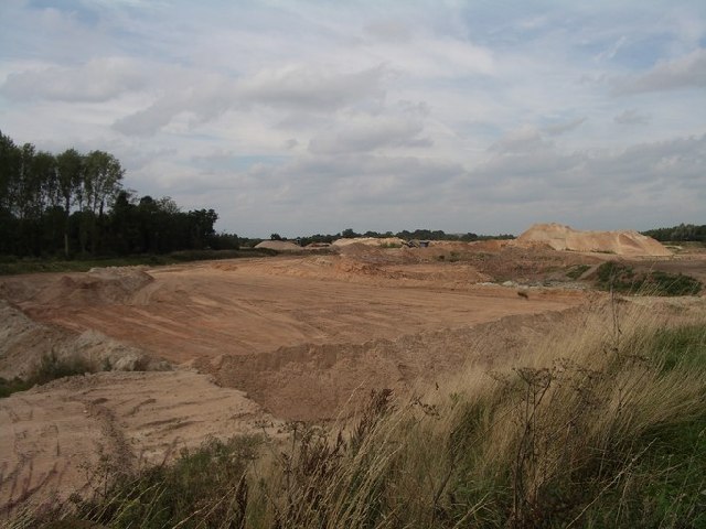
Brooklands Spinney is a charming woodland located in Warwickshire, England. Spread across an area of approximately 10 acres, this tranquil spinney is a haven for nature enthusiasts and those seeking a peaceful retreat. The spinney is situated near the village of Brooklands, which adds to its idyllic setting.

As one ventures into Brooklands Spinney, they are greeted by a diverse range of trees, including oak, ash, and birch. The woodland floor is carpeted with an array of wildflowers, such as bluebells, primroses, and wood sorrel, creating a vibrant and picturesque scene during the spring months.

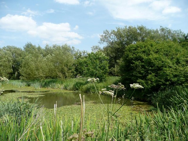
The spinney is home to a variety of wildlife, making it an ideal spot for birdwatching and wildlife observation. Visitors may catch a glimpse of species such as woodpeckers, nuthatches, and tawny owls. Small mammals like foxes, badgers, and squirrels also inhabit the spinney, adding to its ecological richness.

There are several walking trails that wind through the spinney, allowing visitors to explore its beauty at their own pace. These trails are well-maintained and offer a peaceful and meditative experience, with the soothing sounds of nature serving as a backdrop.

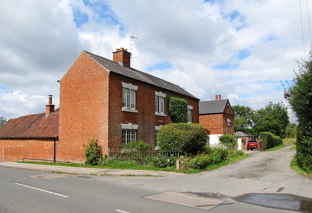
Brooklands Spinney is a popular destination for families, nature lovers, and photographers alike. Its accessibility and tranquil atmosphere make it an ideal location for picnics, photography sessions, and simply enjoying the beauty of the natural world.

Overall, Brooklands Spinney is a hidden gem in Warwickshire, offering a peaceful retreat from the bustling city life and providing a slice of nature's splendor to all who visit.

If you have any feedback on the listing, please let us know in the comments section below.

Brooklands Spinney Images

Images are sourced within 2km of 52.404417/-1.673066 or Grid Reference SP2278. Thanks to Geograph Open Source API. All images are credited.

Berkswell Quarry, eastern end This part of the quarry working is shown on the current OS map as still being woods; some of the woods remain, visible on the left hand side of the photo.  The photo was taken facing north-west from  a bend on Mercote Hall Lane.
Berkswell Quarry, eastern end
This part of the quarry working is shown on the current OS map as still being woods; some of the woods remain, visible on the left hand side of the photo. The photo was taken facing north-west from a bend on Mercote Hall Lane.
Berkswell Quarry being worked This part of the quarry workings lies north of Mercote Hall Lane and east of the access road to Mercote Mill Farm.
Berkswell Quarry being worked
This part of the quarry workings lies north of Mercote Hall Lane and east of the access road to Mercote Mill Farm.
Mercote Mill Farm Surrounded by quarry workings, this old mill, now a farmhouse, is an oasis in the despoiled countryside.
Mercote Mill Farm
Surrounded by quarry workings, this old mill, now a farmhouse, is an oasis in the despoiled countryside.
Raised footway at the end of Marsh Lane Marsh Lane is gated just before reaching this point.  The footway is raised as far as the old Packhorse Bridge due to the River Blythe flooding.  This is signed as a ford on Marsh Lane.
Raised footway at the end of Marsh Lane
Marsh Lane is gated just before reaching this point. The footway is raised as far as the old Packhorse Bridge due to the River Blythe flooding. This is signed as a ford on Marsh Lane.
Entrance to Marsh Lane Nature Reserve
The end of Marsh Lane The lane here turns into a bridleway, going over the packhorse bridge, and through the Packhorse Bridge Nature Reserve.
The end of Marsh Lane
The lane here turns into a bridleway, going over the packhorse bridge, and through the Packhorse Bridge Nature Reserve.
Bridleway to the packhorse bridge
Bridges over the river A comparison of the old packhorse bridge and the more recent railway bridge, both over the same river.
Bridges over the river
A comparison of the old packhorse bridge and the more recent railway bridge, both over the same river.
Hampton-in-Arden packhorse bridge
Pool in Marsh Lane Nature Reserve
Balsall Common-The Saracen's Head Inn On the western fringes of the village.
Balsall Common-The Saracen's Head Inn
On the western fringes of the village.
Balsall Common-Ivy House Farm On Needlers End Lane.
Balsall Common-Ivy House Farm
On Needlers End Lane.
Barston Sewage Treatment Works On the road to Ryton End.
Barston Sewage Treatment Works
On the road to Ryton End.
Balsall Street View from the Lay-by.
Balsall Street
View from the Lay-by.
West Midlands Golf Club from the air Seen on approach to Birmingham Airport from a flight from Prague.
West Midlands Golf Club from the air
Seen on approach to Birmingham Airport from a flight from Prague.
Blythe House Farm from the air Seen on approach to Birmingham Airport from a flight from Prague.
Blythe House Farm from the air
Seen on approach to Birmingham Airport from a flight from Prague.
Barston Lane sewage works from the air Seen on approach to Birmingham from a flight from Prague.
Barston Lane sewage works from the air
Seen on approach to Birmingham from a flight from Prague.
West Midlands Golf Club from the air Viewed on approach to Birmingham from a flight from Prague.
West Midlands Golf Club from the air
Viewed on approach to Birmingham from a flight from Prague.
Show me another place!

Brooklands Spinney is located at Grid Ref: SP2278 (Lat: 52.404417, Lng: -1.673066)

Unitary Authority: Solihull

Police Authority: West Midlands

What 3 Words

///thread.wand.forgiven. Near Barston, West Midlands

Related Wikis

Berkswell Marsh

Berkswell Marsh is a 7.5 hectares (19 acres) biological site of Special Scientific Interest in the West Midlands, en. The site was notified in 1991 under...

Meriden Gap

The Meriden Gap is a mostly rural area in the West Midlands between Solihull and Coventry. It is a part of the wider West Midlands Green Belt, separating...

Barston

Barston is a village and civil parish in Metropolitan Borough of Solihull in the West Midlands of England. It is approximately 4.5 miles (7 km) east of...

Hampton in Arden packhorse bridge

Hampton in Arden packhorse bridge crosses the River Blythe near Hampton in Arden in the West Midlands (historically Warwickshire) of England, between Birmingham...

Berkswell Hall

Berkswell Hall is a 19th-century country house at Berkswell, formerly Warwickshire now West Midlands, now converted into residential apartments. It is...

Balsall Common

Balsall Common is a large village in the Metropolitan Borough of Solihull, West Midlands, England. It is situated 5 miles (7.5 km) northwest of Kenilworth...

Berkswell

Berkswell ( BURK-swəl) is a village and civil parish in the Metropolitan Borough of Solihull, county of West Midlands, England. Historically in Warwickshire...

Berkswell railway station

Berkswell railway station ( BURK-swəl), in the West Midlands of England, takes its name from the nearby village of Berkswell although it is located on...

Nearby Amenities

Located within 500m of 52.404417,-1.673066
Power Historic: tower
Source: OS 1:25k
Lat/Long: 52.407134/-1.67015
Power Historic: tower
Source: OS 1:25k
Lat/Long: 52.4020684/-1.6699099
Barrier: stile
Foot: yes
Lat/Long: 52.4041408/-1.6681456
Barrier: stile
Foot: yes
Lat/Long: 52.4016658/-1.6741953
Barrier: stile
Foot: yes
Lat/Long: 52.4045364/-1.667255
Barrier: kissing_gate
Source: survey
Lat/Long: 52.4072694/-1.6718315
Barrier: stile
Source: survey
Lat/Long: 52.4056347/-1.6696726
Generator Method: photovoltaic
Generator Output Electricity: yes
Generator Source: solar
Generator Type: solar_photovoltaic_panel
Location: roof
Power: generator
Lat/Long: 52.4046886/-1.6784003
Power: pole
Source: bing
Lat/Long: 52.4019803/-1.6754821
Power: pole
Source: bing
Lat/Long: 52.4027012/-1.6796918
Power: pole
Source: bing
Lat/Long: 52.4026881/-1.6784231
Power: pole
Source: bing
Lat/Long: 52.4024565/-1.6773543
Power: pole
Source: bing
Lat/Long: 52.4021849/-1.6761178
Power: pole
Ref: 720378
Source: wpd_open_data
Transformer: distribution
Lat/Long: 52.4017103/-1.674656
The data included in this document is from www.openstreetmap.org. The data is made available under ODbL.

Have you been to Brooklands Spinney?

Leave your review of Brooklands Spinney below (or comments, questions and feedback).