Brickyard Plantation

Wood, Forest in Derbyshire Derbyshire Dales

England

Brickyard Plantation

Church Lane junction Derby Lane, Shirley
Church Lane junction Derby Lane, Shirley Credit: Peter Turner

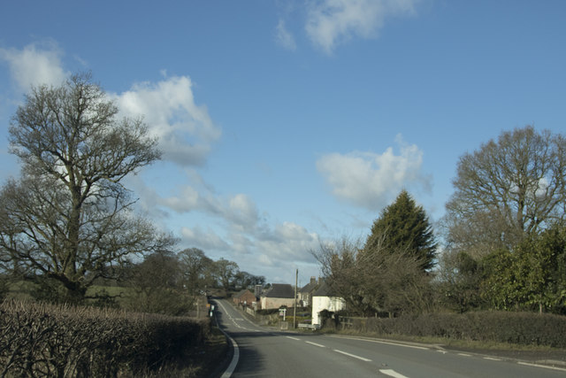
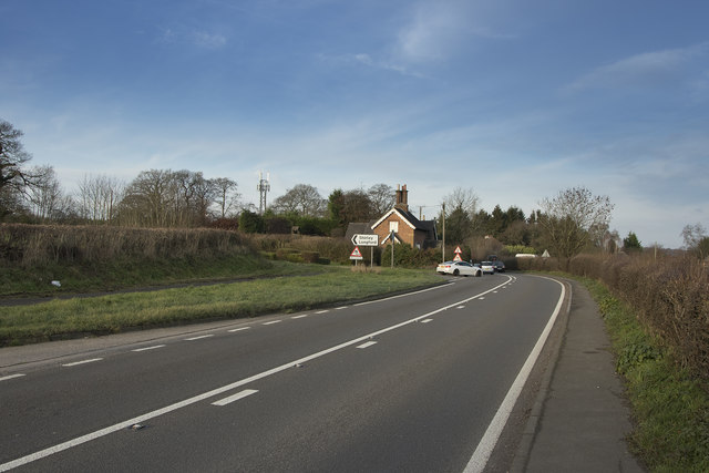
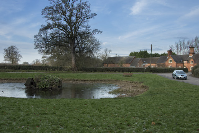
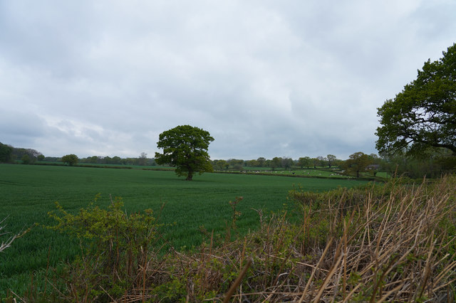
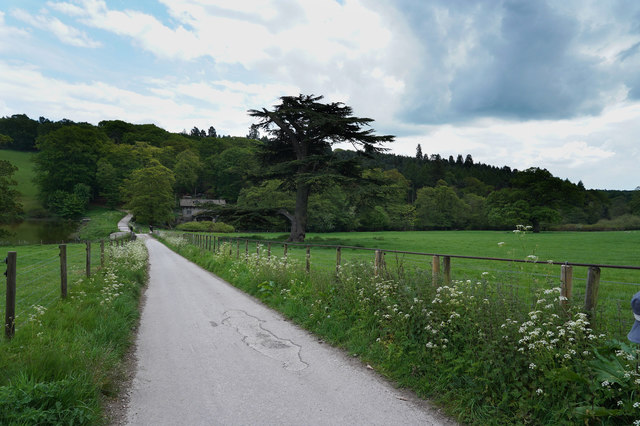
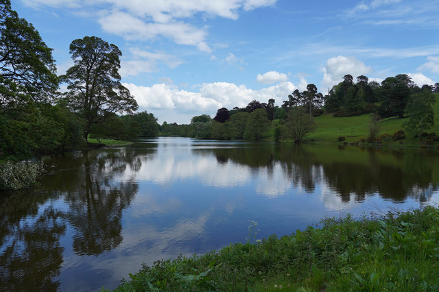
Brickyard Plantation is a picturesque woodland located in Derbyshire, England. Covering an area of approximately 100 acres, this enchanting forest is known for its dense population of trees, making it a haven for nature enthusiasts and wildlife alike.

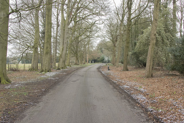
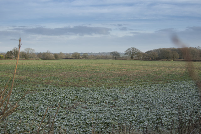
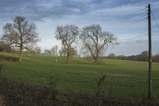
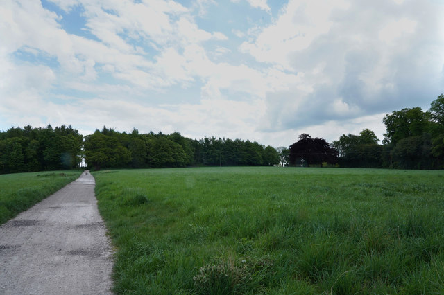
The woodland is predominantly composed of native deciduous trees, including oak, beech, and birch, which create a vibrant and ever-changing landscape throughout the seasons. The forest floor is adorned with a rich carpet of ferns, wildflowers, and mosses, adding to its natural beauty.

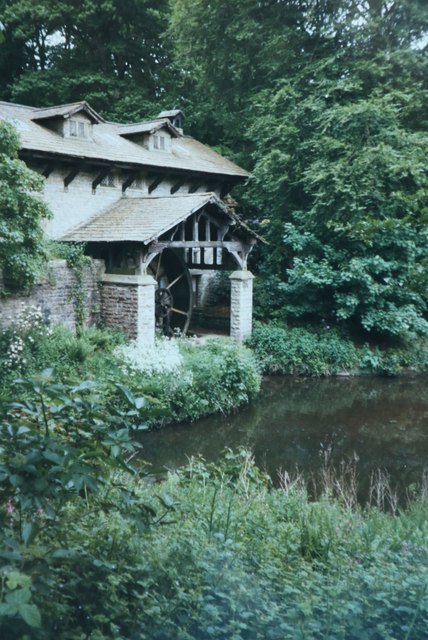
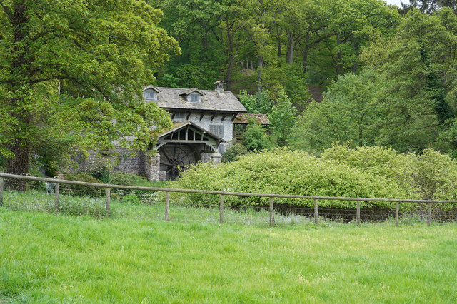
One of the notable features of Brickyard Plantation is its historic brickyard, which dates back to the Victorian era. The brickyard was once a thriving industry that supplied high-quality bricks for local construction projects. Although the brickyard is no longer operational, remnants of the kilns and brickworks can still be seen, giving visitors a glimpse into the area's industrial past.

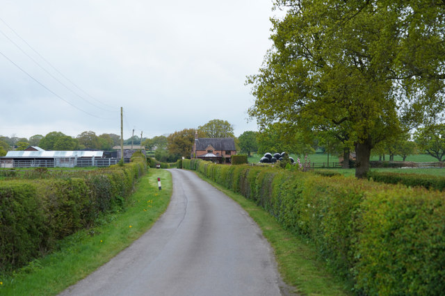
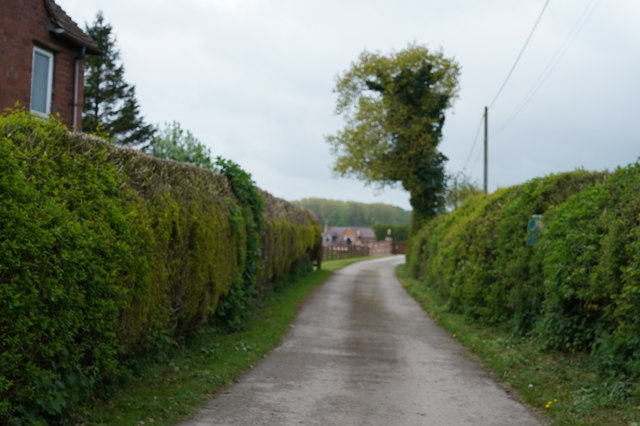
The woodland is crisscrossed with well-maintained walking trails, allowing visitors to explore the plantation at their own pace. These trails wind through enchanting groves and meandering streams, providing a serene and tranquil atmosphere for those seeking a moment of respite from the hustle and bustle of everyday life.

Brickyard Plantation is also home to a diverse range of wildlife, including deer, foxes, badgers, and an array of bird species. It serves as an important habitat for these creatures, offering shelter, food, and breeding grounds. Birdwatchers in particular are drawn to the plantation, as it provides a prime location for observing both resident and migratory species.

Overall, Brickyard Plantation in Derbyshire is a captivating woodland that combines natural beauty, historical significance, and abundant wildlife, making it a must-visit destination for nature lovers and history enthusiasts alike.

If you have any feedback on the listing, please let us know in the comments section below.

Brickyard Plantation Images

Images are sourced within 2km of 52.98821/-1.6743395 or Grid Reference SK2143. Thanks to Geograph Open Source API. All images are credited.

Church Lane junction Derby Lane, Shirley
Church Lane, Shirley
Cottages in Shirley These cottages have a lot of age looking at the small bricks out of which they are constructed.
Cottages in Shirley
These cottages have a lot of age looking at the small bricks out of which they are constructed.
The road to Ashbourne On the way to Ashbourne we pass Yeldersley Hall just behind us and the small group of houses close to Yeldersley Home Farm.
The road to Ashbourne
On the way to Ashbourne we pass Yeldersley Hall just behind us and the small group of houses close to Yeldersley Home Farm.
Looking towards St. Mary's Nursing home This is the tree lined drive to St. Mary's Nursing Home. It is a quiet and peaceful place.
Looking towards St. Mary's Nursing home
This is the tree lined drive to St. Mary's Nursing Home. It is a quiet and peaceful place.
Horseshoe Bench Bench made of old horseshoes beside the (empty) Osmaston Pond.
Horseshoe Bench
Bench made of old horseshoes beside the (empty) Osmaston Pond.
Frosty fields The fields belong to Corner Farm and where they are shaded by the hedge are still covered by frost.
Frosty fields
The fields belong to Corner Farm and where they are shaded by the hedge are still covered by frost.
The road junction to Shirley Taken from the pavement besides the road to Ashbourne showing the road junction to Shirley.
The road junction to Shirley
Taken from the pavement besides the road to Ashbourne showing the road junction to Shirley.
Across the fields A winters morning showing bare trees and grassy fields.
Across the fields
A winters morning showing bare trees and grassy fields.
Osmaston Village pond Looking across the lightly frozen triangular village pond at Osmaston
Osmaston Village pond
Looking across the lightly frozen triangular village pond at Osmaston
Saw Mill in Osmaston Park Taken on film sometime in 1998. The saw mill is on the edge of the lake at Osmaston / Shirley Park.
Saw Mill in Osmaston Park
Taken on film sometime in 1998. The saw mill is on the edge of the lake at Osmaston / Shirley Park.
Looking across the fields The fields are probably Cave Farm and the crop that is growing looks extremely healthy.
Looking across the fields
The fields are probably Cave Farm and the crop that is growing looks extremely healthy.
Near Homestead Farm Well tended hedges line the road on either side as we approach Hoemstead Farm.
Near Homestead Farm
Well tended hedges line the road on either side as we approach Hoemstead Farm.
Looking at War Farm The track is closely lined with hedges as it goes towards the farm.
Looking at War Farm
The track is closely lined with hedges as it goes towards the farm.
Walking along Bonnie Prince Charlie Walk Bonnie Prince Charlie Walk was a Millennial project which linked some footpaths and bridleways and makes for a very pleasant and quiet walk in the countryside.
Walking along Bonnie Prince Charlie Walk
Bonnie Prince Charlie Walk was a Millennial project which linked some footpaths and bridleways and makes for a very pleasant and quiet walk in the countryside.
Close to the Restored Saw mill Visible in the near distance is the restored saw mill.  There are notices outside saying that it will be converted into some sort of venue.
Close to the Restored Saw mill
Visible in the near distance is the restored saw mill. There are notices outside saying that it will be converted into some sort of venue.
A lake view A wonderful view with the sky reflected in the very still water of the lake on this warm afternoon.
A lake view
A wonderful view with the sky reflected in the very still water of the lake on this warm afternoon.
The restored Saw Mill The water wheel that powers the saw mill has been restored but I do not think it is used at all for its original purpose.
The restored Saw Mill
The water wheel that powers the saw mill has been restored but I do not think it is used at all for its original purpose.
Show me another place!

Brickyard Plantation is located at Grid Ref: SK2143 (Lat: 52.98821, Lng: -1.6743395)

Administrative County: Derbyshire

District: Derbyshire Dales

Police Authority: Derbyshire

What 3 Words

///remotest.schools.highlighted. Near Ashbourne, Derbyshire

Related Wikis

Yeldersley

Yeldersley is a manor mentioned in the Domesday book. It is located near Ashbourne in Derbyshire. Today there is Yeldersley Hall. This hamlet had a population...

Yeldersley Hall, Derbyshire

Yeldersley Hall is a building of historical significance in Ashbourne, Derbyshire, England and is listed on the English Heritage Register. It was built...

Osmaston, Derbyshire Dales

Osmaston is a small village and civil parish in the Derbyshire Dales in the county of Derbyshire in England. The population of the civil parish as taken...

St Michael's Church, Shirley

St Michael's Church, Shirley is a Grade II* listed parish church in the Church of England: 318  in Shirley, Derbyshire. == History == The church dates...

Shirley, Derbyshire

Shirley is a small village and civil parish in Derbyshire, 4 miles (6 km) south-east of Ashbourne. The population of the civil parish as taken at the 2011...

St Martin's Church, Osmaston

St Martin's Church, Osmaston is a Grade II* listed parish church in the Church of England: 295  in Osmaston, Derbyshire Dales. == History == The original...

Ednaston Manor

Ednaston Manor is a country house in Ednaston, near Brailsford, Derbyshire, England. It was built in 1912–19 in a Queen Anne style by Edwin Lutyens, for...

Bradley, Derbyshire

Bradley is a village and civil parish in Derbyshire just east of Ashbourne. The population of the civil parish taken at the 2011 Census was 313. Other...

Nearby Amenities

Located within 500m of 52.98821,-1.6743395
Barrier: cattle_grid
Lat/Long: 52.9879146/-1.6717249
Man Made: tower
Note: Observed from road, approximate location
Source: survey
Tower Type: communication
Lat/Long: 52.9849038/-1.6739549
Parking
Description: Patch of dirt on corner
Ele: 147.0000000
Lat/Long: 52.9924763/-1.6738495
Ele: 149.0000000
Lat/Long: 52.9925629/-1.6741402
Ele: 149.0000000
Lat/Long: 52.9925596/-1.6741831
Barrier: stile
Ele: 150.0000000
Steps: 0
Stile: stepover
Lat/Long: 52.9925596/-1.6742126
Ele: 150.0000000
Lat/Long: 52.9925596/-1.6742582
Ele: 153.0000000
Lat/Long: 52.9925871/-1.6740222
Natural: water
Source: View from South
Lat/Long: 52.987488/-1.6811819
Barrier: stile
Steps: 2
Stile: stepover
Lat/Long: 52.9853196/-1.6758349
Barrier: stile
Stile: squeezer
Lat/Long: 52.9870882/-1.672947
Barrier: stile
Steps: 2
Stile: stepover
Lat/Long: 52.9843642/-1.6747414
Note: National speed limit sign SW-bound
Lat/Long: 52.9843868/-1.6717584
Direction: SSE
Generator Method: photovoltaic
Generator Output Electricity: yes
Generator Solar Modules: 16
Generator Source: solar
Generator Type: solar_photovoltaic_panel
Location: roof
Power: generator
Lat/Long: 52.9873745/-1.6702209
Generator Method: photovoltaic
Generator Output Electricity: yes
Generator Solar Modules: 5
Generator Source: solar
Generator Type: solar_photovoltaic_panel
Location: roof
Power: generator
Lat/Long: 52.9876187/-1.6719221
Direction: SSE
Generator Method: photovoltaic
Generator Output Electricity: yes
Generator Solar Modules: 5
Generator Source: solar
Generator Type: solar_photovoltaic_panel
Location: roof
Power: generator
Lat/Long: 52.9874423/-1.6711463
Direction: WSW
Generator Method: photovoltaic
Generator Output Electricity: yes
Generator Solar Modules: 11
Generator Source: solar
Generator Type: solar_photovoltaic_panel
Location: roof
Power: generator
Lat/Long: 52.9873971/-1.6710018
Direction: SSE
Generator Method: photovoltaic
Generator Output Electricity: yes
Generator Solar Modules: 14
Generator Source: solar
Generator Type: solar_photovoltaic_panel
Location: roof
Power: generator
Lat/Long: 52.9876058/-1.6719925
The data included in this document is from www.openstreetmap.org. The data is made available under ODbL.

Have you been to Brickyard Plantation?

Leave your review of Brickyard Plantation below (or comments, questions and feedback).