Spinney

Wood, Forest in Warwickshire North Warwickshire

England

Spinney

Marston roundabout on the A4097
Marston roundabout on the A4097 Credit: Richard Law

Spinney is a small village located in the county of Warwickshire, England. It is situated within the larger district of Wood and Forest, which is known for its picturesque countryside and rich history. The village itself is nestled amidst rolling hills and lush green fields, offering residents and visitors a tranquil and idyllic setting.

The history of Spinney dates back to the medieval era, and remnants of this past can still be seen in the architecture and layout of the village. The village is characterized by traditional thatched-roof cottages, quaint stone buildings, and narrow winding lanes that add to its charm and character.

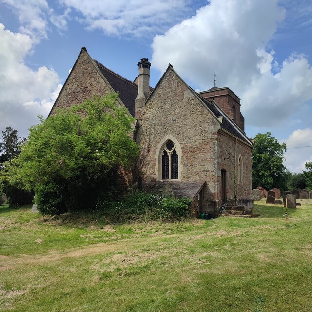
Despite its small size, Spinney boasts a strong sense of community and a range of amenities for its residents. There is a local primary school, a village hall that hosts various events and activities, and a small but well-stocked village shop. The village also has a church, St. Mary's, which serves as a focal point for the community and holds regular services.

Beyond the village boundaries, the surrounding Wood and Forest district offers ample opportunities for outdoor activities and exploration. There are numerous walking and cycling trails that wind through the countryside, providing stunning views of the woodlands and forests that give the district its name. Wildlife enthusiasts can also enjoy spotting various bird species and other animals that inhabit the area.

Overall, Spinney, Warwickshire (Wood, Forest) is a charming village that offers a peaceful and picturesque rural lifestyle. Its rich history, strong sense of community, and natural beauty make it an attractive place to live or visit for those seeking an escape from the hustle and bustle of city life.

If you have any feedback on the listing, please let us know in the comments section below.
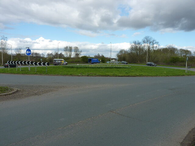
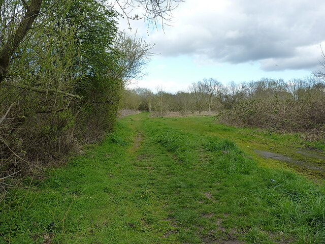
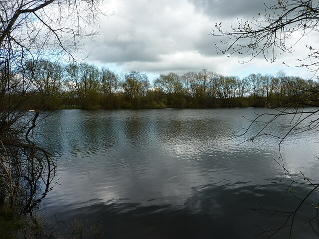
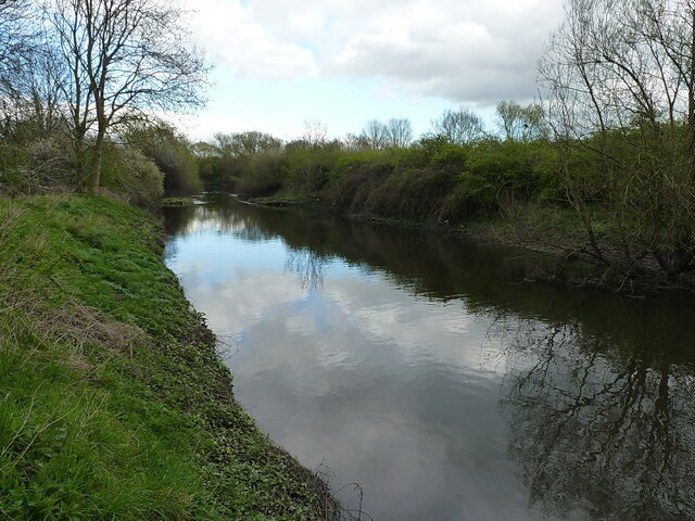
Spinney Images

Images are sourced within 2km of 52.540705/-1.6859741 or Grid Reference SP2193. Thanks to Geograph Open Source API. All images are credited.

Marston roundabout on the A4097
Permissive path through the Lea Marston lakes Part of a network of paths, not all marked as rights of way, through the various lakes here in the valley of the River Tame.
Permissive path through the Lea Marston lakes
Part of a network of paths, not all marked as rights of way, through the various lakes here in the valley of the River Tame.
Lea Marston lakes One of the many pools in the valley; <a href="https://www.geograph.org.uk/photo/6169652">SP2194 : Lake near Lea Marston</a> suggests that this is a flooded former gravel pit.
Lea Marston lakes
One of the many pools in the valley; SP2194 : Lake near Lea Marston suggests that this is a flooded former gravel pit.
A stretch of the River Tame
St Giles' Church
St Giles' Church
Tamenhurst House south of Kingsbury Built in the very early 19th century, although the windows are much more modern than that. Interior features include panelled shutters, segmental arches and a striking stairway. It was Grade II listed <span class="nowrap"><a title="https://britishlistedbuildings.co.uk/101365214-tamenhurst-house-kingsbury" rel="nofollow ugc noopener" href="https://britishlistedbuildings.co.uk/101365214-tamenhurst-house-kingsbury">Link</a><img style="margin-left:2px;" alt="External link" title="External link - shift click to open in new window" src="https://s1.geograph.org.uk/img/external.png" width="10" height="10"/></span> & <span class="nowrap"><a title="https://historicengland.org.uk/listing/the-list/list-entry/1365214?section=official-list-entry" rel="nofollow ugc noopener" href="https://historicengland.org.uk/listing/the-list/list-entry/1365214?section=official-list-entry">Link</a><img style="margin-left:2px;" alt="External link" title="External link - shift click to open in new window" src="https://s1.geograph.org.uk/img/external.png" width="10" height="10"/></span> in 1986.
Tamenhurst House south of Kingsbury
Built in the very early 19th century, although the windows are much more modern than that. Interior features include panelled shutters, segmental arches and a striking stairway. It was Grade II listed LinkExternal link & LinkExternal link in 1986.
Birmingham Road, Whitacre Heath
Semi Detached Cottages near to Flanders Hall
Across a paddock to Flanders Hall Farm
Bridge carrying A4097 Busy road passing over the river
Bridge carrying A4097
Busy road passing over the river
The Gate Public House at Nether Whitacre Since Carl Baker took his photo in 2006, this pub has lost the tree to the left and the old wooden fencing has been replaced by a metal fence.
The Gate Public House at Nether Whitacre
Since Carl Baker took his photo in 2006, this pub has lost the tree to the left and the old wooden fencing has been replaced by a metal fence.
Five Bar Gate and Trees off Middle Lane
Middle Lane meeting  Coton Road at Whitacre Heath
Middle Lane meeting Coton Road at Whitacre Heath
House Renovation in Birmingham Road, Whitacre Heath
Lea Rail Bridge at Lea Marston This bridge is over the Tamworth to Birmingham line.
Lea Rail Bridge at Lea Marston
This bridge is over the Tamworth to Birmingham line.
Looking Northeasterly along the Tamworth to Birmingham line.
Entering Lea Marston on the Birmingham Road Taken from the Lea bridge.
Entering Lea Marston on the Birmingham Road
Taken from the Lea bridge.
The Cedars Factory Complex on Haunch Lane, Lea Marston
Show me another place!

Spinney is located at Grid Ref: SP2193 (Lat: 52.540705, Lng: -1.6859741)

Administrative County: Warwickshire

District: North Warwickshire

Police Authority: Warwickshire

What 3 Words

///ringside.crafts.badge. Near Kingsbury, Warwickshire

Related Wikis

Whitacre Heath

Whitacre Heath is a small village in the North Warwickshire district of the county of Warwickshire in England. It is one of 'The Whitacres' - Whitacre...

Lea Marston

Lea Marston is a village and civil parish on the River Tame in Warwickshire, England, about 7 miles (11 km) south-west of Atherstone. Lea Marston is close...

Ladywalk Reserve

Ladywalk Reserve is a nature reserve on the River Tame, at its confluence with the River Blythe, at Hams Hall in north Warwickshire, England, owned by...

Kingsbury railway station

Kingsbury railway station was a railway station which served the village of Kingsbury in Warwickshire, England. == History == The station was opened in...

Nearby Amenities

Located within 500m of 52.540705,-1.6859741
Maxheight: 4
Source: Warwickshire_OpenData
Lat/Long: 52.5447009/-1.683453
Yew Tree
Place: hamlet
Lat/Long: 52.5420982/-1.6837135
Power: pole
Lat/Long: 52.540287/-1.6790469
Power: pole
Lat/Long: 52.5405741/-1.6802727
Power: pole
Lat/Long: 52.5405105/-1.6812007
Power: pole
Lat/Long: 52.5398629/-1.680624
Power: pole
Lat/Long: 52.5392087/-1.6800205
Power: pole
Lat/Long: 52.5386067/-1.6794439
Power: pole
Lat/Long: 52.5395529/-1.6792275
Generator Method: photovoltaic
Generator Output Electricity: yes
Generator Source: solar
Generator Type: solar_photovoltaic_panel
Location: roof
Power: generator
Lat/Long: 52.5414152/-1.6861385
Power: pole
Source: bing
Lat/Long: 52.5382862/-1.6809927
Power: pole
Ref: 934412
Source: wpd_opendata
Transformer: distribution
Lat/Long: 52.5379298/-1.6827428
Power: pole
Source: bing
Lat/Long: 52.5381068/-1.6818845
Power: pole
Ref: 930112
Source: wpd_opendata
Transformer: distribution
Lat/Long: 52.5384433/-1.6802417
Power: pole
Ref: 934411
Source: wpd_opendata
Transformer: distribution
Lat/Long: 52.5408679/-1.6814259
The data included in this document is from www.openstreetmap.org. The data is made available under ODbL.

Have you been to Spinney?

Leave your review of Spinney below (or comments, questions and feedback).