Darley
Settlement in Yorkshire Harrogate
England
Darley

Darley is a picturesque village located in the county of North Yorkshire, England. Situated in the beautiful Nidderdale Valley, it is part of the Harrogate district and lies just 7 miles west of the town of Harrogate. With its stunning countryside setting, Darley is renowned for its natural beauty and is a popular destination for outdoor enthusiasts.
The village itself is small, with a population of around 500 residents. It boasts a charming and tight-knit community, with a strong sense of local pride and community spirit. The architecture in Darley is predominantly traditional, with many stone-built cottages and houses that add to its rustic charm.
One of the notable landmarks in Darley is St. John's Church, a lovely 19th-century structure that dominates the village skyline. The church is known for its impressive stained glass windows and peaceful atmosphere, attracting visitors from near and far.
For those seeking outdoor activities, Darley offers ample opportunities. The surrounding countryside is perfect for hiking, cycling, and horseback riding, with numerous trails and pathways to explore. Additionally, the nearby Nidderdale Way, a long-distance footpath, passes through the village, providing walkers with stunning views of the rolling hills and picturesque landscapes.
Although small in size, Darley has a few amenities to offer its residents and visitors. There is a local pub, The Wellington Inn, known for its cozy atmosphere and traditional pub grub. The village also has a primary school, ensuring that families are well catered for.
In conclusion, Darley is a charming village nestled in the enchanting Nidderdale Valley. With its natural beauty, strong community spirit, and outdoor pursuits, it is a hidden gem in the heart of Yorkshire.
If you have any feedback on the listing, please let us know in the comments section below.
Darley Images
Images are sourced within 2km of 54.030644/-1.6880255 or Grid Reference SE2059. Thanks to Geograph Open Source API. All images are credited.


Darley is located at Grid Ref: SE2059 (Lat: 54.030644, Lng: -1.6880255)
Division: West Riding
Administrative County: North Yorkshire
District: Harrogate
Police Authority: North Yorkshire
What 3 Words
///bride.yarn.boardroom. Near Pateley Bridge, North Yorkshire
Nearby Locations
Related Wikis

Darley, North Yorkshire
Darley is a linear village in Nidderdale in the Harrogate district of North Yorkshire, England. The population as at the 2011 Census is 1,332 and is included...
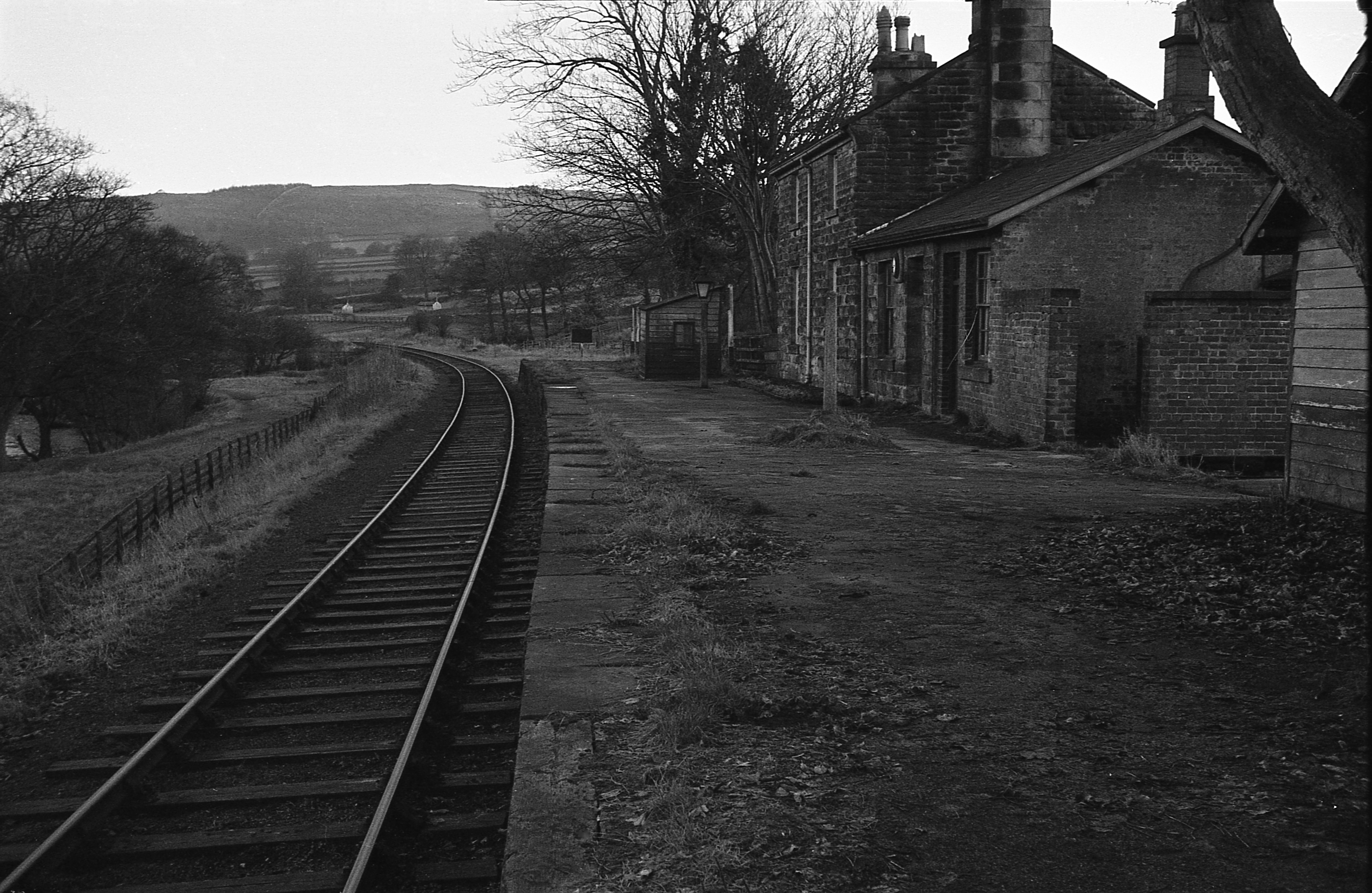
Darley railway station
Darley railway station served the village of Darley, North Yorkshire, England from 1864 to 1951 on the Nidd Valley Railway. == History == The station was...

Dacre, North Yorkshire
Dacre is a village and civil parish in the Harrogate district of North Yorkshire, England, it is 5 miles south of Pateley Bridge. In the 2001 census the...
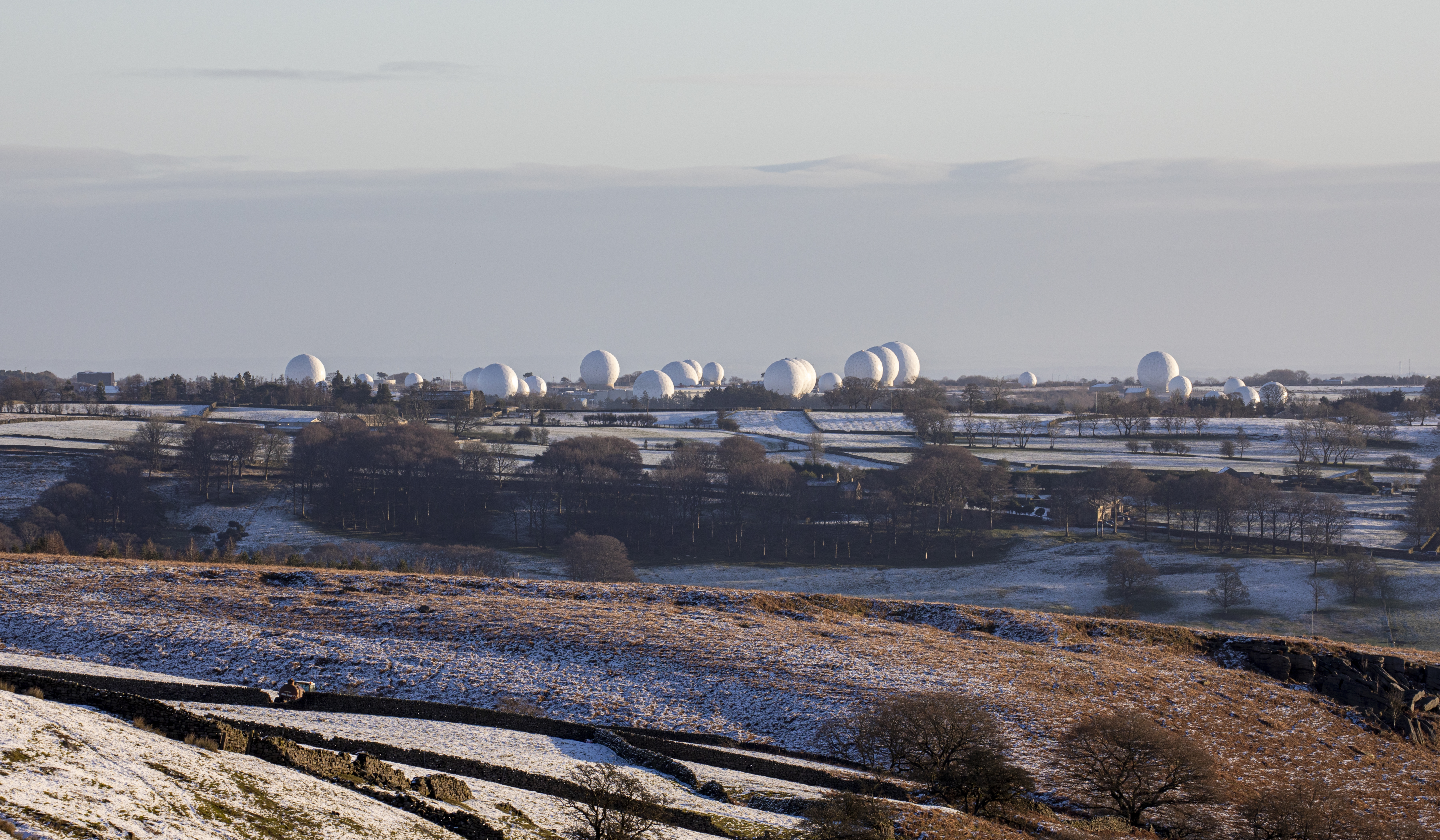
RAF Menwith Hill
Royal Air Force Menwith Hill (RAF Menwith Hill) is a Royal Air Force station near Harrogate, North Yorkshire, England, which provides communications and...
Nearby Amenities
Located within 500m of 54.030644,-1.6880255Have you been to Darley?
Leave your review of Darley below (or comments, questions and feedback).