Hellhole Wood
Wood, Forest in Durham
England
Hellhole Wood

Hellhole Wood is a picturesque forest located in Durham, England. Covering an area of approximately 50 acres, it is a popular destination for nature lovers and outdoor enthusiasts. Despite its rather ominous name, Hellhole Wood offers a serene and tranquil environment, making it an ideal spot for a peaceful retreat.
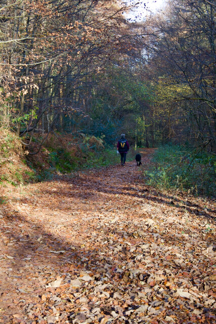
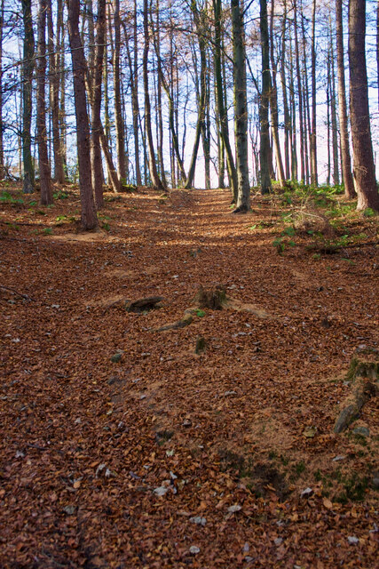
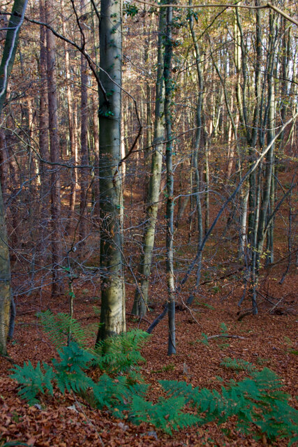
The wood is characterized by its dense canopy of towering trees, predominantly consisting of oak, beech, and ash. These ancient trees provide a natural shelter, creating a cool and shaded atmosphere even on the hottest summer days. The forest floor is adorned with a diverse array of wildflowers, ferns, and mosses, adding to the woodland's enchanting beauty.
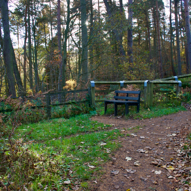
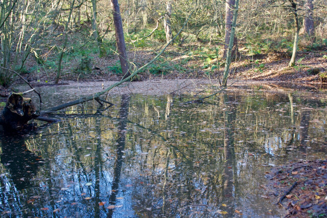
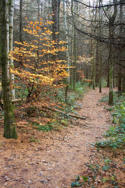
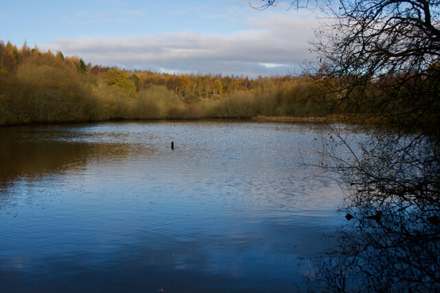
A network of well-maintained trails winds through the wood, allowing visitors to explore its hidden treasures. As they wander along the paths, they might stumble upon a babbling brook or a small pond, attracting an assortment of wildlife. Birdwatchers will be delighted by the variety of species that call Hellhole Wood their home, including woodpeckers, thrushes, and owls.
The wood's name, Hellhole, is believed to have originated from the Old English word "helle," meaning a hidden or secret place. Over time, this name has come to evoke a sense of mystery and intrigue, drawing visitors to uncover its secrets. While the origins of the name remain uncertain, it only adds to the wood's allure and sense of adventure.
Overall, Hellhole Wood offers a captivating escape from the hustle and bustle of everyday life. With its enchanting beauty and peaceful ambiance, it is a haven for nature enthusiasts seeking solace in the heart of Durham.
If you have any feedback on the listing, please let us know in the comments section below.
Hellhole Wood Images
Images are sourced within 2km of 54.878042/-1.6691615 or Grid Reference NZ2153. Thanks to Geograph Open Source API. All images are credited.


![Industrial Ruins Probably boiler and engine houses associated with nearby drift.
sitelines.newcastle.gov.uk. (2021). Beamish Burn, engine house and windlass. [online] Available at: <span class="nowrap"><a title="https://twsitelines.info/SMR/6960" rel="nofollow ugc noopener" href="https://twsitelines.info/SMR/6960">Link</a><img style="margin-left:2px;" alt="External link" title="External link - shift click to open in new window" src="https://s1.geograph.org.uk/img/external.png" width="10" height="10"/></span> [Accessed 2 Dec. 2021].
sitelines.newcastle.gov.uk. (2021). Beamish Burn, boilers. [online] Available at: <span class="nowrap"><a title="https://twsitelines.info/SMR/6961" rel="nofollow ugc noopener" href="https://twsitelines.info/SMR/6961">Link</a><img style="margin-left:2px;" alt="External link" title="External link - shift click to open in new window" src="https://s1.geograph.org.uk/img/external.png" width="10" height="10"/></span> [Accessed 2 Dec. 2021].](https://s1.geograph.org.uk/geophotos/07/03/40/7034045_0235e4a8.jpg)
Hellhole Wood is located at Grid Ref: NZ2153 (Lat: 54.878042, Lng: -1.6691615)
Unitary Authority: County Durham
Police Authority: Durham
What 3 Words
///climber.otherwise.beaker. Near Stanley, Co. Durham
Nearby Locations
Related Wikis

No Place
No Place is a small village near the town of Stanley in County Durham, England, east of Stanley and west of Beamish. Situated to the south of the A693...

Beamish Museum
Beamish Museum is the first regional open-air museum, in England, located at Beamish, near the town of Stanley, in County Durham, England. Beamish pioneered...

Beamish Museum transport collection
Beamish Museum contains much of transport interest, and the size of its site makes good internal transportation for visitors and staff purposes a necessity...

Beamish Hall
Beamish Hall is a mid-18th-century country house, now converted to a hotel, which stands in 24 acres (97,000 m2) of grounds near the town of Stanley, County...

Beamish railway station
Beamish was a railway station which served the village of Beamish in County Durham, North East England, from 1894 to 1953. The station was built by the...

West Stanley Pit disasters
The West Stanley Pit disasters refers to two explosions at the West Stanley colliery (variously known as West Stanley pit or Burns pit). West Stanley colliery...
Kip Hill
Kip Hill is a village in County Durham, in England. It is situated directly to the north of Stanley, near Shield Row. It has two pubs, the Blue Bell Inn...

Beamish, County Durham
Beamish, previously named 'Pit Hill', is a village in County Durham, England, situated to the north east of Stanley. The village is contained within...
Nearby Amenities
Located within 500m of 54.878042,-1.6691615Have you been to Hellhole Wood?
Leave your review of Hellhole Wood below (or comments, questions and feedback).