Kittle Point Wood

Wood, Forest in Yorkshire

England

Kittle Point Wood

Oakwell Hall Country Park Parts of Oakwell Hall date from the 15th century but the present building is largely due to John Batt in 1583, with some further modifications in the 17th century. In the 19th century it was used as a boarding school. When Charlotte Bronte lived at nearby Hartshead, she allegedly used Oakwell as the basis for 'Fieldhead' in the novel 'Shirley' (Fieldhead is in fact a local name for part of Birstall). The hall and its outbuildings are listed grade I (list entry 11344609) and now operated as a museum by Kirklees council (open at weekends). 

The grounds, along with the site of a former colliery and railway line, form Oakwell Country Park covering 45 hectares of woodland and open fields, which has a separate free car park. There are nature trails and a mountain bike route.
Oakwell Hall Country Park Credit: habiloid

Kittle Point Wood is a picturesque woodland located in the county of Yorkshire, England. Situated on the eastern edge of the county, it covers an area of approximately 100 acres, making it a substantial woodland in the region. The wood is part of the wider Kittle Point Forest, which spans several square miles and is renowned for its natural beauty.

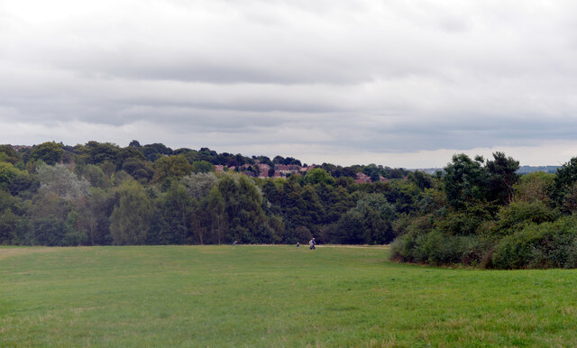
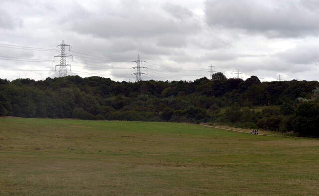
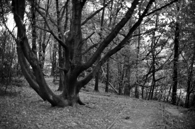
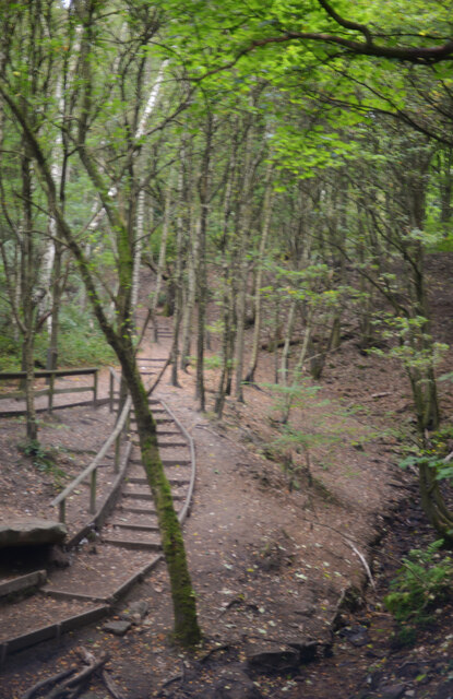
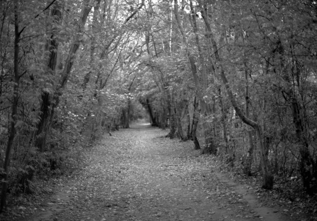
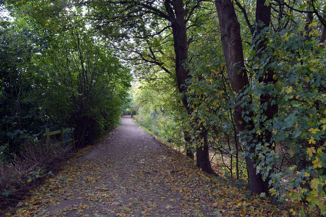
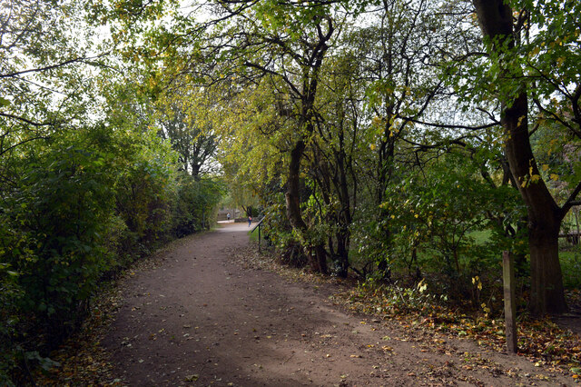
The wood is predominantly composed of native broadleaf trees, such as oak, beech, and ash, creating a diverse and vibrant ecosystem. These trees provide a dense canopy, which casts dappled sunlight on the forest floor, giving the wood a magical and enchanting atmosphere. The undergrowth is rich with a variety of wildflowers, ferns, and mosses, further enhancing its natural charm.

Kittle Point Wood is known for its abundant wildlife. The woodland is home to a range of bird species, including woodpeckers, owls, and various songbirds, making it a paradise for birdwatchers. The wood also provides a habitat for mammals such as foxes, squirrels, and deer, which can often be seen roaming amongst the trees.

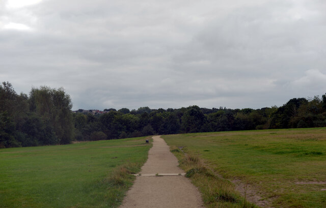
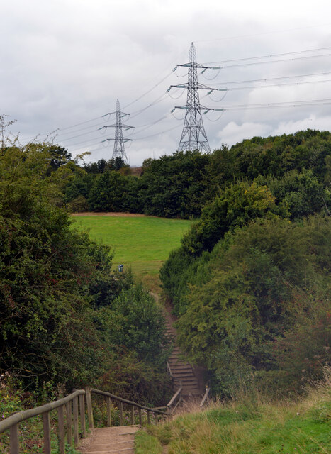
The wood is intersected by several footpaths and trails, making it a popular destination for walkers and nature enthusiasts. These paths meander through the woodland, offering breathtaking views and a chance to immerse oneself in nature. The wood is also a designated Site of Special Scientific Interest (SSSI), recognizing its importance for conservation and biodiversity.

Overall, Kittle Point Wood is a stunning and ecologically valuable woodland, offering visitors a tranquil escape from the hustle and bustle of everyday life. Its natural beauty, diverse wildlife, and accessible trails make it a cherished destination for locals and tourists alike.

If you have any feedback on the listing, please let us know in the comments section below.

Kittle Point Wood Images

Images are sourced within 2km of 53.751536/-1.6817849 or Grid Reference SE2128. Thanks to Geograph Open Source API. All images are credited.

Oakwell Hall Country Park Parts of Oakwell Hall date from the 15th century but the present building is largely due to John Batt in 1583, with some further modifications in the 17th century. In the 19th century it was used as a boarding school. When Charlotte Bronte lived at nearby Hartshead, she allegedly used Oakwell as the basis for 'Fieldhead' in the novel 'Shirley' (Fieldhead is in fact a local name for part of Birstall). The hall and its outbuildings are listed grade I (list entry 11344609) and now operated as a museum by Kirklees council (open at weekends). 

The grounds, along with the site of a former colliery and railway line, form Oakwell Country Park covering 45 hectares of woodland and open fields, which has a separate free car park. There are nature trails and a mountain bike route.
Oakwell Hall Country Park
Parts of Oakwell Hall date from the 15th century but the present building is largely due to John Batt in 1583, with some further modifications in the 17th century. In the 19th century it was used as a boarding school. When Charlotte Bronte lived at nearby Hartshead, she allegedly used Oakwell as the basis for 'Fieldhead' in the novel 'Shirley' (Fieldhead is in fact a local name for part of Birstall). The hall and its outbuildings are listed grade I (list entry 11344609) and now operated as a museum by Kirklees council (open at weekends). The grounds, along with the site of a former colliery and railway line, form Oakwell Country Park covering 45 hectares of woodland and open fields, which has a separate free car park. There are nature trails and a mountain bike route.
Path, Oakwell Hall Country Park Parts of Oakwell Hall date from the 15th century but the present building is largely due to John Batt in 1583, with some further modifications in the 17th century. In the 19th century it was used as a boarding school. When Charlotte Bronte lived at nearby Hartshead, she allegedly used Oakwell as the basis for 'Fieldhead' in the novel 'Shirley' (Fieldhead is in fact a local name for part of Birstall). The hall and its outbuildings are listed grade I (list entry 11344609) and now operated as a museum by Kirklees council (open at weekends). 

The grounds, along with the site of a former colliery and railway line, form Oakwell Country Park covering 45 hectares of woodland and open fields, which has a separate free car park. There are nature trails and a mountain bike route.
Path, Oakwell Hall Country Park
Parts of Oakwell Hall date from the 15th century but the present building is largely due to John Batt in 1583, with some further modifications in the 17th century. In the 19th century it was used as a boarding school. When Charlotte Bronte lived at nearby Hartshead, she allegedly used Oakwell as the basis for 'Fieldhead' in the novel 'Shirley' (Fieldhead is in fact a local name for part of Birstall). The hall and its outbuildings are listed grade I (list entry 11344609) and now operated as a museum by Kirklees council (open at weekends). The grounds, along with the site of a former colliery and railway line, form Oakwell Country Park covering 45 hectares of woodland and open fields, which has a separate free car park. There are nature trails and a mountain bike route.
Path and pylons, Oakwell Hall Country Park Parts of Oakwell Hall date from the 15th century but the present building is largely due to John Batt in 1583, with some further modifications in the 17th century. In the 19th century it was used as a boarding school. When Charlotte Bronte lived at nearby Hartshead, she allegedly used Oakwell as the basis for 'Fieldhead' in the novel 'Shirley' (Fieldhead is in fact a local name for part of Birstall). The hall and its outbuildings are listed grade I (list entry 11344609) and now operated as a museum by Kirklees council (open at weekends). 

The grounds, along with the site of a former colliery and railway line, form Oakwell Country Park covering 45 hectares of woodland and open fields, which has a separate free car park. There are nature trails and a mountain bike route.
Path and pylons, Oakwell Hall Country Park
Parts of Oakwell Hall date from the 15th century but the present building is largely due to John Batt in 1583, with some further modifications in the 17th century. In the 19th century it was used as a boarding school. When Charlotte Bronte lived at nearby Hartshead, she allegedly used Oakwell as the basis for 'Fieldhead' in the novel 'Shirley' (Fieldhead is in fact a local name for part of Birstall). The hall and its outbuildings are listed grade I (list entry 11344609) and now operated as a museum by Kirklees council (open at weekends). The grounds, along with the site of a former colliery and railway line, form Oakwell Country Park covering 45 hectares of woodland and open fields, which has a separate free car park. There are nature trails and a mountain bike route.
Oakwell Hall Country Park Parts of Oakwell Hall date from the 15th century but the present building is largely due to John Batt in 1583, with some further modifications in the 17th century. In the 19th century it was used as a boarding school. When Charlotte Bronte lived at nearby Hartshead, she allegedly used Oakwell as the basis for 'Fieldhead' in the novel 'Shirley' (Fieldhead is in fact a local name for part of Birstall). The hall and its outbuildings are listed grade I (list entry 11344609) and now operated as a museum by Kirklees council (open at weekends). 

The grounds, along with the site of a former colliery and railway line, form Oakwell Country Park covering 45 hectares of woodland and open fields, which has a separate free car park. There are nature trails and a mountain bike route.
Oakwell Hall Country Park
Parts of Oakwell Hall date from the 15th century but the present building is largely due to John Batt in 1583, with some further modifications in the 17th century. In the 19th century it was used as a boarding school. When Charlotte Bronte lived at nearby Hartshead, she allegedly used Oakwell as the basis for 'Fieldhead' in the novel 'Shirley' (Fieldhead is in fact a local name for part of Birstall). The hall and its outbuildings are listed grade I (list entry 11344609) and now operated as a museum by Kirklees council (open at weekends). The grounds, along with the site of a former colliery and railway line, form Oakwell Country Park covering 45 hectares of woodland and open fields, which has a separate free car park. There are nature trails and a mountain bike route.
Path through the woods, Oakwell Hall Country Park
Route of an old railway line passing through the woods, Oakwell Hall Country Park Parts of Oakwell Hall date from the 15th century but the present building is largely due to John Batt in 1583, with some further modifications in the 17th century. In the 19th century it was used as a boarding school. When Charlotte Bronte lived at nearby Hartshead, she allegedly used Oakwell as the basis for 'Fieldhead' in the novel 'Shirley' (Fieldhead is in fact a local name for part of Birstall). The hall and its outbuildings are listed grade I (list entry 11344609) and now operated as a museum by Kirklees council (open at weekends). 

The grounds, along with the site of a former colliery and railway line, form Oakwell Country Park covering 45 hectares of woodland and open fields, which has a separate free car park. There are nature trails and a mountain bike route.
Route of an old railway line passing through the woods, Oakwell Hall Country Park
Parts of Oakwell Hall date from the 15th century but the present building is largely due to John Batt in 1583, with some further modifications in the 17th century. In the 19th century it was used as a boarding school. When Charlotte Bronte lived at nearby Hartshead, she allegedly used Oakwell as the basis for 'Fieldhead' in the novel 'Shirley' (Fieldhead is in fact a local name for part of Birstall). The hall and its outbuildings are listed grade I (list entry 11344609) and now operated as a museum by Kirklees council (open at weekends). The grounds, along with the site of a former colliery and railway line, form Oakwell Country Park covering 45 hectares of woodland and open fields, which has a separate free car park. There are nature trails and a mountain bike route.
"Fiddlehead and Fernblades" by Adrian Moakes, Oakwell Hall Country Park "Fiddlehead and Fernblades" is a sculpture by Adrian Moakes (2008). It stands at the highest point of the colliery field of Oakwell Hall Country park, Birstall. The colliery field is the landscape site of Gomersal Pit which closed in 1973. The sculpture depicts ferns which formed the coal mined there.
It is 6.5m high and is formed from galvanized tubular and sheet steel. It was officially opened on 19th October 2008.
"Fiddlehead and Fernblades" by Adrian Moakes, Oakwell Hall Country Park
"Fiddlehead and Fernblades" is a sculpture by Adrian Moakes (2008). It stands at the highest point of the colliery field of Oakwell Hall Country park, Birstall. The colliery field is the landscape site of Gomersal Pit which closed in 1973. The sculpture depicts ferns which formed the coal mined there. It is 6.5m high and is formed from galvanized tubular and sheet steel. It was officially opened on 19th October 2008.
Route of an old railway line passing through the woods, Oakwell Hall Country Park
Warrens Lane, Oakwell Hall Country Park
Wakefield Road (B6135), Drighlington
Fairfax Avenue, Drighlington
Car Wash, Wakefield Road (B6135), Drighlington
Wakefield Road (B6135), Drighlington
Adwalton House Surgery, Wakefield Road (B6135), Drighlington
Moorside Road, Drighlington
Drighlington Pharmacy, King Street (B6135), Drighlington
King Street (B6135), Drighlington
Show me another place!

Kittle Point Wood is located at Grid Ref: SE2128 (Lat: 53.751536, Lng: -1.6817849)

Division: West Riding

Unitary Authority: Kirklees

Police Authority: West Yorkshire

What 3 Words

///dame.speak.them. Near Drighlington, West Yorkshire

Nearby Locations

Kittle Point Wood

Related Wikis

Birkenshaw and Tong railway station

Birkenshaw and Tong railway station served the village of Birkenshaw, West Yorkshire, England from 1856 to 1964 on the Leeds, Bradford and Halifax Junction...

Birkenshaw, West Yorkshire

Birkenshaw is a village in the borough of Kirklees in the county of West Yorkshire, England. It lies at the crossroads between the A58 Leeds to Halifax...

BBG Academy

BBG Academy (formerly Birkenshaw Middle School) is a mixed secondary school located in Birkenshaw, West Yorkshire, England.Birkenshaw Middle School was...

West Yorkshire

West Yorkshire is a metropolitan and ceremonial county in the Yorkshire and the Humber region of England. It borders North Yorkshire to the north and east...

Battle of Adwalton Moor

The Battle of Adwalton Moor occurred on 30 June 1643 at Adwalton, West Yorkshire, during the First English Civil War. In the battle, the Royalists loyal...

Drighlington and Adwalton railway station

Drighlington and Adwalton railway station served the village of Drighlington, West Yorkshire, England from 1856 to 1962 on the Leeds, Bradford and Halifax...

M62 coach bombing

The M62 coach bombing, sometimes referred to as the M62 Massacre, occurred on 4 February 1974 on the M62 motorway in northern England, when a 25-pound...

Drighlington

Drighlington is a village and civil parish in the City of Leeds metropolitan district, West Yorkshire, England. Historically part of the West Riding of...

Nearby Amenities

Located within 500m of 53.751536,-1.6817849
Created By: Merkaartor 0.12
Lat/Long: 53.7530643/-1.675659
Turning Circle
Lat/Long: 53.747996/-1.6846442
Traffic Signals
Lat/Long: 53.7491818/-1.685757
Bus Stop
Birkenshaw Lane Whitehall Road East
Local Ref: 45012440
Naptan AtcoCode: 450012440
Naptan Bearing: SE
Naptan CommonName: Birkenshaw Lane Whitehall Road East
Naptan Crossing: Whitehall Road East
Naptan Indicator: Stop 45012440
Naptan PlusbusZoneRef: LEEDS
Naptan ShortCommonName: Birkenshaw Bar
Naptan Street: Birkenshaw Lane
Naptan Verified: no
Source: naptan_import
Lat/Long: 53.7490108/-1.6847135
Bus Stop
Old Lane Royds Avenue
Local Ref: 45012441
Naptan AtcoCode: 450012441
Naptan Bearing: NW
Naptan CommonName: Old Lane Royds Avenue
Naptan Crossing: Royds Avenue
Naptan Indicator: Stop 45012441
Naptan Notes: OSR taken place 261005 size 1 case fitted awaiting photos
Naptan PlusbusZoneRef: LEEDS
Naptan ShortCommonName: Birkenshaw Bar
Naptan Street: Old Lane
Naptan Verified: no
Source: naptan_import
Lat/Long: 53.7495538/-1.6861197
Bus Stop
Old Lane St Pauls Road
Local Ref: 45012442
Naptan AtcoCode: 450012442
Naptan Bearing: SE
Naptan CommonName: Old Lane St Pauls Road
Naptan Crossing: St Pauls Road
Naptan Indicator: Stop 45012442
Naptan PlusbusZoneRef: LEEDS
Naptan ShortCommonName: St. Pauls Road
Naptan Street: Old Lane
Naptan Verified: no
Source: naptan_import
Lat/Long: 53.7509721/-1.6888844
Bus Stop
Whitehall Road East Old Lane
Local Ref: 45015440
Naptan AtcoCode: 450015440
Naptan Bearing: NE
Naptan CommonName: Whitehall Road East Old Lane
Naptan Crossing: Old Lane
Naptan Indicator: Stop 45015440
Naptan PlusbusZoneRef: LEEDS
Naptan ShortCommonName: Birkenshaw Bar
Naptan Street: Whitehall Road East
Naptan Verified: no
Source: naptan_import
Lat/Long: 53.7494797/-1.6852862
Fast Food
Lincs Cafe
Cuisine: sandwich
Lat/Long: 53.7495022/-1.6861369
Birkenshaw Convenience Store
Addr City: Bradford
Addr Hamlet: Birkenshaw
Addr Housenumber: 2
Addr Postcode: BD11 2JX
Addr Street: Old Lane
Fhrs Id: 226255
Shop: convenience
Source Addr: FHRS Open Data
Lat/Long: 53.7495016/-1.6854154
Bus Stop
Whitehall Road East Birkenshaw Lane
Local Ref: 45015439
Naptan AtcoCode: 450015439
Naptan Bearing: SW
Naptan CommonName: Whitehall Road East Birkenshaw Lane
Naptan Crossing: Birkenshaw Lane
Naptan Indicator: Stop 45015439
Naptan PlusbusZoneRef: LEEDS
Naptan ShortCommonName: Birkenshaw Bar
Naptan Street: Whitehall Road East
Naptan Verified: no
Source: naptan_import
Lat/Long: 53.7494464/-1.6849056
Kindergarten
Birkenshaw Kindergarden
Lat/Long: 53.750292/-1.6867919
Barrier: stile
Stile: stepover
Lat/Long: 53.7520308/-1.6756306
Post Box
Collection Times: Mo-Fr 09:00; Sa 07:00
Post Box Type: lamp
Ref: BD11 412D
Royal Cypher: EIIR
Royal Cypher Wikidata: Q33102113
Source: survey;Bing
Lat/Long: 53.7503076/-1.6875064
Generator Method: photovoltaic
Generator Output Electricity: yes
Generator Source: solar
Generator Type: solar_photovoltaic_panel
Location: roof
Power: generator
Lat/Long: 53.7512731/-1.6887771
Generator Method: photovoltaic
Generator Output Electricity: yes
Generator Source: solar
Generator Type: solar_photovoltaic_panel
Location: roof
Power: generator
Lat/Long: 53.7512382/-1.6889327
Generator Method: photovoltaic
Generator Output Electricity: yes
Generator Source: solar
Generator Type: solar_photovoltaic_panel
Location: roof
Power: generator
Lat/Long: 53.750155/-1.6879725
Waste Basket
Ref UK Leedscc Bin: 5
Lat/Long: 53.753836/-1.676178
Barrier: stile
Material: wood
Lat/Long: 53.7550623/-1.6778262
Barrier: stile
Material: wood
Stile: stepover
Lat/Long: 53.7522061/-1.6758173
Barrier: stile
Stile: stepover
Lat/Long: 53.7520148/-1.6755557
Barrier: stile
Material: wood
Stile: stepover
Lat/Long: 53.7519315/-1.675166
Access: no
Barrier: stile
Foot: yes
Material: wood
Stile: stepover
Lat/Long: 53.7557037/-1.682316
Recycling
Operator: Kirklees Concil
Recycling Clothes: yes
Recycling Shoes: yes
Recycling Type: container
Lat/Long: 53.7495517/-1.6863164
Access: no
Barrier: stile
Foot: yes
Material: wood
Stile: stepover
Lat/Long: 53.7551905/-1.6791223
The data included in this document is from www.openstreetmap.org. The data is made available under ODbL.

Have you been to Kittle Point Wood?

Leave your review of Kittle Point Wood below (or comments, questions and feedback).