Stephen Wood

Wood, Forest in Yorkshire

England

Stephen Wood

Muddy field entrance on High Moor Lane, Shepley The bridleway is mostly dry after this muddy start.
Muddy field entrance on High Moor Lane, Shepley Credit: Humphrey Bolton

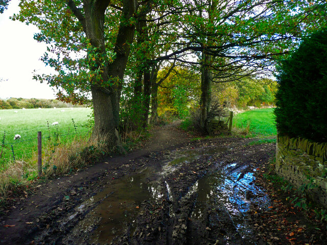
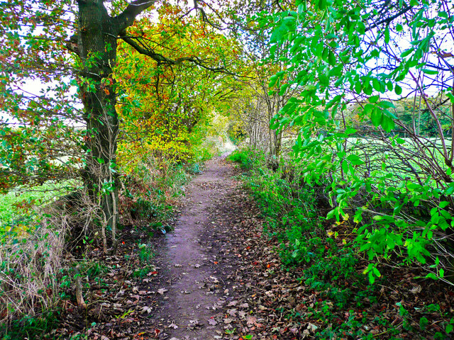
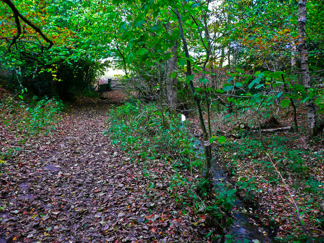
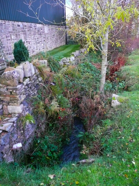
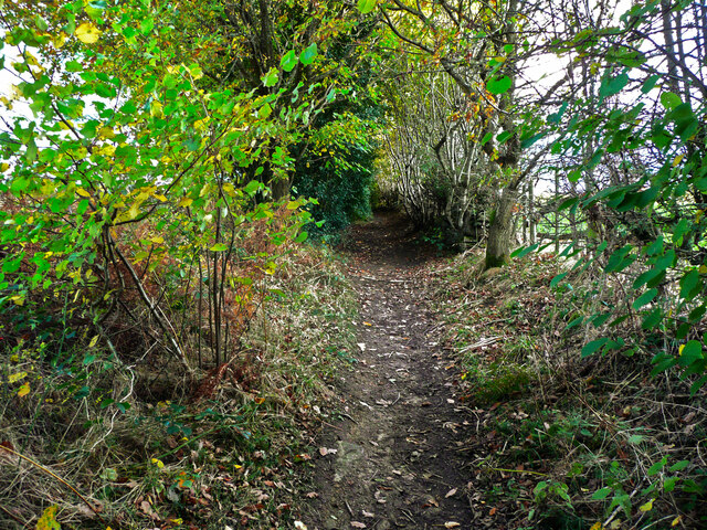
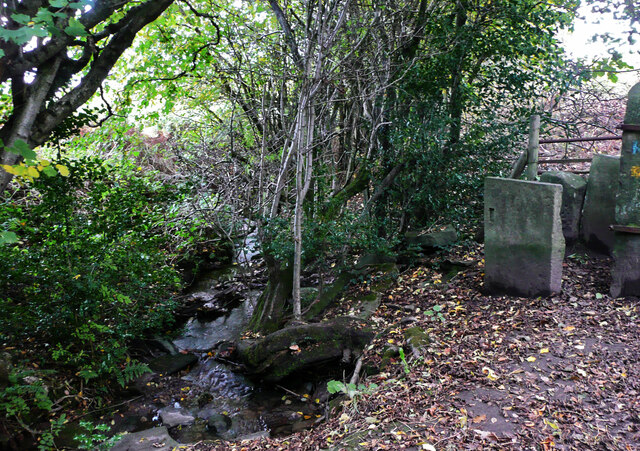
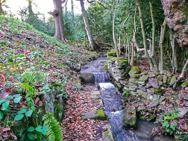
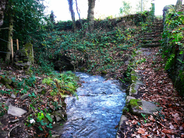
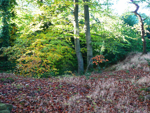
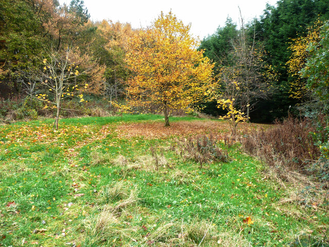
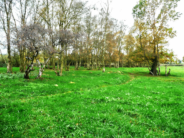
Stephen Wood is a picturesque forest located in Yorkshire, a historic county in northern England. It covers a vast area and is known for its lush greenery and diverse wildlife. The forest is situated in a rural setting, surrounded by rolling hills and charming countryside. It is a popular destination for nature enthusiasts, hikers, and those seeking tranquility in the great outdoors.

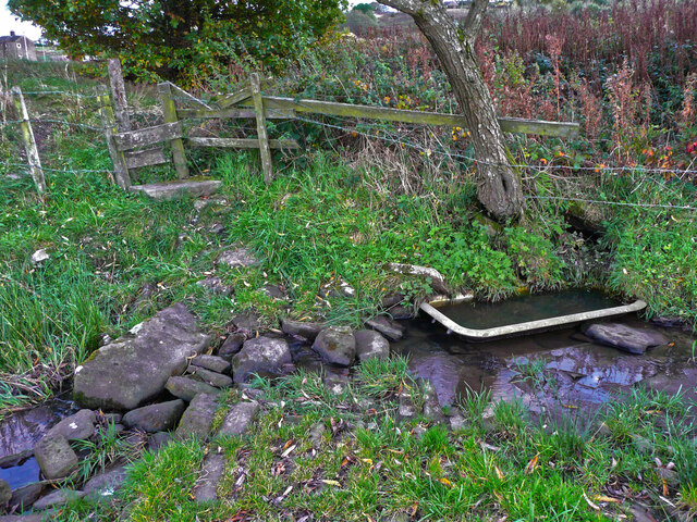
Stephen Wood is home to a variety of tree species, including oak, ash, beech, and pine, creating a rich and vibrant ecosystem. The dense foliage provides shelter and nesting grounds for numerous bird species, including woodpeckers, owls, and songbirds. Visitors may also spot small mammals like squirrels, rabbits, and foxes as they explore the forest trails.

The forest offers a range of recreational activities for visitors to enjoy. There are well-maintained paths and trails for hiking and walking, allowing visitors to immerse themselves in the natural beauty of the surroundings. Additionally, there are designated picnic areas where families and friends can gather for a leisurely meal while enjoying the peaceful ambiance.

Stephen Wood is easily accessible, with ample parking facilities and visitor amenities. There may be visitor centers or information boards providing details about the forest's history, wildlife, and conservation efforts. It is advisable to check for any seasonal restrictions or guidelines before visiting to ensure a safe and enjoyable experience.

Overall, Stephen Wood in Yorkshire is a captivating destination for nature lovers, providing a serene escape from the hustle and bustle of everyday life.

If you have any feedback on the listing, please let us know in the comments section below.

Stephen Wood Images

Images are sourced within 2km of 53.571842/-1.684267 or Grid Reference SE2108. Thanks to Geograph Open Source API. All images are credited.
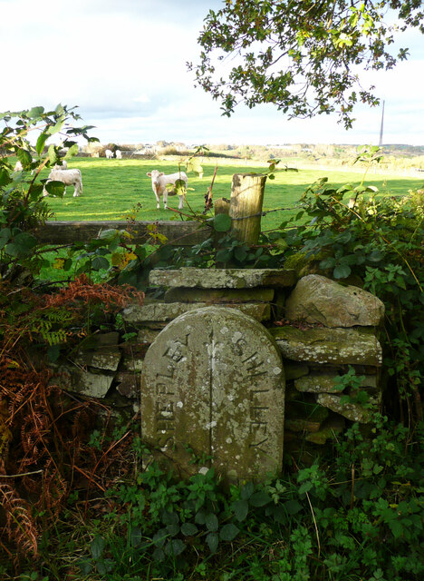
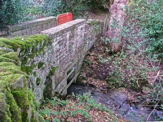
Muddy field entrance on High Moor Lane, Shepley The bridleway is mostly dry after this muddy start.
Muddy field entrance on High Moor Lane, Shepley
The bridleway is mostly dry after this muddy start.
Footpath crossing a stream, Shepley - Cumberworth This stream is here the boundary between Shepley and Cumberworth. It is not named on maps, but is the source tributary of Fenay Beck. The source is a spring below the A635. A bath has been sunk into the bed of the stream to provide a drinking trough for cattle.
Footpath crossing a stream, Shepley - Cumberworth
This stream is here the boundary between Shepley and Cumberworth. It is not named on maps, but is the source tributary of Fenay Beck. The source is a spring below the A635. A bath has been sunk into the bed of the stream to provide a drinking trough for cattle.
High Moor Lane, Shepley A pleasant bridleway.
High Moor Lane, Shepley
A pleasant bridleway.
High Moor Lane passing Yew Tree Wood, Shepley There is a little stream on the right, and a footpath branches off at the gate, where the bridleway bends to the right.
High Moor Lane passing Yew Tree Wood, Shepley
There is a little stream on the right, and a footpath branches off at the gate, where the bridleway bends to the right.
Stream emerging from a culvert under Carr Lane, Cumberworth This is a boundary stream, with Shepley on the left and Cumberworth on the right.
Stream emerging from a culvert under Carr Lane, Cumberworth
This is a boundary stream, with Shepley on the left and Cumberworth on the right.
High Moor Lane, Shepley
Stream leaving High Moor Lane, Shepley This is the stream that comes down through Yew Tree Wood. A stile at the start of a footpath to Copley Lane via Hardingley Farm is on the right.
Stream leaving High Moor Lane, Shepley
This is the stream that comes down through Yew Tree Wood. A stile at the start of a footpath to Copley Lane via Hardingley Farm is on the right.
Boundary stone, High Moor Lane, Shepley / Shelley This stone is not shown on old 1:2500 maps, although others are shown on the boundary. The boundary is along the centre of the lane between two watercourse crossings. Shelley and Shepley Local Boards made an agreement for the joint repair of High Moor Lane in August 1891 (Huddersfield Chronicle via Huddersfield Exposed). As this stone is approximately half-way along the lane between the watercourses perhaps the two local boards decided share the responsibility by dividing the length of lane into two.
Boundary stone, High Moor Lane, Shepley / Shelley
This stone is not shown on old 1:2500 maps, although others are shown on the boundary. The boundary is along the centre of the lane between two watercourse crossings. Shelley and Shepley Local Boards made an agreement for the joint repair of High Moor Lane in August 1891 (Huddersfield Chronicle via Huddersfield Exposed). As this stone is approximately half-way along the lane between the watercourses perhaps the two local boards decided share the responsibility by dividing the length of lane into two.
Footbridge on High Moor Lane, Shelley This is a substantial stone structure, one quarter of which is in Shepley and three quarters in Shelley. The boundary comes down the centre of the stream and then turns left along the centre of the lane.
Footbridge on High Moor Lane, Shelley
This is a substantial stone structure, one quarter of which is in Shepley and three quarters in Shelley. The boundary comes down the centre of the stream and then turns left along the centre of the lane.
Temporary fence on footbridge on High Moor Lane, Shepley In 2015 the wall had lost some capstones but was otherwise sound, see <a href="https://www.geograph.org.uk/photo/7011863">SE2009 : Footbridge on High Moor Lane, Shelley</a>], so I suspect vandalism.
Temporary fence on footbridge on High Moor Lane, Shepley
In 2015 the wall had lost some capstones but was otherwise sound, see SE2009 : Footbridge on High Moor Lane, Shelley], so I suspect vandalism.
Small waterfall on a stream at Copley House, Shelley This man-made waterfall has a paved path going to it. Maybe at was a water supply, or a place to wash items.
Small waterfall on a stream at Copley House, Shelley
This man-made waterfall has a paved path going to it. Maybe at was a water supply, or a place to wash items.
Steps down to stream from Copley Lane, Shelley These lead to the little waterfall shown in [<a href="https://www.geograph.org.uk/photo/7011882">SE2009 : Small waterfall on a stream at Copley House, Shelley</a>.
Steps down to stream from Copley Lane, Shelley
These lead to the little waterfall shown in [SE2009 : Small waterfall on a stream at Copley House, Shelley.
Woodland off Copley Lane, Shelley The stream shown in <a href="https://www.geograph.org.uk/photo/7011892">SE2009 : Steps down to stream from Copley Lane, Shelley</a> flows down below these trees, and presumably in culvert under the railway embankment. Then it goes to Barncliffe Mills.
Woodland off Copley Lane, Shelley
The stream shown in SE2009 : Steps down to stream from Copley Lane, Shelley flows down below these trees, and presumably in culvert under the railway embankment. Then it goes to Barncliffe Mills.
Autumn colour, Upper Cumberworth Whilst exploring a footpath I found that it crosses a field apparently left to nature, with young trees and patches of brambles.  There is a seat behind the tree in the centre of the image, and I thought that this might be a Millennium green, but the nearest ones are at Emley and Clayton West; Upper Cumberworth has a small village garden.
Autumn colour, Upper Cumberworth
Whilst exploring a footpath I found that it crosses a field apparently left to nature, with young trees and patches of brambles. There is a seat behind the tree in the centre of the image, and I thought that this might be a Millennium green, but the nearest ones are at Emley and Clayton West; Upper Cumberworth has a small village garden.
Area of springs, Upper Cumberworth There is water amongst the grass in this area, especially in hollows amongst the birch trees on the other side of the footpath.
Area of springs, Upper Cumberworth
There is water amongst the grass in this area, especially in hollows amongst the birch trees on the other side of the footpath.
View from Snailsden Moor View from Snailsden Moor towards Emley Moor TV mast.
View from Snailsden Moor
View from Snailsden Moor towards Emley Moor TV mast.
The Foresters Arms Public house and restaurant in Lower Cumberworth
The Foresters Arms
Public house and restaurant in Lower Cumberworth
Cumberworth United Cricket Club Pavilion
Show me another place!

Stephen Wood is located at Grid Ref: SE2108 (Lat: 53.571842, Lng: -1.684267)

Division: West Riding

Unitary Authority: Kirklees

Police Authority: West Yorkshire

What 3 Words

///diets.farms.ferrying. Near Denby Dale, West Yorkshire

Related Wikis

Upper Cumberworth

Upper Cumberworth is a small village in West Yorkshire, England, within the civil parish of Denby Dale and the Diocese of Wakefield. It is between the...

Lower Cumberworth

Lower Cumberworth is a village in the borough of Kirklees, West Yorkshire, England. The village is situated 8 miles (13 km) to the south-east of Huddersfield...

Birdsedge

Birdsedge (or Birds Edge) is a small village in the borough of Kirklees in West Yorkshire, England, on the edge of Yorkshire's Pennine Hills, standing...

Denby Dale railway station

Denby Dale railway station serves the village of Denby Dale, in West Yorkshire, England and the surrounding area. It lies on the Penistone Line 9.5 miles...

Nearby Amenities

Located within 500m of 53.571842,-1.684267
Upper Cumberworth
Is In: West Yorkshire, England, UK
Place: village
Wikidata: Q1398136
Wikipedia: en:Upper Cumberworth
Lat/Long: 53.5749192/-1.6879992
Crossing
Button Operated: yes
Crossing: traffic_signals
Crossing Island: no
Crossing Markings: dots
Tactile Paving: yes
Lat/Long: 53.5747712/-1.686775
Stop
Direction: backward
Stop: minor
Lat/Long: 53.5747148/-1.6863165
Bus Stop
Cumberworth Lane Eunice Lane
Bus: yes
Local Ref: 45020796
Naptan AtcoCode: 450020796
Naptan Bearing: NE
Naptan CommonName: Cumberworth Lane Eunice Lane
Naptan Crossing: Eunice Lane
Naptan Indicator: Stop 45020796
Naptan Landmark: Church
Naptan PlusbusZoneRef: LEEDS
Naptan ShortCommonName: Eunice Lane
Naptan Street: Cumberworth Lane
Naptan Verified: no
Public Transport: platform
Source: naptan_import
Lat/Long: 53.5759381/-1.6813207
Bus Stop
Barnsley Road Eunice Lane
Bus: yes
Local Ref: 45020825
Naptan AtcoCode: 450020825
Naptan Bearing: NW
Naptan CommonName: Barnsley Road Eunice Lane
Naptan Crossing: Op Eunice Lane
Naptan Indicator: Stop 45020825
Naptan Landmark: Greenwood Farm
Naptan PlusbusZoneRef: LEEDS
Naptan ShortCommonName: Eunice Lane
Naptan Street: Barnsley Road
Naptan Verified: no
Public Transport: platform
Source: naptan_import
Lat/Long: 53.5727622/-1.6802573
Bus Stop
Barnsley Road Cumberworth Road
Bus: yes
Local Ref: 45020826
Naptan AtcoCode: 450020826
Naptan Bearing: SE
Naptan CommonName: Barnsley Road Cumberworth Road
Naptan Crossing: Cumberworth Road
Naptan Indicator: Stop 45020826
Naptan Landmark: Star Public House
Naptan PlusbusZoneRef: LEEDS
Naptan ShortCommonName: Upper Cumberworth
Naptan Street: Barnsley Road
Naptan Verified: no
Public Transport: platform
Source: naptan_import
Lat/Long: 53.5746381/-1.6859971
Bus Stop
Cumberworth Lane Dearnfield
Bus: yes
Local Ref: 45020827
Naptan AtcoCode: 450020827
Naptan Bearing: E
Naptan CommonName: Cumberworth Lane Dearnfield
Naptan Crossing: Dearnfield
Naptan Indicator: Stop 45020827
Naptan Landmark: Cumberworth CE First School
Naptan PlusbusZoneRef: LEEDS
Naptan ShortCommonName: Dearnfield
Naptan Street: Cumberworth Lane
Naptan Verified: no
Public Transport: platform
Source: naptan_import
Lat/Long: 53.5751914/-1.6844978
Bus Stop
Barnsley Road Cumberworth Way
Bus: yes
Local Ref: 45020828
Naptan AtcoCode: 450020828
Naptan Bearing: W
Naptan CommonName: Barnsley Road Cumberworth Way
Naptan Crossing: Cumberworth Way
Naptan Indicator: Stop 45020828
Naptan Landmark: The Star PH
Naptan PlusbusZoneRef: LEEDS
Naptan ShortCommonName: Upper Cumberworth
Naptan Street: Barnsley Road
Naptan Verified: no
Public Transport: platform
Source: naptan_import
Lat/Long: 53.5747977/-1.6871255
Bus Stop
Cumberworth Lane Dearnfield
Bus: yes
Local Ref: 45023780
Naptan AtcoCode: 450023780
Naptan Bearing: W
Naptan CommonName: Cumberworth Lane Dearnfield
Naptan Crossing: Dreanfield
Naptan Indicator: Stop 45023780
Naptan Landmark: Cumberworth CE First School
Naptan PlusbusZoneRef: LEEDS
Naptan ShortCommonName: Dearnfield
Naptan Street: Cumberworth Lane
Naptan Verified: no
Public Transport: platform
Source: naptan_import
Lat/Long: 53.5750389/-1.6846198
Cumberworth Lane Eunice Lane
Local Ref: 45051020
Naptan AtcoCode: 450051020
Naptan Bearing: SW
Naptan BusStopType: CUS
Naptan CommonName: Cumberworth Lane Eunice Lane
Naptan Crossing: Eunice Lane
Naptan Indicator: Stop 45051020
Naptan PlusbusZoneRef: LEEDS
Naptan ShortCommonName: Eunice Lane
Naptan Street: Cumberworth Lane
Naptan Verified: no
Source: naptan_import
Lat/Long: 53.575875/-1.6812608
Barnsley Road Eunice Lane
Local Ref: 45051023
Naptan AtcoCode: 450051023
Naptan Bearing: SE
Naptan BusStopType: CUS
Naptan CommonName: Barnsley Road Eunice Lane
Naptan Crossing: Eunice Lane
Naptan Indicator: Stop 45051023
Naptan Landmark: Greenwood Farm
Naptan PlusbusZoneRef: LEEDS
Naptan ShortCommonName: Greenwood Farm
Naptan Street: Barnsley Road
Naptan Verified: no
Source: naptan_import
Lat/Long: 53.5728699/-1.6801659
Post Office
Upper Cumberworth Post Office
Addr City: Huddersfield
Addr Postcode: HD8 8NU
Addr Street: Cumberworth Lane
Addr Suburb: Upper Cumberworth
Branch: Upper Cumberworth
Brand: Post Office
Brand Wikidata: Q1783168
Check Date: 2023-12-14
Contact Website: https://www.postoffice.co.uk/branch-finder/240320x/upper-cumberworth
Ref Pol Id: 9353
Lat/Long: 53.5748266/-1.6864034
Barrier: stile
Stile: stepover
Lat/Long: 53.5720272/-1.6875203
Barrier: stile
Stile: stepover
Lat/Long: 53.5717822/-1.6859939
Barrier: stile
Stile: stepover
Lat/Long: 53.5719993/-1.6799936
Ford: yes
Lat/Long: 53.5712467/-1.681502
Ford: yes
Lat/Long: 53.5686221/-1.683844
Ford: stepping_stones
Lat/Long: 53.5703972/-1.6791777
Barrier: stile
Stile: stepover
Lat/Long: 53.5700526/-1.6780581
Post Box
Collection Times: Mo-Fr 16:15; Sa 11:00
Operator: Royal Mail
Operator Wikidata: Q638098
Post Box Type: wall
Ref: HD8 316
Royal Cypher: EIIR
Royal Cypher Wikidata: Q33102113
Source: survey
Lat/Long: 53.5748022/-1.6863238
Generator Method: photovoltaic
Generator Output Electricity: yes
Generator Source: solar
Generator Type: solar_photovoltaic_panel
Location: roof
Power: generator
Lat/Long: 53.57445/-1.6893582
Generator Method: photovoltaic
Generator Output Electricity: yes
Generator Source: solar
Generator Type: solar_photovoltaic_panel
Location: roof
Power: generator
Lat/Long: 53.5737651/-1.6827036
Generator Method: photovoltaic
Generator Output Electricity: yes
Generator Source: solar
Generator Type: solar_photovoltaic_panel
Location: roof
Power: generator
Lat/Long: 53.5737954/-1.6826178
Generator Method: photovoltaic
Generator Output Electricity: yes
Generator Source: solar
Generator Type: solar_photovoltaic_panel
Location: roof
Power: generator
Lat/Long: 53.5730914/-1.6804533
Generator Method: photovoltaic
Generator Output Electricity: yes
Generator Source: solar
Generator Type: solar_photovoltaic_panel
Location: roof
Power: generator
Lat/Long: 53.5731476/-1.6805969
Passing Place
Lat/Long: 53.5730197/-1.6782788
Street Lamp
Lat/Long: 53.5741317/-1.6878919
Board Title: Upper Dearne Woodlands
Information: board
Tourism: information
Lat/Long: 53.5718014/-1.6857696
Barrier: stile
Stile: stepover
Lat/Long: 53.5712855/-1.681461
Board Title: Upper Dearne Woodlands
Information: board
Tourism: information
Lat/Long: 53.5720165/-1.6833637
Board Title: Upper Dearne Woodlands
Information: board
Tourism: information
Lat/Long: 53.5705984/-1.6795647
Bench
Backrest: no
Lat/Long: 53.5704582/-1.6832632
Barrier: stile
Lat/Long: 53.5703026/-1.6782153
Board Title: Upper Dearne Woodlands
Information: board
Tourism: information
Lat/Long: 53.5711716/-1.6815325
Board Title: Upper Dearne Woodlands
Information: board
Tourism: information
Lat/Long: 53.5691677/-1.6896281
Bench
Backrest: yes
Lat/Long: 53.5704233/-1.6796143
Bench
Backrest: no
Lat/Long: 53.5691387/-1.6894042
Bench
Backrest: no
Lat/Long: 53.5703828/-1.6793693
Barrier: stile
Stile: stepover
Lat/Long: 53.5706402/-1.6791188
Barrier: stile
Stile: stepover
Lat/Long: 53.5706573/-1.6790275
Bench
Backrest: no
Lat/Long: 53.5710929/-1.6810318
Information: board
Tourism: information
Lat/Long: 53.5703555/-1.6791006
Barrier: stile
Stile: stepover
Lat/Long: 53.573225/-1.6816954
Marker: aerial
Lat/Long: 53.5701823/-1.6772851
Ford: yes
Lat/Long: 53.5698946/-1.6810632
Bench
Backrest: no
Lat/Long: 53.5701216/-1.6806325
Barrier: stile
Stile: squeezer
Lat/Long: 53.5690677/-1.6897008
Barrier: stile
Lat/Long: 53.5692722/-1.6898148
Entrance: yes
Lat/Long: 53.5755281/-1.6826842
Leisure: playground
Lat/Long: 53.575057/-1.680968
Bench
Backrest: yes
Lat/Long: 53.5754847/-1.6826282
Bench
Backrest: yes
Lat/Long: 53.5754976/-1.6825454
Defibrillator
Access: yes
Defibrillator Location: On outside wall.
Emergency: defibrillator
Indoor: no
Opening Hours: 24/7
Lat/Long: 53.5752758/-1.6844392
Give Way
Direction: forward
Lat/Long: 53.5746929/-1.6865712
Waste Basket
Lat/Long: 53.5749864/-1.6856714
The data included in this document is from www.openstreetmap.org. The data is made available under ODbL.

Have you been to Stephen Wood?

Leave your review of Stephen Wood below (or comments, questions and feedback).