Dapple Heath

Settlement in Staffordshire East Staffordshire

England

Dapple Heath
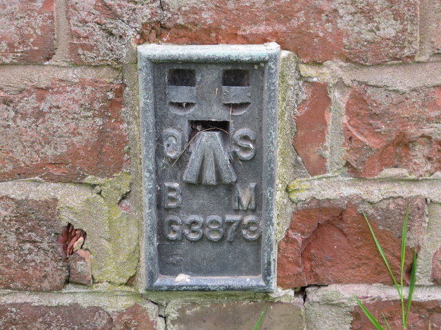
Ordnance Survey Flush Bracket G3873 This can be found on the roadside wall of a former barn - now a private dwelling - at Lea Heath Farm.
For more detail see : <span class="nowrap"><a title="http://www.bench-marks.org.uk/bm10450" rel="nofollow ugc noopener" href="http://www.bench-marks.org.uk/bm10450">Link</a><img style="margin-left:2px;" alt="External link" title="External link - shift click to open in new window" src="https://s1.geograph.org.uk/img/external.png" width="10" height="10"/></span>
Ordnance Survey Flush Bracket G3873 Credit: Peter Wood

Dapple Heath is a small village located in the county of Staffordshire, England. It is nestled in the picturesque countryside, surrounded by rolling hills and lush green landscapes. The village is situated approximately 10 miles north of the bustling market town of Stafford and is easily accessible via the A34 road.

Dapple Heath is known for its tranquil and idyllic setting, making it a popular destination for those seeking a peaceful retreat away from the hustle and bustle of city life. The village exudes a charming rural character, with its traditional stone cottages and well-maintained gardens.

Despite its small size, Dapple Heath boasts a close-knit community, with friendly and welcoming residents. The village has a range of essential amenities, including a local pub, a village hall, and a small convenience store, ensuring that residents have access to everyday necessities.

The surrounding countryside offers ample opportunities for outdoor activities, such as hiking, cycling, and horse riding. Dapple Heath is also located near several nature reserves and parks, providing nature enthusiasts with the chance to explore and appreciate the local flora and fauna.

Overall, Dapple Heath is a peaceful and picturesque village that offers a serene lifestyle amidst the stunning Staffordshire countryside. Its close community spirit and beautiful surroundings make it an appealing location for those seeking a rural retreat.

If you have any feedback on the listing, please let us know in the comments section below.

Dapple Heath Images

Images are sourced within 2km of 52.831663/-1.936439 or Grid Reference SK0426. Thanks to Geograph Open Source API. All images are credited.

Ordnance Survey Flush Bracket G3873 This can be found on the roadside wall of a former barn - now a private dwelling - at Lea Heath Farm.
For more detail see : <span class="nowrap"><a title="http://www.bench-marks.org.uk/bm10450" rel="nofollow ugc noopener" href="http://www.bench-marks.org.uk/bm10450">Link</a><img style="margin-left:2px;" alt="External link" title="External link - shift click to open in new window" src="https://s1.geograph.org.uk/img/external.png" width="10" height="10"/></span>
Ordnance Survey Flush Bracket G3873
This can be found on the roadside wall of a former barn - now a private dwelling - at Lea Heath Farm. For more detail see : LinkExternal link
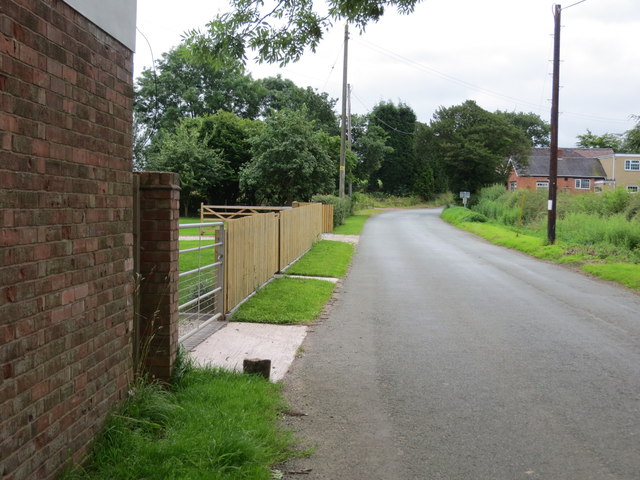
Lea Road at Lea Heath Farm Looking south-eastward.
Lea Road at Lea Heath Farm
Looking south-eastward.
The River Blithe Looking south east from the bridge on Booth Lane.
The River Blithe
Looking south east from the bridge on Booth Lane.
Grazing north off Booth East of Booth Lane.
Grazing north off Booth
East of Booth Lane.
Booth Lane Looking south.
Booth Lane
Looking south.
Grazing near the River Blithe Looking east from Booth Lane towards Callowhill.
Grazing near the River Blithe
Looking east from Booth Lane towards Callowhill.
Telephone exchange on Booth Lane
Booth Lane Looking south near the telephone exchange.
Booth Lane
Looking south near the telephone exchange.
Field entrance off Booth Lane
Grazing, Dapple Heath Off Newton Hurst Lane.
Grazing, Dapple Heath
Off Newton Hurst Lane.
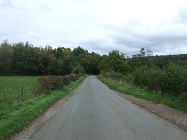
Newton Hurst Lane Looking south east.
Newton Hurst Lane
Looking south east.
Sheep, Newton Bridge Off Newton Hurst Lane.
Sheep, Newton Bridge
Off Newton Hurst Lane.
Field and woodland, Newton Hurst
Fields near Newton Hurst Farm Off Newton Hurst Lane.
Fields near Newton Hurst Farm
Off Newton Hurst Lane.
Newton Hurst Lane towards Abbots Bromley Looking south east.
Newton Hurst Lane towards Abbots Bromley
Looking south east.
Looking south east on Newton Hurst Lane Towards Abbots Bromley.
Looking south east on Newton Hurst Lane
Towards Abbots Bromley.
Elizabeth II postbox on Newton Hurst Lane, Dapple Heath Postbox No. WA15 416.
Elizabeth II postbox on Newton Hurst Lane, Dapple Heath
Postbox No. WA15 416.
Lea Lane, Blithfield The road going of on the right goes to Blithfield Hall.
Lea Lane, Blithfield
The road going of on the right goes to Blithfield Hall.
Show me another place!

Dapple Heath is located at Grid Ref: SK0426 (Lat: 52.831663, Lng: -1.936439)

Administrative County: Staffordshire

District: East Staffordshire

Police Authority: Staffordshire

What 3 Words

///envisage.gazes.passport. Near Abbots Bromley, Staffordshire

Related Wikis

Blithfield Hall

Blithfield Hall (pronounced locally as Bliffield), is a privately owned Grade I listed country house in Staffordshire, England, situated some 9 miles...

Blithfield

Blithfield is a civil parish in the East Staffordshire district of Staffordshire, England. It includes the settlements of Admaston (a small hamlet in Staffordshire...

Chartley Moss

Chartley Moss is a 105.80 hectare biological Site of Special Scientific Interest in Staffordshire, notified in 1987. The area has been designated as an...

Blithfield Reservoir

Blithfield Reservoir is a large raw water reservoir in Staffordshire, England, owned by South Staffordshire Water. Some 800 acres (324 hectares) of reservoir...

Admaston, Staffordshire

Admaston is a small hamlet in Staffordshire, England just outside the town of Rugeley near to Abbots Bromley and Blithfield Hall.The name Admaston is derived...

RAF Abbots Bromley

RAF Abbots Bromley is a former Royal Air Force Relief Landing Ground (RLG) located 0.7 miles (1.1 km) north-west of the village of Abbots Bromley, Staffordshire...

Grindley railway station

Grindley railway station was a former British railway station to serve the village of Grindley in Staffordshire. It was opened by the Stafford and Uttoxeter...

Bagot's Wood

Bagot's Wood is the largest extant piece of the ancient Needwood Forest, located near to Abbots Bromley, in Staffordshire, England. The forest derives...

Nearby Amenities

Located within 500m of 52.831663,-1.936439
Bus Stop
Phone Box
Bus: yes
Naptan AtcoCode: 3800C305000
Naptan Bearing: S
Naptan BusStopType: CUS
Naptan CommonName: Phone Box
Naptan Indicator: Adj
Naptan Landmark: Phone Box
Naptan Street: Booth Lane
Naptan Verified: no
Public Transport: platform
Source: naptan_import
Lat/Long: 52.8318941/-1.9360406
Bus Stop
Booth Lane
Bus: yes
Naptan AtcoCode: 3800C305001
Naptan Bearing: W
Naptan BusStopType: CUS
Naptan CommonName: Booth Lane
Naptan Indicator: Adj
Naptan Landmark: Booth Lane
Naptan Street: Main Road
Naptan Verified: no
Public Transport: platform
Source: naptan_import
Lat/Long: 52.8315616/-1.936234
Dapple Heath
Place: hamlet
Lat/Long: 52.8321475/-1.9350528
Turning Loop
Lat/Long: 52.8313904/-1.9371184
The data included in this document is from www.openstreetmap.org. The data is made available under ODbL.

Have you been to Dapple Heath?

Leave your review of Dapple Heath below (or comments, questions and feedback).