Marlborough Road Plantation

Wood, Forest in Wiltshire

England

Marlborough Road Plantation

Aughton Down, Wiltshire Looking south along a bridleway on Aughton Down.
Aughton Down, Wiltshire Credit: Rebecca A Wills

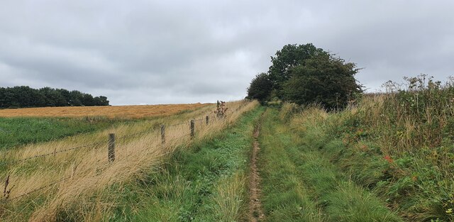
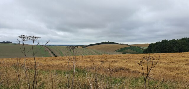
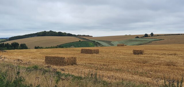
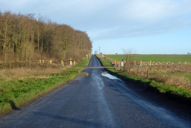
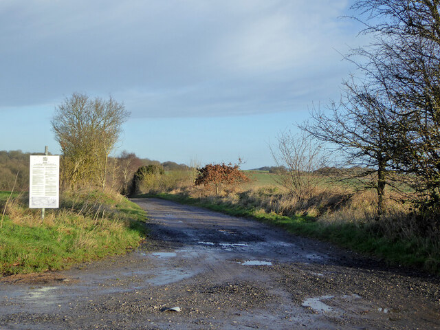
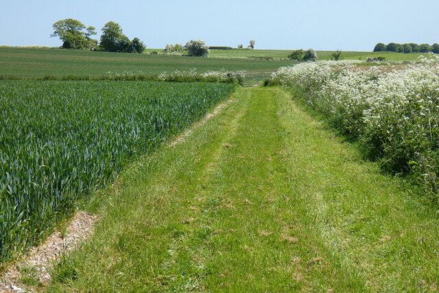
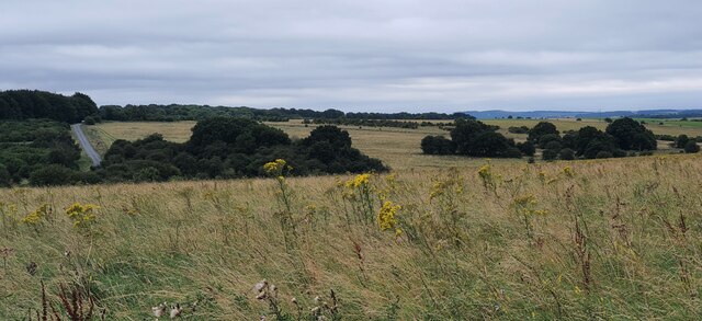
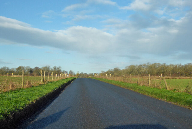
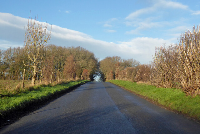
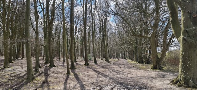
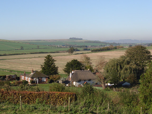
Marlborough Road Plantation is a picturesque woodland located in the county of Wiltshire, England. Situated along Marlborough Road, this plantation covers a vast area and is renowned for its natural beauty and diverse ecosystem. It is a popular destination for nature enthusiasts, hikers, and those seeking tranquility amidst the stunning English countryside.

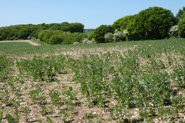
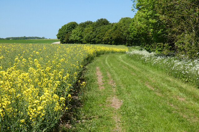
This woodland is characterized by its dense canopy of trees, which primarily comprise native species such as oak, beech, and birch. These towering trees create a cool and shaded environment, perfect for leisurely walks or picnics on sunny days. The forest floor is adorned with a rich carpet of ferns, wildflowers, and mosses, providing a vibrant and colorful display throughout the year.

Marlborough Road Plantation is home to various wildlife species, making it a haven for animal lovers and birdwatchers. Visitors may catch a glimpse of deer, foxes, and rabbits roaming freely in their natural habitat. Bird species such as woodpeckers, owls, and thrushes are also commonly spotted, filling the air with their melodious songs.

The woodland features a network of well-maintained footpaths and trails, allowing visitors to explore its hidden corners and discover its hidden treasures. From meandering streams to small ponds, the plantation offers several delightful spots for visitors to relax and enjoy the peaceful surroundings.

Overall, Marlborough Road Plantation is a captivating woodland that offers a remarkable experience for those seeking solace in nature. Its beauty, biodiversity, and tranquil atmosphere make it a must-visit destination for anyone looking to connect with the natural world in Wiltshire.

If you have any feedback on the listing, please let us know in the comments section below.

Marlborough Road Plantation Images

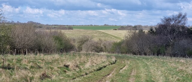
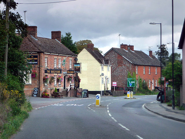
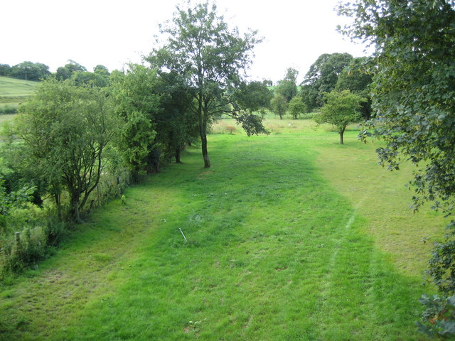
Images are sourced within 2km of 51.294289/-1.7048701 or Grid Reference SU2055. Thanks to Geograph Open Source API. All images are credited.

Aughton Down, Wiltshire Looking south along a bridleway on Aughton Down.
Aughton Down, Wiltshire
Looking south along a bridleway on Aughton Down.
Aughton Down, Wiltshire Looking east across harvested fields on Aughton Down.
Aughton Down, Wiltshire
Looking east across harvested fields on Aughton Down.
Aughton Down, Wiltshire Looking west over harvested fields on Aughton Down.
Aughton Down, Wiltshire
Looking west over harvested fields on Aughton Down.
Tank crossing on Marlborough Road The land to either side is a military training area.
Tank crossing on Marlborough Road
The land to either side is a military training area.
Byway to Easton Royal and Milton Lilbourne The land to the left, but not the track, is a military training area, hence the sign. But by the time you have finished reading its requirements, there is no time to go anywhere anyway.
Byway to Easton Royal and Milton Lilbourne
The land to the left, but not the track, is a military training area, hence the sign. But by the time you have finished reading its requirements, there is no time to go anywhere anyway.
Farmland, Collingbourne Kingston A crop of beans and the copse on Thornhill Down.
Farmland, Collingbourne Kingston
A crop of beans and the copse on Thornhill Down.
Barn and farmland, Collingbourne Kingston At Summer Down Farm and viewed from the byway to the south.
Barn and farmland, Collingbourne Kingston
At Summer Down Farm and viewed from the byway to the south.
Farmland, Collingbourne Kingston A byway follows the field's edge beside oil-seed rape.
Farmland, Collingbourne Kingston
A byway follows the field's edge beside oil-seed rape.
Farmland, Collingbourne Kingston A byway beside wheat above Westhill Farm.  Motorists have been asked to desist voluntarily from using this stretch of track and  its surface is much smoother than 11 years earlier <a title="https://www.geograph.org.uk/photo/2915349" href="https://www.geograph.org.uk/photo/2915349">Link</a>.
Farmland, Collingbourne Kingston
A byway beside wheat above Westhill Farm. Motorists have been asked to desist voluntarily from using this stretch of track and its surface is much smoother than 11 years earlier Link.
Pasture, Everleigh Cattle grazing on farmed MOD land to the east of the village.
Pasture, Everleigh
Cattle grazing on farmed MOD land to the east of the village.
Houses, Everleigh The end of The Street in East Everleigh, the most concentrated area of housing in a scattered community.
Houses, Everleigh
The end of The Street in East Everleigh, the most concentrated area of housing in a scattered community.
Round Down, Wiltshire Looking towards West Everleigh Down from Round Down.
Round Down, Wiltshire
Looking towards West Everleigh Down from Round Down.
West Everleigh Down, Wiltshire A young bramble thriving on a worn tree stump.
West Everleigh Down, Wiltshire
A young bramble thriving on a worn tree stump.
Road towards Pewsey The land to either side is a military training area.
Road towards Pewsey
The land to either side is a military training area.
Road towards Pewsey The land to either side is a military training area.
Road towards Pewsey
The land to either side is a military training area.
Lower Everleigh The exposed wood of a dead tree in the vicinity of Lower Everleigh.
Lower Everleigh
The exposed wood of a dead tree in the vicinity of Lower Everleigh.
Wiren Copse, Wiltshire Looking south-southwest along a sunny track in Wiren Copse.
Wiren Copse, Wiltshire
Looking south-southwest along a sunny track in Wiren Copse.
Round Down, Wiltshire Looking northwest towards West Everleigh Down from Round Down.
Round Down, Wiltshire
Looking northwest towards West Everleigh Down from Round Down.
Show me another place!

Marlborough Road Plantation is located at Grid Ref: SU2055 (Lat: 51.294289, Lng: -1.7048701)

Unitary Authority: Wiltshire

Police Authority: Wiltshire

What 3 Words

///nipped.overgrown.rinsed. Near Collingbourne Kingston, Wiltshire

Related Wikis

St Peter's Church, Everleigh

St Peter's Church, in Everleigh, Wiltshire, England was built in 1813 by John Morlidge for F.D. Astley. It is recorded in the National Heritage List for...

Everleigh, Wiltshire

Everleigh, pronounced and also sometimes spelt Everley, is a village and civil parish in east Wiltshire, England, about 4+1⁄2 miles (7 km) southeast of...

Collingbourne Kingston

Collingbourne Kingston is a village and civil parish about 8 miles (13 km) south of the market town of Marlborough in Wiltshire, England. The village,...

Collingbourne Kingston Halt railway station

Collingbourne Kingston Halt was a small railway station that served the village of Collingbourne Kingston in Wiltshire, England for less than 30 years...

Aughton, Wiltshire

Aughton is a hamlet adjacent to the village of Collingbourne Kingston in Wiltshire, England. Aughton took its name from Aeffe, the owner in the 10th century...

Brunton House

Brunton House is a Grade II* listed house in Brunton, Wiltshire, England. It dates from the late seventeenth or early eighteenth centuries and is of brick...

Brunton, Wiltshire

Brunton is a hamlet adjacent to the village of Collingbourne Kingston in Wiltshire, England. Records of Brunton's existence date back to the 10th century...

Collingbourne Ducis

Collingbourne Ducis is a village and civil parish on Salisbury Plain in Wiltshire, England, about 10 miles (16 km) south of Marlborough. It is one of several...

Nearby Amenities

Located within 500m of 51.294289,-1.7048701
Archaeological Site: tumulus
Historic: archaeological_site
Lat/Long: 51.2932973/-1.698329
The data included in this document is from www.openstreetmap.org. The data is made available under ODbL.

Have you been to Marlborough Road Plantation?

Leave your review of Marlborough Road Plantation below (or comments, questions and feedback).