Knowlands Plantation

Wood, Forest in Warwickshire Stratford-on-Avon

England

Knowlands Plantation

Threatening clouds, on track through Foxcote Farm near Ilmington
Threatening clouds, on track through Foxcote Farm near Ilmington Credit: Colin Park

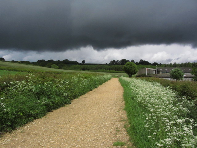
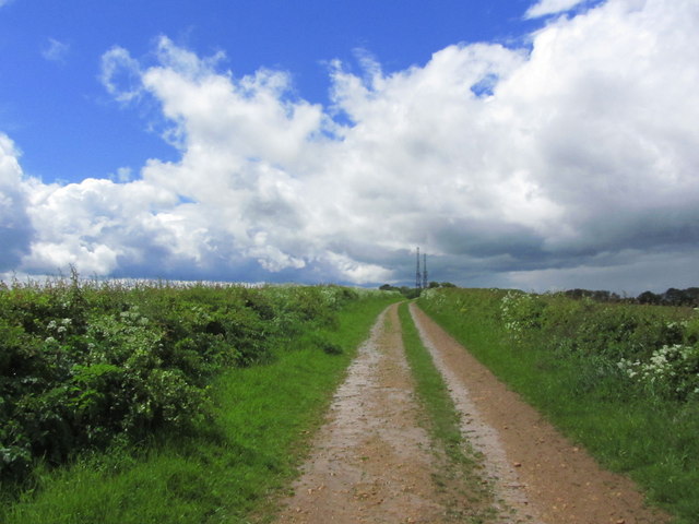
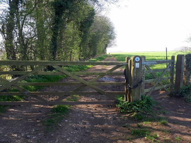
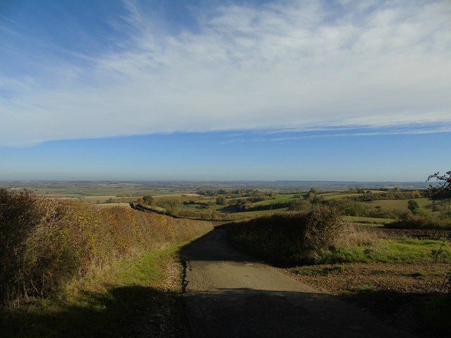
Knowlands Plantation is a picturesque woodland located in Warwickshire, England. Situated amidst the rolling countryside, this plantation covers a vast area of land, offering visitors a tranquil and serene escape from the bustling city life.

The plantation is primarily composed of an assortment of trees, creating a dense and lush forest environment. The dominant species found within the woodland are oak and beech trees, which provide a rich canopy overhead, allowing only glimpses of sunlight to filter through. This creates a dappled and enchanting atmosphere for visitors to explore.

Knowlands Plantation is renowned for its diverse wildlife. The forest is home to a wide range of bird species, including woodpeckers, owls, and various songbirds. Visitors may also spot small mammals such as deer, rabbits, and squirrels darting through the undergrowth. The plantation's biodiversity is further enhanced by numerous wildflowers and ferns that carpet the forest floor, adding to its natural beauty.

This woodland is a popular destination for nature enthusiasts, hikers, and photographers. It offers a network of well-maintained walking trails, allowing visitors to immerse themselves in the stunning surroundings. The plantation also features designated picnic areas, where visitors can relax and enjoy a meal amidst the peaceful ambiance.

Knowlands Plantation is open to the public throughout the year, with seasonal variations showcasing the changing colors of the foliage. Its convenient location and accessibility make it an ideal destination for both locals and tourists seeking a serene and idyllic escape into nature.

If you have any feedback on the listing, please let us know in the comments section below.

Knowlands Plantation Images

Images are sourced within 2km of 52.080192/-1.7011643 or Grid Reference SP2042. Thanks to Geograph Open Source API. All images are credited.

Threatening clouds, on track through Foxcote Farm near Ilmington
Track leading towards masts on Nebsworth Hill near Ilmington
Ilmington Downs transmitter masts View SSW from near the top of Long Hill (128m) towards the transmitter masts on the top of Ilmington Downs (240m), some 10.65km away.
Ilmington Downs transmitter masts
View SSW from near the top of Long Hill (128m) towards the transmitter masts on the top of Ilmington Downs (240m), some 10.65km away.
Farm building and wheat field View east from Nash's Lane, a bridleway running from Ebrington towards Ilmington.
Farm building and wheat field
View east from Nash's Lane, a bridleway running from Ebrington towards Ilmington.
Bridleway towards Ilmington View north down the bridleway.
On the horizon can be seen the two transmitter towers in <a href="https://www.geograph.org.uk/gridref/SP1942">SP1942</a>.
Bridleway towards Ilmington
View north down the bridleway. On the horizon can be seen the two transmitter towers in SP1942.
Wheat field east of the bridleway A field of ripening wheat to the east of the bridleway running from Ebrington towards Ilmington.
On the horizon to the left can be seen the two transmitter towers in <a href="https://www.geograph.org.uk/gridref/SP1942">SP1942</a>.
Wheat field east of the bridleway
A field of ripening wheat to the east of the bridleway running from Ebrington towards Ilmington. On the horizon to the left can be seen the two transmitter towers in SP1942.
View NNW from the bridleway Looking NNW from the bridleway from Ebrington towards Ilmington.
View NNW from the bridleway
Looking NNW from the bridleway from Ebrington towards Ilmington.
Madgcombe Coppice Bridleway and Path heading towards Ebrington.
Madgcombe Coppice
Bridleway and Path heading towards Ebrington.
Lane near Upper Lark Stoke
Foxcote House
Foxcote House
Ebrington Hill triangulation pillar Not far from the Warwickshire county top but seen here from the Gloucestershire side.
Ebrington Hill triangulation pillar
Not far from the Warwickshire county top but seen here from the Gloucestershire side.
Bridleway on Ebrington Hill The bridleway has become much more overgrown since <a href="https://www.geograph.org.uk/photo/2622553">SP1842 : Highest point in Warwickshire, 261 metres</a>, and gives the impression of being little used. The highest point of Warwickshire is just to the left of the left-hand hedge.
Bridleway on Ebrington Hill
The bridleway has become much more overgrown since SP1842 : Highest point in Warwickshire, 261 metres, and gives the impression of being little used. The highest point of Warwickshire is just to the left of the left-hand hedge.
The road to Ilmington
Footpath towards Campden Road
Lane between hedges Lark Stoke
Campden Pitch heading down to Ilmington
Campden Pitch entering Ilmington
Campden Hill in Ilmington
Show me another place!

Knowlands Plantation is located at Grid Ref: SP2042 (Lat: 52.080192, Lng: -1.7011643)

Administrative County: Warwickshire

District: Stratford-on-Avon

Police Authority: Warwickshire

What 3 Words

///nails.tangible.instincts. Near Mickleton, Gloucestershire

Related Wikis

Ilmington Downs

The Ilmington Downs are a large open area situated in Warwickshire, just above the small village of Ilmington. It is the highest point in Warwickshire...

Ilmington

Ilmington is a village and civil parish about 3.5 miles (5.6 km) north-west of Shipston-on-Stour and 8 miles (13 km) south of Stratford-upon-Avon in the...

Flowers Wood

Flowers Wood is a community woodland near Ilmington in Warwickshire, England. It covers a total area of 1.67 hectares (4.13 acres). It is owned and managed...

Ebrington Hill

Ebrington Hill is a hill in Warwickshire, England, which at 261 m (856 ft) is the highest in the county. It is situated between the villages of Ebrington...

Nearby Amenities

Located within 500m of 52.080192,-1.7011643
Windmill Hill
Ele: 220
Natural: peak
Lat/Long: 52.0759123/-1.7017776
The data included in this document is from www.openstreetmap.org. The data is made available under ODbL.

Have you been to Knowlands Plantation?

Leave your review of Knowlands Plantation below (or comments, questions and feedback).