Whin Covert

Wood, Forest in Yorkshire Richmondshire

England

Whin Covert

Telephone box and toilet block off the A66, Scotch Corner Basic facilities for the needy traveller.
Telephone box and toilet block off the A66, Scotch Corner Credit: JThomas

Whin Covert is a picturesque woodland located in the county of Yorkshire, England. Nestled within the larger area known as Yorkshire Dales National Park, this forested area covers a significant portion of land, offering visitors a tranquil and natural escape from the hustle and bustle of modern life.

The woodland is characterized by its dense canopy of trees, primarily consisting of oak, beech, and birch. These towering trees provide ample shade and shelter for a diverse range of flora and fauna that call Whin Covert their home. The forest floor is covered with an array of wildflowers, ferns, and mosses, creating a stunning and vibrant carpet of colors.

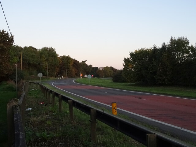
Whin Covert is a haven for nature lovers and outdoor enthusiasts alike. The woodland offers numerous walking trails and paths, allowing visitors to explore its beauty at their own pace. The well-maintained paths wind through the forest, offering glimpses of hidden streams, small waterfalls, and enchanting glades.

Birdwatchers flock to Whin Covert, as the forest is home to a variety of avian species. From colorful songbirds to majestic birds of prey, the woodland provides an ideal habitat for these winged creatures. Lucky visitors may even catch a glimpse of a shy deer or a playful squirrel as they navigate through the trees.

The tranquility and natural beauty of Whin Covert make it a popular destination for those seeking a peaceful retreat or a place to reconnect with nature. Whether it's a leisurely walk, a picnic among the trees, or simply immersing oneself in the serenity of the surroundings, Whin Covert offers an idyllic escape in the heart of Yorkshire.

If you have any feedback on the listing, please let us know in the comments section below.

Whin Covert Images

Images are sourced within 2km of 54.442992/-1.6847328 or Grid Reference NZ2005. Thanks to Geograph Open Source API. All images are credited.

Telephone box and toilet block off the A66, Scotch Corner Basic facilities for the needy traveller.
Telephone box and toilet block off the A66, Scotch Corner
Basic facilities for the needy traveller.
Lay-by off the A66, Scotch Corner
A66, Scotch Corner Towards Brough.
A66, Scotch Corner
Towards Brough.
Scotch Corner services
Greggs at Scotch Corner services
The way to Sedbury East Farm A properly metalled road leads past Low Sedbury (behind the hedge on the left) and via a dogleg to Sedbury East Farm. Without so much as a cattle grid to guard it, it is no surprise that the residents feel the need for a sign to tell us that the road is private.
The way to Sedbury East Farm
A properly metalled road leads past Low Sedbury (behind the hedge on the left) and via a dogleg to Sedbury East Farm. Without so much as a cattle grid to guard it, it is no surprise that the residents feel the need for a sign to tell us that the road is private.
A6108 approaching a roundabout For a view of the roundabout being built, see <a href="https://www.geograph.org.uk/photo/4500201">NZ2104 : New relief road roundabout near Scotch Corner</a>.
A6108 approaching a roundabout
For a view of the roundabout being built, see NZ2104 : New relief road roundabout near Scotch Corner.
A6055 near Scotch Corner
A6055 approaching Kneeton Lane
Sedbury East Farm, Skeeby, near Richmond, North Yorkshire
Ewden House B and B, Skeeby, near Richmond, North Yorkshire Adjoins Skeeby Grange
Ewden House B and B, Skeeby, near Richmond, North Yorkshire
Adjoins Skeeby Grange
Sedbury Layby Off the A66, this layby has a take-away snack bar, telephone and toilets, open daylight hours.
Sedbury Layby
Off the A66, this layby has a take-away snack bar, telephone and toilets, open daylight hours.
Kneeton Cottages.
Kneeton Cottages.
Scotch Corner  Hotel At the junction of the A1 and A66.
Scotch Corner Hotel
At the junction of the A1 and A66.
Violet Grange  Farm From Scotch Corner.
Violet Grange Farm
From Scotch Corner.
A6108 : Scotch Corner to Richmond, Road
Services, Scotch Corner This will win no architectural design awards.  It serves motorists heading up and down the Great North Road (A1)
Services, Scotch Corner
This will win no architectural design awards. It serves motorists heading up and down the Great North Road (A1)
Copse, Scotch Corner Small group of trees seen from the Services at Scotch Corner, just beyond the car park
Copse, Scotch Corner
Small group of trees seen from the Services at Scotch Corner, just beyond the car park
Show me another place!

Whin Covert is located at Grid Ref: NZ2005 (Lat: 54.442992, Lng: -1.6847328)

Division: North Riding

Administrative County: North Yorkshire

District: Richmondshire

Police Authority: North Yorkshire

What 3 Words

///rags.rams.suspect. Near Richmond, North Yorkshire

Related Wikis

Gilling with Hartforth and Sedbury

Gilling with Hartforth and Sedbury is a civil parish in North Yorkshire, England. It includes the villages of Gilling West and Hartforth. The civil parish...

Scotch Corner

Scotch Corner is a junction of the A1(M) and A66 trunk roads near Richmond in North Yorkshire, England. It has been described as "the modern gateway to...

Scot's Dyke

Scot’s Dyke, also known as the Scots Dyke or the Scots Dike, is a linear earthwork in the district of Richmondshire in the county of North Yorkshire, England...

Gilling West

Gilling West is a village about 3.5 miles (5.6 km) north of Richmond in the Richmondshire district of North Yorkshire, England. It is located in the civil...

Middleton Lodge

Middleton Lodge is a Georgian Palladian mansion set within 200 acres (0.81 km2) of open countryside, on the outskirts of the village of Middleton Tyas...

Middleton Tyas

Middleton Tyas is a village and civil parish in the Richmondshire district of North Yorkshire, England. It is located near Scotch Corner. == History... ==

Skeeby

Skeeby is a village and civil parish about 18 miles (29 km) north-west of the county town of Northallerton in North Yorkshire, England. == History == Skeeby...

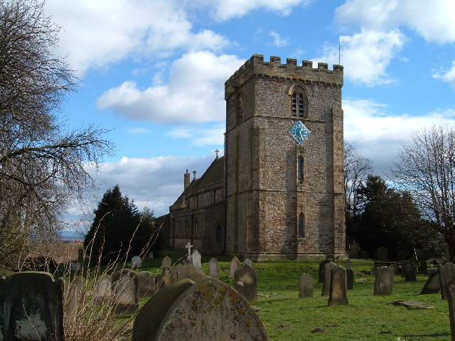
St James' Church, Melsonby

St James' Church is in the village of Melsonby, North Yorkshire, England. It is an Anglican parish church in the deanery of Richmond, the archdeaconry...

Nearby Amenities

Located within 500m of 54.442992,-1.6847328
Rest Area
Toilets: yes
Lat/Long: 54.4424563/-1.6795537
Fast Food
Lat/Long: 54.4426192/-1.6797102
Toilets
Fee: no
Toilets Disposal: flush
Unisex: yes
Lat/Long: 54.4426803/-1.6796557
Telephone
Booth: KX100
Covered: booth
Lat/Long: 54.4426515/-1.6795955
Waste Basket
Lat/Long: 54.4425508/-1.6795579
Leisure: picnic_table
Lat/Long: 54.4428581/-1.6800434
Leisure: picnic_table
Lat/Long: 54.4427707/-1.680038
Leisure: picnic_table
Lat/Long: 54.4427629/-1.679853
Leisure: picnic_table
Lat/Long: 54.442646/-1.6793112
Leisure: picnic_table
Lat/Long: 54.4425539/-1.6793004
Leisure: picnic_table
Lat/Long: 54.4425836/-1.6790269
Waste Basket
Lat/Long: 54.4423652/-1.6782276
Waste Basket
Lat/Long: 54.4423496/-1.6788257
Waste Basket
Lat/Long: 54.4423668/-1.6793809
Waste Basket
Lat/Long: 54.4424666/-1.6799442
Waste Basket
Lat/Long: 54.4426366/-1.6803116
Waste Basket
Lat/Long: 54.442791/-1.6805503
Waste Basket
Lat/Long: 54.4429361/-1.6807488
The data included in this document is from www.openstreetmap.org. The data is made available under ODbL.

Have you been to Whin Covert?

Leave your review of Whin Covert below (or comments, questions and feedback).