Belt Plantation
Wood, Forest in Yorkshire Richmondshire
England
Belt Plantation

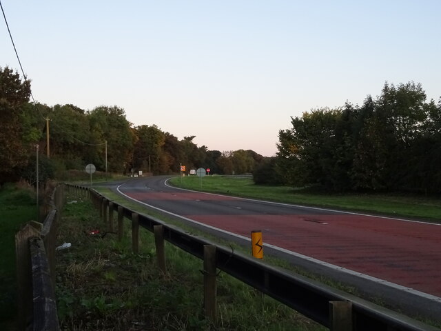
Belt Plantation, situated in Yorkshire, is a captivating woodland area enveloped by the tranquility of nature. Spanning across an expansive area, the plantation is renowned for its lush greenery, dense foliage, and diverse range of tree species. Nestled within the heart of the plantation, visitors are met with a captivating landscape that offers a serene retreat from the bustling city life.
The woodland is characterized by its towering trees, including oak, beech, and pine, which create a picturesque canopy above. This dense cover provides shelter to an array of wildlife, making it a haven for nature enthusiasts and wildlife photographers alike. The plantation is home to numerous species of birds, small mammals, and a variety of flora and fauna that thrive within the woodland ecosystem.
Visitors to Belt Plantation can enjoy a range of recreational activities, such as walking trails that wind through the forest, offering picturesque views and opportunities for peaceful reflection. The woodland also provides an ideal setting for picnics and family outings, with designated areas equipped with picnic tables and benches.
Maintained by Yorkshire's local authorities, Belt Plantation offers a well-preserved natural haven for visitors to explore and appreciate the beauty of the Yorkshire countryside. The plantation serves as an important green space within the region, providing a sanctuary for both wildlife and visitors seeking respite from the demands of urban life.
In conclusion, Belt Plantation in Yorkshire is an enchanting woodland retreat, offering a captivating blend of natural beauty, diverse wildlife, and recreational activities.
If you have any feedback on the listing, please let us know in the comments section below.
Belt Plantation Images
Images are sourced within 2km of 54.445881/-1.6863297 or Grid Reference NZ2005. Thanks to Geograph Open Source API. All images are credited.


Belt Plantation is located at Grid Ref: NZ2005 (Lat: 54.445881, Lng: -1.6863297)
Division: North Riding
Administrative County: North Yorkshire
District: Richmondshire
Police Authority: North Yorkshire
What 3 Words
///funnels.precautions.masterpiece. Near Richmond, North Yorkshire
Related Wikis

Gilling with Hartforth and Sedbury
Gilling with Hartforth and Sedbury is a civil parish in North Yorkshire, England. It includes the villages of Gilling West and Hartforth. The civil parish...
Scot's Dyke
Scot’s Dyke, also known as the Scots Dyke or the Scots Dike, is a linear earthwork in the district of Richmondshire in the county of North Yorkshire, England...
Scotch Corner
Scotch Corner is a junction of the A1(M) and A66 trunk roads near Richmond in North Yorkshire, England. It has been described as "the modern gateway to...

Middleton Lodge
Middleton Lodge is a Georgian Palladian mansion set within 200 acres (0.81 km2) of open countryside, on the outskirts of the village of Middleton Tyas...

Gilling West
Gilling West is a village about 3.5 miles (5.6 km) north of Richmond in the Richmondshire district of North Yorkshire, England. It is located in the civil...
Middleton Tyas
Middleton Tyas is a village and civil parish in the Richmondshire district of North Yorkshire, England. It is located near Scotch Corner. == History... ==
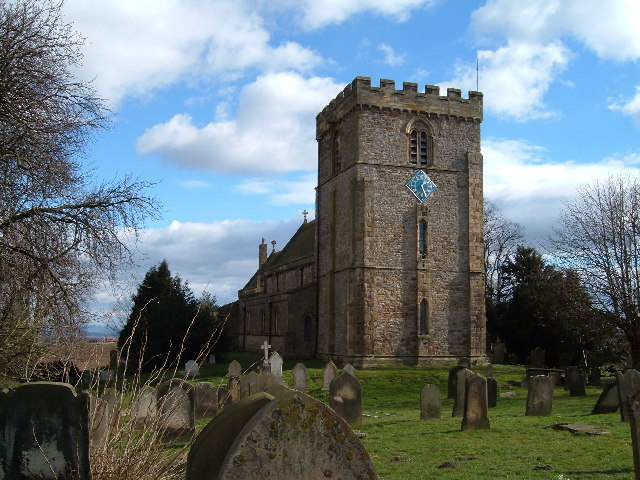
St James' Church, Melsonby
St James' Church is in the village of Melsonby, North Yorkshire, England. It is an Anglican parish church in the deanery of Richmond, the archdeaconry...

Melsonby
Melsonby is a village and civil parish in the Richmondshire district of North Yorkshire, England. It lies a 1.2 miles (2 km) west of the A1(M) motorway...
Nearby Amenities
Located within 500m of 54.445881,-1.6863297Have you been to Belt Plantation?
Leave your review of Belt Plantation below (or comments, questions and feedback).