Devils Den

Wood, Forest in Hampshire New Forest

England

Devils Den

Junction to Forest Lodge
Junction to Forest Lodge Credit: Dave Thompson

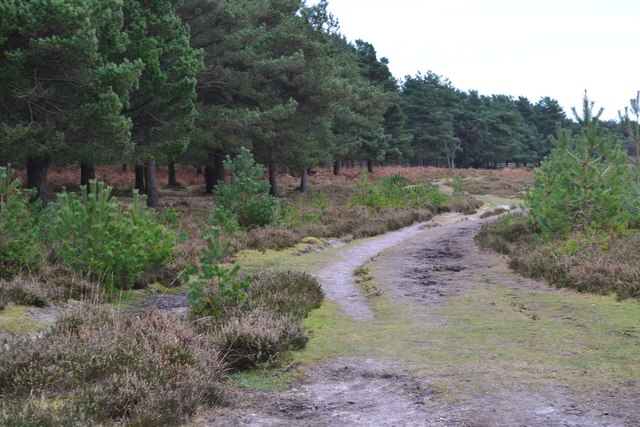
Devil's Den is a picturesque woodland area located in Hampshire, England. Situated within the larger New Forest National Park, this ancient woodland is renowned for its natural beauty and rich history. The name "Devil's Den" is believed to have originated from local folklore and legends surrounding the area.

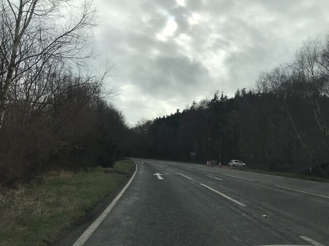
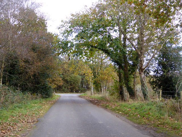
Covering approximately 40 acres, Devil's Den is characterized by a diverse range of tree species, including oak, beech, and birch. The woodland is dense, creating an enchanting atmosphere that is popular among nature enthusiasts, hikers, and photographers. The forest floor is adorned with a vibrant carpet of wildflowers, making it an idyllic setting for leisurely walks and picnics.

Aside from its natural beauty, Devil's Den holds historical significance. The site is scattered with remnants of ancient earthworks and barrows, suggesting that it was once used as a burial ground during the Bronze Age. These archaeological features provide a fascinating insight into the area's past and attract history enthusiasts keen to explore the site.

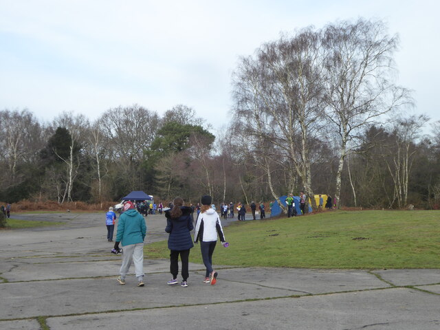
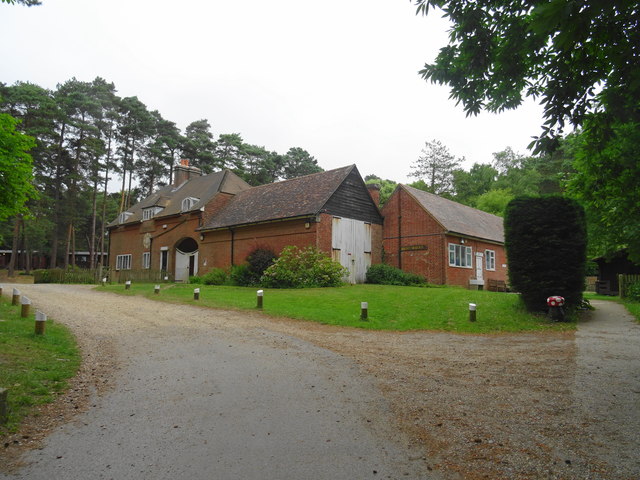
Visitors to Devil's Den can expect a tranquil and peaceful environment, perfect for escaping the hustle and bustle of everyday life. The woodland offers a network of well-maintained footpaths, allowing visitors to navigate through the forest easily. Informative signposts are placed strategically throughout the site, providing interesting facts about the flora, fauna, and history of Devil's Den.

In conclusion, Devil's Den in Hampshire is a captivating woodland area that offers a harmonious blend of natural beauty and historical intrigue. Whether one seeks a peaceful retreat, a scenic hike, or a glimpse into the area's past, Devil's Den is sure to leave a lasting impression on all who visit.

If you have any feedback on the listing, please let us know in the comments section below.

Devils Den Images

Images are sourced within 2km of 50.798621/-1.7120443 or Grid Reference SZ2099. Thanks to Geograph Open Source API. All images are credited.

Junction to Forest Lodge
A35 towards Lyndhurst  The A35 is a major (and regularly congested) route along England's south coast. It runs for 97 miles, connecting Honiton in Devon with Southampton in Hampshire, via Poole and Bournemouth, with much of its route passing through Dorset and the New Forest. It is a trunk road for some of its length.
<span class="nowrap"><a title="http://www.sabre-roads.org.uk/wiki/index.php?title=A35" rel="nofollow ugc noopener" href="http://www.sabre-roads.org.uk/wiki/index.php?title=A35">Link</a><img style="margin-left:2px;" alt="External link" title="External link - shift click to open in new window" src="https://s1.geograph.org.uk/img/external.png" width="10" height="10"/></span>  SABRE
A35 towards Lyndhurst
The A35 is a major (and regularly congested) route along England's south coast. It runs for 97 miles, connecting Honiton in Devon with Southampton in Hampshire, via Poole and Bournemouth, with much of its route passing through Dorset and the New Forest. It is a trunk road for some of its length. LinkExternal link SABRE
Trees beside the A35
Grazing, Plain Heath
Assembly area for an orienteering event at Holmsley Caravan and Camp Site
Services block at Holmsley Caravan and Camp Site
New Forest ponies by Forest Road
Common at Pigsty Hill
Pasture at Pigsty Hill
Joining the A35 road Ar Forest Lodge.
Joining the A35 road
Ar Forest Lodge.
Braggers Lane Heading towards Thorney Hill.
Braggers Lane
Heading towards Thorney Hill.
Path beside dismantled railway The route of the railway itself is at this point heavily waterlogged and impassable on foot.
Path beside dismantled railway
The route of the railway itself is at this point heavily waterlogged and impassable on foot.
Cattle grid on Braggers Lane
Pasture on Whitefield Hill
Avon Tyrrell - Stable Block Grade II listed stable block in 'Arts and Crafts' style by W R Lethaby in 1892 for Lord Manners.
Avon Tyrrell - Stable Block
Grade II listed stable block in 'Arts and Crafts' style by W R Lethaby in 1892 for Lord Manners.
Pond near Lugden Bottom
View across pond near Lugden Bottom
Former gateposts into Dur Hill Inclosure Most of the inclosure is no longer gated and fenced.
Former gateposts into Dur Hill Inclosure
Most of the inclosure is no longer gated and fenced.
Show me another place!

Devils Den is located at Grid Ref: SZ2099 (Lat: 50.798621, Lng: -1.7120443)

Administrative County: Hampshire

District: New Forest

Police Authority: Hampshire

What 3 Words

///adults.sinkhole.erupt. Near Bransgore, Hampshire

Related Wikis

All Saints' Church, Thorney Hill

All Saints' Church is a Church of England church in Thorney Hill, Hampshire, England. It was built in 1905–06 and has been a Grade I listed building since...

RAF Holmsley South

Royal Air Force Holmsley South or more simply RAF Holmsley South is a former Royal Air Force station in Hampshire, England. The airfield is located approximately...

Avon Tyrrell House

Avon Tyrrell is an historic manor within the parish of Sopley, Hampshire. It is situated within the New Forest, near Christchurch. The present manor house...

Bransgore

Bransgore is a village and civil parish within the New Forest District, Hampshire, England. The village developed in the 19th century when a church and...

Holmsley railway station

Holmsley is a closed railway station in the county of Hampshire which served rural settlements in the New Forest. == History == The station was opened...

East Close House

East Close House in Hinton, Hampshire, near Christchurch, Dorset, is a building of historical significance and a grade II listed building on the English...

Burley, Hampshire

Burley is a village and civil parish in the New Forest, Hampshire, England. It has ancient origins and is now somewhat tourist-orientated. == The village... ==

Ossemsley

Ossemsley is an extended hamlet in the New Forest National Park of Hampshire, England. It lies close to the village of Bashley. The nearest town is New...

Nearby Amenities

Located within 500m of 50.798621,-1.7120443
Barrier: cattle_grid
Lat/Long: 50.7992443/-1.7162136
Bus Stop
School Road
Bus: yes
Naptan AtcoCode: 1900HAA09152
Naptan Bearing: NW
Naptan CommonName: School Road
Naptan Crossing: School Road
Naptan NaptanCode: hamjdapt
Naptan Street: Forest Road
Naptan Verified: no
Public Transport: platform
Source: naptan_import
Lat/Long: 50.7987159/-1.7145281
Bus Stop
School Road
Bus: yes
Naptan AtcoCode: 1900HAA09153
Naptan Bearing: SE
Naptan CommonName: School Road
Naptan Crossing: School Road
Naptan NaptanCode: hamjdapw
Naptan Street: Forest Road
Naptan Verified: no
Public Transport: platform
Source: naptan_import
Lat/Long: 50.7987786/-1.7144426
Bus Stop
Thorney Hill Cross Roads
Bus: yes
Naptan AtcoCode: 1900HA080917
Naptan Bearing: S
Naptan CommonName: Thorney Hill Cross Roads
Naptan Crossing: Forest Road
Naptan NaptanCode: hamadtaj
Naptan Street: Burley Road
Naptan Verified: no
Public Transport: platform
Shelter: yes
Source: naptan_import
Tactile Paving: no
Lat/Long: 50.7995342/-1.7182126
Bus Stop
Thorney Hill Cross Roads
Bus: yes
Naptan AtcoCode: 1900HA080918
Naptan Bearing: N
Naptan BusStopType: CUS
Naptan CommonName: Thorney Hill Cross Roads
Naptan Crossing: Forest Road
Naptan NaptanCode: hamadtag
Naptan Street: Burley Road
Naptan Verified: no
Public Transport: platform
Source: naptan_import
Lat/Long: 50.7995838/-1.7183625
Cross Ways
Ele: 75
Natural: peak
Lat/Long: 50.7998772/-1.717815
Thorney Hill
Place: hamlet
Lat/Long: 50.7981152/-1.7172537
The data included in this document is from www.openstreetmap.org. The data is made available under ODbL.

Have you been to Devils Den?

Leave your review of Devils Den below (or comments, questions and feedback).