Radcliffe Wood

Wood, Forest in Yorkshire

England

Radcliffe Wood

Muddy field entrance on High Moor Lane, Shepley The bridleway is mostly dry after this muddy start.
Muddy field entrance on High Moor Lane, Shepley Credit: Humphrey Bolton

The requested URL returned error: 429 Too Many Requests

If you have any feedback on the listing, please let us know in the comments section below.

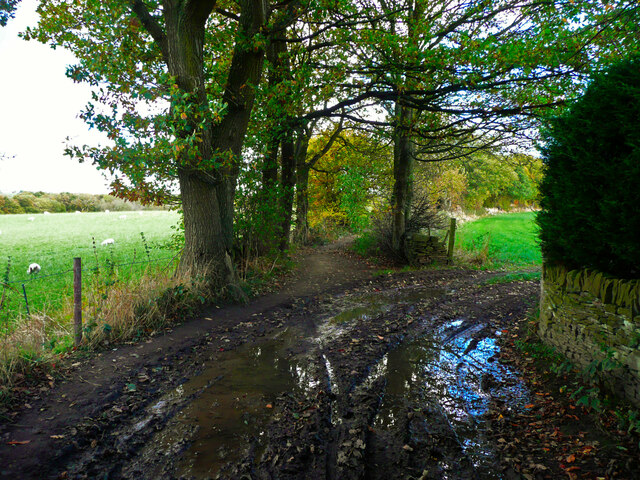
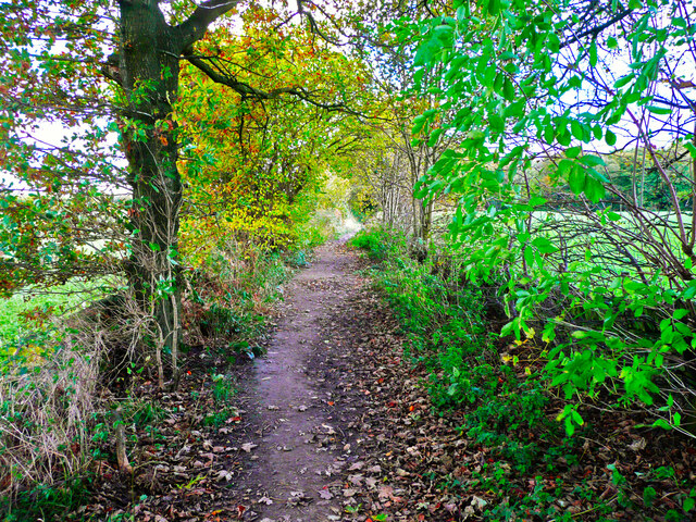
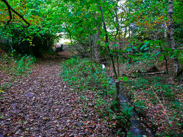
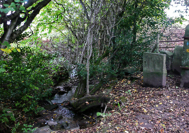
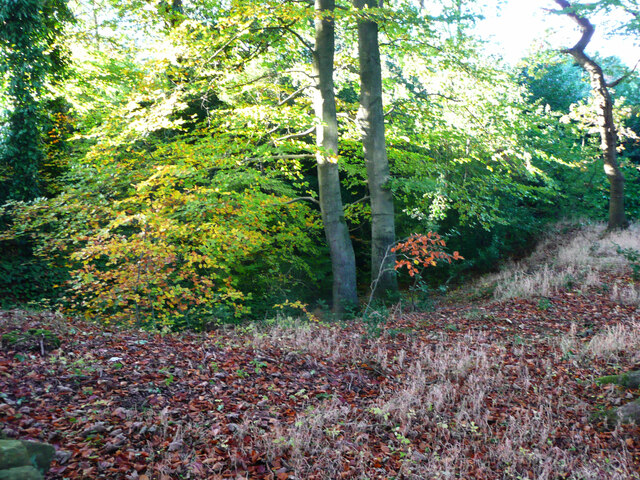
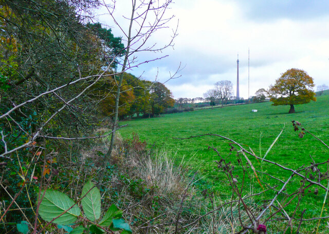
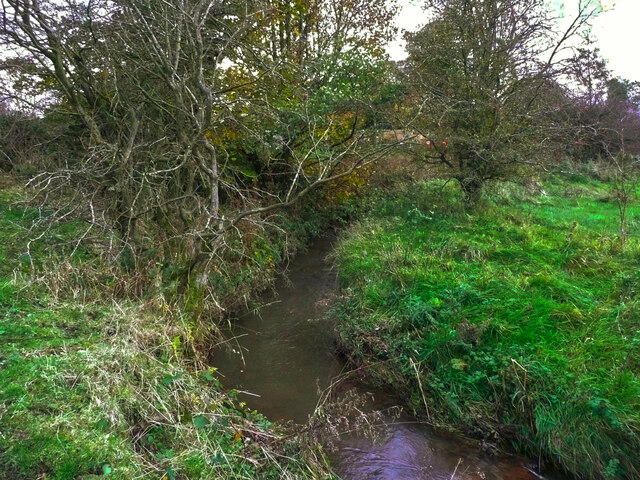
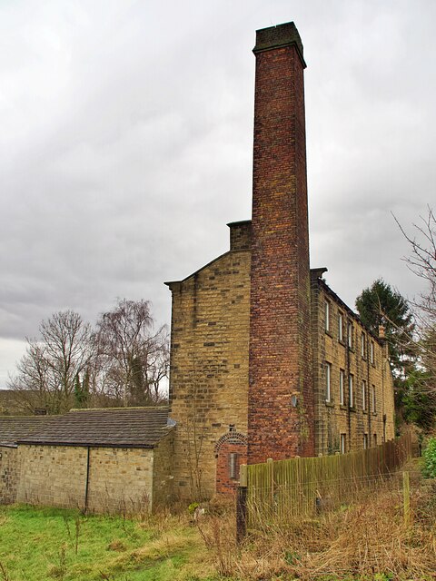
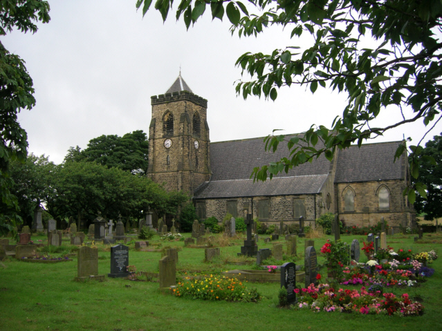
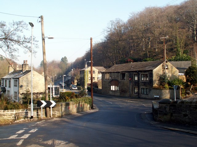
Radcliffe Wood Images

Images are sourced within 2km of 53.602988/-1.6952329 or Grid Reference SE2011. Thanks to Geograph Open Source API. All images are credited.

Muddy field entrance on High Moor Lane, Shepley The bridleway is mostly dry after this muddy start.
Muddy field entrance on High Moor Lane, Shepley
The bridleway is mostly dry after this muddy start.
High Moor Lane, Shepley A pleasant bridleway.
High Moor Lane, Shepley
A pleasant bridleway.
High Moor Lane passing Yew Tree Wood, Shepley There is a little stream on the right, and a footpath branches off at the gate, where the bridleway bends to the right.
High Moor Lane passing Yew Tree Wood, Shepley
There is a little stream on the right, and a footpath branches off at the gate, where the bridleway bends to the right.
Stream leaving High Moor Lane, Shepley This is the stream that comes down through Yew Tree Wood. A stile at the start of a footpath to Copley Lane via Hardingley Farm is on the right.
Stream leaving High Moor Lane, Shepley
This is the stream that comes down through Yew Tree Wood. A stile at the start of a footpath to Copley Lane via Hardingley Farm is on the right.
Woodland off Copley Lane, Shelley The stream shown in <a href="https://www.geograph.org.uk/photo/7011892">SE2009 : Steps down to stream from Copley Lane, Shelley</a> flows down below these trees, and presumably in culvert under the railway embankment. Then it goes to Barncliffe Mills.
Woodland off Copley Lane, Shelley
The stream shown in SE2009 : Steps down to stream from Copley Lane, Shelley flows down below these trees, and presumably in culvert under the railway embankment. Then it goes to Barncliffe Mills.
View towards Emley Mast from Huddersfield Road, Shelley This is a revisit to the first geograph for the square: <a href="https://www.geograph.org.uk/photo/123985">SE2011 : Radcliffe Wood, near Shelley</a>  taken in February 2006. Radcliffe Wood is on the left. A young tree has grown and the hawthorn hedge makes the viewpoint a bit uncomfortable. The slender mast to the right of Emley Moor mast is a temporary one. "A temporary 310m mast was erected to May 2018 to enable transmissions to continue whilst the existing mast’s antennas are being modified to prepare for the 700MHz clearance and interruption of the broadcasts are not allowed. It was never made clear how long the temporary mast would be up for, but mid to late 2021 would seem a good guess,  being as they were advertising its sale (for collection...) from that date !" From <span class="nowrap"><a title="https://www.aerialsandtv.com/knowledge/transmitters/emley-moor-transmitter" rel="nofollow ugc noopener" href="https://www.aerialsandtv.com/knowledge/transmitters/emley-moor-transmitter">Link</a><img style="margin-left:2px;" alt="External link" title="External link - shift click to open in new window" src="https://s1.geograph.org.uk/img/external.png" width="10" height="10"/></span> .
View towards Emley Mast from Huddersfield Road, Shelley
This is a revisit to the first geograph for the square: SE2011 : Radcliffe Wood, near Shelley taken in February 2006. Radcliffe Wood is on the left. A young tree has grown and the hawthorn hedge makes the viewpoint a bit uncomfortable. The slender mast to the right of Emley Moor mast is a temporary one. "A temporary 310m mast was erected to May 2018 to enable transmissions to continue whilst the existing mast’s antennas are being modified to prepare for the 700MHz clearance and interruption of the broadcasts are not allowed. It was never made clear how long the temporary mast would be up for, but mid to late 2021 would seem a good guess, being as they were advertising its sale (for collection...) from that date !" From LinkExternal link .
Shepley Dike off Near Bank, Shelley, looking downstream A tree, probably hawthorn. has fallen over the stream.
Shepley Dike off Near Bank, Shelley, looking downstream
A tree, probably hawthorn. has fallen over the stream.
Shepley Dike off Near Bank looking upstream Brook House Bridge is a little way upstream.
Shepley Dike off Near Bank looking upstream
Brook House Bridge is a little way upstream.
Stream alongside Brook House Lane, Shelley It is not clear from maps whether this flows through Brook House Mill or Barncliffe Mills, but either way it joins Shepley Dike and is its longest tributary.
Stream alongside Brook House Lane, Shelley
It is not clear from maps whether this flows through Brook House Mill or Barncliffe Mills, but either way it joins Shepley Dike and is its longest tributary.
View over Barncliffe Dike Farm To the village of Shelley at the top of the hill
View over Barncliffe Dike Farm
To the village of Shelley at the top of the hill
Warning sign for low bridges There are two bridges here: the further carries the Barnsley - Huddersfield railway and the nearer used to carry the Clayton West branch of the Lancashire & Yorkshire Railway. This line was closed to traffic in 1983. Immediately to the left of the bridge is the terminal station of the Kirklees Light Railway, a narrow gauge heritage railway that runs between here and Clayton West on the original trackbed.
Warning sign for low bridges
There are two bridges here: the further carries the Barnsley - Huddersfield railway and the nearer used to carry the Clayton West branch of the Lancashire & Yorkshire Railway. This line was closed to traffic in 1983. Immediately to the left of the bridge is the terminal station of the Kirklees Light Railway, a narrow gauge heritage railway that runs between here and Clayton West on the original trackbed.
Old industrial building and chimney Off Abbey Road in Shepley. The building now appears to be in residential use.
Old industrial building and chimney
Off Abbey Road in Shepley. The building now appears to be in residential use.
Bus stop and shelter on Far Bank Provided by West Yorkshire PTE
Bus stop and shelter on Far Bank
Provided by West Yorkshire PTE
Three cottages on Far Bank Named Bakers Cottage, Drapers Cottage and Grocers Cottage they were presumably small businesses before being converted to residential use.
Three cottages on Far Bank
Named Bakers Cottage, Drapers Cottage and Grocers Cottage they were presumably small businesses before being converted to residential use.
Tree-lined path to Emmanuel Church I think these are flowering cherry trees and, if so, would provide a beautiful approach to the church in Spring.
Tree-lined path to Emmanuel Church
I think these are flowering cherry trees and, if so, would provide a beautiful approach to the church in Spring.
Houses on Stead Gate Reflected in a pond to the south of the road.
Houses on Stead Gate
Reflected in a pond to the south of the road.
Houses and pond at Shelley Woodhouse
Shelley Station Terminus of Kirklees Light Railway from West Clayton
Shelley Station
Terminus of Kirklees Light Railway from West Clayton
Show me another place!

Radcliffe Wood is located at Grid Ref: SE2011 (Lat: 53.602988, Lng: -1.6952329)

Division: West Riding

Unitary Authority: Kirklees

Police Authority: West Yorkshire

What 3 Words

///bedroom.condense.outwards. Near Shelley, West Yorkshire

Nearby Locations

Radcliffe Wood Shelley

Related Wikis

Shelley, West Yorkshire

Shelley is a village in the civil parish of Kirkburton, in the Kirklees district, in the county of West Yorkshire, England. The village is 3 miles (5 km...

Kirkburton

Kirkburton is a village, civil parish and ward in Kirklees in West Yorkshire, England. It is 5 miles (8 km) south-east of Huddersfield. Historically part...

Roydhouse

Roydhouse is a hamlet in the civil parish of Kirkburton, in Kirklees, West Yorkshire, England. Roydhouse was recorded as "le Roides". It has a public house...

Thunder Bridge

Thunder Bridge or Thunderbridge is a hamlet and bridge in the civil parish of Kirkburton, in the Kirklees district, in the county of West Yorkshire, England...

Nearby Amenities

Located within 500m of 53.602988,-1.6952329
Bus Stop
Huddersfield Road Westerley Way
Bench: no
Bin: yes
Lit: yes
Local Ref: 45020750
Naptan AtcoCode: 450020750
Naptan Bearing: N
Naptan CommonName: Huddersfield Road Westerly Way
Naptan Crossing: Westerly Way
Naptan Indicator: Stop 45020750
Naptan Landmark: Oddfellows PH
Naptan PlusbusZoneRef: LEEDS
Naptan ShortCommonName: Westerly Way
Naptan Street: Huddersfield Road
Naptan Verified: no
Shelter: no
Source: naptan_import
Tactile Paving: no
Lat/Long: 53.5991886/-1.6940051
Bus Stop
Huddersfield Road Westerly Way
Bench: no
Bin: yes
Bus: yes
Lit: yes
Local Ref: 45020751
Naptan AtcoCode: 450020751
Naptan Bearing: S
Naptan CommonName: Huddersfield Road Westerly Way
Naptan Crossing: Westerly Way
Naptan Indicator: Stop 45020751
Naptan Landmark: The Oddfellows PH
Naptan PlusbusZoneRef: LEEDS
Naptan ShortCommonName: Shelley Oddfellows
Naptan Street: Huddersfield Road
Naptan Verified: no
Public Transport: platform
Shelter: no
Source: naptan_import
Tactile Paving: no
Lat/Long: 53.5987023/-1.6936309
Bus Stop
Huddersfield Road Cross Lane
Local Ref: 45020752
Naptan AtcoCode: 450020752
Naptan Bearing: SE
Naptan CommonName: Huddersfield Road Cross Lane
Naptan Crossing: Cross Lane
Naptan Indicator: Stop 45020752
Naptan PlusbusZoneRef: LEEDS
Naptan ShortCommonName: Cross Lane
Naptan Street: Huddersfield Road
Naptan Verified: no
Source: naptan_import
Lat/Long: 53.6035473/-1.6972379
Bus Stop
Huddersfield Road Cross Lane
Local Ref: 45026867
Naptan AtcoCode: 450026867
Naptan Bearing: SE
Naptan CommonName: Huddersfield Road Cross Lane
Naptan Crossing: Cross Lane
Naptan Indicator: Stop 45026867
Naptan PlusbusZoneRef: LEEDS
Naptan ShortCommonName: Cross Lane
Naptan Street: Huddersfield Road
Naptan Verified: no
Source: naptan_import
Lat/Long: 53.6034848/-1.6973895
Crossing
Crossing: uncontrolled
Crossing Island: no
Crossing Ref: zebra
Source: survey
Tactile Paving: yes
Lat/Long: 53.5988481/-1.6937954
Barrier: bollard
Bollard: fixed
Foot: designated
Material: metal
Source: survey
Survey Date: 2021-09-08
Lat/Long: 53.5986313/-1.6941528
Shelter
Shelter Type: public_transport
Lat/Long: 53.5991286/-1.6940133
Generator Method: photovoltaic
Generator Output Electricity: small_installation
Generator Source: solar
Generator Type: solar_photovoltaic_panel
Note: roof household
Power: generator
Lat/Long: 53.6050683/-1.6984667
Post Box
Collection Times: Mo-Fr 16:00; Sa 12:00
Operator: Royal Mail
Post Box Type: lamp
Ref: HD8 357
Royal Cypher: EIIR
Royal Cypher Wikidata: Q33102113
Source: survey
Lat/Long: 53.5989859/-1.6940187
Post Box
Collection Times: Mo-Fr 09:00; Sa 07:00
Operator: Royal Mail
Post Box Type: lamp
Ref: HD8 414D
Royal Cypher: EIIR
Royal Cypher Wikidata: Q33102113
Source: survey
Lat/Long: 53.6055658/-1.6981819
Addr City: Huddersfield
Addr Housenumber: 2B
Addr Postcode: HD8 8HN
Addr Street: Westerley Way
Addr Suburb: Shelley
Level: 1
Lat/Long: 53.5990338/-1.6942527
The data included in this document is from www.openstreetmap.org. The data is made available under ODbL.

Have you been to Radcliffe Wood?

Leave your review of Radcliffe Wood below (or comments, questions and feedback).