Amie's Wood

Wood, Forest in Hampshire New Forest

England

Amie's Wood

Grassy ride in Milkham Inclosure
Grassy ride in Milkham Inclosure Credit: David Martin

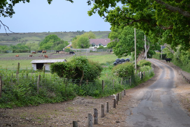
Amie's Wood is a picturesque woodland located in Hampshire, England. Stretching over an area of approximately 100 acres, this tranquil forest is a haven for nature enthusiasts and those seeking a peaceful retreat from the bustling city life. The wood is named after Amie, a local resident who dedicated her life to preserving and protecting the natural beauty of the area.

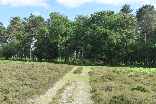
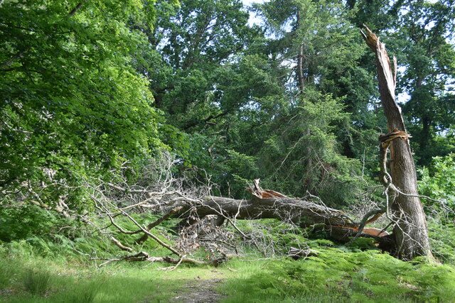
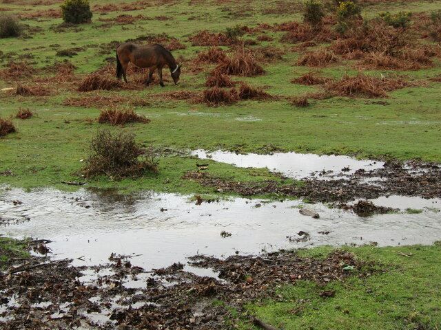
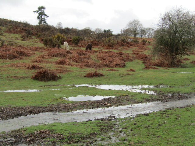
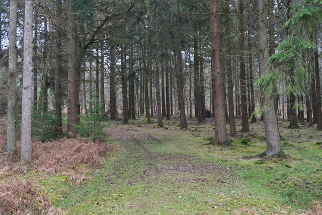
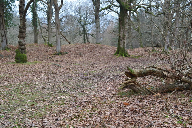
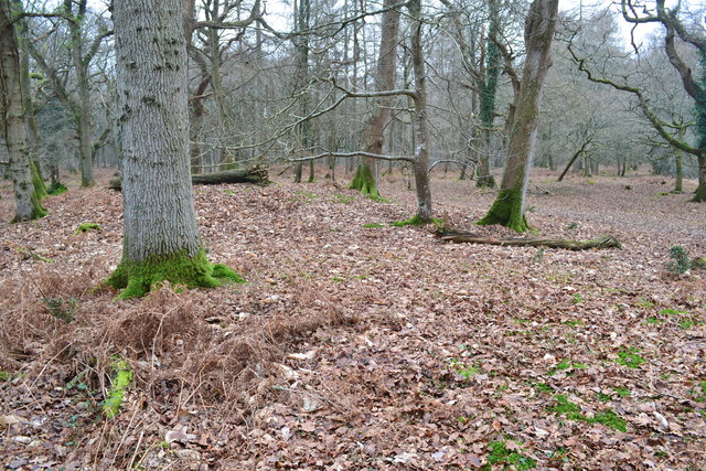
The woodland is predominantly composed of native tree species such as oak, beech, and birch, creating a diverse and vibrant ecosystem. The dense canopy of the trees provides ample shade, making it an excellent spot for hiking and exploring on sunny days. The forest floor is covered in a lush carpet of ferns, moss, and wildflowers, adding to the enchanting atmosphere.

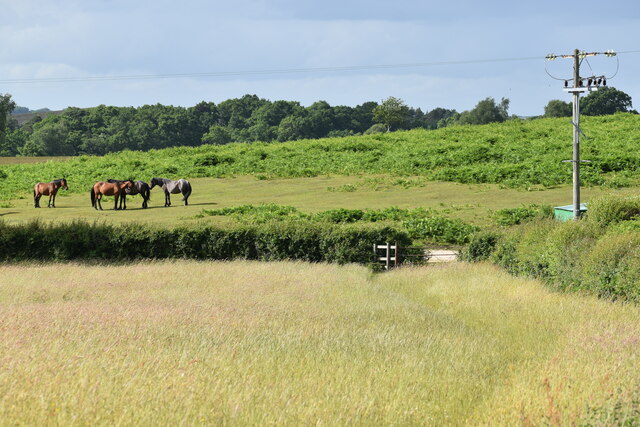
Amie's Wood is not only visually appealing but also teeming with wildlife. Birdsong fills the air as various species, including woodpeckers, robins, and thrushes, make their homes in the branches above. In addition, small mammals like squirrels and rabbits can often be spotted scurrying through the undergrowth.

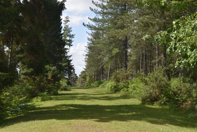
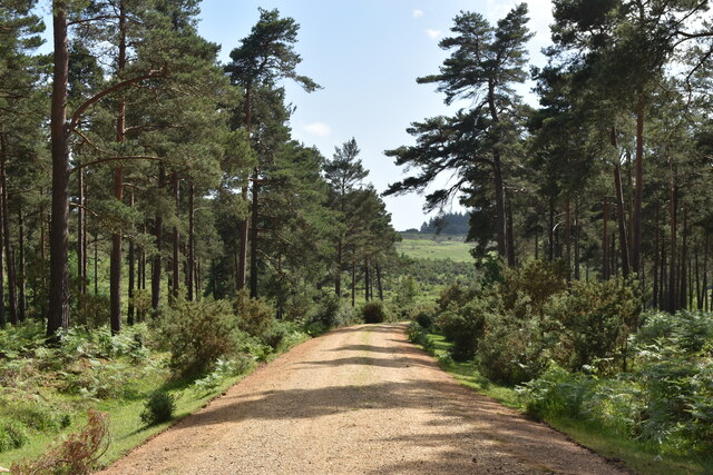
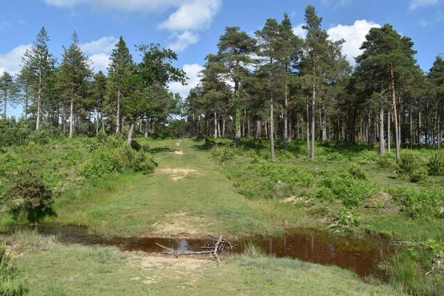
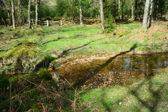
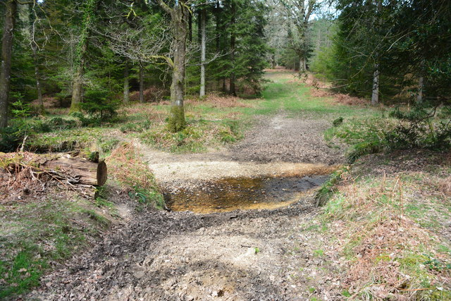
The wood is crisscrossed by a network of well-maintained walking trails, allowing visitors to immerse themselves in the natural beauty and serenity of the surroundings. These paths lead to a picturesque lake nestled within the wood, providing a peaceful spot for reflection and relaxation. The wood is also home to several picnic areas, making it an ideal destination for families and groups.

Amie's Wood, Hampshire, offers a unique opportunity to connect with nature and unwind in a tranquil setting. Whether it's a leisurely stroll, birdwatching, or simply enjoying a picnic amidst the beauty of the forest, this wood has something to offer for everyone.

If you have any feedback on the listing, please let us know in the comments section below.
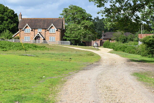
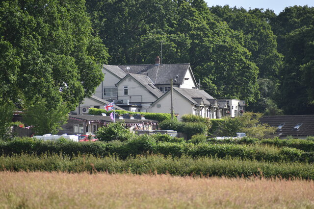
Amie's Wood Images

Images are sourced within 2km of 50.889975/-1.7225145 or Grid Reference SU1910. Thanks to Geograph Open Source API. All images are credited.

Grassy ride in Milkham Inclosure
Cycle track descending through Milkham Inclosure
Ford on path in Milkham Inclosure
Path into Milkham Inclosure
Track past Forest View Farm
The Red Shoot pub and campsite
Field edge at Linwood The ponies are grazing on an area of access land known as Black Heath.
Field edge at Linwood
The ponies are grazing on an area of access land known as Black Heath.
Fallen tree at Castle Piece This large fallen tree is within the embankment of the iron age hillfort at Castle Piece.
Fallen tree at Castle Piece
This large fallen tree is within the embankment of the iron age hillfort at Castle Piece.
Appleslade Bottom New Forest ponies grazing on a valley floor by Linwood.
<span class="nowrap"><a title="www.newforestnpa.gov.uk" rel="nofollow ugc noopener" href="http://www.newforestnpa.gov.uk">Link</a><img style="margin-left:2px;" alt="External link" title="External link - shift click to open in new window" src="https://s1.geograph.org.uk/img/external.png" width="10" height="10"/></span>
Appleslade Bottom
New Forest ponies grazing on a valley floor by Linwood. LinkExternal link
Appleslade Bottom New Forest ponies on a boggy valley bottom by Linwood.
<span class="nowrap"><a title="www.newforestnpa.gov.uk" rel="nofollow ugc noopener" href="http://www.newforestnpa.gov.uk">Link</a><img style="margin-left:2px;" alt="External link" title="External link - shift click to open in new window" src="https://s1.geograph.org.uk/img/external.png" width="10" height="10"/></span>
Appleslade Bottom
New Forest ponies on a boggy valley bottom by Linwood. LinkExternal link
Grassy track in the forest, Roe Inclosure
Castle Piece hill fort, Roe Inclosure A fairly complete circular earth embankment, believed to be an iron age hill fort <span class="nowrap"><a title="http://www.megalithic.co.uk/article.php?sid=11605" rel="nofollow ugc noopener" href="http://www.megalithic.co.uk/article.php?sid=11605">Link</a><img style="margin-left:2px;" alt="External link" title="External link - shift click to open in new window" src="https://s1.geograph.org.uk/img/external.png" width="10" height="10"/></span>
Castle Piece hill fort, Roe Inclosure
A fairly complete circular earth embankment, believed to be an iron age hill fort LinkExternal link
Castle Piece hill fort, Roe Inclosure Here, standing on the earth embankment in the centre of <a href="https://www.geograph.org.uk/photo/5279273">SU1908 : Castle Piece hill fort, Roe Inclosure</a>, the outline is much harder to see than from a distance.
Castle Piece hill fort, Roe Inclosure
Here, standing on the earth embankment in the centre of SU1908 : Castle Piece hill fort, Roe Inclosure, the outline is much harder to see than from a distance.
Linwood Ford This ford is found on Toms Lane at Linwood.
Linwood Ford
This ford is found on Toms Lane at Linwood.
Ford at Linwood This is one of five fords in the Inclosure at Linwood.
Ford at Linwood
This is one of five fords in the Inclosure at Linwood.
Ford at Linwood This is one of five fords at Linwood.
Ford at Linwood
This is one of five fords at Linwood.
Toms Lane from the Red Shoot Inn
The Red Shoot Inn
The Red Shoot Inn
Show me another place!

Amie's Wood is located at Grid Ref: SU1910 (Lat: 50.889975, Lng: -1.7225145)

Administrative County: Hampshire

District: New Forest

Police Authority: Hampshire

What 3 Words

///reconnect.headsets.manuals. Near Fordingbridge, Hampshire

Related Wikis

Linwood, Hampshire

Linwood is a hamlet in the New Forest National Park of Hampshire, England. Its nearest town is Ringwood, which lies approximately 4.2 miles (5.9 km) south...

Furze Hill

Furze Hill (or Furzehill) is a hamlet situated in the New Forest National Park of Hampshire, England. It is in the civil parish of Ellingham, Harbridge...

Ogdens

Ogdens is a small hamlet south of Hyde Common near Frogham in the New Forest area of Hampshire, England. Ogdens is a hamlet in the civil parish of Hyde...

Gorley Lynch

Gorley Lynch is a hamlet in the civil parish of Gorley in the New Forest National Park of Hampshire, England. It is in the civil parish of Hyde. Its nearest...

Ellingham, Harbridge and Ibsley

Ellingham, Harbridge and Ibsley is a civil parish in the west of the English county of Hampshire. The population of the civil parish at the 2011 Census...

Gorley Hill

Gorley Hill is the site of a former Iron Age promontory hillfort located in Hampshire in the United Kingdom. The fort once occupied the southwestern corner...

Hyde, Hampshire

Hyde is a village and civil parish in the New Forest near Fordingbridge in Hampshire, England. == Overview == The parish of Hyde is mostly within the boundary...

Linford, Hampshire

Linford is a hamlet in the New Forest district of Hampshire, England, close to the market town of Ringwood. It is about 1.5 miles east of Ringwood. It...

Nearby Amenities

Located within 500m of 50.889975,-1.7225145
Lcn Ref: 42
Lat/Long: 50.8900872/-1.7181981
Odbl: clean
Lat/Long: 50.8879505/-1.7226959
Odbl: clean
Lat/Long: 50.887597/-1.7231091
Odbl: clean
Lat/Long: 50.8867913/-1.7237536
Odbl: clean
Lat/Long: 50.8861467/-1.7243177
Barrier: stile
Foot: yes
Lat/Long: 50.8907227/-1.7272071
Barrier: stile
Lat/Long: 50.8914717/-1.7266509
Barrier: stile
Lat/Long: 50.8909415/-1.7270361
Passing Place
Lat/Long: 50.8895721/-1.7196528
Passing Place
Lat/Long: 50.8902279/-1.7176959
Barrier: stile
Lat/Long: 50.8924445/-1.7259478
Passing Place
Lat/Long: 50.8865107/-1.7245028
The data included in this document is from www.openstreetmap.org. The data is made available under ODbL.

Have you been to Amie's Wood?

Leave your review of Amie's Wood below (or comments, questions and feedback).