Damgate

Settlement in Norfolk Great Yarmouth

England

Damgate

Big sky and oilseed crop, East Somerton The wind turbine on the right horizon is just west of this gridsquare.
Big sky and oilseed crop, East Somerton Credit: Brian Robert Marshall

Damgate is a small village located in the county of Norfolk, England. It is situated approximately 5 miles southwest of the market town of Wymondham and is nestled within the picturesque Norfolk countryside.

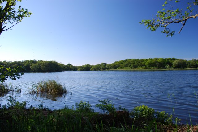
The village is known for its tranquility and rural charm, making it an attractive destination for those seeking a peaceful retreat away from the hustle and bustle of city life. Damgate is surrounded by rolling hills, lush green fields, and meandering streams, creating an idyllic setting for nature enthusiasts and outdoor lovers.

The village itself is relatively small, with a population of around 200 residents. It is characterized by its traditional Norfolk architecture, featuring quaint cottages and farmhouses. The local community is tight-knit and friendly, contributing to the warm and welcoming atmosphere that Damgate is known for.

Despite its size, Damgate offers a range of amenities to its residents and visitors. These include a village hall, a small local pub, and a primary school. The village is also well-connected, with good transport links to neighboring towns and cities, allowing for easy access to a wider range of services and facilities.

One of the notable attractions near Damgate is the Mid-Norfolk Railway, a preserved heritage railway that operates steam and diesel trains. This provides an opportunity for visitors to experience a nostalgic journey through the Norfolk countryside.

In summary, Damgate is a charming village in Norfolk, renowned for its peaceful surroundings, friendly community, and rural beauty. It offers a tranquil escape from the fast-paced modern world, making it an appealing destination for those seeking a taste of traditional English countryside living.

If you have any feedback on the listing, please let us know in the comments section below.

Damgate Images

Images are sourced within 2km of 52.713897/1.638527 or Grid Reference TG4519. Thanks to Geograph Open Source API. All images are credited.

Big sky and oilseed crop, East Somerton The wind turbine on the right horizon is just west of this gridsquare.
Big sky and oilseed crop, East Somerton
The wind turbine on the right horizon is just west of this gridsquare.
St. Mary The Virgin Church, Martham Grade I Listed  C14 Tower
St. Mary The Virgin Church, Martham
Grade I Listed C14 Tower
Horsey Road through West Somerton
West Somerton Staithe Kayaks can be hired here, when it's a short paddle down to Martham Broad.
West Somerton Staithe
Kayaks can be hired here, when it's a short paddle down to Martham Broad.
Heigham Holmes drainage mill View from public footpath leading from Martham Ferry to Martham Broad Nature Reserve.
Heigham Holmes drainage mill
View from public footpath leading from Martham Ferry to Martham Broad Nature Reserve.
Heigham Holmes drainage mill View from the public footpath which leads from Martham Ferry to Martham Broad Nature Reserve.
Heigham Holmes drainage mill
View from the public footpath which leads from Martham Ferry to Martham Broad Nature Reserve.
West Somerton Drainage Mill View from the public footpath which leads from Martham Ferry to Martham Broad Nature Reserve.
West Somerton Drainage Mill
View from the public footpath which leads from Martham Ferry to Martham Broad Nature Reserve.
Boat House, Martham Broad View from public footpath leading from Martham Ferry to West Somerton.
Boat House, Martham Broad
View from public footpath leading from Martham Ferry to West Somerton.
West Somerton Drainage Mill View from the public footpath which leads from Martham Ferry to west Somerton.
West Somerton Drainage Mill
View from the public footpath which leads from Martham Ferry to west Somerton.
West Somerton Staithe Seating and village sign next to the staithe.
West Somerton Staithe
Seating and village sign next to the staithe.
Village sign, West Somerton See <a href="https://www.geograph.org.uk/photo/3320638">TG4620 : West Somerton Staithe</a>.
Village sign, West Somerton
Boats near the entrance to Martham Broad
West Somerton, green and village sign
OS Flush Bracket - West Somerton Flush Bracket S048 on the wall of a farm building; originally levelled at 2.203m above Ordnance Datum Newlyn.
OS Flush Bracket - West Somerton
Flush Bracket S048 on the wall of a farm building; originally levelled at 2.203m above Ordnance Datum Newlyn.
The River Thume at West Somerton The river drains into Martham Broad from the southeast, but has been widened into a navigable cut.
The River Thume at West Somerton
The river drains into Martham Broad from the southeast, but has been widened into a navigable cut.
Drainage ditch on West Somerton marsh
Evening sun on stubble at West Somerton
West Somerton Drainage Mill On Martham Broad beside West Somerton Boat Dyke. Martham Broad is an internationally important wetland for wildlife.
West Somerton Drainage Mill
On Martham Broad beside West Somerton Boat Dyke. Martham Broad is an internationally important wetland for wildlife.
Show me another place!

Damgate is located at Grid Ref: TG4519 (Lat: 52.713897, Lng: 1.638527)

Administrative County: Norfolk

District: Great Yarmouth

Police Authority: Norfolk

What 3 Words

///burn.grass.commutes. Near Martham, Norfolk

Nearby Locations

Damgate

Related Wikis

Flegg High Ormiston Academy

Flegg High Ormiston Academy (formerly Flegg High School) is an 11–16 mixed secondary school with academy status in Martham, Great Yarmouth, Norfolk, England...

Martham

Martham is a village and civil parish in the English county of Norfolk. It is situated some 10 mi (16 km) north-west of the town of Great Yarmouth and...

The Broads

The Broads (known for marketing purposes as The Broads National Park) is a network of mostly navigable rivers and lakes in the English counties of Norfolk...

Martham Broad

Martham Broad is a 60-hectare (150-acre) national nature reserve north of Great Yarmouth in Norfolk. It is managed by the Norfolk Wildlife Trust, and...

Nearby Amenities

Located within 500m of 52.713897,1.638527
Bus Stop
Bensley Road
Naptan AtcoCode: 2900M0510
Naptan Bearing: NE
Naptan CommonName: Bensley Road
Naptan Indicator: opp
Naptan Landmark: Bensley Road
Naptan Locality: Martham
Naptan NaptanCode: nfodgdwp
Naptan Street: Somerton Road
Shelter: yes
Source: naptan_import;survey
Lat/Long: 52.7114175/1.6400922
Bensley Road, adj
Naptan AtcoCode: 2900M0511
Naptan Bearing: SW
Naptan BusStopType: CUS
Naptan CommonName: Bensley Road
Naptan Indicator: adj
Naptan Landmark: Bensley Road
Naptan Locality: Martham
Naptan NaptanCode: nfodgdwt
Naptan Street: Somerton Road
Naptan Verified: no
Source: naptan_import
Lat/Long: 52.7115656/1.6399565
Flegg High School, adj
Naptan AtcoCode: 2900M052
Naptan Bearing: NE
Naptan BusStopType: CUS
Naptan CommonName: Flegg High School
Naptan Indicator: adj
Naptan Landmark: High School Grounds
Naptan Locality: Martham
Naptan NaptanCode: nfodgjad
Naptan Street: Somerton Road
Naptan Verified: no
Source: naptan_import
Lat/Long: 52.712301/1.6409064
Turning Circle
Lat/Long: 52.7125302/1.639669
Man Made: telephone_box
Note: No phone inside
Lat/Long: 52.7107251/1.6385292
Crossing
Crossing: uncontrolled
Lat/Long: 52.7121869/1.6407399
Damgate Farm
Place: farm
Lat/Long: 52.7126524/1.6366518
Crossing
Crossing: uncontrolled
Lat/Long: 52.7123842/1.6415354
Crossing
Crossing: uncontrolled
Lat/Long: 52.712276/1.6411593
Give Way
Lat/Long: 52.710979/1.6389518
Martham
Colour: black
Material: metal
Traffic Sign: city_limit
Lat/Long: 52.7115311/1.6403854
Crossing
Crossing: uncontrolled
Lat/Long: 52.7123419/1.6415609
Communication Mobile Phone: yes
Layer: 1
Man Made: mast
Material: metal
Operator: EE
Tower Construction: guyed_tube
Tower Type: communication
Lat/Long: 52.7127811/1.639517
The data included in this document is from www.openstreetmap.org. The data is made available under ODbL.

Have you been to Damgate?

Leave your review of Damgate below (or comments, questions and feedback).