Blackington Copse

Wood, Forest in Gloucestershire Cotswold

England

Blackington Copse

Downs Barn trig
Downs Barn trig Credit: Iain Macaulay

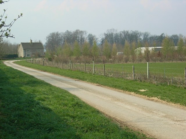
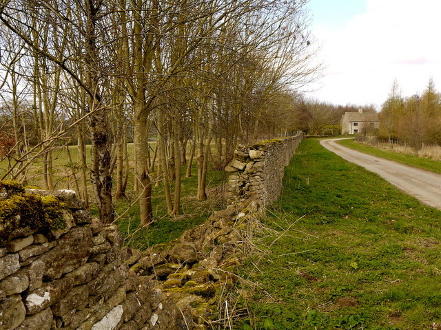
Blackington Copse is a picturesque woodland area located in the county of Gloucestershire, England. Situated near the village of Blackington, this copse is a natural haven for nature enthusiasts and those seeking a peaceful retreat.

Covering an area of approximately 50 acres, Blackington Copse is characterized by its dense, mature trees and diverse wildlife. The wood is predominantly made up of deciduous species such as oak, beech, and ash, which create a rich and vibrant canopy during the summer months. The forest floor is adorned with a variety of flora, including bluebells, foxgloves, and ferns, adding to the enchanting atmosphere of the copse.

Traversing through the woodland, visitors will find a network of well-maintained footpaths and trails, providing opportunities for leisurely walks and exploration. These paths wind their way through the trees, offering glimpses of the surrounding countryside and allowing visitors to immerse themselves in the beauty and tranquility of the natural surroundings.

Blackington Copse is also home to a diverse range of wildlife. Birdwatchers can spot various species, including woodpeckers, nuthatches, and owls, while small mammals such as foxes, badgers, and squirrels roam the forest floor. The copse is particularly known for its population of deer, with sightings of roe deer and fallow deer being relatively common.

Overall, Blackington Copse is a cherished natural gem in Gloucestershire, offering visitors a chance to connect with nature, explore its beauty, and witness the wonders of the woodland ecosystem.

If you have any feedback on the listing, please let us know in the comments section below.

Blackington Copse Images

Images are sourced within 2km of 51.837749/-1.7243669 or Grid Reference SP1915. Thanks to Geograph Open Source API. All images are credited.

Downs Barn trig
Downs Barn trig
Downs Barn trig. point With the public footpath clearly visible beyond.
Downs Barn trig. point
With the public footpath clearly visible beyond.
View towards Little Rissington Airfield Looking across the square from Downs Barn trig. point.
View towards Little Rissington Airfield
Looking across the square from Downs Barn trig. point.
Great Rissington Primary School Situated on the east side of the sloping village green.
Great Rissington Primary School
Situated on the east side of the sloping village green.
662 feet in old money The trig point on the downs between the Rissingtons.
662 feet in old money
The trig point on the downs between the Rissingtons.
View to Bromham Plantation
Young shelter belt
Young shelter belt
Farm Part of Barrington Park Estate.
Farm
Part of Barrington Park Estate.
Deer Park
Deer Park
Folly on Deer Park
Folly on Deer Park
Farmland track Farmland track giving access to fields to the north of Great Barrington.
Farmland track
Farmland track giving access to fields to the north of Great Barrington.
Dovecote in Barrington Park Viewed from the nearby road, a domed 18th century dovecote built in a classical style in Barrington Park.  The building is Grade II* listed, see:<span class="nowrap"><a title="https://historicengland.org.uk/listing/the-list/list-entry/1340832" rel="nofollow ugc noopener" href="https://historicengland.org.uk/listing/the-list/list-entry/1340832">Link</a><img style="margin-left:2px;" alt="External link" title="External link - shift click to open in new window" src="https://s1.geograph.org.uk/img/external.png" width="10" height="10"/></span>  Fallow deer can be seen in the foreground.
Dovecote in Barrington Park
Viewed from the nearby road, a domed 18th century dovecote built in a classical style in Barrington Park. The building is Grade II* listed, see:LinkExternal link Fallow deer can be seen in the foreground.
Bridleway to Great Rissington Bridleway from Great Barrington to Great Rissington.
Bridleway to Great Rissington
Bridleway from Great Barrington to Great Rissington.
Bridleway to Great Barrington
Dovecote in Barrington Park Viewed from the nearby road, a domed 18th century dovecote built in a classical style in Barrington Park.  The building is Grade II* listed.

Historic England description
Dovecote c400m north of Barrington Park GV II* Dovecote. C18. Ashlar. Circular plan with domed roof. Low Ionic tetrastyle portico on the east side with single width doorway at the centre and single-light windows between the columns either side. Four segmental-headed dormers from eaves. Lantern at the apex of roof. Interior not accessible. Exterior described from the road. Reputed to have been designed by William Kent. The building formerly had an external spiral staircase and a lead cupola removed c1920. (V.C.H. Vol VI, p 18)
Source:<span class="nowrap"><a title="https://historicengland.org.uk/listing/the-list/list-entry/1340832" rel="nofollow ugc noopener" href="https://historicengland.org.uk/listing/the-list/list-entry/1340832">Link</a><img style="margin-left:2px;" alt="External link" title="External link - shift click to open in new window" src="https://s1.geograph.org.uk/img/external.png" width="10" height="10"/></span>
Dovecote in Barrington Park
Viewed from the nearby road, a domed 18th century dovecote built in a classical style in Barrington Park. The building is Grade II* listed. Historic England description Dovecote c400m north of Barrington Park GV II* Dovecote. C18. Ashlar. Circular plan with domed roof. Low Ionic tetrastyle portico on the east side with single width doorway at the centre and single-light windows between the columns either side. Four segmental-headed dormers from eaves. Lantern at the apex of roof. Interior not accessible. Exterior described from the road. Reputed to have been designed by William Kent. The building formerly had an external spiral staircase and a lead cupola removed c1920. (V.C.H. Vol VI, p 18) Source:LinkExternal link
Bridleway and track to Great Rissington
Damaged wall and young shelterbelt Public road ends just beyond the house, the track then terminating at Manor Farm.
Damaged wall and young shelterbelt
Public road ends just beyond the house, the track then terminating at Manor Farm.
Gates at the end of the public road Beyond is Manor Farm.
Grosvenor Plantation is to the left and Comb Hill Plantation to the right.
Gates at the end of the public road
Beyond is Manor Farm. Grosvenor Plantation is to the left and Comb Hill Plantation to the right.
Show me another place!

Blackington Copse is located at Grid Ref: SP1915 (Lat: 51.837749, Lng: -1.7243669)

Administrative County: Gloucestershire

District: Cotswold

Police Authority: Gloucestershire

What 3 Words

///incensed.playback.metro. Near Bourton on the Water, Gloucestershire

Related Wikis

Sherborne, Gloucestershire

Sherborne is a village and civil parish almost 3.5 miles (5.6 km) east of Northleach in Gloucestershire. Sherborne is a linear village, extending more...

Great Rissington

Great Rissington is a village in the Cotswold district of Gloucestershire, England. The population taken at the 2011 census was 367. == History == In the...

Sherborne House, Gloucestershire

Sherborne House is a large house in the village of Sherborne, Gloucestershire, England. It is a former country house that has been converted into flats...

Barrington Park

Barrington Park is a Palladian style country house standing in an estate of the same name near the villages of Great Barrington and Little Barrington,...

Church of St Peter, Windrush

The Anglican Church of St Peter at Windrush in the Cotswold District of Gloucestershire, England was built in the 12th century. It is a grade I listed...

Church of St Peter, Little Barrington

The Anglican Church of St Peter at Little Barrington in the civil parish of Barrington in the Cotswold District of Gloucestershire, England was built in...

River Dikler

The River Dikler is a short river in the Cotswold District of Gloucestershire which flows for 12 kilometres (7.5 mi) through Upper Swell and to the west...

RAF Little Rissington

Royal Air Force Little Rissington or more simply RAF Little Rissington (ICAO: EGVL) is an Royal Air Force satellite station in Gloucestershire, England...

Have you been to Blackington Copse?

Leave your review of Blackington Copse below (or comments, questions and feedback).