Arlington

Settlement in Sussex Wealdon

England

Arlington

Abbot's Wood car park A Forestry England pay and display car park.
Abbot's Wood car park Credit: David Martin

Arlington is a small village located in the district of Wealden, in the county of East Sussex, England. Situated on the eastern edge of the South Downs National Park, Arlington is surrounded by picturesque countryside and offers a tranquil and idyllic setting.

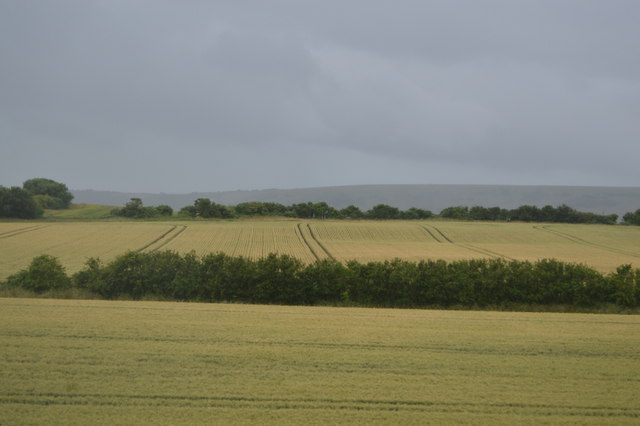
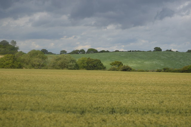
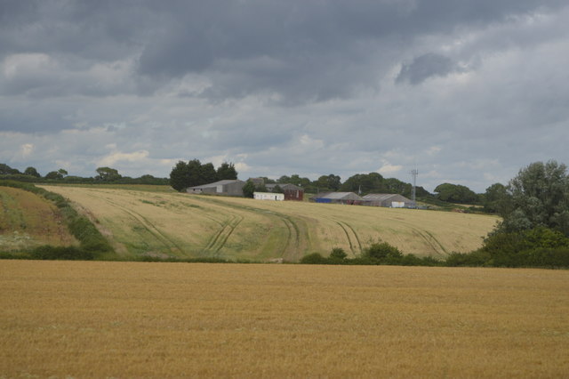
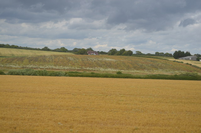
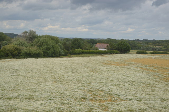
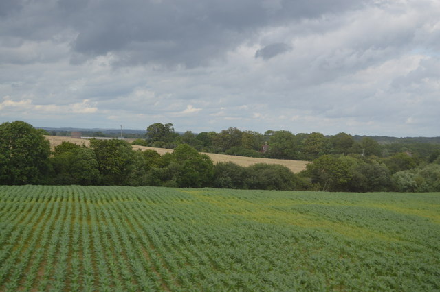
The village is characterized by its charming rural landscape, with rolling hills, meadows, and woodlands. It is primarily an agricultural community, with farming being a significant part of the local economy. The fertile land in Arlington supports various crops and livestock, contributing to the village's agricultural heritage.

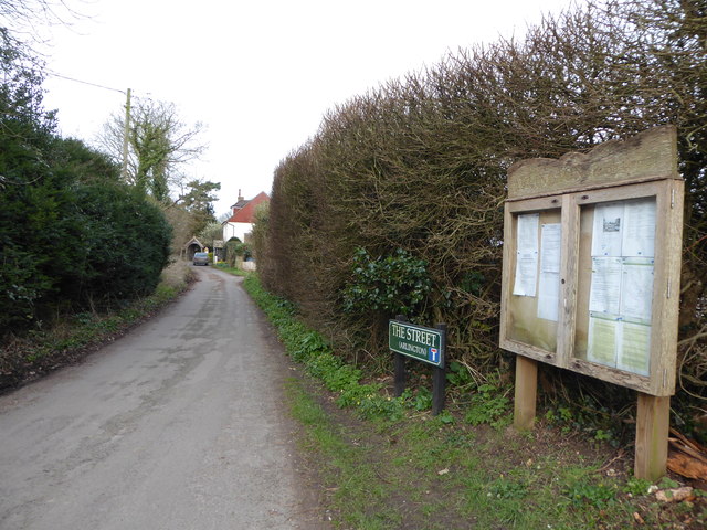
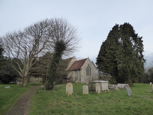
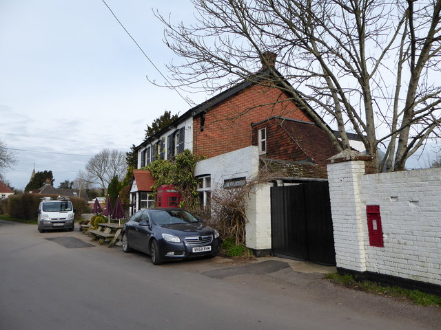
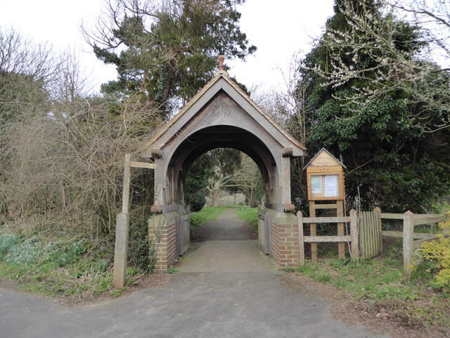
Arlington is home to a relatively small population, with a close-knit community that takes pride in preserving the village's traditional character. The architecture in Arlington is a mix of historic and modern buildings, with several notable examples of traditional Sussex-style cottages and farmhouses.

One of the village's prominent landmarks is Arlington Reservoir, a man-made lake that serves as a local nature reserve and a popular spot for outdoor activities such as fishing, sailing, and bird-watching. The reservoir offers stunning views of the surrounding countryside and attracts visitors from both within the village and beyond.

Although relatively secluded, Arlington benefits from its proximity to nearby towns and cities. The village is conveniently located just a short drive away from the historic town of Lewes and the coastal city of Eastbourne, providing residents with access to a range of amenities, including shops, schools, and healthcare facilities.

Overall, Arlington offers a charming rural lifestyle, with its picturesque landscapes, tight-knit community, and easy access to nearby urban centers making it an appealing place to live for those seeking a peaceful and idyllic setting in the heart of Sussex.

If you have any feedback on the listing, please let us know in the comments section below.
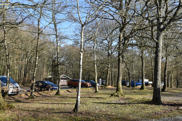
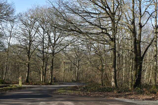
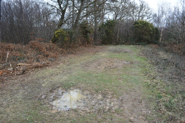
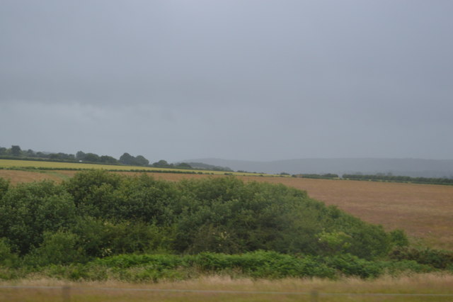
Arlington Images

Images are sourced within 2km of 50.845693/0.19197631 or Grid Reference TQ5407. Thanks to Geograph Open Source API. All images are credited.

Abbot's Wood car park A Forestry England pay and display car park.
Abbot's Wood car park
A Forestry England pay and display car park.
Road towards entrance, Abbot's Wood
End of forest track, Abbot's Wood
Abbot's Amble Trail, Abbots Wood, Arlington, Abbot's Wood is a mixed woodland of approximately 360 hectares, offering waymarked forest trails, an adventure play area and barbecue/picnic area. <span class="nowrap"><a title="http://www.forestry.gov.uk/website/Recreation.nsf/LUwebdocsBykey/EnglandEastSussexAbbotsWood" rel="nofollow ugc noopener" href="http://www.forestry.gov.uk/website/Recreation.nsf/LUwebdocsBykey/EnglandEastSussexAbbotsWood">Link</a><img style="margin-left:2px;" alt="External link" title="External link - shift click to open in new window" src="https://s1.geograph.org.uk/img/external.png" width="10" height="10"/></span>
Abbot's Amble Trail, Abbots Wood, Arlington,
Abbot's Wood is a mixed woodland of approximately 360 hectares, offering waymarked forest trails, an adventure play area and barbecue/picnic area. LinkExternal link
Monken Pyn
Monken Pyn
By the railway line
By the railway line
Farmland near Berwick
Station Rd
Station Rd
Rolling fields
Rolling fields
View towards Endlewick Farm
View towards Endlewick Cottage
Farmland, Chilvers Bridge Farm
Cropland near Berwick
2016: a year on Geograph (Day 59) The Street, Arlington, East Sussex
2016: a year on Geograph (Day 59)
The Street, Arlington, East Sussex
St Pancras, Arlington: late February 2016 Arlington is a rural parish in East Sussex that once stretched from Windover Hill in the south to the outskirts of Hailsham in the north until 1990 when boundary changes meant the modern railway formed the new southern border whilst a section of the former Dicker Common, once part of Chiddingly, was added to the north, and in the north west where the parish once crossed into the suburbs of Hailsham it was pulled back to the A22. Geologically the old parish crossed three distinct areas, the chalk of the South Downs, the clay of the Low Weald and the strip of gault and greensand that separates them. The latter is highly fertile and was one of the earliest areas north of the Downs to be cultivated, starting during the Iron Age and continuing into the Roman period, particularly in the case of neighbouring Ripe and Chalvington. It is watered by the Cuckmere River which provided a western boundary with Berwick in the south of the parish (Until boundary changes in 1990) and Hellingly in the north and between them ran through the centre of the parish. In 1971 a large meander to the west of the village was cut off to make Arlington Reservoir.

There were five distinct settlements in the old parish; the village of Arlington, Milton Street, Upper Dicker, Wick Street and Caneheath. The main village of Arlington was settled during the Saxon period and grew during the middle ages mainly to the west of the church. However, sometime during that period the village was deserted or shrank in size with the remnant coalescing around its current position on a minor crossroads to the east of the church. To the south is Milton Street which lies on the edge of the Cuckmere Valley as it breaks out of the Downs along an old droving route. The settlement was most likely formed to serve the nearby manor of Milton Court during the middle ages. Nearby are two earthworks, Burlough Castle and The Rookery, which were built during the early Norman period to protect the Cuckmere River. Milton Street was transferred out of Arlington in 1990 to form a new parish called Long Man, an amalgamation of Wilmington, Folkington and the southern end of Arlington. To the north is Upper Dicker also located around a crossroads at the southern edge of the former 1000 acre common known as The Dicker. The common straddled the parishes of Chiddingly, Hellingly and Arlington and was enclosed in 1813 except for the small portion in Arlington which survived until 1852. It is on this portion that much of the village is located and is likely to have grown around the individual farms and smallholdings that would often position themselves around the entrance/exit of a common. There is also a case that the settlement may have shifted westwards on the building of Michelham Priory in 1229 which was known to be a location of a former chapel. The subsequent emparking of the land to the south may also have contributed to this shift. The collection of dwellings became known as The Dicker in the 18th century and grew during the 19th to become the largest populated settlement within the parish. The two minor settlements of Wick Street and Caneheath, little more than a collection of farms, lie to the west and east of Arlington village respectively. Wick Street, as the name suggests, lies on an old local Roman Road that is now the minor route from Upper Dicker to Berwick. Caneheath straggles along a country lane next to Abbots Wood, a large area of woodland that once belonged to Michelham Priory that is now a nature reserve.

Two main roads briefly crossed the old parish boundaries; the A27 in the south that has now been transferred to Long Man parish and the A22 which forms the eastern boundary with Hailsham. Both are new roads, the latter was approved and started in 1937 but not completed until after the war, whilst the former was built as a turnpike in 1819 to replace a much older east-west route that dates from the Roman period was known as Farne Street and linked Chichester to Pevensey Castle. As it crossed the parish it followed Chilverbridge Road now a minor lane from Berwick, then Moorshill Lane, Whiteing Lane and Hayreed Lane now little more than unmetalled restricted byways. Another former local Roman Road that once ran from Newhaven to The Dicker follows the course of the minor road called Wick Street from Berwick to Upper Dicker and was the B2108 until it was downgraded to C status in the 1970s. There are a number of other minor lanes; Arlington Road heads east from Hailsham before splitting at Milton Hide one route heading to Upper Dicker whilst the other heads to Arlington via Caneheath; The road to Berwick heads south from the village via The Street and Chilverbridge Road; whilst south of the A27 a minor lane heads to Milton Street then on to Litlington and Exceat. The Lewes to Eastbourne railway crosses the parish to the south with Berwick station just over the parish boundary. There are tales that it was built for Horatio Bottomley, founder of the John Bull newspaper and MP, who resided at Upper Dicker between 1889 and 1929, but this is incorrect as the station building dates from 1846 and is clearly marked on an 1874 OS map as Berwick Station. A small airfield known as Wilmington Aerodrome was laid out at Milton Gate near the A27 in 1916 as a landing ground which passed into civilian use after the war and was home to Eastbourne Flying Club in the 1930s. There was talk of developing it as Eastbourne Municipal Airport but this was halted by the Second World War with the authorities closing the runway after which it never reopened and has since returned to agricultural use.

There are two churches in the parish, the 11th century church of St Pancras in Arlington built on the site of an earlier wooden one and utilising stone from the remains of nearby Roman roads, and the Holy Trinity in Upper Dicker, consecrated in 1845. Two former chapels at Michelham and Milton Court have long been demolished. Education is provided by Park Mead Junior School at Upper Dicker which opened in 1881 and St Bedes independent school which arrived in the same village in 1979. There are four public houses within the old parish boundary; The Old Oak Inn at Caneheath dates from the 18th century; the Plough Inn at Upper Dicker was first licensed in 1826; the Yew Tree Inn at Arlington opened as a beer house in the 1890s as did the Sussex Ox in Milton Street. A post office operated in Upper Dicker from 1852 until its closure in 2008, however, the small general stores is still open. To the north east on the minor road from Hailsham is Arlington Stadium, opened in 1929, and since 1938 home to the Eastbourne Eagles speedway team. The venue also hosts stock car and banger racing.

Bibliography

Books
P.Brandon - The South Downs (Phillimore, 1998)
GR.Burleigh - "Medieval Earthworks at Arlington" Sussex Archaeological Collections 112 (1974)
C.Butler - East Sussex Under Attack (Tempus, 2007)
M.Larkin - In the Footsteps of Time (Ulmus, 2006)
K.Leslie & B.Short (ed) - An Historical Atlas of Sussex (Phillimore, 1999)
P.Longstaff-Tyrell - Turnpike Territory - A Guide to the Old Coach Road (Eastbourne Local History Society, 2007)
L.Smith - A History of the Dicker (Lez Smith, 2003)
J.Vigar - The Lost Villages of Sussex (Dovecote Press, 1994)
A.Vincent - Roman Roads of Sussex (Middleton Press, 2000)

Websites
Burlough Castle (<span class="nowrap"><a title="http://castlefacts.info/contentpages/castledetails/castledetails.asp?country=England&countyid=40&county=Sussex&castleid=3756&latitude=50.8139&longitude=0.1692&uin=11080)" rel="nofollow ugc noopener" href="http://castlefacts.info/contentpages/castledetails/castledetails.asp?country=England&countyid=40&county=Sussex&castleid=3756&latitude=50.8139&longitude=0.1692&uin=11080)">Link</a><img style="margin-left:2px;" alt="External link" title="External link - shift click to open in new window" src="https://s1.geograph.org.uk/img/external.png" width="10" height="10"/></span>
Listed Buildings in Arlington (<span class="nowrap"><a title="http://www.britishlistedbuildings.co.uk/england/east+sussex/arlington)" rel="nofollow ugc noopener" href="http://www.britishlistedbuildings.co.uk/england/east+sussex/arlington)">Link</a><img style="margin-left:2px;" alt="External link" title="External link - shift click to open in new window" src="https://s1.geograph.org.uk/img/external.png" width="10" height="10"/></span>
St Pancras, Arlington (<span class="nowrap"><a title="http://www.stpancras-arlington.org.uk/index.html)" rel="nofollow ugc noopener" href="http://www.stpancras-arlington.org.uk/index.html)">Link</a><img style="margin-left:2px;" alt="External link" title="External link - shift click to open in new window" src="https://s1.geograph.org.uk/img/external.png" width="10" height="10"/></span>

Maps 
Tithe Map, 1843 (East Sussex Record Office, TD/E 51/1-2 )
Yeakell & Gardner, 1778-83 (2 inches to a mile - see <span class="nowrap"><a title="http://www.envf.port.ac.uk/geo/research/historical/webmap/sussexmap/Yeakelllarge36.htm)" rel="nofollow ugc noopener" href="http://www.envf.port.ac.uk/geo/research/historical/webmap/sussexmap/Yeakelllarge36.htm)">Link</a><img style="margin-left:2px;" alt="External link" title="External link - shift click to open in new window" src="https://s1.geograph.org.uk/img/external.png" width="10" height="10"/></span>
Ordnance Survey, Eastbourne & Hastings 1813 (1:50,000 - Timeline Maps, 2005)
Ordnance Survey, 1874-1980 (1:2500 and 1:10000 - See <span class="nowrap"><a title="http://www.old-maps.co.uk/maps.html)" rel="nofollow ugc noopener" href="http://www.old-maps.co.uk/maps.html)">Link</a><img style="margin-left:2px;" alt="External link" title="External link - shift click to open in new window" src="https://s1.geograph.org.uk/img/external.png" width="10" height="10"/></span>
Ordnance Survey, Brighton & the South Downs 1929 (1 inch to a mile)
Ordnance Survey, Eastbourne 1940 Revised Edition (1 inch to a mile)
Ordnance Survey, Eastbourne 1967 Revised Edition ( 1 inch to a mile)
Ordnance Survey, Pathfinder Series 1982 - Newhaven & Polegate (1:25000)
Ordnance Survey, Explorer Series 2009 - Eastbourne & Beachy Head (1:25000)
Lewes District Street Plan (Barnetts, circa 1972)
East Sussex Street Atlas (Geographers A to Z Company, 2004)
St Pancras, Arlington: late February 2016
Arlington is a rural parish in East Sussex that once stretched from Windover Hill in the south to the outskirts of Hailsham in the north until 1990 when boundary changes meant the modern railway formed the new southern border whilst a section of the former Dicker Common, once part of Chiddingly, was added to the north, and in the north west where the parish once crossed into the suburbs of Hailsham it was pulled back to the A22. Geologically the old parish crossed three distinct areas, the chalk of the South Downs, the clay of the Low Weald and the strip of gault and greensand that separates them. The latter is highly fertile and was one of the earliest areas north of the Downs to be cultivated, starting during the Iron Age and continuing into the Roman period, particularly in the case of neighbouring Ripe and Chalvington. It is watered by the Cuckmere River which provided a western boundary with Berwick in the south of the parish (Until boundary changes in 1990) and Hellingly in the north and between them ran through the centre of the parish. In 1971 a large meander to the west of the village was cut off to make Arlington Reservoir. There were five distinct settlements in the old parish; the village of Arlington, Milton Street, Upper Dicker, Wick Street and Caneheath. The main village of Arlington was settled during the Saxon period and grew during the middle ages mainly to the west of the church. However, sometime during that period the village was deserted or shrank in size with the remnant coalescing around its current position on a minor crossroads to the east of the church. To the south is Milton Street which lies on the edge of the Cuckmere Valley as it breaks out of the Downs along an old droving route. The settlement was most likely formed to serve the nearby manor of Milton Court during the middle ages. Nearby are two earthworks, Burlough Castle and The Rookery, which were built during the early Norman period to protect the Cuckmere River. Milton Street was transferred out of Arlington in 1990 to form a new parish called Long Man, an amalgamation of Wilmington, Folkington and the southern end of Arlington. To the north is Upper Dicker also located around a crossroads at the southern edge of the former 1000 acre common known as The Dicker. The common straddled the parishes of Chiddingly, Hellingly and Arlington and was enclosed in 1813 except for the small portion in Arlington which survived until 1852. It is on this portion that much of the village is located and is likely to have grown around the individual farms and smallholdings that would often position themselves around the entrance/exit of a common. There is also a case that the settlement may have shifted westwards on the building of Michelham Priory in 1229 which was known to be a location of a former chapel. The subsequent emparking of the land to the south may also have contributed to this shift. The collection of dwellings became known as The Dicker in the 18th century and grew during the 19th to become the largest populated settlement within the parish. The two minor settlements of Wick Street and Caneheath, little more than a collection of farms, lie to the west and east of Arlington village respectively. Wick Street, as the name suggests, lies on an old local Roman Road that is now the minor route from Upper Dicker to Berwick. Caneheath straggles along a country lane next to Abbots Wood, a large area of woodland that once belonged to Michelham Priory that is now a nature reserve. Two main roads briefly crossed the old parish boundaries; the A27 in the south that has now been transferred to Long Man parish and the A22 which forms the eastern boundary with Hailsham. Both are new roads, the latter was approved and started in 1937 but not completed until after the war, whilst the former was built as a turnpike in 1819 to replace a much older east-west route that dates from the Roman period was known as Farne Street and linked Chichester to Pevensey Castle. As it crossed the parish it followed Chilverbridge Road now a minor lane from Berwick, then Moorshill Lane, Whiteing Lane and Hayreed Lane now little more than unmetalled restricted byways. Another former local Roman Road that once ran from Newhaven to The Dicker follows the course of the minor road called Wick Street from Berwick to Upper Dicker and was the B2108 until it was downgraded to C status in the 1970s. There are a number of other minor lanes; Arlington Road heads east from Hailsham before splitting at Milton Hide one route heading to Upper Dicker whilst the other heads to Arlington via Caneheath; The road to Berwick heads south from the village via The Street and Chilverbridge Road; whilst south of the A27 a minor lane heads to Milton Street then on to Litlington and Exceat. The Lewes to Eastbourne railway crosses the parish to the south with Berwick station just over the parish boundary. There are tales that it was built for Horatio Bottomley, founder of the John Bull newspaper and MP, who resided at Upper Dicker between 1889 and 1929, but this is incorrect as the station building dates from 1846 and is clearly marked on an 1874 OS map as Berwick Station. A small airfield known as Wilmington Aerodrome was laid out at Milton Gate near the A27 in 1916 as a landing ground which passed into civilian use after the war and was home to Eastbourne Flying Club in the 1930s. There was talk of developing it as Eastbourne Municipal Airport but this was halted by the Second World War with the authorities closing the runway after which it never reopened and has since returned to agricultural use. There are two churches in the parish, the 11th century church of St Pancras in Arlington built on the site of an earlier wooden one and utilising stone from the remains of nearby Roman roads, and the Holy Trinity in Upper Dicker, consecrated in 1845. Two former chapels at Michelham and Milton Court have long been demolished. Education is provided by Park Mead Junior School at Upper Dicker which opened in 1881 and St Bedes independent school which arrived in the same village in 1979. There are four public houses within the old parish boundary; The Old Oak Inn at Caneheath dates from the 18th century; the Plough Inn at Upper Dicker was first licensed in 1826; the Yew Tree Inn at Arlington opened as a beer house in the 1890s as did the Sussex Ox in Milton Street. A post office operated in Upper Dicker from 1852 until its closure in 2008, however, the small general stores is still open. To the north east on the minor road from Hailsham is Arlington Stadium, opened in 1929, and since 1938 home to the Eastbourne Eagles speedway team. The venue also hosts stock car and banger racing. Bibliography Books P.Brandon - The South Downs (Phillimore, 1998) GR.Burleigh - "Medieval Earthworks at Arlington" Sussex Archaeological Collections 112 (1974) C.Butler - East Sussex Under Attack (Tempus, 2007) M.Larkin - In the Footsteps of Time (Ulmus, 2006) K.Leslie & B.Short (ed) - An Historical Atlas of Sussex (Phillimore, 1999) P.Longstaff-Tyrell - Turnpike Territory - A Guide to the Old Coach Road (Eastbourne Local History Society, 2007) L.Smith - A History of the Dicker (Lez Smith, 2003) J.Vigar - The Lost Villages of Sussex (Dovecote Press, 1994) A.Vincent - Roman Roads of Sussex (Middleton Press, 2000) Websites Burlough Castle (LinkExternal link Listed Buildings in Arlington (LinkExternal link St Pancras, Arlington (LinkExternal link Maps Tithe Map, 1843 (East Sussex Record Office, TD/E 51/1-2 ) Yeakell & Gardner, 1778-83 (2 inches to a mile - see LinkExternal link Ordnance Survey, Eastbourne & Hastings 1813 (1:50,000 - Timeline Maps, 2005) Ordnance Survey, 1874-1980 (1:2500 and 1:10000 - See LinkExternal link Ordnance Survey, Brighton & the South Downs 1929 (1 inch to a mile) Ordnance Survey, Eastbourne 1940 Revised Edition (1 inch to a mile) Ordnance Survey, Eastbourne 1967 Revised Edition ( 1 inch to a mile) Ordnance Survey, Pathfinder Series 1982 - Newhaven & Polegate (1:25000) Ordnance Survey, Explorer Series 2009 - Eastbourne & Beachy Head (1:25000) Lewes District Street Plan (Barnetts, circa 1972) East Sussex Street Atlas (Geographers A to Z Company, 2004)
The Yew Tree Inn, Arlington: late February 2016
Rush hour in Arlington
St Pancras, Arlington: lych gate
Show me another place!

Arlington is located at Grid Ref: TQ5407 (Lat: 50.845693, Lng: 0.19197631)

Administrative County: East Sussex

District: Wealdon

Police Authority: Sussex

What 3 Words

///harder.rooting.adjusting. Near Hailsham, East Sussex

Nearby Locations

Tye Hill Arlington

Related Wikis

Arlington, East Sussex

Arlington is a village and civil parish in the Wealden district of East Sussex, England. The parish is on the River Cuckmere, and is the location of a...
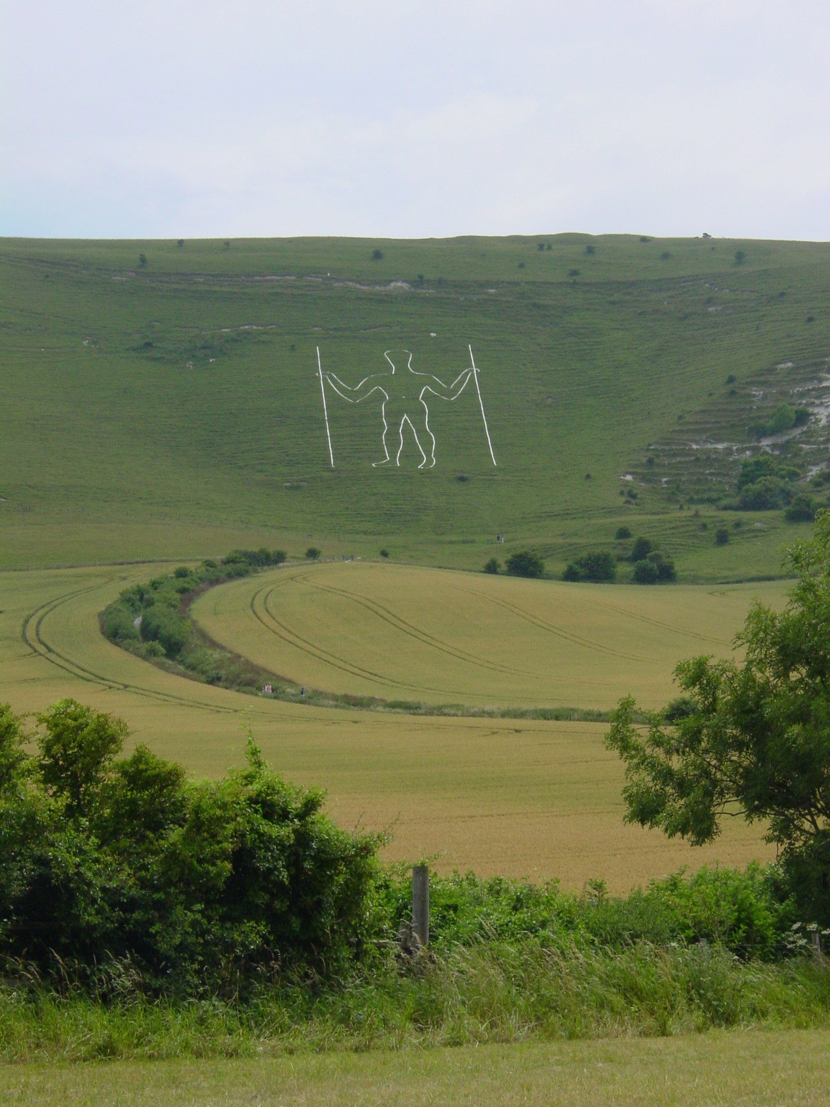
Long Man

Long Man is a civil parish in the Wealden District of East Sussex, England, which includes the villages of Wilmington, Milton Street and Folkington. The...

Arlington Reservoir

Arlington Reservoir is a 100.4-hectare (248-acre) biological Site of Special Scientific Interest west of Hailsham in East Sussex, England. It is also a...

Milton Gate Marsh

Milton Gate Marsh is a 17.7-hectare (44-acre) biological Site of Special Scientific Interest north-west of Eastbourne in East Sussex.This site consists...

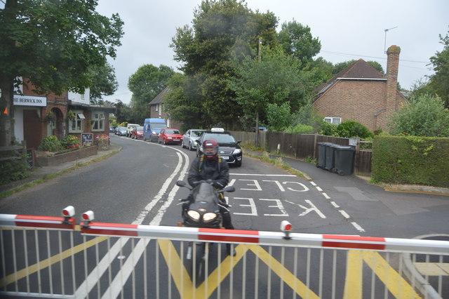
Berwick railway station (East Sussex)

Berwick railway station is located in Berwick, East Sussex, England. Berwick village is located nearby to the south of the A27 road. The station is on...
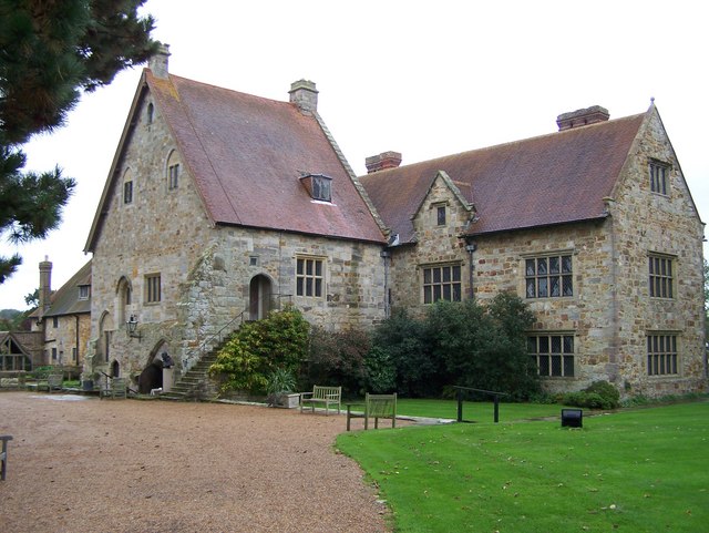
Michelham Priory

Michelham Priory is the site of a former Augustinian Priory in Upper Dicker, East Sussex, England, United Kingdom. The surviving buildings are owned and...

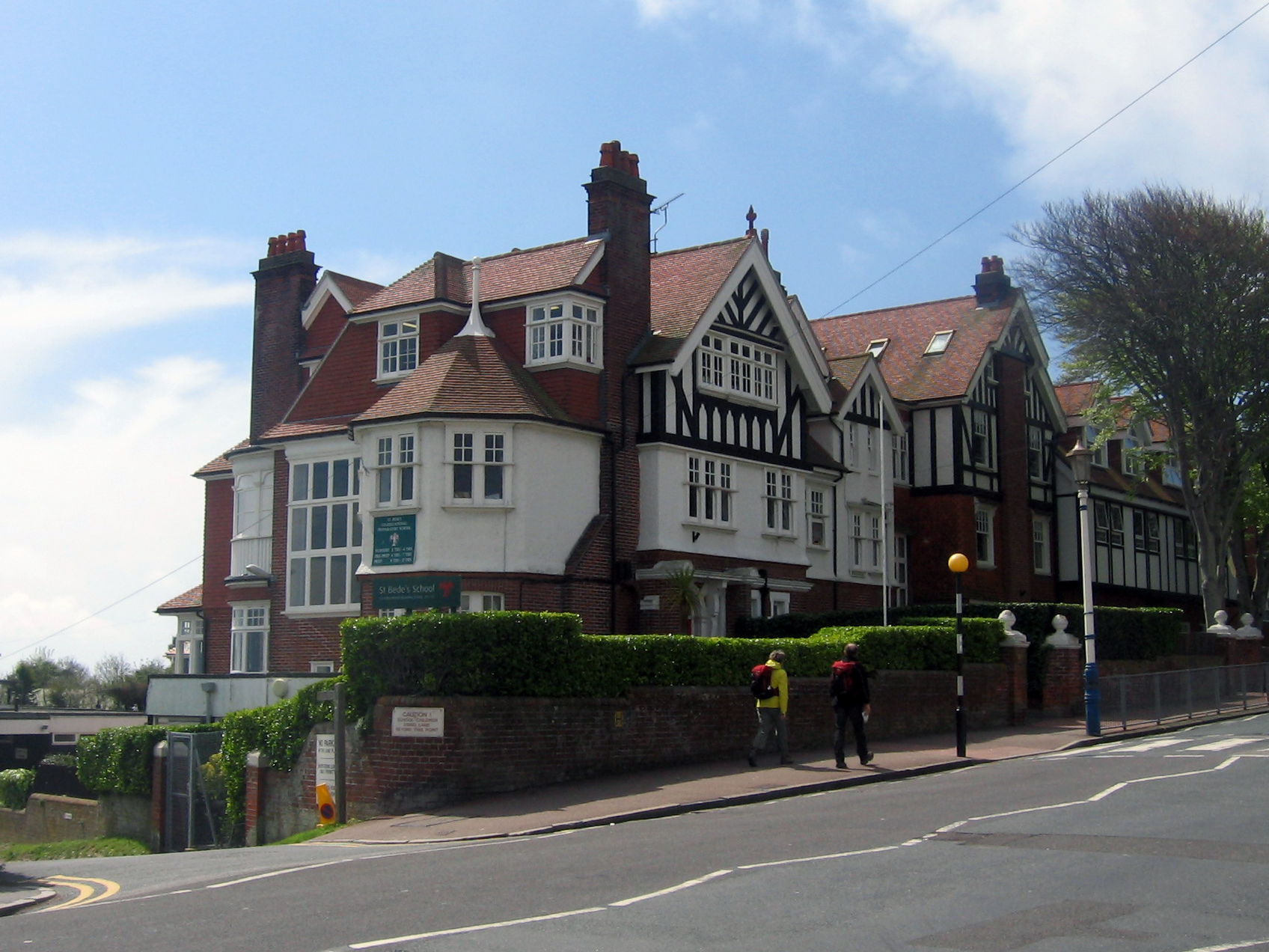
Bede's School, Eastbourne

Bede's School (until 2012, known as St Bede's School), consists of a preparatory school and pre-preparatory nursery in Holywell, Meads, Eastbourne, East...

Out of the Ordinary Festival

The Out of the Ordinary Festival was an annual family- and eco-friendly music festival near Hailsham in the Sussex countryside. From 2007 to 2013 it celebrated...

Nearby Amenities

Located within 500m of 50.845693,0.19197631
Pub
Yew Tree Inn
Addr City: Arlington
Addr Postcode: BN26 6RX
Addr Street: The Street
Fhrs Id: 174652
Source Addr: FHRS Open Data
Lat/Long: 50.8457037/0.1921568
Post Box
Postal Code: BN26
Ref: BN26 1028
Lat/Long: 50.8456913/0.1923258
Power: tower
Lat/Long: 50.8448984/0.1976586
Power: tower
Lat/Long: 50.8471521/0.1916446
Power: tower
Lat/Long: 50.848392/0.1884587
Power: tower
Lat/Long: 50.8459287/0.1949739
Barrier: stile
Lat/Long: 50.8452953/0.1885154
Arlington
Place: village
Lat/Long: 50.8458768/0.191918
Barrier: stile
Bicycle: no
Foot: yes
Horse: no
Material: wood
Motor Vehicle: no
Stile: stepover
Lat/Long: 50.8457086/0.1880714
Barrier: stile
Lat/Long: 50.8449877/0.1960488
The data included in this document is from www.openstreetmap.org. The data is made available under ODbL.

Have you been to Arlington?

Leave your review of Arlington below (or comments, questions and feedback).