Bee Low Wood

Wood, Forest in Derbyshire Derbyshire Dales

England

Bee Low Wood

Old  stone  barn  alongside  River  Lathkill
Old stone barn alongside River Lathkill Credit: Martin Dawes

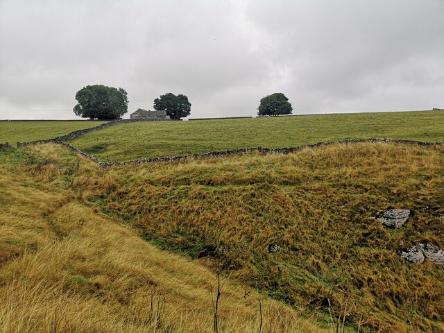
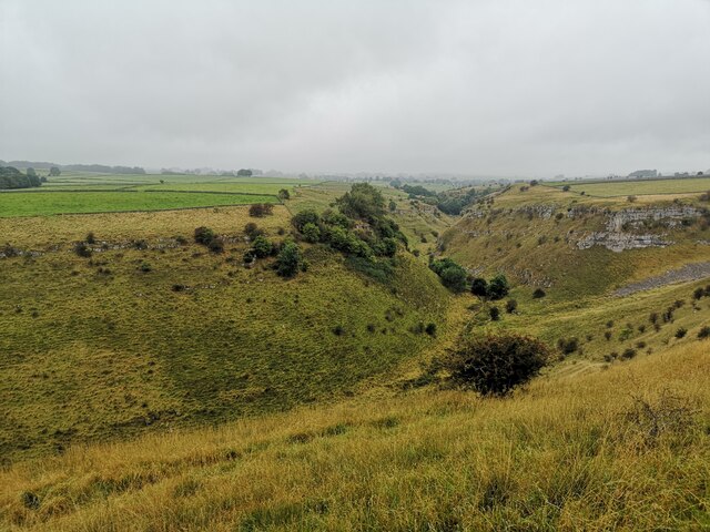
Bee Low Wood is located in the county of Derbyshire, England. It is a picturesque woodland area situated in the Peak District National Park. Covering an area of approximately 100 hectares, it is known for its diverse range of trees, wildlife, and scenic beauty.

The wood is predominantly made up of native British species including oak, birch, and beech trees, creating a rich and vibrant woodland landscape. The forest floor is adorned with an array of wildflowers, providing a colorful display during the spring and summer months.

Bee Low Wood is home to a variety of wildlife, including numerous bird species such as woodpeckers, owls, and songbirds. Mammals such as deer, foxes, and badgers can also be spotted in the area, along with a diverse range of insects and butterflies.

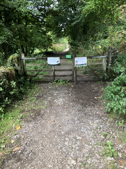
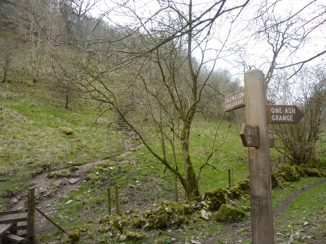
The wood is a popular destination for nature lovers, hikers, and wildlife enthusiasts. It offers a network of well-maintained walking trails, allowing visitors to explore the natural beauty of the area at their own pace. The peaceful ambiance and tranquil surroundings make it an ideal spot for those seeking solitude and a connection with nature.

Bee Low Wood is owned and managed by the Peak District National Park Authority, ensuring its preservation and conservation for future generations to enjoy. It is a valuable natural resource and a vital habitat for a wide range of flora and fauna, contributing to the overall biodiversity of the region.

If you have any feedback on the listing, please let us know in the comments section below.

Bee Low Wood Images

Images are sourced within 2km of 53.183602/-1.7227525 or Grid Reference SK1865. Thanks to Geograph Open Source API. All images are credited.

Old  stone  barn  alongside  River  Lathkill
Old stone barn alongside River Lathkill
Stone  flagged  footbridge  over  dry  River  Lathkill
Stone flagged footbridge over dry River Lathkill
Meadow Place Grange
Meadow Place Grange
Meadow Place Grange Meadow Place Grange viewed from the footpath approaching from the south-west.  Over Haddon can be seen in the distance.
Meadow Place Grange
Meadow Place Grange viewed from the footpath approaching from the south-west. Over Haddon can be seen in the distance.
Meadow Place Grange Farm buildings at Meadow Place Grange, viewed here from a footpath to the north-east.
Meadow Place Grange
Farm buildings at Meadow Place Grange, viewed here from a footpath to the north-east.
Farmland around Meadow Place Grange Farmland around Meadow Place Grange near the village of Over Haddon.
Farmland around Meadow Place Grange
Farmland around Meadow Place Grange near the village of Over Haddon.
Woodland path Woodland path descending into Lathkill Dale.
Woodland path
Woodland path descending into Lathkill Dale.
The gate into Lathkill Dale Nature Reserve Follow this path to take you to the waterfall weir.
The gate into Lathkill Dale Nature Reserve
Follow this path to take you to the waterfall weir.
Farm Buildings near Haddon Grove Farm Taken from footpath on northern edge of Lathkill Dale
Farm Buildings near Haddon Grove Farm
Taken from footpath on northern edge of Lathkill Dale
Lathkill Dale Looking west from the northern edge of Lathkill Dale
Lathkill Dale
Looking west from the northern edge of Lathkill Dale
One Ash Grange Farm Not sure what these are for. Some old cattle feeders?
One Ash Grange Farm
Not sure what these are for. Some old cattle feeders?
The Limestone Way A tree beside the Limestone Way near One Ash Grange Farm.
The Limestone Way
A tree beside the Limestone Way near One Ash Grange Farm.
Cattle in a field Cattle in a field above Cales Dale.  Lathkill Dales can be seen on the right.
Cattle in a field
Cattle in a field above Cales Dale. Lathkill Dales can be seen on the right.
Old pigsty at One Ash Grange Farm I last walked this footpath around twenty years ago and clearly remembered this ancient pigsty dating from the 28th century.  The pigsty is Grade II listed, see <span class="nowrap"><a title="https://historicengland.org.uk/listing/the-list/list-entry/1159150?section=official-list-entry" rel="nofollow ugc noopener" href="https://historicengland.org.uk/listing/the-list/list-entry/1159150?section=official-list-entry">Link</a><img style="margin-left:2px;" alt="External link" title="External link - shift click to open in new window" src="https://s1.geograph.org.uk/img/external.png" width="10" height="10"/></span>
Old pigsty at One Ash Grange Farm
I last walked this footpath around twenty years ago and clearly remembered this ancient pigsty dating from the 28th century. The pigsty is Grade II listed, see LinkExternal link
Peacock at One Ash Grange Farm Not a sight one normally expects to see in a farmyard.
Peacock at One Ash Grange Farm
Not a sight one normally expects to see in a farmyard.
Peacock tail feathers
Footpath in Fern Dale Footpath below a limestone scar in Fern Dale.
Footpath in Fern Dale
Footpath below a limestone scar in Fern Dale.
Show me another place!

Bee Low Wood is located at Grid Ref: SK1865 (Lat: 53.183602, Lng: -1.7227525)

Administrative County: Derbyshire

District: Derbyshire Dales

Police Authority: Derbyshire

What 3 Words

///venues.plod.future. Near Youlgreave, Derbyshire

Related Wikis

Limey Way

The Limey Way is a 65-kilometre (40 mi) challenge walk through Derbyshire, England. It starts at Castleton and progresses through 15 major and 5 minor...

Cales Dale

Cales Dale is a short valley towards the head of Lathkill Dale near Monyash, Derbyshire in the Peak District of England. Cales Dale is included within...

Conksbury

Conksbury is the site of a deserted medieval settlement between Over Haddon and Youlgreave in Derbyshire, England. == History == The village was recorded...

St Anne's Church, Over Haddon

St Anne's Church, Over Haddon is a Grade II listed parish church in the Church of England in Over Haddon, Derbyshire. == History == The church was built...

Over Haddon

Over Haddon is a small village and civil parish in Derbyshire, England. The population of the civil parish (including Nether Haddon) at the 2011 Census...

Middleton-by-Youlgreave

Middleton, often known as Middleton-by-Youlgreave or Middleton-by-Youlgrave to distinguish it from nearby Middleton-by-Wirksworth, is a village in the...

Youlgreave

Youlgreave or Youlgrave is a village and civil parish in the Peak District of Derbyshire, England, on the River Bradford 2+1⁄2 miles (4.0 km) south of...

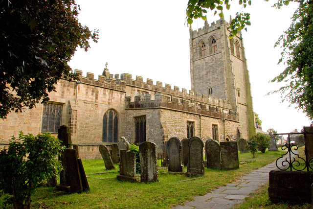
All Saints' Church, Youlgreave

All Saints’ Church, Youlgreave is a Grade I listed parish church in the Church of England in Youlgreave, Derbyshire. == History == The church dates from...

Nearby Amenities

Located within 500m of 53.183602,-1.7227525
Barrier: stile
Material: stone
Stile: stepover
Lat/Long: 53.1807468/-1.727719
Low Moor Wood
Information: board
Tourism: information
Lat/Long: 53.1805317/-1.7265862
The data included in this document is from www.openstreetmap.org. The data is made available under ODbL.

Have you been to Bee Low Wood?

Leave your review of Bee Low Wood below (or comments, questions and feedback).