Hunsworth Great Wood

Wood, Forest in Yorkshire

England

Hunsworth Great Wood

Factory, Heathfield Lane, Birkenshaw This is now occupied by Status who produce light bulbs and other electrical goods.  It was built for Park House Healthcare.
Factory, Heathfield Lane, Birkenshaw Credit: Humphrey Bolton

Hunsworth Great Wood, located in Yorkshire, is a vast and picturesque forest known for its natural beauty and diverse ecosystem. Spanning over a large area, this woodland is a haven for nature enthusiasts and hikers alike.

The wood is predominantly made up of native deciduous trees such as oak, birch, and beech, which provide a stunning display of colors during the autumn months. The lush vegetation and rich soil create a thriving habitat for a wide range of wildlife, including deer, foxes, badgers, and numerous bird species.

Traversing the wood, visitors can find a network of well-maintained walking trails, allowing them to explore its captivating scenery. These paths wind through the forest, leading to hidden clearings, babbling brooks, and serene ponds. It is common to spot wildflowers blooming along the paths during the spring and summer seasons.

Hunsworth Great Wood offers something for everyone. Families can enjoy picnics in designated areas, while birdwatchers can set up camp in one of the bird hides strategically positioned throughout the wood. The forest also provides a tranquil escape for those seeking solitude, with its peaceful atmosphere and secluded spots.

Maintained by dedicated conservationists and volunteers, Hunsworth Great Wood serves as an important ecological site, promoting biodiversity and preserving the region's natural heritage. Whether it's for a leisurely stroll, a day of exploring, or simply immersing oneself in the beauty of nature, this Yorkshire woodland offers a truly enchanting experience for all who visit.

If you have any feedback on the listing, please let us know in the comments section below.

Hunsworth Great Wood Images

Images are sourced within 2km of 53.741546/-1.7195367 or Grid Reference SE1827. Thanks to Geograph Open Source API. All images are credited.

Factory, Heathfield Lane, Birkenshaw This is now occupied by Status who produce light bulbs and other electrical goods.  It was built for Park House Healthcare.
Factory, Heathfield Lane, Birkenshaw
This is now occupied by Status who produce light bulbs and other electrical goods. It was built for Park House Healthcare.
Housing estate road off Heathfield Lane, Birkenshaw This road leads up to a vacant plot that will presumably be built on eventually, but the tops of borehole tubes suggest that there might be difficulties. There is a small hill on the left that looks artificial, but old maps don't help.
Housing estate road off Heathfield Lane, Birkenshaw
This road leads up to a vacant plot that will presumably be built on eventually, but the tops of borehole tubes suggest that there might be difficulties. There is a small hill on the left that looks artificial, but old maps don't help.
Vacant site off Heathfield Lane, Birkenshaw This is adjacent to a large recent housing development, and the site will presumably be built on eventually. There is a capped borehole tube at bottom left and another in the far corner of the field.
Vacant site off Heathfield Lane, Birkenshaw
This is adjacent to a large recent housing development, and the site will presumably be built on eventually. There is a capped borehole tube at bottom left and another in the far corner of the field.
Bridleway from Heathfield Lane to Bradford Road (1) This bridleway went to Latham Lane, but was severed by the motorway.
Bridleway from Heathfield Lane to Bradford Road (1)
This bridleway went to Latham Lane, but was severed by the motorway.
Bridleway from Bradford Road to Heathfield Lane (2) Here the bridleway is approaching Bradford Road.
Bridleway from Bradford Road to Heathfield Lane (2)
Here the bridleway is approaching Bradford Road.
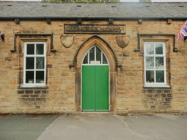
Entrance to the former National School, Birkenshaw
Holly trees along the south side of St Paul's Church, Birkenshaw
Eastbound M62 near Swincliffe The M62 is the west to east trans-Pennine motorway. It is 107 miles long running from Liverpool to Hull. It was built between 1971 and 1976. At Windy Hill it is 372m above sea level, making it the highest point on any British motorway.
Wikipedia: <span class="nowrap"><a title="http://en.wikipedia.org/wiki/M62_motorway" rel="nofollow ugc noopener" href="http://en.wikipedia.org/wiki/M62_motorway">Link</a><img style="margin-left:2px;" alt="External link" title="External link - shift click to open in new window" src="https://s1.geograph.org.uk/img/external.png" width="10" height="10"/></span>
Eastbound M62 near Swincliffe
The M62 is the west to east trans-Pennine motorway. It is 107 miles long running from Liverpool to Hull. It was built between 1971 and 1976. At Windy Hill it is 372m above sea level, making it the highest point on any British motorway. Wikipedia: LinkExternal link
Eastbound M62, Oxford Road Bridge The M62 is the west to east trans-Pennine motorway. It is 107 miles long running from Liverpool to Hull. It was built between 1971 and 1976. At Windy Hill it is 372m above sea level, making it the highest point on any British motorway.
Wikipedia: <span class="nowrap"><a title="http://en.wikipedia.org/wiki/M62_motorway" rel="nofollow ugc noopener" href="http://en.wikipedia.org/wiki/M62_motorway">Link</a><img style="margin-left:2px;" alt="External link" title="External link - shift click to open in new window" src="https://s1.geograph.org.uk/img/external.png" width="10" height="10"/></span>
Eastbound M62, Oxford Road Bridge
The M62 is the west to east trans-Pennine motorway. It is 107 miles long running from Liverpool to Hull. It was built between 1971 and 1976. At Windy Hill it is 372m above sea level, making it the highest point on any British motorway. Wikipedia: LinkExternal link
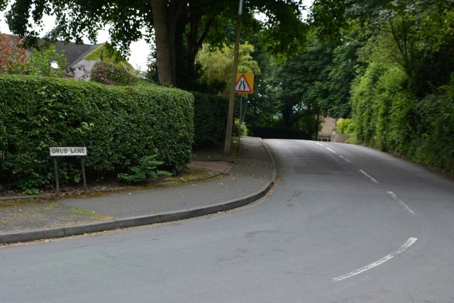
Drub Lane, Bradford
Drub Lane, Bradford
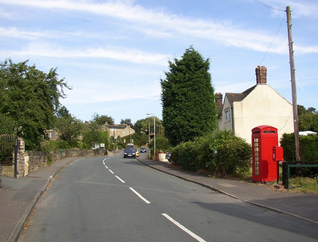
Latham Lane, Gomersal
Show me another place!

Hunsworth Great Wood is located at Grid Ref: SE1827 (Lat: 53.741546, Lng: -1.7195367)

Division: West Riding

Unitary Authority: Kirklees

Police Authority: West Yorkshire

What 3 Words

///eagles.pits.acting. Near Cleckheaton, West Yorkshire

Related Wikis

Drub, West Yorkshire

Drub is a hamlet in the Kirklees district, in the county of West Yorkshire, England. It is located between Cleckheaton, Birkenshaw, and Gomersal and is...

Oakenshaw, West Yorkshire

Oakenshaw is a village located in both the City of Bradford and Kirklees in West Yorkshire, England. It is located midway between the town of Cleckheaton...

Whitechapel Church, Cleckheaton

Whitechapel Church, is an unusual church building located approximately half a mile north of Cleckheaton, West Yorkshire, England. It was built in 1820...

Whitcliffe Mount School

Whitcliffe Mount School is a mixed secondary school located in Cleckheaton, West Yorkshire, England. == History == It was established as Cleckheaton Secondary...

Cleckheaton

Cleckheaton is a town in Kirklees, West Yorkshire, England. Historically part of the West Riding of Yorkshire, it is situated south of Bradford, east of...

Birkenshaw, West Yorkshire

Birkenshaw is a village in the borough of Kirklees in the county of West Yorkshire, England. It lies at the crossroads between the A58 Leeds to Halifax...

Cleckheaton Central railway station

Cleckheaton Central railway station was a railway station serving the West Yorkshire town of Cleckheaton, England, until it was closed in the Beeching...

Cleckheaton Town Hall

Cleckheaton Town Hall is a municipal building in Bradford Road, Cleckheaton, West Yorkshire, England. The town hall, which was the headquarters of Spenborough...

Nearby Amenities

Located within 500m of 53.741546,-1.7195367
Motorway Junction
Chain Bar Interchange
Ref: 26
Lat/Long: 53.7424698/-1.719539
Power: tower
Lat/Long: 53.7442011/-1.7196911
Power: tower
Lat/Long: 53.7424703/-1.7252458
Bus Stop
Hunsworth Lane Westroyd Avenue
Local Ref: 45015451
Naptan AtcoCode: 450015451
Naptan Bearing: N
Naptan CommonName: Hunsworth Lane Westroyd Avenue
Naptan Crossing: Westroyd Avenue
Naptan Indicator: Stop 45015451
Naptan PlusbusZoneRef: LEEDS
Naptan ShortCommonName: Westroyd Avenue
Naptan Street: Hunsworth Lane
Naptan Verified: no
Source: naptan_import
Lat/Long: 53.7384538/-1.7151748
Bus Stop
Hunsworth Lane Mill Lane
Local Ref: 45015452
Naptan AtcoCode: 450015452
Naptan Bearing: NW
Naptan CommonName: Hunsworth Lane Mill Lane
Naptan Crossing: Mill Lane
Naptan Indicator: Stop 45015452
Naptan Landmark: Village Green
Naptan Notes: OSR taken place 070905
Naptan PlusbusZoneRef: LEEDS
Naptan ShortCommonName: Mill Lane
Naptan Street: Hunsworth Lane
Naptan Verified: no
Source: naptan_import
Lat/Long: 53.7398585/-1.7162265
Bus Stop
Hunsworth Lane Mill Lane
Local Ref: 45015453
Naptan AtcoCode: 450015453
Naptan Bearing: SE
Naptan CommonName: Hunsworth Lane Mill Lane
Naptan Crossing: Mill Lane
Naptan Indicator: Stop 45015453
Naptan Landmark: Saville Arms PH
Naptan Notes: OSR taken place 070905
Naptan PlusbusZoneRef: LEEDS
Naptan ShortCommonName: Mill Lane
Naptan Street: Hunsworth Lane
Naptan Verified: no
Source: naptan_import
Lat/Long: 53.7398486/-1.7158324
Bus Stop
Hunsworth Lane Plane Trees Close
Local Ref: 45015454
Naptan AtcoCode: 450015454
Naptan Bearing: S
Naptan CommonName: Hunsworth Lane Plane Trees Close
Naptan Crossing: Plane Trees Close
Naptan Indicator: Stop 45015454
Naptan PlusbusZoneRef: LEEDS
Naptan ShortCommonName: Plane Trees Close
Naptan Street: Hunsworth Lane
Naptan Verified: no
Source: naptan_import
Lat/Long: 53.7413239/-1.7163531
Bus Stop
Hunsworth Lane Motorway Bridge
Local Ref: 45015455
Naptan AtcoCode: 450015455
Naptan Bearing: N
Naptan CommonName: Hunsworth Lane Motorway Bridge
Naptan Crossing: Adj M62 Motorway Bridge
Naptan Indicator: Stop 45015455
Naptan Landmark: Motorway Bridge
Naptan Notes: OSR taken place 261005
Naptan PlusbusZoneRef: LEEDS
Naptan ShortCommonName: Hunsworth Lane M62
Naptan Street: Hunsworth Lane
Naptan Verified: no
Source: naptan_import
Lat/Long: 53.7438213/-1.7157905
Bus Stop
Hunsworth Lane Motorway Bridge
Local Ref: 45015456
Naptan AtcoCode: 450015456
Naptan Bearing: S
Naptan CommonName: Hunsworth Lane Motorway Bridge
Naptan Crossing: Adj M62 Motorway Bridge
Naptan Indicator: Stop 45015456
Naptan Landmark: Motorway Bridge
Naptan Notes: OSR taken place 070905
Naptan PlusbusZoneRef: LEEDS
Naptan ShortCommonName: Hunsworth Lane M62
Naptan Street: Hunsworth Lane
Naptan Verified: no
Source: naptan_import
Lat/Long: 53.7437491/-1.7156545
Bus Stop
Hunsworth Lane Greenroyd Avenue
Local Ref: 45028099
Naptan AtcoCode: 450028099
Naptan Bearing: S
Naptan CommonName: Hunsworth Lane Greenroyd Avenue
Naptan Crossing: Greenroyd Avenue
Naptan Indicator: Stop 45028099
Naptan Landmark: Unknown
Naptan PlusbusZoneRef: LEEDS
Naptan ShortCommonName: Greenroyd Avenue
Naptan Street: Hunsworth Lane
Naptan Verified: no
Source: naptan_import
Lat/Long: 53.7384894/-1.7149926
Bus Stop
Hunsworth Lane Plane Trees Close
Local Ref: 45028100
Naptan AtcoCode: 450028100
Naptan Bearing: N
Naptan CommonName: Hunsworth Lane Plane Trees Close
Naptan Crossing: Plane Trees Close
Naptan Indicator: Stop 45028100
Naptan Landmark: Unknown
Naptan PlusbusZoneRef: LEEDS
Naptan ShortCommonName: Planetrees Close
Naptan Street: Hunsworth Lane
Naptan Verified: no
Source: naptan_import
Lat/Long: 53.7413872/-1.7165043
Post Box
Operator: Royal Mail
Post Box Type: lamp
Ref: BD19 704
Royal Cypher: EIIR
Lat/Long: 53.7399571/-1.7157938
Public Bookcase
Booth: K6
Disused Amenity: telephone
Man Made: telephone_box
Public Bookcase Type: phone_box
Lat/Long: 53.7399567/-1.7157585
Hunsworth
Place: village
Source: npe
Lat/Long: 53.7394935/-1.7144257
Restaurant
The Savile Arms
Addr City: Cleckheaton
Addr Housenumber: 174
Addr Postcode: BD19 4DX
Addr Street: Hunsworth Lane
Addr Village: Hunsworth
Cuisine: regional
Fhrs Id: 227071
Opening Hours: Mo-Th 12:00-23:00; Fr-Sa 12:00-24:00; Su 12:00-23:00
Outdoor Seating: yes
Lat/Long: 53.7398091/-1.7153357
Bench
Lat/Long: 53.7399515/-1.715886
Barrier: lift_gate
Lat/Long: 53.7374876/-1.7210953
Crossing
Crossing: marked
Lat/Long: 53.7375044/-1.7210773
Generator Method: photovoltaic
Generator Output Electricity: yes
Generator Source: solar
Generator Type: solar_photovoltaic_panel
Location: roof
Power: generator
Lat/Long: 53.7432406/-1.7155127
Generator Method: photovoltaic
Generator Output Electricity: yes
Generator Source: solar
Generator Type: solar_photovoltaic_panel
Location: roof
Power: generator
Lat/Long: 53.7391732/-1.7161618
Generator Method: photovoltaic
Generator Output Electricity: yes
Generator Source: solar
Generator Type: solar_photovoltaic_panel
Location: roof
Power: generator
Lat/Long: 53.7391669/-1.7162369
Generator Method: photovoltaic
Generator Output Electricity: yes
Generator Source: solar
Generator Type: solar_photovoltaic_panel
Location: roof
Power: generator
Lat/Long: 53.7383039/-1.7160142
Generator Method: photovoltaic
Generator Output Electricity: yes
Generator Source: solar
Generator Type: solar_photovoltaic_panel
Location: roof
Power: generator
Lat/Long: 53.7383086/-1.7159499
Crossing
Crossing: marked
Lat/Long: 53.7375402/-1.7211572
Barrier: stile
Material: wood
Stile: stepover
Lat/Long: 53.7387997/-1.7141188
Bench
Lat/Long: 53.7398979/-1.7159036
Bench
Lat/Long: 53.7398577/-1.7157838
Advertising: board
Lat/Long: 53.7398757/-1.7158079
The data included in this document is from www.openstreetmap.org. The data is made available under ODbL.

Have you been to Hunsworth Great Wood?

Leave your review of Hunsworth Great Wood below (or comments, questions and feedback).