Stubbin's Plantation

Wood, Forest in Yorkshire

England

Stubbin's Plantation

Path off the Calder Valley Greenway, Colne Bridge This leads down from the eastern end of Bradley Viaduct into woodland next to the River Colne.
Path off the Calder Valley Greenway, Colne Bridge Credit: Humphrey Bolton

Stubbin's Plantation is a picturesque woodland located in Yorkshire, England. Spanning across a vast area, this enchanting forest is a haven for nature lovers and outdoor enthusiasts. The plantation is situated in the heart of the county, making it easily accessible for visitors from nearby towns and cities.

The woodland is known for its diverse range of tree species, including oak, beech, and birch. These majestic trees create a dense canopy that provides a tranquil and serene atmosphere. The forest floor is adorned with a rich carpet of wildflowers, adding bursts of color to the surroundings.

Walking trails crisscross the plantation, allowing visitors to explore its natural beauty at their own pace. These well-maintained paths lead to hidden nooks and crannies, where visitors can discover small streams, charming glades, and even the occasional wildlife sighting. The plantation is home to an array of bird species, such as woodpeckers, owls, and warblers, making it a popular spot for birdwatchers.

Stubbin's Plantation is also known for its historical significance. The forest has been carefully managed for centuries, with evidence of human activity dating back to medieval times. The remains of old stone walls and ancient agricultural features can still be seen, providing a glimpse into the region's past.

Overall, Stubbin's Plantation offers a sanctuary of tranquility and natural beauty. Whether it's for a leisurely stroll, a picnic with family and friends, or an immersive nature experience, this woodland gem in Yorkshire is a must-visit destination for anyone seeking solace in the great outdoors.

If you have any feedback on the listing, please let us know in the comments section below.

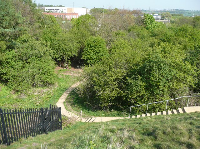
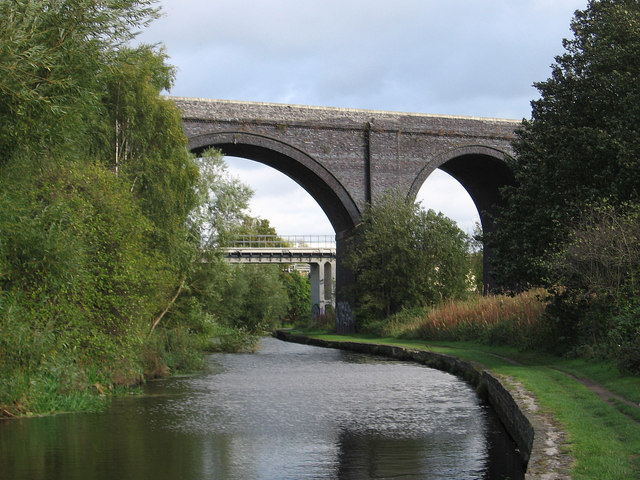
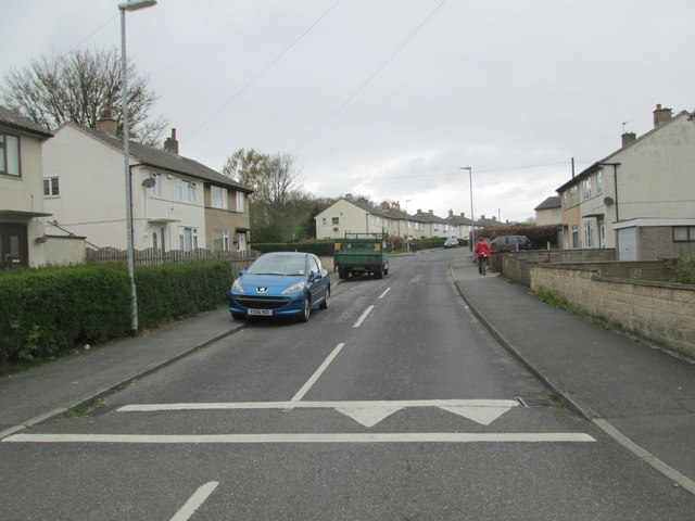
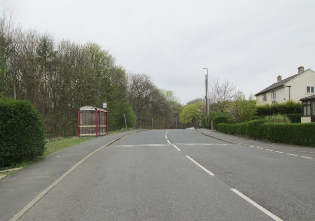
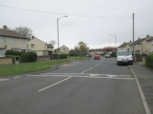
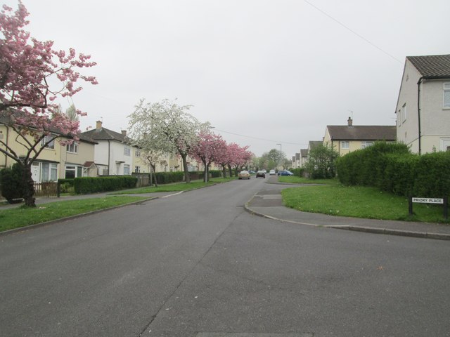
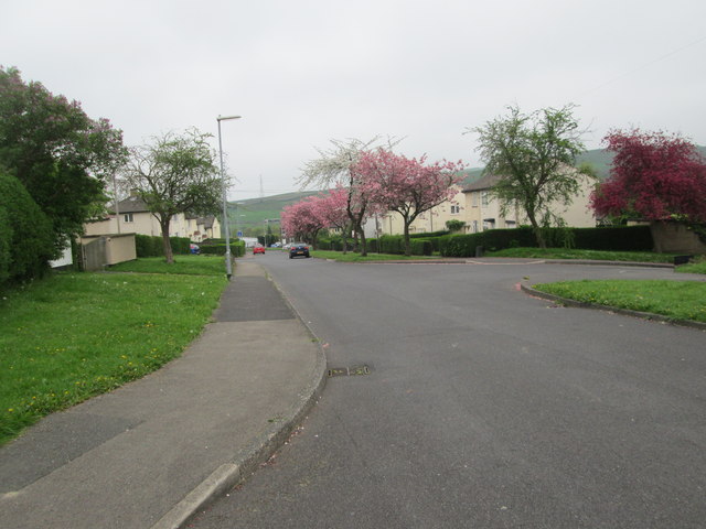
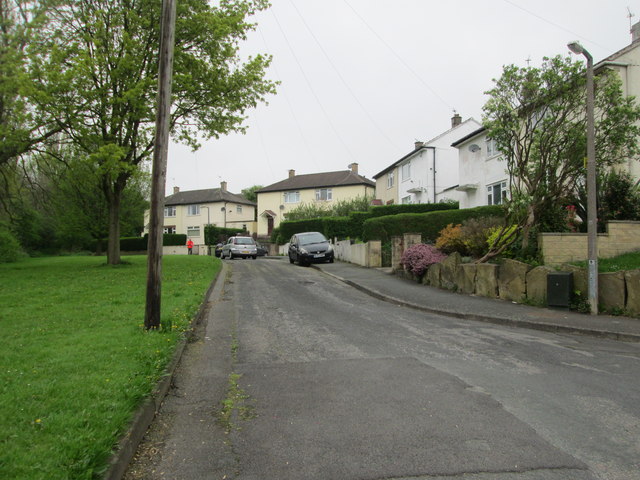
Stubbin's Plantation Images

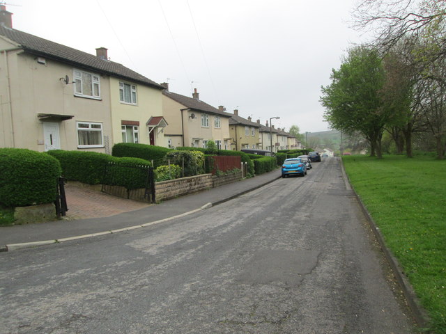
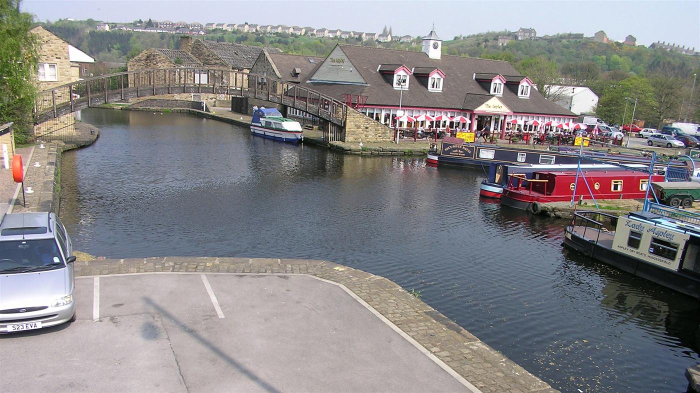
Images are sourced within 2km of 53.686221/-1.7299127 or Grid Reference SE1721. Thanks to Geograph Open Source API. All images are credited.

Path off the Calder Valley Greenway, Colne Bridge This leads down from the eastern end of Bradley Viaduct into woodland next to the River Colne.
Path off the Calder Valley Greenway, Colne Bridge
This leads down from the eastern end of Bradley Viaduct into woodland next to the River Colne.
60009 Union of South Africa Pictured is the preserved class A4 Pacific steam locomotive 60009 "Union of South Africa" hauling the very popular steam tour from Crewe to Scarborough  aptly named "The Scarborough Flyer". This locomotive was built in 1937 and was used in service on the London to Edinburgh main east coast line. Pictured on the 22nd August 2008 at Bradley in West Yorkshire in her popular preserved roll of steam specials.
60009 Union of South Africa
Pictured is the preserved class A4 Pacific steam locomotive 60009 "Union of South Africa" hauling the very popular steam tour from Crewe to Scarborough aptly named "The Scarborough Flyer". This locomotive was built in 1937 and was used in service on the London to Edinburgh main east coast line. Pictured on the 22nd August 2008 at Bradley in West Yorkshire in her popular preserved roll of steam specials.
Deighton - viaduct over canal For an alternative view, please see <a href="https://www.geograph.org.uk/photo/95233">SE1719 : Viaduct (disused) crossing the Huddersfield Broad Canal</a>.
Deighton - viaduct over canal
Power lines on North Moor
Huddersfield Broad Canal, Johnson's Lock 3, Bridge 5
Huddersfield Broad Canal, Bradley Railway Viaduct This now carries Sustrans National Route 66.
Huddersfield Broad Canal, Bradley Railway Viaduct
This now carries Sustrans National Route 66.
Pipe bridge over the Huddersfield Broad Canal This is an industrial pipe bridge.
Pipe bridge over the Huddersfield Broad Canal
This is an industrial pipe bridge.
The Batley water supply main crossing the disused Huddersfield to Leeds railway
Batley Corporation Water Works air valve marker plate This is a more modern type than the one shown in <a href="https://www.geograph.org.uk/photo/3572710">SE1718 : Batley Corporation Water Works air valve marker plate</a>, but is old enough to have the initials 'BCWW' at the top. The grid reference is approximate - I have assumed that it is at the spot height.
Batley Corporation Water Works air valve marker plate
This is a more modern type than the one shown in SE1718 : Batley Corporation Water Works air valve marker plate, but is old enough to have the initials 'BCWW' at the top. The grid reference is approximate - I have assumed that it is at the spot height.
Location of Batley CWW air valve marker, Dalton Bank Road The marker post is in shadow on the right-hand side of the road. The grid reference is approximate - I have assumed that it is at the spot height. See <a href="https://www.geograph.org.uk/photo/3572726">SE1719 : Batley Corporation Water Works air valve marker plate</a> for a close view.
Location of Batley CWW air valve marker, Dalton Bank Road
The marker post is in shadow on the right-hand side of the road. The grid reference is approximate - I have assumed that it is at the spot height. See SE1719 : Batley Corporation Water Works air valve marker plate for a close view.
Disused railway viaduct over the Huddersfield Broad Canal The viaduct now carries a footpath and cycle track
Disused railway viaduct over the Huddersfield Broad Canal
The viaduct now carries a footpath and cycle track
Stuart Place - Keldregate
Keldregate - viewed from Stuart Place
Huntingdon Avenue - viewed from Priory Place
Coufford Grove - viewed from Huntingdon Avenue
Show me another place!

Stubbin's Plantation is located at Grid Ref: SE1721 (Lat: 53.686221, Lng: -1.7299127)

Division: West Riding

Unitary Authority: Kirklees

Police Authority: West Yorkshire

What 3 Words

///leaned.marble.panels. Near Mirfield, West Yorkshire

Related Wikis

Cooper Bridge railway station

Cooper Bridge was a railway station built by the Manchester and Leeds Railway to serve the town of Huddersfield in West Yorkshire, England. == History... ==

Huddersfield Broad Canal

The Huddersfield Broad Canal or Sir John Ramsden's Canal, is a wide-locked navigable canal in West Yorkshire in northern England. The waterway is 3.75...

Robin Hood's Grave

Robin Hood's Grave is the name given to a monument in Kirklees Park Estate, West Yorkshire, England, near the now-ruined Kirklees Priory. It is alleged...

River Colne, West Yorkshire

The River Colne in West Yorkshire is formed at the confluence of two brooks that originate in the Pennines close to Marsden. It flows in an easterly...

Nearby Amenities

Located within 500m of 53.686221,-1.7299127
Traffic Signals
Lat/Long: 53.6861065/-1.7261667
Battyeford Flood Lock
Waterway: lock_gate
Lat/Long: 53.6837246/-1.7247999
Source: survey
Lat/Long: 53.685741/-1.7316465
Source: survey
Lat/Long: 53.6858287/-1.7315171
Source: survey
Lat/Long: 53.6858322/-1.7313598
Source: survey
Lat/Long: 53.6858022/-1.7312759
Traffic Signals
Source: survey
Lat/Long: 53.6857483/-1.7312184
Source: survey
Lat/Long: 53.685655/-1.7312249
Source: survey
Lat/Long: 53.6856016/-1.7312948
Source: survey
Lat/Long: 53.6855746/-1.7314166
Source: survey
Lat/Long: 53.6856326/-1.7316158
Source: survey
Lat/Long: 53.6856911/-1.7316526
Source: survey
Lat/Long: 53.6858989/-1.730168
Source: survey
Lat/Long: 53.6857062/-1.7312071
Traffic Signals
Lat/Long: 53.6858024/-1.731585
Traffic Signals
Lat/Long: 53.6855948/-1.7315499
Traffic Signals
Lat/Long: 53.6856726/-1.7310676
Traffic Signals
Lat/Long: 53.685532/-1.7316923
Traffic Signals
Lat/Long: 53.6858572/-1.731592
Bus Stop
Leeds Road Huddersfield Road
Kerb: raised
Local Ref: 45011852
Naptan AtcoCode: 450011852
Naptan Bearing: W
Naptan CommonName: Leeds Road Huddersfield Road
Naptan Crossing: Huddersfield Road
Naptan Indicator: Stop 45011852
Naptan PlusbusZoneRef: LEEDS
Naptan ShortCommonName: Huddersfield Road
Naptan Street: Leeds Road
Naptan Verified: no
Shelter: yes
Source: naptan_import
Lat/Long: 53.6864022/-1.7240211
Bus Stop
Leeds Road / Cooper Bridge Road
Local Ref: 45013099
Naptan AtcoCode: 450013099
Naptan Bearing: W
Naptan CommonName: Leeds Road Cooper Bridge Road
Naptan Crossing: Cooper Bridge Road
Naptan Indicator: Stop 45013099
Naptan PlusbusZoneRef: LEEDS
Naptan ShortCommonName: Cooper Bridge Road
Naptan Street: Leeds Road
Shelter: no
Source: naptan_import; survey
Towards: Huddersfield
Lat/Long: 53.6856738/-1.730669
Bus Stop
Huddersfield Road Shell Garage
Local Ref: 45015157
Naptan AtcoCode: 450015157
Naptan Bearing: W
Naptan CommonName: Huddersfield Road Shell Garage
Naptan Indicator: Stop 45015157
Naptan Landmark: Filling Station
Naptan PlusbusZoneRef: LEEDS
Naptan ShortCommonName: Leeds Road
Naptan Street: Huddersfield Road
Naptan Verified: no
Source: naptan_import
Lat/Long: 53.6858315/-1.7248422
Bus Stop
Huddersfield Road Leeds Road
Local Ref: 45015158
Naptan AtcoCode: 450015158
Naptan Bearing: SE
Naptan CommonName: Huddersfield Road Leeds Road
Naptan Indicator: Stop 45015158
Naptan PlusbusZoneRef: LEEDS
Naptan ShortCommonName: Leeds Road
Naptan Street: Huddersfield Road
Naptan Verified: no
Shelter: no
Source: naptan_import
Lat/Long: 53.6856944/-1.7238438
Bus Stop
Wakefield Road Cooper Bridge
Local Ref: 45021661
Naptan AtcoCode: 450021661
Naptan Bearing: NW
Naptan CommonName: Wakefield Road Cooper Bridge
Naptan Crossing: Cooper Bridge Road
Naptan Indicator: Stop 45021661
Naptan PlusbusZoneRef: LEEDS
Naptan ShortCommonName: Cooper Bridge Road
Naptan Street: Wakefield Road
Naptan Verified: yes
Shelter: no
Source: naptan_import
Timetable: yes
Lat/Long: 53.6861281/-1.7327596
Bus Stop
Wakefield Road / Cooper Bridge
Local Ref: 45021662
Naptan AtcoCode: 450021662
Naptan Bearing: SE
Naptan CommonName: Wakefield Road Cooper Bridge
Naptan Crossing: Cooper Bridge Road
Naptan Indicator: Stop 45021662
Naptan PlusbusZoneRef: LEEDS
Naptan ShortCommonName: Cooper Bridge Road
Naptan Street: Wakefield Road
Shelter: no
Source: naptan_import
Towards: Dewsbury
Lat/Long: 53.6861636/-1.7325625
Bus Stop
Wakefield Road / Cooper Bridge
Local Ref: 45021663
Naptan AtcoCode: 450021663
Naptan Bearing: SE
Naptan CommonName: Wakefield Road
Naptan Indicator: Stop 45021663
Naptan PlusbusZoneRef: LEEDS
Naptan ShortCommonName: Park Bottom Wood
Naptan Street: Wakefield Road
Opposite: yes
Shelter: no
Source: naptan_import
Lat/Long: 53.6871259/-1.7354882
Wakefield Road Scrap Yard
Local Ref: 45051125
Naptan AtcoCode: 450051125
Naptan Bearing: NW
Naptan BusStopType: CUS
Naptan CommonName: Wakefield Road Scrap Yard
Naptan Indicator: Stop 45051125
Naptan PlusbusZoneRef: LEEDS
Naptan ShortCommonName: Cooper Bridge
Naptan Street: Wakefield Road
Naptan Verified: no
Source: naptan_import
Lat/Long: 53.6870392/-1.7355709
Brighouse Waste Water Treatment Works
Man Made: wastewater_plant
Name Source: survey
Lat/Long: 53.6826173/-1.7330867
Crossing
Crossing Island: no
Crossing Markings: no
Crossing Signals: no
Tactile Paving: no
Lat/Long: 53.6826313/-1.7335817
Restaurant
Miller & Carter
Brand: Miller & Carter
Brand Wikidata: Q87067401
Contact Website: https://www.millerandcarter.co.uk/restaurants/yorkshire-and-the-humber/millerandcartermirfield
Cuisine: steak_house
Lat/Long: 53.6867619/-1.7267738
Traffic Signals
Lat/Long: 53.6862224/-1.7259641
Traffic Signals
Lat/Long: 53.6862787/-1.725917
Dumb Steeple
Historic: monument
Lat/Long: 53.6858824/-1.7313663
Generator Method: photovoltaic
Generator Output Electricity: yes
Generator Source: solar
Generator Type: solar_photovoltaic_panel
Location: roof
Power: generator
Lat/Long: 53.685523/-1.7226913
Generator Method: photovoltaic
Generator Output Electricity: yes
Generator Source: solar
Generator Type: solar_photovoltaic_panel
Location: roof
Power: generator
Lat/Long: 53.6864113/-1.7226309
Ford: yes
Lat/Long: 53.6846502/-1.7245947
Waterway: weir
Lat/Long: 53.6891147/-1.7296346
Cooper Bridge
Historic Railway: station
Railway: site
Wikidata: Q5167751
Wikipedia: en:Cooper Bridge railway station
Lat/Long: 53.6848865/-1.7317126
Crossing
Crossing: unmarked
Crossing Island: no
Tactile Paving: no
Lat/Long: 53.685781/-1.7317085
The data included in this document is from www.openstreetmap.org. The data is made available under ODbL.

Have you been to Stubbin's Plantation?

Leave your review of Stubbin's Plantation below (or comments, questions and feedback).