Lappingwell Wood

Wood, Forest in Gloucestershire Cotswold

England

Lappingwell Wood

Beer Furlong Buildings The interestingly named Beer Furlong Buildings viewed from the passing road near Eastleach Turville.
Beer Furlong Buildings Credit: Philip Halling

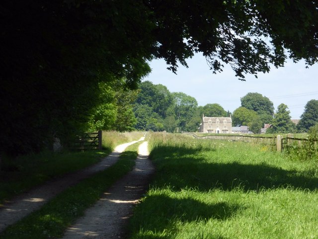
Lappingwell Wood is a charming woodland area located in Gloucestershire, England. Situated in the heart of the countryside, this wood offers a picturesque and tranquil escape from the hustle and bustle of city life.

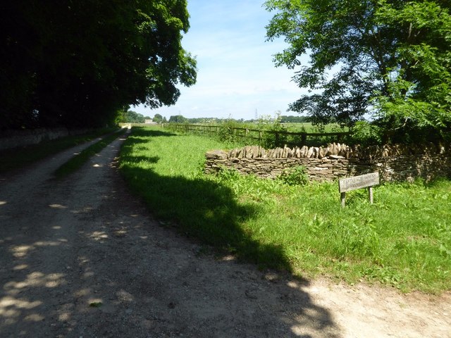
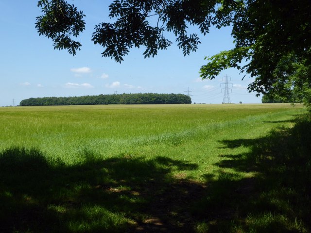
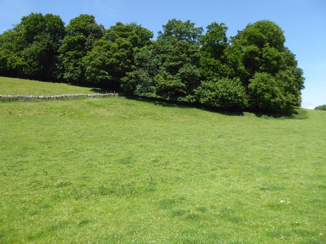
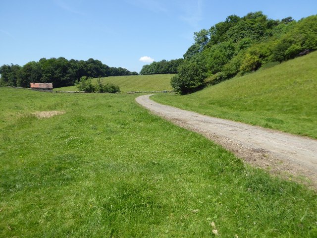
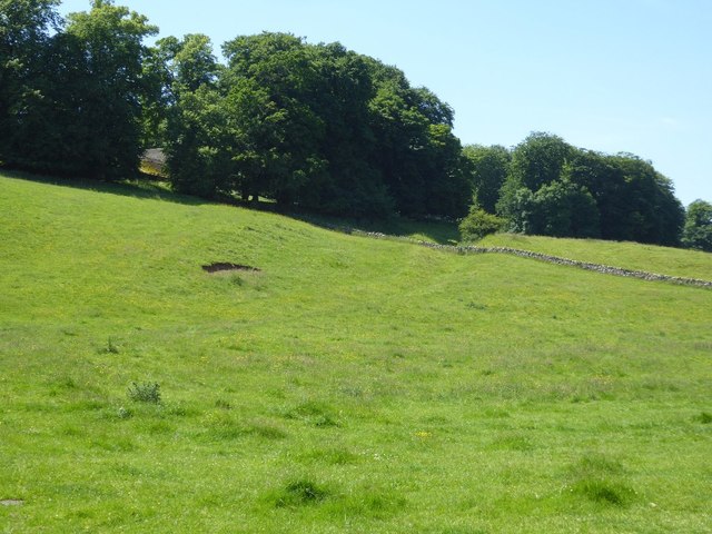
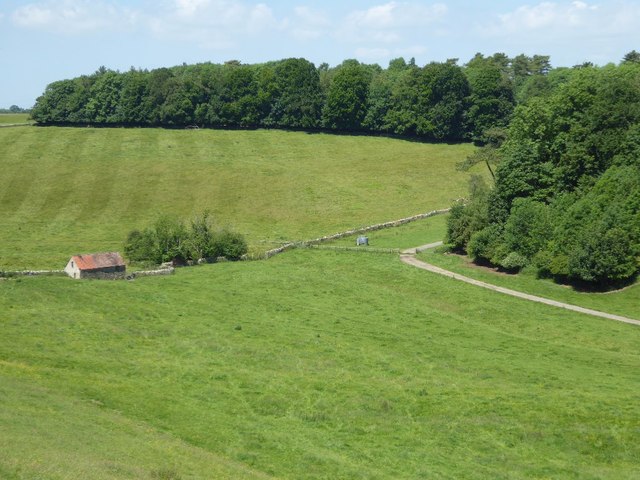
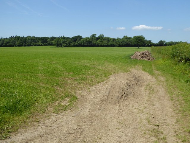
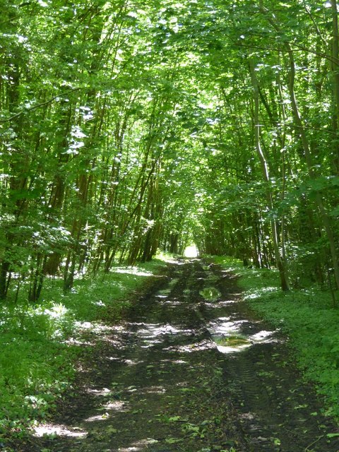
Covering an area of approximately 50 acres, Lappingwell Wood is home to a diverse range of flora and fauna, making it a haven for nature enthusiasts. The wood is predominantly made up of native broadleaf trees, including oak, beech, and ash, creating a beautiful canopy that provides shade during the summer months. Bluebells and wildflowers carpet the forest floor in spring, adding bursts of color to the peaceful setting.

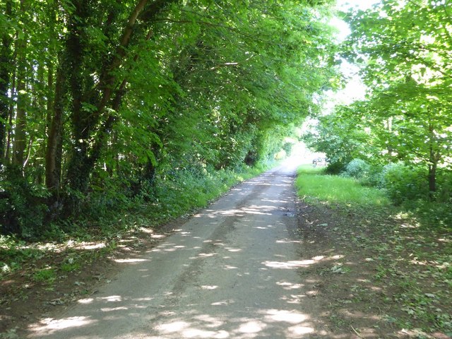
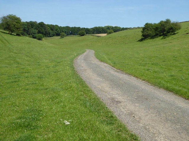
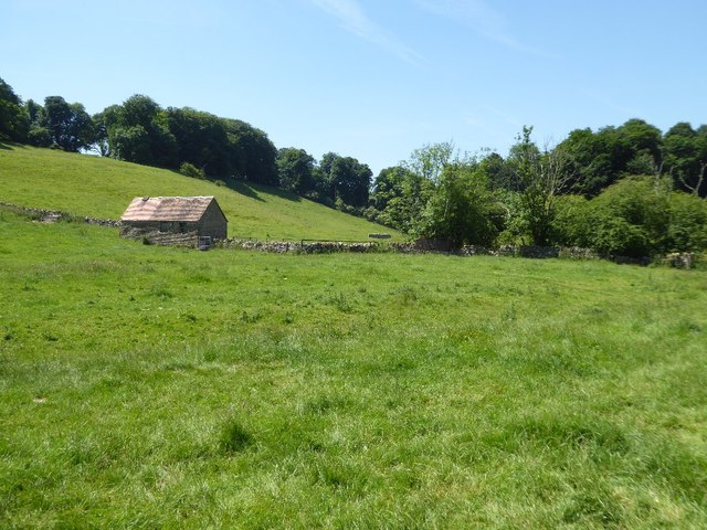
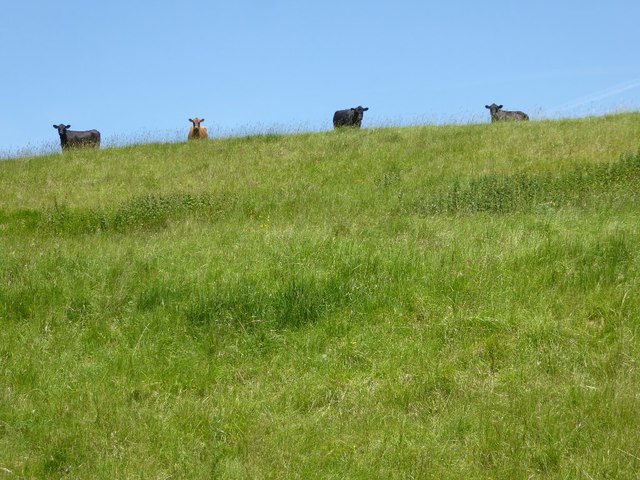
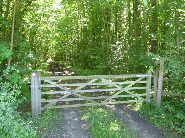
The wood is crisscrossed by a network of well-maintained footpaths, allowing visitors to explore its natural beauty at their own pace. These paths wind through the wood, leading visitors to hidden glades and tranquil ponds. Along the way, one may encounter a variety of wildlife, including deer, foxes, and an array of bird species.

Lappingwell Wood is a popular spot for recreational activities such as walking, jogging, and birdwatching. The peaceful ambiance and the abundance of wildlife make it an ideal destination for nature lovers and photographers alike. The wood is also a great place for families to enjoy a picnic or for children to play and explore in a safe environment.

Overall, Lappingwell Wood is a hidden gem in Gloucestershire, offering a serene and natural escape for visitors to enjoy the beauty of the countryside and reconnect with nature.

If you have any feedback on the listing, please let us know in the comments section below.

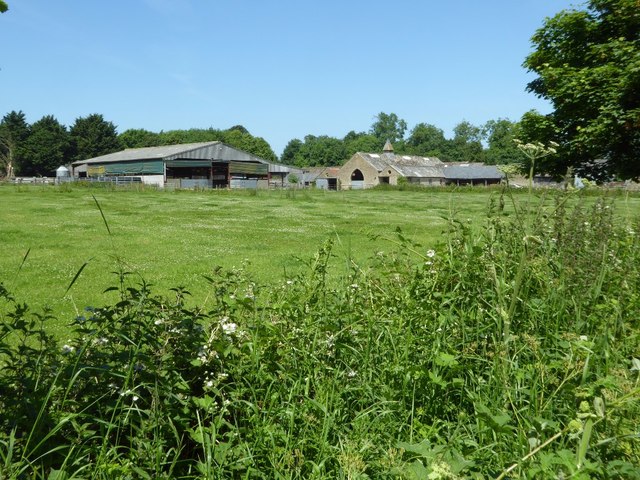
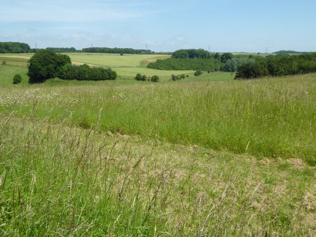
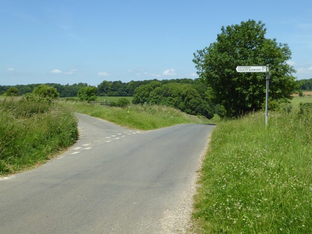
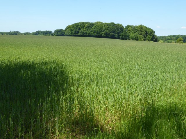
Lappingwell Wood Images

Images are sourced within 2km of 51.766103/-1.7418587 or Grid Reference SP1707. Thanks to Geograph Open Source API. All images are credited.

Beer Furlong Buildings The interestingly named Beer Furlong Buildings viewed from the passing road near Eastleach Turville.
Beer Furlong Buildings
The interestingly named Beer Furlong Buildings viewed from the passing road near Eastleach Turville.
Farmland in the Leach valley Rolling farmland in the Leach valley in south-east Gloucestershire near Eastleach Turville.
Farmland in the Leach valley
Rolling farmland in the Leach valley in south-east Gloucestershire near Eastleach Turville.
Road junction near Eastleach Turville Junction of road to Hatherop and Coln St Aldwyns with a country road near Eastleach Turville.
Road junction near Eastleach Turville
Junction of road to Hatherop and Coln St Aldwyns with a country road near Eastleach Turville.
Wheat field near Eastleach Turville
Track to Eastleach Downs Farmhouse Eastleach Downs Farmhouse viewed along a track from its junction with the passing country road.  There is no public right of way along this track.
Track to Eastleach Downs Farmhouse
Eastleach Downs Farmhouse viewed along a track from its junction with the passing country road. There is no public right of way along this track.
Entrance to Eastleach Downs Farmhouse Entrance to a long track leading to Eastleach Downs Farmhouse.  There is no public right of way along this track.
Entrance to Eastleach Downs Farmhouse
Entrance to a long track leading to Eastleach Downs Farmhouse. There is no public right of way along this track.
View to No Man's Land Plantation View across a barley field to No Man's Land Plantation of the Eastleach Downs.
View to No Man's Land Plantation
View across a barley field to No Man's Land Plantation of the Eastleach Downs.
No through road near Eastleach Downs Farm
Road to Macaroni Downs Farm A no through road following a dry Cotswold valley and leading to Macaroni Downs Farm.

The name Macaroni appears somewhat out of place in this corner of Gloucestershire, a little research has identified the origin of this name.  One of the dictionary definitions for the word 'Macaroni' is 'an English dandy of the 18th century who affected Continental mannerisms, clothes, etc.'  Back in the eighteenth century members of the London-based 'Macaroni Club' would attend a racecourse on this land.  In the late 18th and early 19th Century during the reign of George III, enclosure took place here with the farm adopting the name of these former visitors.  Nearby there is another farm named Macaroni Farm and also Macaroni Wood.
Road to Macaroni Downs Farm
A no through road following a dry Cotswold valley and leading to Macaroni Downs Farm. The name Macaroni appears somewhat out of place in this corner of Gloucestershire, a little research has identified the origin of this name. One of the dictionary definitions for the word 'Macaroni' is 'an English dandy of the 18th century who affected Continental mannerisms, clothes, etc.' Back in the eighteenth century members of the London-based 'Macaroni Club' would attend a racecourse on this land. In the late 18th and early 19th Century during the reign of George III, enclosure took place here with the farm adopting the name of these former visitors. Nearby there is another farm named Macaroni Farm and also Macaroni Wood.
Hatherop Piece Hatherop Piece a woodland above a dry valley near Macaroni Downs Farm.
Hatherop Piece
Hatherop Piece a woodland above a dry valley near Macaroni Downs Farm.
Shed in a Cotswold valley
Cattle on the skyline Inquisitive cattle on the brow of the hill watching me in the valley below.
Cattle on the skyline
Inquisitive cattle on the brow of the hill watching me in the valley below.
Road to Macaroni Downs Farm Country road passing through a dry Cotswold valley.


The name Macaroni appears somewhat out of place in this corner of Gloucestershire, a little research has identified the origin of this name.  One of the dictionary definitions for the word 'Macaroni' is 'an English dandy of the 18th century who affected Continental mannerisms, clothes, etc.'  Back in the eighteenth century members of the London-based 'Macaroni Club' would attend a racecourse on this land.  In the late 18th and early 19th Century during the reign of George III, enclosure took place here with the farm adopting the name of these former visitors.  Nearby there is another farm named Macaroni Farm and also Macaroni Wood.
Road to Macaroni Downs Farm
Country road passing through a dry Cotswold valley. The name Macaroni appears somewhat out of place in this corner of Gloucestershire, a little research has identified the origin of this name. One of the dictionary definitions for the word 'Macaroni' is 'an English dandy of the 18th century who affected Continental mannerisms, clothes, etc.' Back in the eighteenth century members of the London-based 'Macaroni Club' would attend a racecourse on this land. In the late 18th and early 19th Century during the reign of George III, enclosure took place here with the farm adopting the name of these former visitors. Nearby there is another farm named Macaroni Farm and also Macaroni Wood.
The line of Akeman Street The line of Akeman Street, a Roman Road connecting Watling Street and the Fosse Way is very evident here as it descends into this valley near Eastleach, see the slight depression and the line of the dry stone wall to the right of the centre of the picture.
The line of Akeman Street
The line of Akeman Street, a Roman Road connecting Watling Street and the Fosse Way is very evident here as it descends into this valley near Eastleach, see the slight depression and the line of the dry stone wall to the right of the centre of the picture.
Cotswold valley Farmland in a Cotswold valley to the south of Macaroni Downs Farm near Eastleach Turville.
Cotswold valley
Farmland in a Cotswold valley to the south of Macaroni Downs Farm near Eastleach Turville.
Gate on woodland track Gate on a track and footpath passing through a wood at Coln Lane Ground.
Gate on woodland track
Gate on a track and footpath passing through a wood at Coln Lane Ground.
Farmland near Williamstrip Farm Tyning Wood can be seen on the far side of the field.
Farmland near Williamstrip Farm
Tyning Wood can be seen on the far side of the field.
Woodland track and footpath Woodland track and footpath at Coln Lane Ground.
Woodland track and footpath
Woodland track and footpath at Coln Lane Ground.
Show me another place!

Lappingwell Wood is located at Grid Ref: SP1707 (Lat: 51.766103, Lng: -1.7418587)

Administrative County: Gloucestershire

District: Cotswold

Police Authority: Gloucestershire

What 3 Words

///bright.blog.birthing. Near Fairford, Gloucestershire

Related Wikis

Aldsworth

Aldsworth is a village and civil parish in the Cotswold district of Gloucestershire, about ten miles north-east of Cirencester. In 2010 its population...

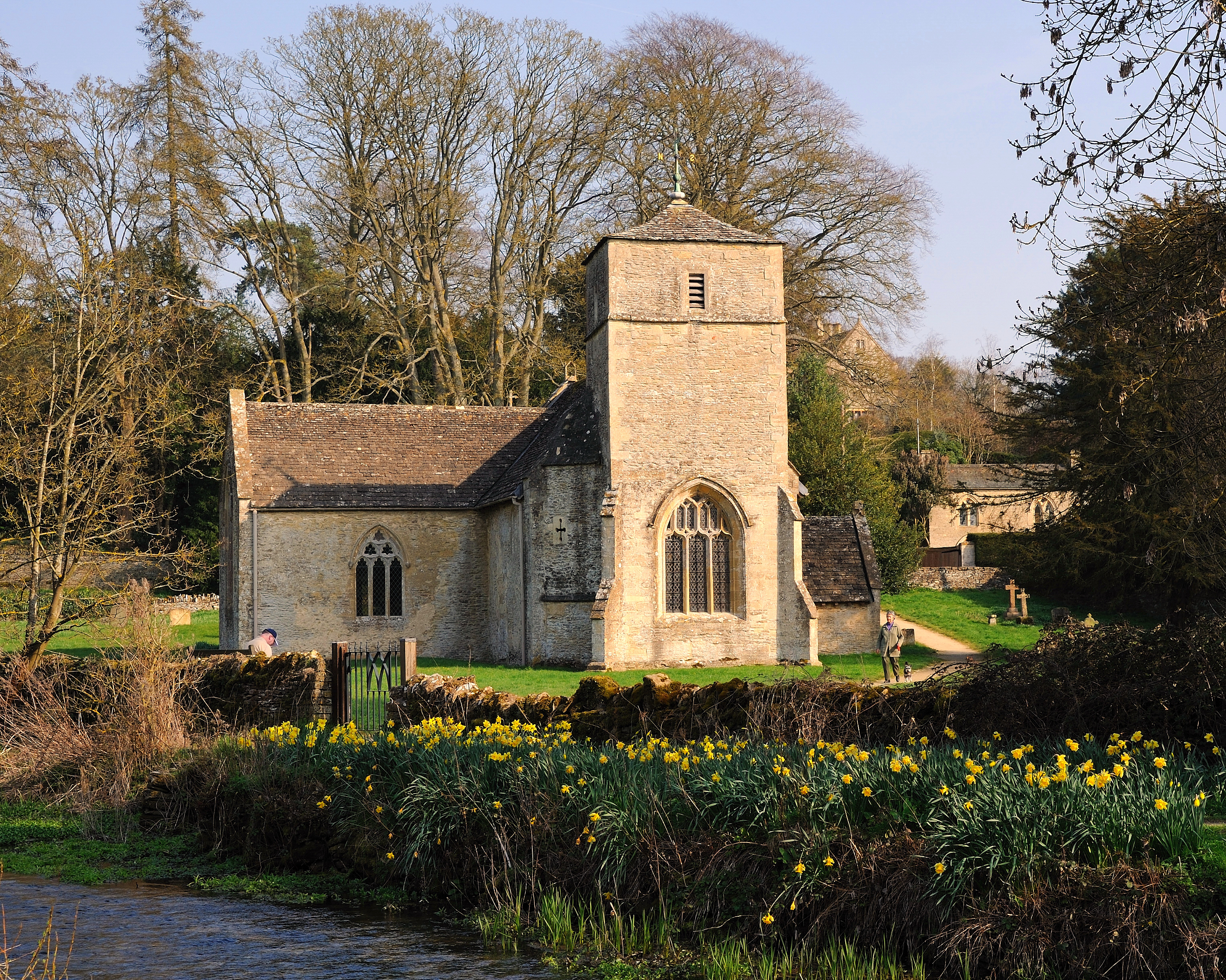
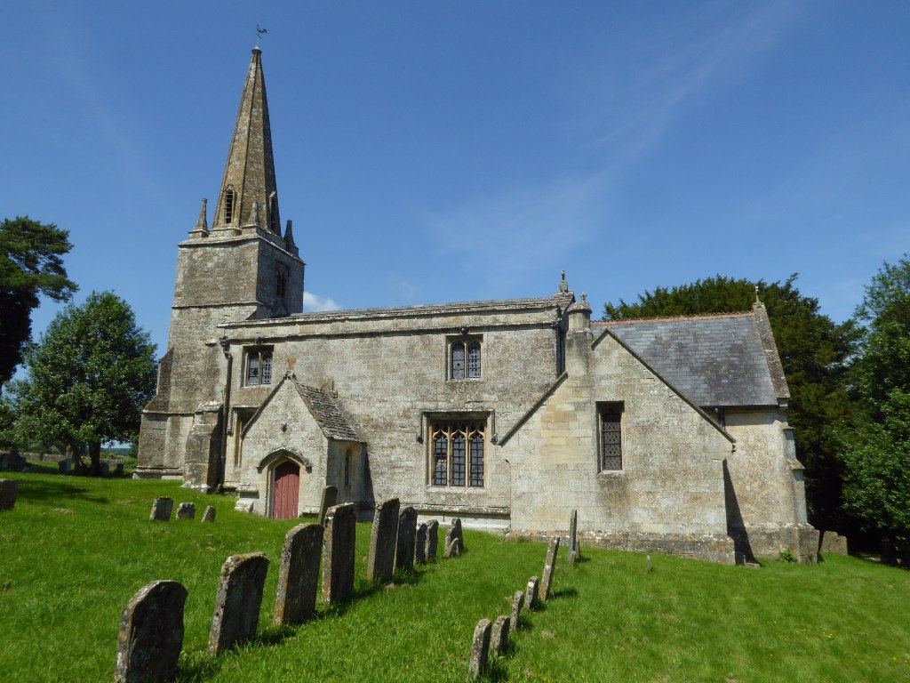
Church of St Andrew, Eastleach Turville

The Anglican Church of St Andrew at Eastleach Turville in the Cotswold District of Gloucestershire, England, was built in the 12th century. It is a grade...

Eastleach

Eastleach is a civil parish in the county of Gloucestershire, England. It was created in 1935 when the separate parishes of Eastleach Turville and Eastleach...

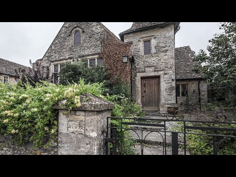
St Michael and St Martin's Church, Eastleach Martin

St Michael and St Martin's Church is a historic Anglican church in Eastleach Martin, Gloucestershire, England under the care of The Churches Conservation...

Hatherop

Hatherop is a village and civil parish in the Cotswolds Area of Outstanding Natural Beauty, about 2.5 miles (4.0 km) north of Fairford in Gloucestershire...
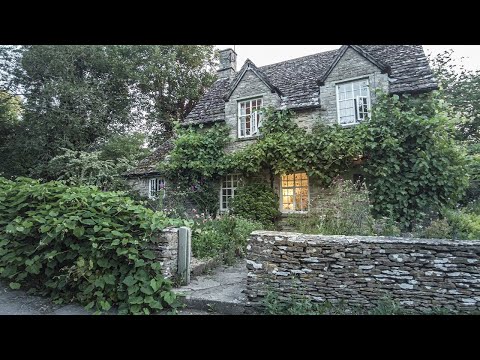
Eastleach House

Eastleach House is Grade II listed country house in Eastleach Martin, Gloucestershire, designed by the architect Walter Cave and completed in 1900. �...

Church of St Bartholomew, Aldsworth

The Anglican Church of St Bartholomew at Aldsworth in the Cotswold District of Gloucestershire, England was built in the late 12th century. It is a grade...

RAF Southrop

Royal Air Force Southrop or more simply RAF Southrop is a former Royal Air Force satellite station west of the village of Southrop, Gloucestershire during...

Related Videos

An Ethereal Morning Walk in a Dreamlike Cotswold Village || ENGLAND

So, today we are out and about walking in the Cotswold village(s) of Eastleach, which is located in the county of Gloucestershire.

Overcast & Breezy Morning Walk Through a Cotswold Village

So, today we are out and about walking in the Cotswold village & parish of Aldsworth, which is located 10 miles north-east of ...

The Cotswolds 🏴󠁧󠁢󠁥󠁮󠁧󠁿, incredibly beautiful...🌿

Saturday, 1st April 2023 #cotswolds #thecotswolds bourton-on-the-water St. John Baptist, Cirencester.

Beauty along the River Leach

Here is a video of our walk from Eastleach to Southrop. To view the full route, see the link here: ...

Have you been to Lappingwell Wood?

Leave your review of Lappingwell Wood below (or comments, questions and feedback).