Walklane Plantation
Wood, Forest in Derbyshire Derbyshire Dales
England
Walklane Plantation
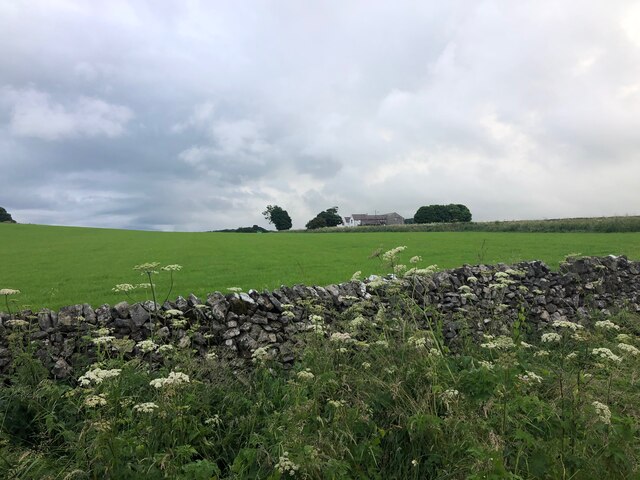
Walklane Plantation is a picturesque woodland located in Derbyshire, England. With its lush greenery and tall trees, it offers a serene escape from the hustle and bustle of city life. The plantation covers a vast area, providing ample space for visitors to explore and immerse themselves in nature.
The woodland is home to a rich variety of flora and fauna, making it a haven for wildlife enthusiasts and nature lovers. The diverse range of tree species found in Walklane Plantation includes oak, beech, ash, and birch, creating a beautiful tapestry of colors throughout the seasons. The forest floor is adorned with an array of wildflowers, adding to the natural charm of the area.
The plantation boasts a network of well-maintained walking trails, allowing visitors to navigate through the woodland easily. These paths lead to hidden gems such as tranquil ponds and clear streams, where visitors can take a break and admire the peaceful surroundings. The plantation also features designated picnic areas, providing the perfect spot for a leisurely outdoor lunch.
Walklane Plantation is a popular destination for recreational activities such as hiking, birdwatching, and photography. The abundance of wildlife, including deer, rabbits, and various bird species, offers ample opportunities for nature enthusiasts to capture stunning photographs.
Overall, Walklane Plantation is a true natural treasure in Derbyshire, offering a peaceful retreat for individuals and families alike. Its well-maintained trails, diverse wildlife, and breathtaking scenery make it a must-visit destination for anyone seeking solace in nature.
If you have any feedback on the listing, please let us know in the comments section below.
Walklane Plantation Images
Images are sourced within 2km of 53.151366/-1.7379426 or Grid Reference SK1761. Thanks to Geograph Open Source API. All images are credited.
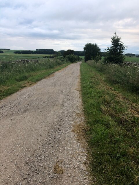
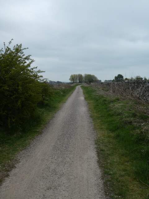
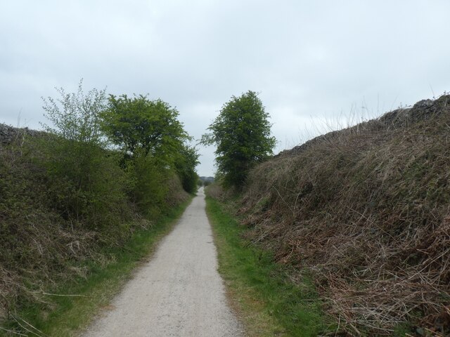
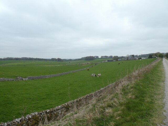
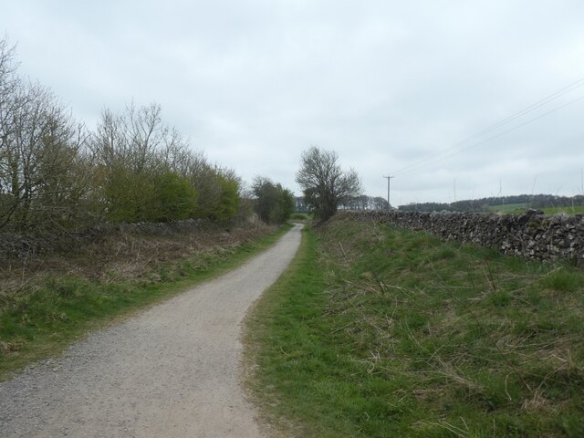
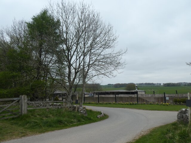
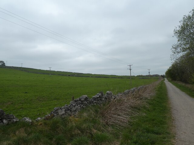
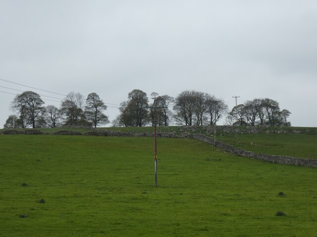
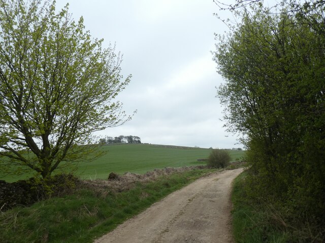
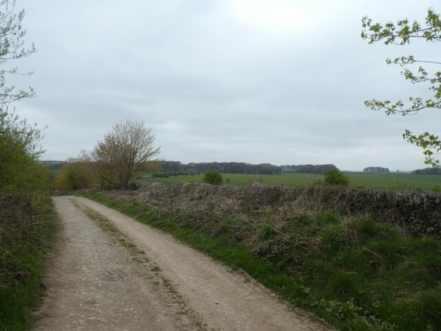
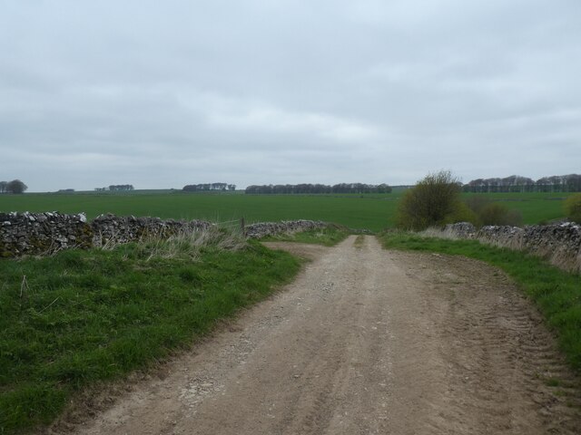
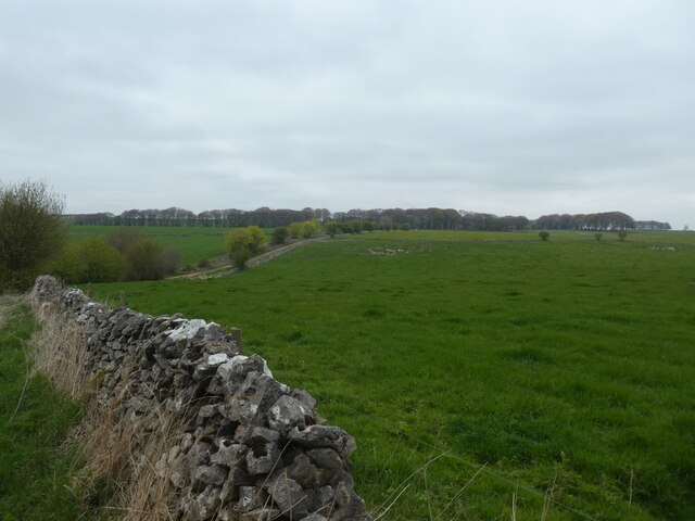

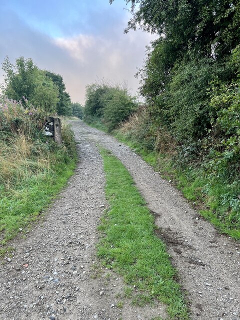
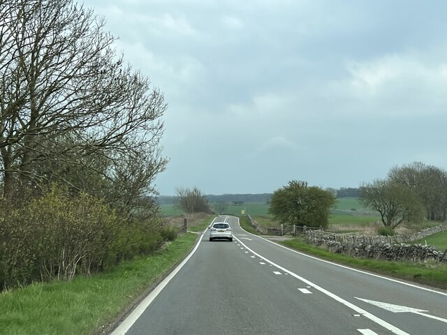
Notice (8): Undefined index: ownername [APP/View/Records/view.ctp, line 101]Code Context<figure class="figure mb-0 pt-2"><? echo $this->Html->image($images[0]['url'], array('alt' => $images[0]['title'], 'class' => 'img-fluid mx-auto d-block')) ?><figcaption class="figure-caption text-center"><? echo $images[0]['title'] ?> Credit: <? echo $images[0]['ownername'] ?>$viewFile = '/var/www/html/uk_places.millsbomb.com/app/View/Records/view.ctp' $dataForView = array( 'meta_keywords' => 'Walklane Plantation', 'meta_description' => 'Walklane Plantation is a picturesque woodland located in Derbyshire, England. With its lush greenery and tall trees, it offers a serene escape from the hustle and bustle of city life. The plantation covers a vast area, providing ample space for visitors to explore and immerse themselves in...', 'title_for_layout' => 'Walklane Plantation Derbyshire Dales Derbyshire', 'videos' => array( 'kind' => 'youtube#searchListResponse', 'etag' => '_HY2cTQzT5rmamihOd5OLj8upuA', 'nextPageToken' => 'CAQQAA', 'regionCode' => 'GB', 'pageInfo' => array( 'totalResults' => (int) 16, 'resultsPerPage' => (int) 4 ), 'items' => array( (int) 0 => array( [maximum depth reached] ), (int) 1 => array( [maximum depth reached] ), (int) 2 => array( [maximum depth reached] ), (int) 3 => array( [maximum depth reached] ) ) ), 'wikis' => array( 'batchcomplete' => '', 'query' => array( 'geosearch' => array( [maximum depth reached] ) ) ), 'neighbours' => array( 'prev' => array( 'Record' => array( [maximum depth reached] ) ), 'next' => array( 'Record' => array( [maximum depth reached] ) ) ), 'para' => 'Walklane Plantation is a Wood, Forest in Derbyshire', 'record' => array( 'Record' => array( 'id' => '115980', 'GBPNID' => '118226', 'PlaceName' => 'Walklane Plantation', 'GridRef' => 'SK1761', 'Lat' => '53.151366', 'Lng' => '-1.7379426', 'HistCounty' => 'Derbyshire', 'Division' => null, 'AdCounty' => 'Derbyshire', 'District' => 'Derbyshire Dales', 'UniAuth' => null, 'Police' => 'Derbyshire', 'Region' => 'England', 'Alternative_Names' => null, 'Type' => 'Wood, Forest', 'description' => 'Walklane Plantation is a picturesque woodland located in Derbyshire, England. With its lush greenery and tall trees, it offers a serene escape from the hustle and bustle of city life. The plantation covers a vast area, providing ample space for visitors to explore and immerse themselves in nature. The woodland is home to a rich variety of flora and fauna, making it a haven for wildlife enthusiasts and nature lovers. The diverse range of tree species found in Walklane Plantation includes oak, beech, ash, and birch, creating a beautiful tapestry of colors throughout the seasons. The forest floor is adorned with an array of wildflowers, adding to the natural charm of the area. The plantation boasts a network of well-maintained walking trails, allowing visitors to navigate through the woodland easily. These paths lead to hidden gems such as tranquil ponds and clear streams, where visitors can take a break and admire the peaceful surroundings. The plantation also features designated picnic areas, providing the perfect spot for a leisurely outdoor lunch. Walklane Plantation is a popular destination for recreational activities such as hiking, birdwatching, and photography. The abundance of wildlife, including deer, rabbits, and various bird species, offers ample opportunities for nature enthusiasts to capture stunning photographs. Overall, Walklane Plantation is a true natural treasure in Derbyshire, offering a peaceful retreat for individuals and families alike. Its well-maintained trails, diverse wildlife, and breathtaking scenery make it a must-visit destination for anyone seeking solace in nature.', 'what3words' => 'padlock.printouts.impressed', 'what3words_place' => 'Newhaven, Derbyshire', 'images' => '[{"id":"6908300","title":"View across pasture to the Jug and Glass Inn from Green Lane","grid_reference":"SK1561","realname":"Philip Cornwall","monthname":"July","hash":"1b8cb39b","takenyear":"2021","user_id":"132959","geodist":"1961.419189","description":"The Jug and Glass Inn is located on the A515","url":"https:\/\/s0.geograph.org.uk\/geophotos\/06\/90\/83\/6908300_1b8cb39b.jpg"},{"id":"6908310","title":"Green Lane","grid_reference":"SK1561","realname":"Philip Cornwall","monthname":"July","hash":"f210000a","takenyear":"2021","user_id":"132959","geodist":"1895.309448","description":"A well maintained track near Caskinlow Farm","url":"https:\/\/s2.geograph.org.uk\/geophotos\/06\/90\/83\/6908310_f210000a.jpg"},{"id":"7207355","title":"High Peak Trail east of Caskinlow Farm","grid_reference":"SK1562","realname":"David Smith","monthname":"April","hash":"5966cd66","takenyear":"2022","user_id":"708","geodist":"1851.774780","description":"The Pennine Bridleway is a new National Trail.\r\nIt runs roughly parallel with the Pennine Way but provides access for horseback riders and cyclists as well as walkers. The trail is around 205 miles long, extending from Derbyshire to Cumbria.\r\nWikipedia: <span class=\"nowrap\"><a title=\"https:\/\/en.wikipedia.org\/wiki\/Pennine_Bridleway\" rel=\"nofollow ugc noopener\" href=\"https:\/\/en.wikipedia.org\/wiki\/Pennine_Bridleway\">Link<\/a><img style=\"margin-left:2px;\" alt=\"External link\" title=\"External link - shift click to open in new window\" src=\"https:\/\/s1.geograph.org.uk\/img\/external.png\" width=\"10\" height=\"10\"\/><\/span> ","url":"https:\/\/s3.geograph.org.uk\/geophotos\/07\/20\/73\/7207355_5966cd66.jpg"},{"id":"7207356","title":"Scrub and trees by High Peak Trail","grid_reference":"SK1661","realname":"David Smith","monthname":"April","hash":"bbf7bb51","takenyear":"2022","user_id":"708","geodist":"1642.568359","description":"The High Peak Trail follows the route of the Cromford and High Peak Railway which was completed in 1831 and axed as part of the Beeching cuts in the 1960s.","url":"https:\/\/s0.geograph.org.uk\/geophotos\/07\/20\/73\/7207356_bbf7bb51.jpg"},{"id":"7207360","title":"Farmland east of High Peak Trail near Brundcliffe","grid_reference":"SK1661","realname":"David Smith","monthname":"April","hash":"73e0c7bc","takenyear":"2022","user_id":"708","geodist":"1521.761719","description":"The High Peak Trail follows the route of the Cromford and High Peak Railway which was completed in 1831 and axed as part of the Beeching cuts in the 1960s.","url":"https:\/\/s0.geograph.org.uk\/geophotos\/07\/20\/73\/7207360_73e0c7bc.jpg"},{"id":"7207361","title":"High Peak Trail south of Brundcliffe","grid_reference":"SK1661","realname":"David Smith","monthname":"April","hash":"afb8fc47","takenyear":"2022","user_id":"708","geodist":"1381.721069","description":"The High Peak Trail follows the route of the Cromford and High Peak Railway which was completed in 1831 and axed as part of the Beeching cuts in the 1960s.","url":"https:\/\/s1.geograph.org.uk\/geophotos\/07\/20\/73\/7207361_afb8fc47.jpg"},{"id":"7208222","title":"Entrance road to Brundcliffe","grid_reference":"SK1661","realname":"David Smith","monthname":"April","hash":"8ce29af6","takenyear":"2022","user_id":"708","geodist":"1373.265625","description":"Brundcliffe is a small farm by the High Peak Trail","url":"https:\/\/s2.geograph.org.uk\/geophotos\/07\/20\/82\/7208222_8ce29af6.jpg"},{"id":"7208224","title":"High Peak Trail passing Brundcliffe","grid_reference":"SK1661","realname":"David Smith","monthname":"April","hash":"eb275db8","takenyear":"2022","user_id":"708","geodist":"1437.290039","description":"The High Peak Trail follows the route of the Cromford and High Peak Railway which was completed in 1831 and axed as part of the Beeching cuts in the 1960s.","url":"https:\/\/s0.geograph.org.uk\/geophotos\/07\/20\/82\/7208224_eb275db8.jpg"},{"id":"7208226","title":"A patch of woodland west of Brundcliffe","grid_reference":"SK1561","realname":"David Smith","monthname":"April","hash":"d0985a2c","takenyear":"2022","user_id":"708","geodist":"1762.254150","description":"A view of these trees from the A515 is at <a href=\"https:\/\/www.geograph.org.uk\/photo\/5430985\">SK1561 : A stand of trees near Newhaven<\/a>. The OS map notes a tumulus here.","url":"https:\/\/s2.geograph.org.uk\/geophotos\/07\/20\/82\/7208226_d0985a2c.jpg"},{"id":"7208229","title":"Track to A515 from High Peak Trail","grid_reference":"SK1561","realname":"David Smith","monthname":"April","hash":"919a00ae","takenyear":"2022","user_id":"708","geodist":"1727.385010","description":"The OS map notes a tumulus in the stand of trees on the skyline","url":"https:\/\/s1.geograph.org.uk\/geophotos\/07\/20\/82\/7208229_919a00ae.jpg"},{"id":"7208230","title":"Green Lane to A515","grid_reference":"SK1561","realname":"David Smith","monthname":"April","hash":"a75ea0ca","takenyear":"2022","user_id":"708","geodist":"1726.153931","description":"","url":"https:\/\/s2.geograph.org.uk\/geophotos\/07\/20\/82\/7208230_a75ea0ca.jpg"},{"id":"7208232","title":"Green Lane leading across High Peak Trail","grid_reference":"SK1662","realname":"David Smith","monthname":"April","hash":"ab578066","takenyear":"2022","user_id":"708","geodist":"1664.300049","description":"","url":"https:\/\/s0.geograph.org.uk\/geophotos\/07\/20\/82\/7208232_ab578066.jpg"},{"id":"7208235","title":"Green Lane north of High Peak Trail","grid_reference":"SK1662","realname":"David Smith","monthname":"April","hash":"e0efae6a","takenyear":"2022","user_id":"708","geodist":"1504.643188","description":"The lane can be seen dipping and rising to a line of trees, which form a field boundary along the course of a Roman road","url":"https:\/\/s3.geograph.org.uk\/geophotos\/07\/20\/82\/7208235_e0efae6a.jpg"},{"id":"7274790","title":"Signs","grid_reference":"SK1561","realname":"Jay Pea","monthname":"September","hash":"4cf11b62","takenyear":"2022","user_id":"73422","geodist":"1668.070923","description":"A footpath sign and a metal railway post dating from pre 1967 when the railway closed.","url":"https:\/\/s2.geograph.org.uk\/geophotos\/07\/27\/47\/7274790_4cf11b62.jpg"},{"id":"7274792","title":"Green Lane","grid_reference":"SK1561","realname":"Jay Pea","monthname":"September","hash":"21262f39","takenyear":"2022","user_id":"73422","geodist":"1693.313721","description":"Looking up Green Lane towards the A515.","url":"https:\/\/s0.geograph.org.uk\/geophotos\/07\/27\/47\/7274792_21262f39.jpg"},{"id":"7334129","title":" Cafe in Derbyshire ","grid_reference":"SK1660","realname":"Bob Harvey","monthname":"November","hash":"772cab75","takenyear":"2022","user_id":"8272","geodist":"1638.087891","description":"Coaches is a cafe bar in Newhaven. ","url":"https:\/\/s1.geograph.org.uk\/geophotos\/07\/33\/41\/7334129_772cab75.jpg"},{"id":"7334139","title":"Simulated railway carriage","grid_reference":"SK1660","realname":"Bob Harvey","monthname":"November","hash":"24a15862","takenyear":"2022","user_id":"8272","geodist":"1637.873535","description":"The reason <a href=\"https:\/\/www.geograph.org.uk\/photo\/7334129\">SK1660 : Cafe in Derbyshire <\/a> is called 'Coaches'. A portion of the dining area is done up like a carriage on the Orient Express.","url":"https:\/\/s3.geograph.org.uk\/geophotos\/07\/33\/41\/7334139_24a15862.jpg"},{"id":"7464550","title":"Newhaven Crossing","grid_reference":"SK1859","realname":"Andrew Abbott","monthname":"April","hash":"5e552cf3","takenyear":"2023","user_id":"45714","geodist":"1890.142578","description":"The site of an old railway crossing on the A5012.","url":"https:\/\/s2.geograph.org.uk\/geophotos\/07\/46\/45\/7464550_5e552cf3.jpg"}]', 'wikis' => '{"batchcomplete":"","query":{"geosearch":[{"pageid":69190938,"ns":0,"title":"Middleton and Smerrill","lat":53.158,"lon":-1.729,"dist":948.5,"primary":"","url":"https:\/\/en.wikipedia.org\/wiki\/Middleton_and_Smerrill","image":"https:\/\/upload.wikimedia.org\/wikipedia\/commons\/7\/7e\/Middleton-by-Youlgreave_-_Church_-_geograph.org.uk_-_943825.jpg","extract":"Middleton and Smerrill is a civil parish within the Derbyshire Dales district, in the county of Derbyshire, England. Largely rural except for the village..."},{"pageid":65652172,"ns":0,"title":"Friden Goods Yard","lat":53.1436,"lon":-1.7441,"dist":956.2,"primary":"","url":"https:\/\/en.wikipedia.org\/wiki\/Friden_Goods_Yard","extract":"Friden Goods Yard was a goods station located on the Cromford and High Peak Railway near the villages of Friden in Derbyshire. Mostly for moving mineral..."},{"pageid":16976138,"ns":0,"title":"Friden, Derbyshire","lat":53.143,"lon":-1.746,"dist":1074.3,"primary":"","url":"https:\/\/en.wikipedia.org\/wiki\/Friden,_Derbyshire","image":"https:\/\/upload.wikimedia.org\/wikipedia\/commons\/9\/90\/Friden_-_High_Peak_Trail_-_geograph.org.uk_-_59337.jpg","extract":"Friden is a hamlet in the civil parish of Hartington Nether Quarter, Derbyshire, England. It is 11 miles (18 km) south-east of Buxton, just off the Newhaven..."},{"pageid":990638,"ns":0,"title":"High Peak Trail","lat":53.1401,"lon":-1.7357,"dist":1261.6,"primary":"","url":"https:\/\/en.wikipedia.org\/wiki\/High_Peak_Trail","image":"https:\/\/upload.wikimedia.org\/wikipedia\/commons\/2\/24\/Top_of_Sheep_Pasture_Incline.jpg","extract":"The High Peak Trail is a 17-mile (27 km) trail for walkers, cyclists and horse riders in the Peak District of England. Running from Dowlow (53.2059\u00b0N 1..."},{"pageid":152010,"ns":0,"title":"Newhaven, Derbyshire","lat":53.139,"lon":-1.753,"dist":1702.7,"primary":"","url":"https:\/\/en.wikipedia.org\/wiki\/Newhaven,_Derbyshire","image":"https:\/\/upload.wikimedia.org\/wikipedia\/commons\/9\/90\/Friden_-_High_Peak_Trail_-_geograph.org.uk_-_59337.jpg","extract":"Newhaven is a hamlet in the county of Derbyshire, England, east of Hartington and west of Cromford.\nThe principal employer in the area is DSF Refractories..."},{"pageid":63845115,"ns":0,"title":"Long Dale","lat":53.1396,"lon":-1.719,"dist":1818.7,"primary":"","url":"https:\/\/en.wikipedia.org\/wiki\/Long_Dale","image":"https:\/\/upload.wikimedia.org\/wikipedia\/commons\/f\/f2\/Gratton_Dale_-_Long_Dale_junction_-_geograph.org.uk_-_1614951.jpg","extract":"Long Dale is a carboniferous limestone valley near the village of Elton, Derbyshire, in the Peak District of England. The dale is cut into the plateau..."},{"pageid":7052665,"ns":0,"title":"Middleton-by-Youlgreave","lat":53.165,"lon":-1.709,"dist":2454,"primary":"","url":"https:\/\/en.wikipedia.org\/wiki\/Middleton-by-Youlgreave","image":"https:\/\/upload.wikimedia.org\/wikipedia\/commons\/e\/e9\/Middleton-By-Youlgrave_014815_3919b36d.jpg","extract":"Middleton, often known as Middleton-by-Youlgreave or Middleton-by-Youlgrave to distinguish it from nearby Middleton-by-Wirksworth, is a village in the..."},{"pageid":37137792,"ns":0,"title":"Gib Hill","lat":53.166944444444,"lon":-1.7644444444444,"dist":2474.4,"primary":"","url":"https:\/\/en.wikipedia.org\/wiki\/Gib_Hill","image":"https:\/\/upload.wikimedia.org\/wikipedia\/commons\/f\/f3\/Gib_Hill_burial_mound%2C_Peak_District%2C_Derbyshire.jpg","extract":"Gib Hill is a large burial mound in the Peak District, Derbyshire, England. It is thought to be a Neolithic oval barrow with an Early Bronze Age round..."}]}}', 'videos' => '{"kind":"youtube#searchListResponse","etag":"_HY2cTQzT5rmamihOd5OLj8upuA","nextPageToken":"CAQQAA","regionCode":"GB","pageInfo":{"totalResults":16,"resultsPerPage":4},"items":[{"kind":"youtube#searchResult","etag":"qkoWGBoZwnoN69Od9yOOMybhKTc","id":{"kind":"youtube#video","videoId":"xPTuSwPwVFQ"},"snippet":{"publishedAt":"2022-10-23T19:20:41Z","channelId":"UC5852IQavfhKQ1QbRVHErag","title":"Walking in Peak District, the Square.","description":"Short walk in Sunday October on the dog level in Derbyshire, Middleton by Youlgrave.","thumbnails":{"default":{"url":"https:\/\/i.ytimg.com\/vi\/xPTuSwPwVFQ\/default.jpg","width":120,"height":90},"medium":{"url":"https:\/\/i.ytimg.com\/vi\/xPTuSwPwVFQ\/mqdefault.jpg","width":320,"height":180},"high":{"url":"https:\/\/i.ytimg.com\/vi\/xPTuSwPwVFQ\/hqdefault.jpg","width":480,"height":360}},"channelTitle":"Nature in GreatBritain","liveBroadcastContent":"none","publishTime":"2022-10-23T19:20:41Z"}},{"kind":"youtube#searchResult","etag":"94ciHoV3K8GZYlDVaUGygfe8j3c","id":{"kind":"youtube#video","videoId":"hdEDBNiARJc"},"snippet":{"publishedAt":"2023-11-26T14:17:39Z","channelId":"UCLFwTvr0nc6ZqPF6xHfGgvg","title":"Aleck Low #peakdistrict #summit #derbyshire #summit","description":"Aleck Low - a Peak District amble. #peakdistrict #summit.","thumbnails":{"default":{"url":"https:\/\/i.ytimg.com\/vi\/hdEDBNiARJc\/default.jpg","width":120,"height":90},"medium":{"url":"https:\/\/i.ytimg.com\/vi\/hdEDBNiARJc\/mqdefault.jpg","width":320,"height":180},"high":{"url":"https:\/\/i.ytimg.com\/vi\/hdEDBNiARJc\/hqdefault.jpg","width":480,"height":360}},"channelTitle":"Chris Bentley Walking and Rambling","liveBroadcastContent":"none","publishTime":"2023-11-26T14:17:39Z"}},{"kind":"youtube#searchResult","etag":"mlgp_uOZjTn4tMfXnSM2TT8t6hI","id":{"kind":"youtube#video","videoId":"OUc3yoZmYSw"},"snippet":{"publishedAt":"2024-01-27T12:15:33Z","channelId":"UC1gZtMEn-27bAKCe5zYrnoA","title":"Camping day \ud83c\udfd5","description":"A perfect weekend in Derbyshire, camping . #camping #Derbyshire #summer #me #green #grass #nature #peace #\u044f\u0432\u043c\u043e\u043c\u0435\u043d\u0442\u0435 ...","thumbnails":{"default":{"url":"https:\/\/i.ytimg.com\/vi\/OUc3yoZmYSw\/default.jpg","width":120,"height":90},"medium":{"url":"https:\/\/i.ytimg.com\/vi\/OUc3yoZmYSw\/mqdefault.jpg","width":320,"height":180},"high":{"url":"https:\/\/i.ytimg.com\/vi\/OUc3yoZmYSw\/hqdefault.jpg","width":480,"height":360}},"channelTitle":"Nat's blog \ud83d\udc9a","liveBroadcastContent":"none","publishTime":"2024-01-27T12:15:33Z"}},{"kind":"youtube#searchResult","etag":"n1DIk1kO0aXqdDLDNwd_vpUEpSY","id":{"kind":"youtube#video","videoId":"e9_mReU2z6U"},"snippet":{"publishedAt":"2021-10-14T19:00:28Z","channelId":"UC7p8vz3Togah1s-TbTajfCw","title":"Arbor Low Stone Circle | Week in The Peaks 2021 - PART 3","description":"arborlow #stonecircle #peakdistrict #derbyshire #bakewell Join as we discover a fascinating neolithic stone circle in the Peak ...","thumbnails":{"default":{"url":"https:\/\/i.ytimg.com\/vi\/e9_mReU2z6U\/default.jpg","width":120,"height":90},"medium":{"url":"https:\/\/i.ytimg.com\/vi\/e9_mReU2z6U\/mqdefault.jpg","width":320,"height":180},"high":{"url":"https:\/\/i.ytimg.com\/vi\/e9_mReU2z6U\/hqdefault.jpg","width":480,"height":360}},"channelTitle":"Lou and Lol's Travels","liveBroadcastContent":"none","publishTime":"2021-10-14T19:00:28Z"}}]}', 'places' => '{ "version": 0.6, "generator": "Overpass API 0.7.62.1 084b4234", "osm3s": { "timestamp_osm_base": "2024-03-23T17:27:29Z", "copyright": "The data included in this document is from www.openstreetmap.org. The data is made available under ODbL." }, "elements": [ { "type": "node", "id": 282357162, "lat": 53.1476743, "lon": -1.7407280, "tags": { "barrier": "gate" } }, { "type": "node", "id": 3175290858, "lat": 53.1528518, "lon": -1.7372109, "tags": { "barrier": "cattle_grid", "bicycle": "yes", "foot": "yes" } }, { "type": "node", "id": 8319330812, "lat": 53.1497962, "lon": -1.7445383, "tags": { "natural": "tree", "source": "bing" } }, { "type": "node", "id": 8319330813, "lat": 53.1499265, "lon": -1.7440608, "tags": { "natural": "tree", "source": "bing" } }, { "type": "node", "id": 8319330814, "lat": 53.1498396, "lon": -1.7444068, "tags": { "natural": "tree", "source": "bing" } }, { "type": "node", "id": 8319344231, "lat": 53.1546506, "lon": -1.7404439, "tags": { "natural": "tree", "source": "bing" } }, { "type": "node", "id": 8319344232, "lat": 53.1546732, "lon": -1.7405283, "tags": { "natural": "tree", "source": "bing" } }, { "type": "node", "id": 8319344233, "lat": 53.1547689, "lon": -1.7404170, "tags": { "natural": "tree", "source": "bing" } }, { "type": "node", "id": 8319344234, "lat": 53.1547898, "lon": -1.7405592, "tags": { "natural": "tree", "source": "bing" } }, { "type": "node", "id": 8319344261, "lat": 53.1487039, "lon": -1.7427573, "tags": { "natural": "tree", "source": "bing" } }, { "type": "node", "id": 8319344262, "lat": 53.1481297, "lon": -1.7417809, "tags": { "natural": "tree", "source": "bing" } }, { "type": "node", "id": 8319344263, "lat": 53.1484610, "lon": -1.7419714, "tags": { "natural": "tree", "source": "bing" } }, { "type": "node", "id": 8319344264, "lat": 53.1484144, "lon": -1.7420116, "tags": { "natural": "tree", "source": "bing" } }, { "type": "node", "id": 8319344265, "lat": 53.1486251, "lon": -1.7426419, "tags": { "natural": "tree", "source": "bing" } } ] } ' ) ), 'nearbyPlaces' => array( (int) 0 => array( 'Record' => array( [maximum depth reached] ) ), (int) 1 => array( 'Record' => array( [maximum depth reached] ) ), (int) 2 => array( 'Record' => array( [maximum depth reached] ) ), (int) 3 => array( 'Record' => array( [maximum depth reached] ) ), (int) 4 => array( 'Record' => array( [maximum depth reached] ) ), (int) 5 => array( 'Record' => array( [maximum depth reached] ) ) ), 'noIndex' => false, 'images' => array( (int) 0 => array( 'id' => '6908300', 'title' => 'View across pasture to the Jug and Glass Inn from Green Lane', 'grid_reference' => 'SK1561', 'realname' => 'Philip Cornwall', 'monthname' => 'July', 'hash' => '1b8cb39b', 'takenyear' => '2021', 'user_id' => '132959', 'geodist' => '1961.419189', 'description' => 'The Jug and Glass Inn is located on the A515', 'url' => 'https://s0.geograph.org.uk/geophotos/06/90/83/6908300_1b8cb39b.jpg' ), (int) 1 => array( 'id' => '6908310', 'title' => 'Green Lane', 'grid_reference' => 'SK1561', 'realname' => 'Philip Cornwall', 'monthname' => 'July', 'hash' => 'f210000a', 'takenyear' => '2021', 'user_id' => '132959', 'geodist' => '1895.309448', 'description' => 'A well maintained track near Caskinlow Farm', 'url' => 'https://s2.geograph.org.uk/geophotos/06/90/83/6908310_f210000a.jpg' ), (int) 2 => array( 'id' => '7207355', 'title' => 'High Peak Trail east of Caskinlow Farm', 'grid_reference' => 'SK1562', 'realname' => 'David Smith', 'monthname' => 'April', 'hash' => '5966cd66', 'takenyear' => '2022', 'user_id' => '708', 'geodist' => '1851.774780', 'description' => 'The Pennine Bridleway is a new National Trail. It runs roughly parallel with the Pennine Way but provides access for horseback riders and cyclists as well as walkers. The trail is around 205 miles long, extending from Derbyshire to Cumbria. Wikipedia: <span class="nowrap"><a title="https://en.wikipedia.org/wiki/Pennine_Bridleway" rel="nofollow ugc noopener" href="https://en.wikipedia.org/wiki/Pennine_Bridleway">Link</a><img style="margin-left:2px;" alt="External link" title="External link - shift click to open in new window" src="https://s1.geograph.org.uk/img/external.png" width="10" height="10"/></span> ', 'url' => 'https://s3.geograph.org.uk/geophotos/07/20/73/7207355_5966cd66.jpg' ), (int) 3 => array( 'id' => '7207356', 'title' => 'Scrub and trees by High Peak Trail', 'grid_reference' => 'SK1661', 'realname' => 'David Smith', 'monthname' => 'April', 'hash' => 'bbf7bb51', 'takenyear' => '2022', 'user_id' => '708', 'geodist' => '1642.568359', 'description' => 'The High Peak Trail follows the route of the Cromford and High Peak Railway which was completed in 1831 and axed as part of the Beeching cuts in the 1960s.', 'url' => 'https://s0.geograph.org.uk/geophotos/07/20/73/7207356_bbf7bb51.jpg' ), (int) 4 => array( 'id' => '7207360', 'title' => 'Farmland east of High Peak Trail near Brundcliffe', 'grid_reference' => 'SK1661', 'realname' => 'David Smith', 'monthname' => 'April', 'hash' => '73e0c7bc', 'takenyear' => '2022', 'user_id' => '708', 'geodist' => '1521.761719', 'description' => 'The High Peak Trail follows the route of the Cromford and High Peak Railway which was completed in 1831 and axed as part of the Beeching cuts in the 1960s.', 'url' => 'https://s0.geograph.org.uk/geophotos/07/20/73/7207360_73e0c7bc.jpg' ), (int) 5 => array( 'id' => '7207361', 'title' => 'High Peak Trail south of Brundcliffe', 'grid_reference' => 'SK1661', 'realname' => 'David Smith', 'monthname' => 'April', 'hash' => 'afb8fc47', 'takenyear' => '2022', 'user_id' => '708', 'geodist' => '1381.721069', 'description' => 'The High Peak Trail follows the route of the Cromford and High Peak Railway which was completed in 1831 and axed as part of the Beeching cuts in the 1960s.', 'url' => 'https://s1.geograph.org.uk/geophotos/07/20/73/7207361_afb8fc47.jpg' ), (int) 6 => array( 'id' => '7208222', 'title' => 'Entrance road to Brundcliffe', 'grid_reference' => 'SK1661', 'realname' => 'David Smith', 'monthname' => 'April', 'hash' => '8ce29af6', 'takenyear' => '2022', 'user_id' => '708', 'geodist' => '1373.265625', 'description' => 'Brundcliffe is a small farm by the High Peak Trail', 'url' => 'https://s2.geograph.org.uk/geophotos/07/20/82/7208222_8ce29af6.jpg' ), (int) 7 => array( 'id' => '7208224', 'title' => 'High Peak Trail passing Brundcliffe', 'grid_reference' => 'SK1661', 'realname' => 'David Smith', 'monthname' => 'April', 'hash' => 'eb275db8', 'takenyear' => '2022', 'user_id' => '708', 'geodist' => '1437.290039', 'description' => 'The High Peak Trail follows the route of the Cromford and High Peak Railway which was completed in 1831 and axed as part of the Beeching cuts in the 1960s.', 'url' => 'https://s0.geograph.org.uk/geophotos/07/20/82/7208224_eb275db8.jpg' ), (int) 8 => array( 'id' => '7208226', 'title' => 'A patch of woodland west of Brundcliffe', 'grid_reference' => 'SK1561', 'realname' => 'David Smith', 'monthname' => 'April', 'hash' => 'd0985a2c', 'takenyear' => '2022', 'user_id' => '708', 'geodist' => '1762.254150', 'description' => 'A view of these trees from the A515 is at <a href="https://www.geograph.org.uk/photo/5430985">SK1561 : A stand of trees near Newhaven</a>. The OS map notes a tumulus here.', 'url' => 'https://s2.geograph.org.uk/geophotos/07/20/82/7208226_d0985a2c.jpg' ), (int) 9 => array( 'id' => '7208229', 'title' => 'Track to A515 from High Peak Trail', 'grid_reference' => 'SK1561', 'realname' => 'David Smith', 'monthname' => 'April', 'hash' => '919a00ae', 'takenyear' => '2022', 'user_id' => '708', 'geodist' => '1727.385010', 'description' => 'The OS map notes a tumulus in the stand of trees on the skyline', 'url' => 'https://s1.geograph.org.uk/geophotos/07/20/82/7208229_919a00ae.jpg' ), (int) 10 => array( 'id' => '7208230', 'title' => 'Green Lane to A515', 'grid_reference' => 'SK1561', 'realname' => 'David Smith', 'monthname' => 'April', 'hash' => 'a75ea0ca', 'takenyear' => '2022', 'user_id' => '708', 'geodist' => '1726.153931', 'description' => '', 'url' => 'https://s2.geograph.org.uk/geophotos/07/20/82/7208230_a75ea0ca.jpg' ), (int) 11 => array( 'id' => '7208232', 'title' => 'Green Lane leading across High Peak Trail', 'grid_reference' => 'SK1662', 'realname' => 'David Smith', 'monthname' => 'April', 'hash' => 'ab578066', 'takenyear' => '2022', 'user_id' => '708', 'geodist' => '1664.300049', 'description' => '', 'url' => 'https://s0.geograph.org.uk/geophotos/07/20/82/7208232_ab578066.jpg' ), (int) 12 => array( 'id' => '7208235', 'title' => 'Green Lane north of High Peak Trail', 'grid_reference' => 'SK1662', 'realname' => 'David Smith', 'monthname' => 'April', 'hash' => 'e0efae6a', 'takenyear' => '2022', 'user_id' => '708', 'geodist' => '1504.643188', 'description' => 'The lane can be seen dipping and rising to a line of trees, which form a field boundary along the course of a Roman road', 'url' => 'https://s3.geograph.org.uk/geophotos/07/20/82/7208235_e0efae6a.jpg' ), (int) 13 => array( 'id' => '7274790', 'title' => 'Signs', 'grid_reference' => 'SK1561', 'realname' => 'Jay Pea', 'monthname' => 'September', 'hash' => '4cf11b62', 'takenyear' => '2022', 'user_id' => '73422', 'geodist' => '1668.070923', 'description' => 'A footpath sign and a metal railway post dating from pre 1967 when the railway closed.', 'url' => 'https://s2.geograph.org.uk/geophotos/07/27/47/7274790_4cf11b62.jpg' ), (int) 14 => array( 'id' => '7274792', 'title' => 'Green Lane', 'grid_reference' => 'SK1561', 'realname' => 'Jay Pea', 'monthname' => 'September', 'hash' => '21262f39', 'takenyear' => '2022', 'user_id' => '73422', 'geodist' => '1693.313721', 'description' => 'Looking up Green Lane towards the A515.', 'url' => 'https://s0.geograph.org.uk/geophotos/07/27/47/7274792_21262f39.jpg' ), (int) 15 => array( 'id' => '7334129', 'title' => ' Cafe in Derbyshire ', 'grid_reference' => 'SK1660', 'realname' => 'Bob Harvey', 'monthname' => 'November', 'hash' => '772cab75', 'takenyear' => '2022', 'user_id' => '8272', 'geodist' => '1638.087891', 'description' => 'Coaches is a cafe bar in Newhaven. ', 'url' => 'https://s1.geograph.org.uk/geophotos/07/33/41/7334129_772cab75.jpg' ), (int) 16 => array( 'id' => '7334139', 'title' => 'Simulated railway carriage', 'grid_reference' => 'SK1660', 'realname' => 'Bob Harvey', 'monthname' => 'November', 'hash' => '24a15862', 'takenyear' => '2022', 'user_id' => '8272', 'geodist' => '1637.873535', 'description' => 'The reason <a href="https://www.geograph.org.uk/photo/7334129">SK1660 : Cafe in Derbyshire </a> is called 'Coaches'. A portion of the dining area is done up like a carriage on the Orient Express.', 'url' => 'https://s3.geograph.org.uk/geophotos/07/33/41/7334139_24a15862.jpg' ), (int) 17 => array( 'id' => '7464550', 'title' => 'Newhaven Crossing', 'grid_reference' => 'SK1859', 'realname' => 'Andrew Abbott', 'monthname' => 'April', 'hash' => '5e552cf3', 'takenyear' => '2023', 'user_id' => '45714', 'geodist' => '1890.142578', 'description' => 'The site of an old railway crossing on the A5012.', 'url' => 'https://s2.geograph.org.uk/geophotos/07/46/45/7464550_5e552cf3.jpg' ) ), 'amp' => false ) $meta_keywords = 'Walklane Plantation' $meta_description = 'Walklane Plantation is a picturesque woodland located in Derbyshire, England. With its lush greenery and tall trees, it offers a serene escape from the hustle and bustle of city life. The plantation covers a vast area, providing ample space for visitors to explore and immerse themselves in...' $title_for_layout = 'Walklane Plantation Derbyshire Dales Derbyshire' $videos = array( 'kind' => 'youtube#searchListResponse', 'etag' => '_HY2cTQzT5rmamihOd5OLj8upuA', 'nextPageToken' => 'CAQQAA', 'regionCode' => 'GB', 'pageInfo' => array( 'totalResults' => (int) 16, 'resultsPerPage' => (int) 4 ), 'items' => array( (int) 0 => array( 'kind' => 'youtube#searchResult', 'etag' => 'qkoWGBoZwnoN69Od9yOOMybhKTc', 'id' => array( [maximum depth reached] ), 'snippet' => array( [maximum depth reached] ) ), (int) 1 => array( 'kind' => 'youtube#searchResult', 'etag' => '94ciHoV3K8GZYlDVaUGygfe8j3c', 'id' => array( [maximum depth reached] ), 'snippet' => array( [maximum depth reached] ) ), (int) 2 => array( 'kind' => 'youtube#searchResult', 'etag' => 'mlgp_uOZjTn4tMfXnSM2TT8t6hI', 'id' => array( [maximum depth reached] ), 'snippet' => array( [maximum depth reached] ) ), (int) 3 => array( 'kind' => 'youtube#searchResult', 'etag' => 'n1DIk1kO0aXqdDLDNwd_vpUEpSY', 'id' => array( [maximum depth reached] ), 'snippet' => array( [maximum depth reached] ) ) ) ) $wikis = array( 'batchcomplete' => '', 'query' => array( 'geosearch' => array( (int) 0 => array( [maximum depth reached] ), (int) 1 => array( [maximum depth reached] ), (int) 2 => array( [maximum depth reached] ), (int) 3 => array( [maximum depth reached] ), (int) 4 => array( [maximum depth reached] ), (int) 5 => array( [maximum depth reached] ), (int) 6 => array( [maximum depth reached] ), (int) 7 => array( [maximum depth reached] ) ) ) ) $neighbours = array( 'prev' => array( 'Record' => array( 'id' => '115979', 'GBPNID' => '118225', 'PlaceName' => 'New Close Wood', 'GridRef' => 'SK1792', 'Lat' => '53.426544', 'Lng' => '-1.7362852', 'HistCounty' => 'Yorkshire', 'Division' => 'West Riding', 'AdCounty' => null, 'District' => null, 'UniAuth' => 'Sheffield', 'Police' => 'South Yorkshire', 'Region' => 'England', 'Alternative_Names' => null, 'Type' => 'Wood, Forest', 'description' => 'New Close Wood is a picturesque woodland located in Yorkshire, England. Covering an area of approximately 100 acres, it is nestled in the heart of the Yorkshire Dales National Park. The wood is characterized by its dense canopy of towering trees, vibrant undergrowth, and tranquil atmosphere. Home to a diverse range of flora and fauna, New Close Wood is a haven for nature enthusiasts and wildlife lovers. The ancient woodland boasts a rich variety of tree species, including oak, beech, ash, and birch. These trees provide a habitat for a myriad of bird species, such as woodpeckers, owls, and various songbirds. The forest floor is adorned with a carpet of bluebells in spring, creating a breathtaking display of color. Visitors to New Close Wood can explore a network of well-maintained footpaths that wind through the forest, allowing for peaceful walks and leisurely strolls. The wood also features a small picnic area, providing a perfect spot for visitors to relax and enjoy the natural surroundings. In addition to its aesthetic appeal, New Close Wood plays an important role in the local ecosystem. It acts as a carbon sink, absorbing carbon dioxide from the atmosphere and helping to mitigate climate change. The woodland also serves as a natural flood defense, absorbing excess rainfall and reducing the risk of flooding in surrounding areas. Overall, New Close Wood is a cherished natural gem in Yorkshire, offering a serene escape from the bustling city life and providing a sanctuary for wildlife and nature lovers alike.', 'what3words' => 'cuddled.crusted.depend', 'what3words_place' => 'Hope Valley, Derbyshire', 'images' => '[{"id":"6909011","title":"Foliage above Howden Reservoir","grid_reference":"SK1793","realname":"Bill Boaden","monthname":"July","hash":"604c818a","takenyear":"2021","user_id":"42541","geodist":"1018.275452","description":"There are rare glimpses of the reservoir through the leaves from the main track, but this one gives a brief view of Howden Dam.","url":"https:\/\/s3.geograph.org.uk\/geophotos\/06\/90\/90\/6909011_604c818a.jpg"},{"id":"6909019","title":"The bottom of Howden Clough","grid_reference":"SK1793","realname":"Bill Boaden","monthname":"July","hash":"1e2773b4","takenyear":"2021","user_id":"42541","geodist":"995.796021","description":"Where the clough enters Howden Reservoir, it is full of flotsam.","url":"https:\/\/s3.geograph.org.uk\/geophotos\/06\/90\/90\/6909019_1e2773b4.jpg"},{"id":"6909024","title":"Howden Reservoir","grid_reference":"SK1793","realname":"Bill Boaden","monthname":"July","hash":"8441f492","takenyear":"2021","user_id":"42541","geodist":"956.781067","description":"The arm in the foreground is the former bottom of Howden Clough.","url":"https:\/\/s0.geograph.org.uk\/geophotos\/06\/90\/90\/6909024_8441f492.jpg"},{"id":"6909034","title":"Howden Dam","grid_reference":"SK1792","realname":"Bill Boaden","monthname":"July","hash":"907240af","takenyear":"2021","user_id":"42541","geodist":"639.149780","description":"A view from the eastern side into bright afternoon sun.","url":"https:\/\/s2.geograph.org.uk\/geophotos\/06\/90\/90\/6909034_907240af.jpg"},{"id":"6909050","title":"Woodland in Abbey Clough","grid_reference":"SK1792","realname":"Bill Boaden","monthname":"July","hash":"032e1457","takenyear":"2021","user_id":"42541","geodist":"451.853821","description":"The sign warns about forestry operations, but there is not much evidence of any.","url":"https:\/\/s2.geograph.org.uk\/geophotos\/06\/90\/90\/6909050_032e1457.jpg"},{"id":"6909070","title":"Path to Ewden via Broomhead","grid_reference":"SK1791","realname":"Bill Boaden","monthname":"July","hash":"978f8e37","takenyear":"2021","user_id":"42541","geodist":"621.820923","description":"Marked by Peak & Northern Footpaths Society sign no. 72.","url":"https:\/\/s2.geograph.org.uk\/geophotos\/06\/90\/90\/6909070_978f8e37.jpg"},{"id":"6909093","title":"Cycle path by Upper Derwent Reservoir","grid_reference":"SK1691","realname":"Bill Boaden","monthname":"July","hash":"0176624c","takenyear":"2021","user_id":"42541","geodist":"1075.115356","description":"This is the first view of Derwent Dam when coming down the eastern side of the reservoir.","url":"https:\/\/s1.geograph.org.uk\/geophotos\/06\/90\/90\/6909093_0176624c.jpg"},{"id":"6909111","title":"Cycle path by Upper Derwent Reservoir","grid_reference":"SK1791","realname":"Bill Boaden","monthname":"July","hash":"307d6ff5","takenyear":"2021","user_id":"42541","geodist":"1151.364990","description":"Derwent Dam is now visible straight ahead.","url":"https:\/\/s3.geograph.org.uk\/geophotos\/06\/90\/91\/6909111_307d6ff5.jpg"},{"id":"6909131","title":"Path junction at the bottom of Walker's Clough","grid_reference":"SK1790","realname":"Bill Boaden","monthname":"July","hash":"9644f799","takenyear":"2021","user_id":"42541","geodist":"1353.558472","description":"The path up the clough is marked by Peak & Northern Footpaths Society sign no. 191.","url":"https:\/\/s3.geograph.org.uk\/geophotos\/06\/90\/91\/6909131_9644f799.jpg"},{"id":"6943043","title":"Howden Reservoir","grid_reference":"SK1693","realname":"Graham Hogg","monthname":"August","hash":"b1cce117","takenyear":"2021","user_id":"47667","geodist":"1627.666992","description":"The northern arm of the reservoir looking south from the end of the public road. The water level looks low though the reservoir was 50% full at the time.","url":"https:\/\/s3.geograph.org.uk\/geophotos\/06\/94\/30\/6943043_b1cce117.jpg"},{"id":"6943047","title":"Remains of Birchinlee Viaduct","grid_reference":"SK1691","realname":"Graham Hogg","monthname":"August","hash":"70ca3a4b","takenyear":"2021","user_id":"47667","geodist":"1287.925659","description":"The viaduct carried the railway used in the construction of the Derwent dams over Ouzelden Clough. The water level was low with capacity below 50% on the day of the visit. The low water level has exposed the stone foundations <a href=\"https:\/\/www.geograph.org.uk\/photo\/6943062\">SK1691 : Foundations of Birchinlee Viaduct<\/a> but these fragments of wooden beams have survived over 100 years as they are usually above the water level.","url":"https:\/\/s3.geograph.org.uk\/geophotos\/06\/94\/30\/6943047_70ca3a4b.jpg"},{"id":"6943054","title":"Upper Derwent Reservoir","grid_reference":"SK1691","realname":"Graham Hogg","monthname":"August","hash":"b43aa2c2","takenyear":"2021","user_id":"47667","geodist":"1326.906128","description":"The stone foundations of the railway bridge over Ouzelden Clough can be seen in the foreground. The railway was built for the construction of the Derwent and Howden dams and the foundations have been exposed due to the low water level.","url":"https:\/\/s2.geograph.org.uk\/geophotos\/06\/94\/30\/6943054_b43aa2c2.jpg"},{"id":"6943057","title":"Foundations of Birchinlee Viaduct","grid_reference":"SK1691","realname":"Graham Hogg","monthname":"August","hash":"19055ba5","takenyear":"2021","user_id":"47667","geodist":"1371.985107","description":"The viaduct carried the railway used in the construction of the Derwent and Howden dams over Ouzelden Clough. The water level was low with capacity at 50% on the day of the visit.","url":"https:\/\/s1.geograph.org.uk\/geophotos\/06\/94\/30\/6943057_19055ba5.jpg"},{"id":"6943060","title":"Foundations of Birchinlee Viaduct","grid_reference":"SK1691","realname":"Graham Hogg","monthname":"August","hash":"e369de78","takenyear":"2021","user_id":"47667","geodist":"1371.985107","description":"The viaduct carried the railway used in the construction of the Derwent and Howden dams over Ouzelden Clough. The water level was low with capacity at 50% on the day of the visit.","url":"https:\/\/s0.geograph.org.uk\/geophotos\/06\/94\/30\/6943060_e369de78.jpg"},{"id":"6943062","title":"Foundations of Birchinlee Viaduct","grid_reference":"SK1691","realname":"Graham Hogg","monthname":"August","hash":"1acfe565","takenyear":"2021","user_id":"47667","geodist":"1371.985107","description":"The viaduct carried the railway used in the construction of the Derwent and Howden dams over Ouzelden Clough. The water level was low with capacity at 50% on the day of the visit.","url":"https:\/\/s2.geograph.org.uk\/geophotos\/06\/94\/30\/6943062_1acfe565.jpg"},{"id":"7002576","title":"Derwent Reservoir, looking towards the Howden Dam","grid_reference":"SK1691","realname":"Mike Pennington","monthname":"October","hash":"24e60659","takenyear":"2021","user_id":"9715","geodist":"1378.299194","description":"","url":"https:\/\/s0.geograph.org.uk\/geophotos\/07\/00\/25\/7002576_24e60659.jpg"},{"id":"7002577","title":"Fly Agaric (Amanita muscaria), Upper Derwent Valley","grid_reference":"SK1691","realname":"Mike Pennington","monthname":"October","hash":"f7b70293","takenyear":"2021","user_id":"9715","geodist":"1442.888672","description":"","url":"https:\/\/s1.geograph.org.uk\/geophotos\/07\/00\/25\/7002577_f7b70293.jpg"},{"id":"7002579","title":"Derwent Reservoir from Gores Farm","grid_reference":"SK1690","realname":"Mike Pennington","monthname":"October","hash":"867a0b6c","takenyear":"2021","user_id":"9715","geodist":"1615.239136","description":"","url":"https:\/\/s3.geograph.org.uk\/geophotos\/07\/00\/25\/7002579_867a0b6c.jpg"}]', 'wikis' => '{"batchcomplete":"","query":{"geosearch":[{"pageid":6118214,"ns":0,"title":"River Westend","lat":53.4312,"lon":-1.74467,"dist":759.4,"primary":"","url":"https:\/\/en.wikipedia.org\/wiki\/River_Westend","image":"https:\/\/upload.wikimedia.org\/wikipedia\/commons\/7\/7f\/River_westend_055033_ec99aba0.jpg","extract":"The River Westend flows through the Dark Peak of the Derbyshire Peak District in England. Its source is at Bleaklow Stones on Bleaklow, from where it..."},{"pageid":166479,"ns":0,"title":"Howden Reservoir","lat":53.433333333333,"lon":-1.75,"dist":1181.3,"primary":"","url":"https:\/\/en.wikipedia.org\/wiki\/Howden_Reservoir","image":"https:\/\/upload.wikimedia.org\/wikipedia\/commons\/3\/35\/Howden_Dam.jpg","extract":"The Howden Reservoir is a Y-shaped reservoir, the uppermost of the three in the Upper Derwent Valley, England. The western half of the reservoir lies in..."},{"pageid":166477,"ns":0,"title":"Derwent Reservoir (Derbyshire)","lat":53.4125,"lon":-1.7430555555556,"dist":1624.8,"primary":"","url":"https:\/\/en.wikipedia.org\/wiki\/Derwent_Reservoir_(Derbyshire)","image":"https:\/\/upload.wikimedia.org\/wikipedia\/commons\/4\/4b\/Derwent_reservoir.JPG","extract":"Derwent Reservoir is the middle of three reservoirs in the Upper Derwent Valley in the north of Derbyshire, England. It lies approximately 10 mi (16 km..."},{"pageid":49728344,"ns":0,"title":"Lost Lad","lat":53.4173,"lon":-1.7108,"dist":1977,"primary":"","url":"https:\/\/en.wikipedia.org\/wiki\/Lost_Lad","image":"https:\/\/upload.wikimedia.org\/wikipedia\/commons\/2\/26\/Path_up_to_Lost_Lad_hill_-_geograph.org.uk_-_1465150.jpg","extract":"Lost Lad is a hill, 518 metres (1,699 ft) high on the Derwent Edge in the Peak District in the county of Derbyshire in England. It is a subpeak of Back..."},{"pageid":4757061,"ns":0,"title":"Howden Edge","lat":53.44514,"lon":-1.71993,"dist":2334.4,"primary":"","url":"https:\/\/en.wikipedia.org\/wiki\/Howden_Edge","image":"https:\/\/upload.wikimedia.org\/wikipedia\/commons\/4\/4c\/Howden_Edge_from_Nether_Hey_-_geograph.org.uk_-_385175.jpg","extract":"Howden Edge (grid reference SK187943) is a peak in the north-east of the Upper Derwent Valley area of the Peak District National Park in England. At 545..."},{"pageid":18209207,"ns":0,"title":"High Stones","lat":53.44514,"lon":-1.71842,"dist":2382.5,"primary":"","url":"https:\/\/en.wikipedia.org\/wiki\/High_Stones","image":"https:\/\/upload.wikimedia.org\/wikipedia\/commons\/a\/ad\/HighStones.jpg","extract":"High Stones, at 548 metres (1,798 ft), is the highest point within the boundaries of both the City of Sheffield and South Yorkshire, England.High Stones..."},{"pageid":3161343,"ns":0,"title":"Alport Castles","lat":53.4209,"lon":-1.7884,"dist":3509.7,"primary":"","url":"https:\/\/en.wikipedia.org\/wiki\/Alport_Castles","image":"https:\/\/upload.wikimedia.org\/wikipedia\/commons\/f\/f1\/Tower_alport_castles_741794_e344ef7f.jpg","extract":"The Alport Castles are a landslip feature in the Peak District National Park in Derbyshire. At over half a mile long, it is thought to be the largest landslide..."},{"pageid":3800631,"ns":0,"title":"Derwent Edge","lat":53.4,"lon":-1.707,"dist":3532.5,"primary":"","url":"https:\/\/en.wikipedia.org\/wiki\/Derwent_Edge","image":"https:\/\/upload.wikimedia.org\/wikipedia\/commons\/1\/14\/Salt_cellar_2_%282%29.jpg","extract":"Derwent Edge is a Millstone Grit escarpment that lies above the Upper Derwent Valley in the Peak District National Park in the English county of Derbyshire..."}]}}', 'videos' => null, 'places' => '{ "version": 0.6, "generator": "Overpass API 0.7.61.5 4133829e", "osm3s": { "timestamp_osm_base": "2024-03-19T22:27:15Z", "copyright": "The data included in this document is from www.openstreetmap.org. The data is made available under ODbL." }, "elements": [ { "type": "node", "id": 261984409, "lat": 53.4241877, "lon": -1.7421773, "tags": { "barrier": "gate" } }, { "type": "node", "id": 1569846905, "lat": 53.4246312, "lon": -1.7341913, "tags": { "ford": "yes" } }, { "type": "node", "id": 3649583326, "lat": 53.4264281, "lon": -1.7383080, "tags": { "name": "Hey Bank", "place": "locality" } } ] } ' ) ), 'next' => array( 'Record' => array( 'id' => '115981', 'GBPNID' => '118227', 'PlaceName' => 'Elm Wood', 'GridRef' => 'SE1740', 'Lat' => '53.863518', 'Lng' => '-1.7334565', 'HistCounty' => 'Yorkshire', 'Division' => 'West Riding', 'AdCounty' => null, 'District' => null, 'UniAuth' => 'Bradford', 'Police' => 'West Yorkshire', 'Region' => 'England', 'Alternative_Names' => null, 'Type' => 'Wood, Forest', 'description' => 'Elm Wood is a picturesque forest located in the county of Yorkshire, England. Spanning over several acres, it is known for its dense population of elm trees, which give the wood its name. The wood is situated in a rural area, surrounded by rolling hills, meadows, and farmland. The forest is a haven for nature enthusiasts and wildlife lovers alike. Its diverse ecosystem supports a wide range of flora and fauna. The canopy of elm trees provides shelter for numerous bird species, including woodpeckers, owls, and warblers. Small mammals like squirrels and rabbits can also be spotted scurrying through the undergrowth. Elm Wood offers an array of recreational activities for visitors to enjoy. There are several well-maintained walking trails that wind through the forest, allowing visitors to explore its natural beauty at their own pace. These trails offer breathtaking views of the surrounding countryside and opportunities for birdwatching and photography. Additionally, Elm Wood is a popular destination for picnickers and families looking for a peaceful spot to relax. There are designated picnic areas with benches and tables where visitors can enjoy a meal amidst the tranquil surroundings. The forest is easily accessible by road, with ample parking available for visitors. Local authorities have taken measures to preserve and protect Elm Wood, ensuring its continued beauty and sustainability for future generations to enjoy.', 'what3words' => 'noting.puff.overnight', 'what3words_place' => 'Guiseley, West Yorkshire', 'images' => '[{"id":"7084813","title":"Denbirayne Chimney, Tong Park Industrial Estate, Baildon","grid_reference":"SE1640","realname":"Stephen Armstrong","monthname":"January","hash":"a9369700","takenyear":"2022","user_id":"1810","geodist":"1063.670410","description":"See <a href=\"https:\/\/www.geograph.org.uk\/photo\/6887736\">SE1640 : The Denbirayne chimney<\/a> for another view and a brief history. Also see <a href=\"https:\/\/www.geograph.org.uk\/photo\/7096458\">SE1640 : Looking Up the Denbirayne Chimney, Tong Park Industrial Estate, Baildon<\/a> for a much closer view. Tong Park railway viaduct is in the distance.","url":"https:\/\/s1.geograph.org.uk\/geophotos\/07\/08\/48\/7084813_a9369700.jpg"},{"id":"7090883","title":"Otley Road (A65), Guiseley","grid_reference":"SE1941","realname":"habiloid","monthname":"February","hash":"f5496e3f","takenyear":"2022","user_id":"127703","geodist":"1812.784302","description":"The A65 is a 69 mile long Trans-Pennine road, from Leeds to Kendal.\r\n<span class=\"nowrap\"><a title=\"http:\/\/www.sabre-roads.org.uk\/wiki\/index.php?title=A65\" rel=\"nofollow ugc noopener\" href=\"http:\/\/www.sabre-roads.org.uk\/wiki\/index.php?title=A65\">Link<\/a><img style=\"margin-left:2px;\" alt=\"External link\" title=\"External link - shift click to open in new window\" src=\"https:\/\/s1.geograph.org.uk\/img\/external.png\" width=\"10\" height=\"10\"\/><\/span> ","url":"https:\/\/s3.geograph.org.uk\/geophotos\/07\/09\/08\/7090883_f5496e3f.jpg"},{"id":"7090890","title":"Springfield Court, Guiseley","grid_reference":"SE1941","realname":"habiloid","monthname":"February","hash":"0225ae71","takenyear":"2022","user_id":"127703","geodist":"1820.256836","description":"","url":"https:\/\/s2.geograph.org.uk\/geophotos\/07\/09\/08\/7090890_0225ae71.jpg"},{"id":"7090894","title":"Junction of Victoria Road, Otley Road (A65) and Oxford Road, Guiseley","grid_reference":"SE1842","realname":"habiloid","monthname":"February","hash":"05c2ec71","takenyear":"2022","user_id":"127703","geodist":"1764.179688","description":"The A65 is a 69 mile long Trans-Pennine road, from Leeds to Kendal.\r\n<span class=\"nowrap\"><a title=\"http:\/\/www.sabre-roads.org.uk\/wiki\/index.php?title=A65\" rel=\"nofollow ugc noopener\" href=\"http:\/\/www.sabre-roads.org.uk\/wiki\/index.php?title=A65\">Link<\/a><img style=\"margin-left:2px;\" alt=\"External link\" title=\"External link - shift click to open in new window\" src=\"https:\/\/s1.geograph.org.uk\/img\/external.png\" width=\"10\" height=\"10\"\/><\/span> ","url":"https:\/\/s2.geograph.org.uk\/geophotos\/07\/09\/08\/7090894_05c2ec71.jpg"},{"id":"7090897","title":"Morrisons, Otley Road (A65), Guiseley","grid_reference":"SE1941","realname":"habiloid","monthname":"February","hash":"c6e9e753","takenyear":"2022","user_id":"127703","geodist":"1808.791138","description":"The A65 is a 69 mile long Trans-Pennine road, from Leeds to Kendal.\r\n<span class=\"nowrap\"><a title=\"http:\/\/www.sabre-roads.org.uk\/wiki\/index.php?title=A65\" rel=\"nofollow ugc noopener\" href=\"http:\/\/www.sabre-roads.org.uk\/wiki\/index.php?title=A65\">Link<\/a><img style=\"margin-left:2px;\" alt=\"External link\" title=\"External link - shift click to open in new window\" src=\"https:\/\/s1.geograph.org.uk\/img\/external.png\" width=\"10\" height=\"10\"\/><\/span> ","url":"https:\/\/s1.geograph.org.uk\/geophotos\/07\/09\/08\/7090897_c6e9e753.jpg"},{"id":"7096458","title":"Looking Up the Denbirayne Chimney, Tong Park Industrial Estate, Baildon","grid_reference":"SE1640","realname":"Stephen Armstrong","monthname":"January","hash":"3313bb37","takenyear":"2022","user_id":"1810","geodist":"1063.670410","description":"I almost fell over backwards taking this image, but it was something I just had to do. See <a href=\"https:\/\/www.geograph.org.uk\/photo\/7084813\">SE1640 : Denbirayne Chimney, Tong Park Industrial Estate, Baildon<\/a> for a more distant view.","url":"https:\/\/s2.geograph.org.uk\/geophotos\/07\/09\/64\/7096458_3313bb37.jpg"},{"id":"7154935","title":"High View, Esholt","grid_reference":"SE1840","realname":"habiloid","monthname":"April","hash":"ede043b0","takenyear":"2022","user_id":"127703","geodist":"812.217346","description":"","url":"https:\/\/s3.geograph.org.uk\/geophotos\/07\/15\/49\/7154935_ede043b0.jpg"},{"id":"7154939","title":"Station Road, Esholt","grid_reference":"SE1840","realname":"habiloid","monthname":"April","hash":"8e9a0401","takenyear":"2022","user_id":"127703","geodist":"722.119202","description":"","url":"https:\/\/s3.geograph.org.uk\/geophotos\/07\/15\/49\/7154939_8e9a0401.jpg"},{"id":"7154942","title":"Station Road, Esholt","grid_reference":"SE1840","realname":"habiloid","monthname":"April","hash":"bf305159","takenyear":"2022","user_id":"127703","geodist":"639.263672","description":"The viaduct crossing the road carries the Leeds-Skipton railway line.","url":"https:\/\/s2.geograph.org.uk\/geophotos\/07\/15\/49\/7154942_bf305159.jpg"},{"id":"7154949","title":"Main Street seen from Station Road, Esholt","grid_reference":"SE1840","realname":"habiloid","monthname":"April","hash":"1fb3d859","takenyear":"2022","user_id":"127703","geodist":"825.905762","description":"","url":"https:\/\/s1.geograph.org.uk\/geophotos\/07\/15\/49\/7154949_1fb3d859.jpg"},{"id":"7154953","title":"Post Office, Main Street, Esholt","grid_reference":"SE1840","realname":"habiloid","monthname":"April","hash":"e3d2bb7e","takenyear":"2022","user_id":"127703","geodist":"818.656128","description":"A close-up of the post box can be seen in <a href=\"https:\/\/www.geograph.org.uk\/photo\/7154966\">SE1840 : Post box, Main Street, Esholt<\/a>.","url":"https:\/\/s1.geograph.org.uk\/geophotos\/07\/15\/49\/7154953_e3d2bb7e.jpg"},{"id":"7154958","title":"The side of the Post Office, Main Street, Esholt","grid_reference":"SE1840","realname":"habiloid","monthname":"April","hash":"4bcea0b4","takenyear":"2022","user_id":"127703","geodist":"825.905762","description":"A close-up of the post box can be seen in <a href=\"https:\/\/www.geograph.org.uk\/photo\/7154966\">SE1840 : Post box, Main Street, Esholt<\/a>.","url":"https:\/\/s2.geograph.org.uk\/geophotos\/07\/15\/49\/7154958_4bcea0b4.jpg"},{"id":"7154966","title":"Post box, Main Street, Esholt","grid_reference":"SE1840","realname":"habiloid","monthname":"April","hash":"1a48a7b0","takenyear":"2022","user_id":"127703","geodist":"825.905762","description":"This post box can be seen in context in <a href=\"https:\/\/www.geograph.org.uk\/photo\/7154953\">SE1840 : Post Office, Main Street, Esholt<\/a> and <a href=\"https:\/\/www.geograph.org.uk\/photo\/7154958\">SE1840 : The side of the Post Office, Main Street, Esholt<\/a>.","url":"https:\/\/s2.geograph.org.uk\/geophotos\/07\/15\/49\/7154966_1a48a7b0.jpg"},{"id":"7154973","title":"Main Street, Esholt","grid_reference":"SE1840","realname":"habiloid","monthname":"April","hash":"1a35f361","takenyear":"2022","user_id":"127703","geodist":"861.402588","description":"","url":"https:\/\/s1.geograph.org.uk\/geophotos\/07\/15\/49\/7154973_1a35f361.jpg"},{"id":"7154975","title":"The Woolpack, Main Street, Esholt","grid_reference":"SE1840","realname":"habiloid","monthname":"April","hash":"2acfa96b","takenyear":"2022","user_id":"127703","geodist":"819.823486","description":"","url":"https:\/\/s3.geograph.org.uk\/geophotos\/07\/15\/49\/7154975_2acfa96b.jpg"},{"id":"7154978","title":"Main Street leading into Chapel Lane, Esholt","grid_reference":"SE1840","realname":"habiloid","monthname":"April","hash":"e3ccfcc5","takenyear":"2022","user_id":"127703","geodist":"804.182739","description":"","url":"https:\/\/s2.geograph.org.uk\/geophotos\/07\/15\/49\/7154978_e3ccfcc5.jpg"},{"id":"7154980","title":"Church Lane, Esholt","grid_reference":"SE1840","realname":"habiloid","monthname":"April","hash":"0a18b6ca","takenyear":"2022","user_id":"127703","geodist":"825.748718","description":"","url":"https:\/\/s0.geograph.org.uk\/geophotos\/07\/15\/49\/7154980_0a18b6ca.jpg"},{"id":"7154993","title":"Recreation ground, Church Lane, Esholt","grid_reference":"SE1840","realname":"habiloid","monthname":"April","hash":"187ddfd2","takenyear":"2022","user_id":"127703","geodist":"853.980530","description":"","url":"https:\/\/s1.geograph.org.uk\/geophotos\/07\/15\/49\/7154993_187ddfd2.jpg"}]', 'wikis' => '{"batchcomplete":"","query":{"geosearch":[{"pageid":22104021,"ns":0,"title":"Esholt railway station","lat":53.86076,"lon":-1.73099,"dist":346.7,"primary":"","url":"https:\/\/en.wikipedia.org\/wiki\/Esholt_railway_station","image":"https:\/\/upload.wikimedia.org\/wikipedia\/commons\/9\/94\/Esholt-railway-station-by-Derek-Parkinson.jpg","extract":"Esholt railway station was a railway station on the Shipley to Guiseley line of the Midland Railway. It opened on 4 December 1876 along with Baildon station..."},{"pageid":149974,"ns":0,"title":"Esholt","lat":53.8585,"lon":-1.7245,"dist":810.1,"primary":"","url":"https:\/\/en.wikipedia.org\/wiki\/Esholt","image":"https:\/\/upload.wikimedia.org\/wikipedia\/commons\/9\/97\/Esholtmay2005.JPG","extract":"Esholt is a village and former civil parish in the metropolitan district of the City of Bradford, West Yorkshire, England. It is situated 3 miles (4.8..."},{"pageid":48489670,"ns":0,"title":"Guiseley School","lat":53.8715,"lon":-1.7178,"dist":1357,"primary":"","url":"https:\/\/en.wikipedia.org\/wiki\/Guiseley_School","extract":"Guiseley School is a Mixed Secondary School and Sixth Form located in Guiseley in the City of Leeds, West Yorkshire, England.Guiseley School offers GCSEs..."},{"pageid":42213765,"ns":0,"title":"Hawksworth, Guiseley","lat":53.873,"lon":-1.751,"dist":1560.4,"primary":"","url":"https:\/\/en.wikipedia.org\/wiki\/Hawksworth,_Guiseley","image":"https:\/\/upload.wikimedia.org\/wikipedia\/commons\/7\/7c\/Hawksworth_Village%2C_looking_NW_along_Old_Lane_-_geograph.org.uk_-_410434.jpg","extract":"Hawksworth is a village 1 mile (1.6 km) west of the town of Guiseley in West Yorkshire, England. It is located to the south of Menston and north of Baildon..."}]}}', 'videos' => null, 'places' => '{ "version": 0.6, "generator": "Overpass API 0.7.62.1 084b4234", "osm3s": { "timestamp_osm_base": "2024-04-02T16:36:45Z", "copyright": "The data included in this document is from www.openstreetmap.org. The data is made available under ODbL." }, "elements": [ { "type": "node", "id": 27670608, "lat": 53.8674021, "lon": -1.7347523, "tags": { "created_by": "JOSM" } }, { "type": "node", "id": 249431875, "lat": 53.8674743, "lon": -1.7354699, "tags": { "created_by": "JOSM" } }, { "type": "node", "id": 249431887, "lat": 53.8675505, "lon": -1.7355376, "tags": { "created_by": "JOSM" } }, { "type": "node", "id": 429546382, "lat": 53.8607031, "lon": -1.7290780, "tags": { "historic:railway": "station", "name": "Esholt", "railway": "site", "wikidata": "Q5397885", "wikipedia": "en:Esholt railway station" } }, { "type": "node", "id": 496726846, "lat": 53.8616665, "lon": -1.7315510, "tags": { "bench": "yes", "bin": "no", "highway": "bus_stop", "lit": "yes", "local_ref": "45018839", "name": "Hollins Hill Station Road", "naptan:AtcoCode": "450018839", "naptan:Bearing": "SW", "naptan:CommonName": "Hollins Hill Station Road", "naptan:Crossing": "Station Road", "naptan:Indicator": "Stop 45018839", "naptan:PlusbusZoneRef": "LEEDS", "naptan:ShortCommonName": "Station Road", "naptan:Street": "Hollins Hill", "naptan:verified": "no", "shelter": "yes", "source": "naptan_import", "tactile_paving": "no" } }, { "type": "node", "id": 496726847, "lat": 53.8615954, "lon": -1.7319468, "tags": { "bench": "no", "bin": "no", "highway": "bus_stop", "lit": "yes", "local_ref": "45018840", "name": "Hollins Hill Station Road", "naptan:AtcoCode": "450018840", "naptan:Bearing": "NE", "naptan:CommonName": "Hollins Hill Station Road", "naptan:Crossing": "Station Road", "naptan:Indicator": "Stop 45018840", "naptan:PlusbusZoneRef": "LEEDS", "naptan:ShortCommonName": "Station Road", "naptan:Street": "Hollins Hill", "naptan:verified": "no", "shelter": "no", "source": "naptan_import", "tactile_paving": "no" } }, { "type": "node", "id": 496726848, "lat": 53.8594378, "lon": -1.7357617, "tags": { "bench": "no", "bin": "no", "highway": "bus_stop", "lit": "yes", "local_ref": "45018841", "name": "Hollins Hill Lamb Springs Lane", "naptan:AtcoCode": "450018841", "naptan:Bearing": "NE", "naptan:CommonName": "Hollins Hill Lamb Springs Lane", "naptan:Indicator": "Stop 45018841", "naptan:Notes": "OSR taken place 020905", "naptan:PlusbusZoneRef": "LEEDS", "naptan:ShortCommonName": "Lamb Springs Lane", "naptan:Street": "Hollins Hill", "naptan:verified": "no", "shelter": "no", "source": "naptan_import", "tactile_paving": "no" } }, { "type": "node", "id": 496736241, "lat": 53.8612708, "lon": -1.7314775, "tags": { "bus": "yes", "highway": "bus_stop", "local_ref": "45024484", "name": "Station Road Hollins Hill", "naptan:AtcoCode": "450024484", "naptan:Bearing": "E", "naptan:BusStopType": "CUS", "naptan:CommonName": "Station Road Hollins Hill", "naptan:Crossing": "Hollins Hill", "naptan:Indicator": "Stop 45024484", "naptan:PlusbusZoneRef": "LEEDS", "naptan:ShortCommonName": "Hollins Hill", "naptan:Street": "Station Road", "naptan:verified": "no", "public_transport": "platform", "source": "naptan_import" } }, { "type": "node", "id": 496736772, "lat": 53.8594282, "lon": -1.7354881, "tags": { "bench": "no", "bin": "no", "highway": "bus_stop", "lit": "yes", "local_ref": "45024300", "name": "Hollins Hill Lamb Spring Lane", "naptan:AtcoCode": "450024300", "naptan:Bearing": "SW", "naptan:CommonName": "Hollins Hill Lamb Spring Lane", "naptan:Crossing": "Lamb Spring Lane", "naptan:Indicator": "Stop 45024300", "naptan:Landmark": "Lamb Spring Farm", "naptan:PlusbusZoneRef": "LEEDS", "naptan:ShortCommonName": "Lamb Spring Lane", "naptan:Street": "Hollins Hill", "naptan:verified": "no", "shelter": "no", "source": "naptan_import", "tactile_paving": "no" } }, { "type": "node", "id": 3364026094, "lat": 53.8619598, "lon": -1.7362640, "tags": { "amenity": "restaurant", "name": "Heathcliff's" } }, { "type": "node", "id": 3366638017, "lat": 53.8610695, "lon": -1.7327646, "tags": { "cycleway": "asl", "direction": "forward" } }, { "type": "node", "id": 3366638022, "lat": 53.8609049, "lon": -1.7330645, "tags": { "crossing": "unmarked", "crossing:island": "yes", "highway": "crossing", "tactile_paving": "yes" } }, { "type": "node", "id": 3369179212, "lat": 53.8631578, "lon": -1.7397368, "tags": { "barrier": "entrance", "foot": "yes" } }, { "type": "node", "id": 7572446831, "lat": 53.8592572, "lon": -1.7357867, "tags": { "information": "route_marker", "name": "The Welcome Way", "tourism": "information" } }, { "type": "node", "id": 8215166992, "lat": 53.8639069, "lon": -1.7407330, "tags": { "access": "private", "barrier": "stile", "foot": "yes" } }, { "type": "node", "id": 8260187059, "lat": 53.8669132, "lon": -1.7287798, "tags": { "access": "no", "barrier": "stile", "foot": "yes", "material": "wood", "stile": "stepover" } }, { "type": "node", "id": 8313060364, "lat": 53.8615660, "lon": -1.7281929, "tags": { "material": "wood", "power": "pole" } }, { "type": "node", "id": 8313060365, "lat": 53.8616134, "lon": -1.7298330, "tags": { "material": "wood", "power": "pole" } }, { "type": "node", "id": 8313060366, "lat": 53.8616609, "lon": -1.7313190, "tags": { "location:transition": "yes", "material": "wood", "power": "pole" } }, { "type": "node", "id": 8690169588, "lat": 53.8672532, "lon": -1.7294712, "tags": { "material": "wood", "power": "pole" } }, { "type": "node", "id": 8690169590, "lat": 53.8673217, "lon": -1.7306914, "tags": { "material": "wood", "power": "pole" } }, { "type": "node", "id": 8695269522, "lat": 53.8663410, "lon": -1.7288060, "tags": { "power": "pole" } }, { "type": "node", "id": 9765485773, "lat": 53.8596227, "lon": -1.7319017, "tags": { "material": "wood", "power": "pole" } }, { "type": "node", "id": 9765485774, "lat": 53.8599822, "lon": -1.7329122, "tags": { "material": "wood", "power": "pole" } }, { "type": "node", "id": 9765485775, "lat": 53.8603001, "lon": -1.7338094, "tags": { "fixme": "continues over Hollins Hill road?", "material": "wood", "power": "pole" } }, { "type": "node", "id": 9846301454, "lat": 53.8612352, "lon": -1.7374531, "tags": { "amenity": "bench", "backrest": "yes", "material": "wood" } }, { "type": "node", "id": 9846303098, "lat": 53.8621415, "lon": -1.7378497, "tags": { "designation": "public_footpath", "hiking": "yes", "information": "route_marker", "inscription": "Welcome Way", "name": "Welcome Way", "operator": "Walkers Are Welcome", "tourism": "information", "url": "http://www.welcomeway.org.uk" } }, { "type": "node", "id": 9846303099, "lat": 53.8630524, "lon": -1.7395483, "tags": { "designation": "public_footpath", "hiking": "yes", "information": "route_marker", "inscription": "Welcome Way", "name": "Welcome Way", "operator": "Walkers Are Welcome", "tourism": "information", "url": "http://www.welcomeway.org.uk" } }, { "type": "node", "id": 9846303100, "lat": 53.8635609, "lon": -1.7404995, "tags": { "designation": "public_footpath", "hiking": "yes", "information": "route_marker", "inscription": "Welcome Way", "name": "Welcome Way", "operator": "Walkers Are Welcome", "tourism": "information", "url": "http://www.welcomeway.org.uk" } }, { "type": "node", "id": 9846303101, "lat": 53.8622865, "lon": -1.7389633, "tags": { "designation": "public_footpath", "hiking": "yes", "information": "route_marker", "inscription": "Welcome Way", "name": "Welcome Way", "operator": "Walkers Are Welcome", "tourism": "information", "url": "http://www.welcomeway.org.uk" } }, { "type": "node", "id": 9846303102, "lat": 53.8631611, "lon": -1.7397354, "tags": { "designation": "public_footpath", "hiking": "yes", "information": "route_marker", "inscription": "Welcome Way", "name": "Welcome Way", "operator": "Walkers Are Welcome", "tourism": "information", "url": "http://www.welcomeway.org.uk" } }, { "type": "node", "id": 9846372806, "lat": 53.8604971, "lon": -1.7371402, "tags": { "designation": "public_footpath", "information": "route_marker", "operator": "Welcome Way", "tourism": "information" } }, { "type": "node", "id": 9846372809, "lat": 53.8610491, "lon": -1.7373745, "tags": { "designation": "public_footpath", "information": "route_marker", "operator": "Welcome Way", "tourism": "information" } }, { "type": "node", "id": 9846372812, "lat": 53.8602746, "lon": -1.7387161, "tags": { "designation": "public_footpath", "information": "route_marker", "tourism": "information" } }, { "type": "node", "id": 9847042903, "lat": 53.8604813, "lon": -1.7371189, "tags": { "access": "yes", "barrier": "gate" } }, { "type": "node", "id": 9847042916, "lat": 53.8639143, "lon": -1.7407303, "tags": { "designation": "public_bridleway", "hiking": "yes", "information": "route_marker", "inscription": "Public Bridleway | Welcome Way", "name": "Welcome Way", "operator": "Walkers Are Welcome", "tourism": "information", "url": "http://www.welcomeway.org.uk" } }, { "type": "node", "id": 10684374956, "lat": 53.8611004, "lon": -1.7329288, "tags": { "crossing": "unmarked", "crossing:markings": "no", "highway": "crossing", "tactile_paving": "yes" } }, { "type": "node", "id": 10684374960, "lat": 53.8610515, "lon": -1.7330302, "tags": { "crossing": "unmarked", "crossing:markings": "no", "highway": "crossing", "tactile_paving": "yes" } }, { "type": "node", "id": 10684374961, "lat": 53.8608805, "lon": -1.7331057, "tags": { "cycleway": "asl", "direction": "backward" } }, { "type": "node", "id": 10684374962, "lat": 53.8608559, "lon": -1.7331445, "tags": { "crossing": "no", "highway": "traffic_signals", "traffic_signals:direction": "backward" } }, { "type": "node", "id": 10684374966, "lat": 53.8610951, "lon": -1.7327209, "tags": { "crossing": "no", "highway": "traffic_signals", "traffic_signals:direction": "forward" } }, { "type": "node", "id": 10840289245, "lat": 53.8616722, "lon": -1.7314140, "tags": { "name": "Station Road", "power": "substation", "ref": "4315" } }, { "type": "node", "id": 11013101632, "lat": 53.8637433, "lon": -1.7274226, "tags": { "historic": "milestone", "inscription": "Otley 4|Bradford 6", "source": "NLS OS 25-inch (CC-BY);survey" } }, { "type": "node", "id": 11343352844, "lat": 53.8639151, "lon": -1.7407319, "tags": { "hiking": "yes", "information": "route_marker", "inscription": "Welcome Way", "name": "Welcome Way", "operator": "Walkers Are Welcome", "tourism": "information", "url": "http://www.welcomeway.org.uk" } }, { "type": "node", "id": 11462576117, "lat": 53.8602325, "lon": -1.7373088, "tags": { "name": "Lamb Springs", "place": "locality" } }, { "type": "node", "id": 11758821648, "lat": 53.8623702, "lon": -1.7322558, "tags": { "addr:housename": "Hawkswood", "addr:street": "Hollins Hill" } } ] } ' ) ) ) $para = 'Walklane Plantation is a Wood, Forest in Derbyshire' $record = array( 'Record' => array( 'id' => '115980', 'GBPNID' => '118226', 'PlaceName' => 'Walklane Plantation', 'GridRef' => 'SK1761', 'Lat' => '53.151366', 'Lng' => '-1.7379426', 'HistCounty' => 'Derbyshire', 'Division' => null, 'AdCounty' => 'Derbyshire', 'District' => 'Derbyshire Dales', 'UniAuth' => null, 'Police' => 'Derbyshire', 'Region' => 'England', 'Alternative_Names' => null, 'Type' => 'Wood, Forest', 'description' => 'Walklane Plantation is a picturesque woodland located in Derbyshire, England. With its lush greenery and tall trees, it offers a serene escape from the hustle and bustle of city life. The plantation covers a vast area, providing ample space for visitors to explore and immerse themselves in nature. The woodland is home to a rich variety of flora and fauna, making it a haven for wildlife enthusiasts and nature lovers. The diverse range of tree species found in Walklane Plantation includes oak, beech, ash, and birch, creating a beautiful tapestry of colors throughout the seasons. The forest floor is adorned with an array of wildflowers, adding to the natural charm of the area. The plantation boasts a network of well-maintained walking trails, allowing visitors to navigate through the woodland easily. These paths lead to hidden gems such as tranquil ponds and clear streams, where visitors can take a break and admire the peaceful surroundings. The plantation also features designated picnic areas, providing the perfect spot for a leisurely outdoor lunch. Walklane Plantation is a popular destination for recreational activities such as hiking, birdwatching, and photography. The abundance of wildlife, including deer, rabbits, and various bird species, offers ample opportunities for nature enthusiasts to capture stunning photographs. Overall, Walklane Plantation is a true natural treasure in Derbyshire, offering a peaceful retreat for individuals and families alike. Its well-maintained trails, diverse wildlife, and breathtaking scenery make it a must-visit destination for anyone seeking solace in nature.', 'what3words' => 'padlock.printouts.impressed', 'what3words_place' => 'Newhaven, Derbyshire', 'images' => '[{"id":"6908300","title":"View across pasture to the Jug and Glass Inn from Green Lane","grid_reference":"SK1561","realname":"Philip Cornwall","monthname":"July","hash":"1b8cb39b","takenyear":"2021","user_id":"132959","geodist":"1961.419189","description":"The Jug and Glass Inn is located on the A515","url":"https:\/\/s0.geograph.org.uk\/geophotos\/06\/90\/83\/6908300_1b8cb39b.jpg"},{"id":"6908310","title":"Green Lane","grid_reference":"SK1561","realname":"Philip Cornwall","monthname":"July","hash":"f210000a","takenyear":"2021","user_id":"132959","geodist":"1895.309448","description":"A well maintained track near Caskinlow Farm","url":"https:\/\/s2.geograph.org.uk\/geophotos\/06\/90\/83\/6908310_f210000a.jpg"},{"id":"7207355","title":"High Peak Trail east of Caskinlow Farm","grid_reference":"SK1562","realname":"David Smith","monthname":"April","hash":"5966cd66","takenyear":"2022","user_id":"708","geodist":"1851.774780","description":"The Pennine Bridleway is a new National Trail.\r\nIt runs roughly parallel with the Pennine Way but provides access for horseback riders and cyclists as well as walkers. The trail is around 205 miles long, extending from Derbyshire to Cumbria.\r\nWikipedia: <span class=\"nowrap\"><a title=\"https:\/\/en.wikipedia.org\/wiki\/Pennine_Bridleway\" rel=\"nofollow ugc noopener\" href=\"https:\/\/en.wikipedia.org\/wiki\/Pennine_Bridleway\">Link<\/a><img style=\"margin-left:2px;\" alt=\"External link\" title=\"External link - shift click to open in new window\" src=\"https:\/\/s1.geograph.org.uk\/img\/external.png\" width=\"10\" height=\"10\"\/><\/span> ","url":"https:\/\/s3.geograph.org.uk\/geophotos\/07\/20\/73\/7207355_5966cd66.jpg"},{"id":"7207356","title":"Scrub and trees by High Peak Trail","grid_reference":"SK1661","realname":"David Smith","monthname":"April","hash":"bbf7bb51","takenyear":"2022","user_id":"708","geodist":"1642.568359","description":"The High Peak Trail follows the route of the Cromford and High Peak Railway which was completed in 1831 and axed as part of the Beeching cuts in the 1960s.","url":"https:\/\/s0.geograph.org.uk\/geophotos\/07\/20\/73\/7207356_bbf7bb51.jpg"},{"id":"7207360","title":"Farmland east of High Peak Trail near Brundcliffe","grid_reference":"SK1661","realname":"David Smith","monthname":"April","hash":"73e0c7bc","takenyear":"2022","user_id":"708","geodist":"1521.761719","description":"The High Peak Trail follows the route of the Cromford and High Peak Railway which was completed in 1831 and axed as part of the Beeching cuts in the 1960s.","url":"https:\/\/s0.geograph.org.uk\/geophotos\/07\/20\/73\/7207360_73e0c7bc.jpg"},{"id":"7207361","title":"High Peak Trail south of Brundcliffe","grid_reference":"SK1661","realname":"David Smith","monthname":"April","hash":"afb8fc47","takenyear":"2022","user_id":"708","geodist":"1381.721069","description":"The High Peak Trail follows the route of the Cromford and High Peak Railway which was completed in 1831 and axed as part of the Beeching cuts in the 1960s.","url":"https:\/\/s1.geograph.org.uk\/geophotos\/07\/20\/73\/7207361_afb8fc47.jpg"},{"id":"7208222","title":"Entrance road to Brundcliffe","grid_reference":"SK1661","realname":"David Smith","monthname":"April","hash":"8ce29af6","takenyear":"2022","user_id":"708","geodist":"1373.265625","description":"Brundcliffe is a small farm by the High Peak Trail","url":"https:\/\/s2.geograph.org.uk\/geophotos\/07\/20\/82\/7208222_8ce29af6.jpg"},{"id":"7208224","title":"High Peak Trail passing Brundcliffe","grid_reference":"SK1661","realname":"David Smith","monthname":"April","hash":"eb275db8","takenyear":"2022","user_id":"708","geodist":"1437.290039","description":"The High Peak Trail follows the route of the Cromford and High Peak Railway which was completed in 1831 and axed as part of the Beeching cuts in the 1960s.","url":"https:\/\/s0.geograph.org.uk\/geophotos\/07\/20\/82\/7208224_eb275db8.jpg"},{"id":"7208226","title":"A patch of woodland west of Brundcliffe","grid_reference":"SK1561","realname":"David Smith","monthname":"April","hash":"d0985a2c","takenyear":"2022","user_id":"708","geodist":"1762.254150","description":"A view of these trees from the A515 is at <a href=\"https:\/\/www.geograph.org.uk\/photo\/5430985\">SK1561 : A stand of trees near Newhaven<\/a>. The OS map notes a tumulus here.","url":"https:\/\/s2.geograph.org.uk\/geophotos\/07\/20\/82\/7208226_d0985a2c.jpg"},{"id":"7208229","title":"Track to A515 from High Peak Trail","grid_reference":"SK1561","realname":"David Smith","monthname":"April","hash":"919a00ae","takenyear":"2022","user_id":"708","geodist":"1727.385010","description":"The OS map notes a tumulus in the stand of trees on the skyline","url":"https:\/\/s1.geograph.org.uk\/geophotos\/07\/20\/82\/7208229_919a00ae.jpg"},{"id":"7208230","title":"Green Lane to A515","grid_reference":"SK1561","realname":"David Smith","monthname":"April","hash":"a75ea0ca","takenyear":"2022","user_id":"708","geodist":"1726.153931","description":"","url":"https:\/\/s2.geograph.org.uk\/geophotos\/07\/20\/82\/7208230_a75ea0ca.jpg"},{"id":"7208232","title":"Green Lane leading across High Peak Trail","grid_reference":"SK1662","realname":"David Smith","monthname":"April","hash":"ab578066","takenyear":"2022","user_id":"708","geodist":"1664.300049","description":"","url":"https:\/\/s0.geograph.org.uk\/geophotos\/07\/20\/82\/7208232_ab578066.jpg"},{"id":"7208235","title":"Green Lane north of High Peak Trail","grid_reference":"SK1662","realname":"David Smith","monthname":"April","hash":"e0efae6a","takenyear":"2022","user_id":"708","geodist":"1504.643188","description":"The lane can be seen dipping and rising to a line of trees, which form a field boundary along the course of a Roman road","url":"https:\/\/s3.geograph.org.uk\/geophotos\/07\/20\/82\/7208235_e0efae6a.jpg"},{"id":"7274790","title":"Signs","grid_reference":"SK1561","realname":"Jay Pea","monthname":"September","hash":"4cf11b62","takenyear":"2022","user_id":"73422","geodist":"1668.070923","description":"A footpath sign and a metal railway post dating from pre 1967 when the railway closed.","url":"https:\/\/s2.geograph.org.uk\/geophotos\/07\/27\/47\/7274790_4cf11b62.jpg"},{"id":"7274792","title":"Green Lane","grid_reference":"SK1561","realname":"Jay Pea","monthname":"September","hash":"21262f39","takenyear":"2022","user_id":"73422","geodist":"1693.313721","description":"Looking up Green Lane towards the A515.","url":"https:\/\/s0.geograph.org.uk\/geophotos\/07\/27\/47\/7274792_21262f39.jpg"},{"id":"7334129","title":" Cafe in Derbyshire ","grid_reference":"SK1660","realname":"Bob Harvey","monthname":"November","hash":"772cab75","takenyear":"2022","user_id":"8272","geodist":"1638.087891","description":"Coaches is a cafe bar in Newhaven. ","url":"https:\/\/s1.geograph.org.uk\/geophotos\/07\/33\/41\/7334129_772cab75.jpg"},{"id":"7334139","title":"Simulated railway carriage","grid_reference":"SK1660","realname":"Bob Harvey","monthname":"November","hash":"24a15862","takenyear":"2022","user_id":"8272","geodist":"1637.873535","description":"The reason <a href=\"https:\/\/www.geograph.org.uk\/photo\/7334129\">SK1660 : Cafe in Derbyshire <\/a> is called 'Coaches'. A portion of the dining area is done up like a carriage on the Orient Express.","url":"https:\/\/s3.geograph.org.uk\/geophotos\/07\/33\/41\/7334139_24a15862.jpg"},{"id":"7464550","title":"Newhaven Crossing","grid_reference":"SK1859","realname":"Andrew Abbott","monthname":"April","hash":"5e552cf3","takenyear":"2023","user_id":"45714","geodist":"1890.142578","description":"The site of an old railway crossing on the A5012.","url":"https:\/\/s2.geograph.org.uk\/geophotos\/07\/46\/45\/7464550_5e552cf3.jpg"}]', 'wikis' => '{"batchcomplete":"","query":{"geosearch":[{"pageid":69190938,"ns":0,"title":"Middleton and Smerrill","lat":53.158,"lon":-1.729,"dist":948.5,"primary":"","url":"https:\/\/en.wikipedia.org\/wiki\/Middleton_and_Smerrill","image":"https:\/\/upload.wikimedia.org\/wikipedia\/commons\/7\/7e\/Middleton-by-Youlgreave_-_Church_-_geograph.org.uk_-_943825.jpg","extract":"Middleton and Smerrill is a civil parish within the Derbyshire Dales district, in the county of Derbyshire, England. Largely rural except for the village..."},{"pageid":65652172,"ns":0,"title":"Friden Goods Yard","lat":53.1436,"lon":-1.7441,"dist":956.2,"primary":"","url":"https:\/\/en.wikipedia.org\/wiki\/Friden_Goods_Yard","extract":"Friden Goods Yard was a goods station located on the Cromford and High Peak Railway near the villages of Friden in Derbyshire. Mostly for moving mineral..."},{"pageid":16976138,"ns":0,"title":"Friden, Derbyshire","lat":53.143,"lon":-1.746,"dist":1074.3,"primary":"","url":"https:\/\/en.wikipedia.org\/wiki\/Friden,_Derbyshire","image":"https:\/\/upload.wikimedia.org\/wikipedia\/commons\/9\/90\/Friden_-_High_Peak_Trail_-_geograph.org.uk_-_59337.jpg","extract":"Friden is a hamlet in the civil parish of Hartington Nether Quarter, Derbyshire, England. It is 11 miles (18 km) south-east of Buxton, just off the Newhaven..."},{"pageid":990638,"ns":0,"title":"High Peak Trail","lat":53.1401,"lon":-1.7357,"dist":1261.6,"primary":"","url":"https:\/\/en.wikipedia.org\/wiki\/High_Peak_Trail","image":"https:\/\/upload.wikimedia.org\/wikipedia\/commons\/2\/24\/Top_of_Sheep_Pasture_Incline.jpg","extract":"The High Peak Trail is a 17-mile (27 km) trail for walkers, cyclists and horse riders in the Peak District of England. Running from Dowlow (53.2059\u00b0N 1..."},{"pageid":152010,"ns":0,"title":"Newhaven, Derbyshire","lat":53.139,"lon":-1.753,"dist":1702.7,"primary":"","url":"https:\/\/en.wikipedia.org\/wiki\/Newhaven,_Derbyshire","image":"https:\/\/upload.wikimedia.org\/wikipedia\/commons\/9\/90\/Friden_-_High_Peak_Trail_-_geograph.org.uk_-_59337.jpg","extract":"Newhaven is a hamlet in the county of Derbyshire, England, east of Hartington and west of Cromford.\nThe principal employer in the area is DSF Refractories..."},{"pageid":63845115,"ns":0,"title":"Long Dale","lat":53.1396,"lon":-1.719,"dist":1818.7,"primary":"","url":"https:\/\/en.wikipedia.org\/wiki\/Long_Dale","image":"https:\/\/upload.wikimedia.org\/wikipedia\/commons\/f\/f2\/Gratton_Dale_-_Long_Dale_junction_-_geograph.org.uk_-_1614951.jpg","extract":"Long Dale is a carboniferous limestone valley near the village of Elton, Derbyshire, in the Peak District of England. The dale is cut into the plateau..."},{"pageid":7052665,"ns":0,"title":"Middleton-by-Youlgreave","lat":53.165,"lon":-1.709,"dist":2454,"primary":"","url":"https:\/\/en.wikipedia.org\/wiki\/Middleton-by-Youlgreave","image":"https:\/\/upload.wikimedia.org\/wikipedia\/commons\/e\/e9\/Middleton-By-Youlgrave_014815_3919b36d.jpg","extract":"Middleton, often known as Middleton-by-Youlgreave or Middleton-by-Youlgrave to distinguish it from nearby Middleton-by-Wirksworth, is a village in the..."},{"pageid":37137792,"ns":0,"title":"Gib Hill","lat":53.166944444444,"lon":-1.7644444444444,"dist":2474.4,"primary":"","url":"https:\/\/en.wikipedia.org\/wiki\/Gib_Hill","image":"https:\/\/upload.wikimedia.org\/wikipedia\/commons\/f\/f3\/Gib_Hill_burial_mound%2C_Peak_District%2C_Derbyshire.jpg","extract":"Gib Hill is a large burial mound in the Peak District, Derbyshire, England. It is thought to be a Neolithic oval barrow with an Early Bronze Age round..."}]}}', 'videos' => '{"kind":"youtube#searchListResponse","etag":"_HY2cTQzT5rmamihOd5OLj8upuA","nextPageToken":"CAQQAA","regionCode":"GB","pageInfo":{"totalResults":16,"resultsPerPage":4},"items":[{"kind":"youtube#searchResult","etag":"qkoWGBoZwnoN69Od9yOOMybhKTc","id":{"kind":"youtube#video","videoId":"xPTuSwPwVFQ"},"snippet":{"publishedAt":"2022-10-23T19:20:41Z","channelId":"UC5852IQavfhKQ1QbRVHErag","title":"Walking in Peak District, the Square.","description":"Short walk in Sunday October on the dog level in Derbyshire, Middleton by Youlgrave.","thumbnails":{"default":{"url":"https:\/\/i.ytimg.com\/vi\/xPTuSwPwVFQ\/default.jpg","width":120,"height":90},"medium":{"url":"https:\/\/i.ytimg.com\/vi\/xPTuSwPwVFQ\/mqdefault.jpg","width":320,"height":180},"high":{"url":"https:\/\/i.ytimg.com\/vi\/xPTuSwPwVFQ\/hqdefault.jpg","width":480,"height":360}},"channelTitle":"Nature in GreatBritain","liveBroadcastContent":"none","publishTime":"2022-10-23T19:20:41Z"}},{"kind":"youtube#searchResult","etag":"94ciHoV3K8GZYlDVaUGygfe8j3c","id":{"kind":"youtube#video","videoId":"hdEDBNiARJc"},"snippet":{"publishedAt":"2023-11-26T14:17:39Z","channelId":"UCLFwTvr0nc6ZqPF6xHfGgvg","title":"Aleck Low #peakdistrict #summit #derbyshire #summit","description":"Aleck Low - a Peak District amble. #peakdistrict #summit.","thumbnails":{"default":{"url":"https:\/\/i.ytimg.com\/vi\/hdEDBNiARJc\/default.jpg","width":120,"height":90},"medium":{"url":"https:\/\/i.ytimg.com\/vi\/hdEDBNiARJc\/mqdefault.jpg","width":320,"height":180},"high":{"url":"https:\/\/i.ytimg.com\/vi\/hdEDBNiARJc\/hqdefault.jpg","width":480,"height":360}},"channelTitle":"Chris Bentley Walking and Rambling","liveBroadcastContent":"none","publishTime":"2023-11-26T14:17:39Z"}},{"kind":"youtube#searchResult","etag":"mlgp_uOZjTn4tMfXnSM2TT8t6hI","id":{"kind":"youtube#video","videoId":"OUc3yoZmYSw"},"snippet":{"publishedAt":"2024-01-27T12:15:33Z","channelId":"UC1gZtMEn-27bAKCe5zYrnoA","title":"Camping day \ud83c\udfd5","description":"A perfect weekend in Derbyshire, camping . #camping #Derbyshire #summer #me #green #grass #nature #peace #\u044f\u0432\u043c\u043e\u043c\u0435\u043d\u0442\u0435 ...","thumbnails":{"default":{"url":"https:\/\/i.ytimg.com\/vi\/OUc3yoZmYSw\/default.jpg","width":120,"height":90},"medium":{"url":"https:\/\/i.ytimg.com\/vi\/OUc3yoZmYSw\/mqdefault.jpg","width":320,"height":180},"high":{"url":"https:\/\/i.ytimg.com\/vi\/OUc3yoZmYSw\/hqdefault.jpg","width":480,"height":360}},"channelTitle":"Nat's blog \ud83d\udc9a","liveBroadcastContent":"none","publishTime":"2024-01-27T12:15:33Z"}},{"kind":"youtube#searchResult","etag":"n1DIk1kO0aXqdDLDNwd_vpUEpSY","id":{"kind":"youtube#video","videoId":"e9_mReU2z6U"},"snippet":{"publishedAt":"2021-10-14T19:00:28Z","channelId":"UC7p8vz3Togah1s-TbTajfCw","title":"Arbor Low Stone Circle | Week in The Peaks 2021 - PART 3","description":"arborlow #stonecircle #peakdistrict #derbyshire #bakewell Join as we discover a fascinating neolithic stone circle in the Peak ...","thumbnails":{"default":{"url":"https:\/\/i.ytimg.com\/vi\/e9_mReU2z6U\/default.jpg","width":120,"height":90},"medium":{"url":"https:\/\/i.ytimg.com\/vi\/e9_mReU2z6U\/mqdefault.jpg","width":320,"height":180},"high":{"url":"https:\/\/i.ytimg.com\/vi\/e9_mReU2z6U\/hqdefault.jpg","width":480,"height":360}},"channelTitle":"Lou and Lol's Travels","liveBroadcastContent":"none","publishTime":"2021-10-14T19:00:28Z"}}]}', 'places' => '{ "version": 0.6, "generator": "Overpass API 0.7.62.1 084b4234", "osm3s": { "timestamp_osm_base": "2024-03-23T17:27:29Z", "copyright": "The data included in this document is from www.openstreetmap.org. The data is made available under ODbL." }, "elements": [ { "type": "node", "id": 282357162, "lat": 53.1476743, "lon": -1.7407280, "tags": { "barrier": "gate" } }, { "type": "node", "id": 3175290858, "lat": 53.1528518, "lon": -1.7372109, "tags": { "barrier": "cattle_grid", "bicycle": "yes", "foot": "yes" } }, { "type": "node", "id": 8319330812, "lat": 53.1497962, "lon": -1.7445383, "tags": { "natural": "tree", "source": "bing" } }, { "type": "node", "id": 8319330813, "lat": 53.1499265, "lon": -1.7440608, "tags": { "natural": "tree", "source": "bing" } }, { "type": "node", "id": 8319330814, "lat": 53.1498396, "lon": -1.7444068, "tags": { "natural": "tree", "source": "bing" } }, { "type": "node", "id": 8319344231, "lat": 53.1546506, "lon": -1.7404439, "tags": { "natural": "tree", "source": "bing" } }, { "type": "node", "id": 8319344232, "lat": 53.1546732, "lon": -1.7405283, "tags": { "natural": "tree", "source": "bing" } }, { "type": "node", "id": 8319344233, "lat": 53.1547689, "lon": -1.7404170, "tags": { "natural": "tree", "source": "bing" } }, { "type": "node", "id": 8319344234, "lat": 53.1547898, "lon": -1.7405592, "tags": { "natural": "tree", "source": "bing" } }, { "type": "node", "id": 8319344261, "lat": 53.1487039, "lon": -1.7427573, "tags": { "natural": "tree", "source": "bing" } }, { "type": "node", "id": 8319344262, "lat": 53.1481297, "lon": -1.7417809, "tags": { "natural": "tree", "source": "bing" } }, { "type": "node", "id": 8319344263, "lat": 53.1484610, "lon": -1.7419714, "tags": { "natural": "tree", "source": "bing" } }, { "type": "node", "id": 8319344264, "lat": 53.1484144, "lon": -1.7420116, "tags": { "natural": "tree", "source": "bing" } }, { "type": "node", "id": 8319344265, "lat": 53.1486251, "lon": -1.7426419, "tags": { "natural": "tree", "source": "bing" } } ] } ' ) ) $nearbyPlaces = array( (int) 0 => array( 'Record' => array( 'id' => '115969', 'PlaceName' => 'Bolderstone Plantation' ) ), (int) 1 => array( 'Record' => array( 'id' => '115814', 'PlaceName' => 'Barleylands Plantation' ) ), (int) 2 => array( 'Record' => array( 'id' => '115980', 'PlaceName' => 'Walklane Plantation' ) ), (int) 3 => array( 'Record' => array( 'id' => '297181', 'PlaceName' => 'Ringham Low' ) ), (int) 4 => array( 'Record' => array( 'id' => '115954', 'PlaceName' => 'Oldhams Plantation' ) ), (int) 5 => array( 'Record' => array( 'id' => '115774', 'PlaceName' => 'Long Plantation' ) ) ) $noIndex = false $images = array( (int) 0 => array( 'id' => '6908300', 'title' => 'View across pasture to the Jug and Glass Inn from Green Lane', 'grid_reference' => 'SK1561', 'realname' => 'Philip Cornwall', 'monthname' => 'July', 'hash' => '1b8cb39b', 'takenyear' => '2021', 'user_id' => '132959', 'geodist' => '1961.419189', 'description' => 'The Jug and Glass Inn is located on the A515', 'url' => 'https://s0.geograph.org.uk/geophotos/06/90/83/6908300_1b8cb39b.jpg' ), (int) 1 => array( 'id' => '6908310', 'title' => 'Green Lane', 'grid_reference' => 'SK1561', 'realname' => 'Philip Cornwall', 'monthname' => 'July', 'hash' => 'f210000a', 'takenyear' => '2021', 'user_id' => '132959', 'geodist' => '1895.309448', 'description' => 'A well maintained track near Caskinlow Farm', 'url' => 'https://s2.geograph.org.uk/geophotos/06/90/83/6908310_f210000a.jpg' ), (int) 2 => array( 'id' => '7207355', 'title' => 'High Peak Trail east of Caskinlow Farm', 'grid_reference' => 'SK1562', 'realname' => 'David Smith', 'monthname' => 'April', 'hash' => '5966cd66', 'takenyear' => '2022', 'user_id' => '708', 'geodist' => '1851.774780', 'description' => 'The Pennine Bridleway is a new National Trail. It runs roughly parallel with the Pennine Way but provides access for horseback riders and cyclists as well as walkers. The trail is around 205 miles long, extending from Derbyshire to Cumbria. Wikipedia: <span class="nowrap"><a title="https://en.wikipedia.org/wiki/Pennine_Bridleway" rel="nofollow ugc noopener" href="https://en.wikipedia.org/wiki/Pennine_Bridleway">Link</a><img style="margin-left:2px;" alt="External link" title="External link - shift click to open in new window" src="https://s1.geograph.org.uk/img/external.png" width="10" height="10"/></span> ', 'url' => 'https://s3.geograph.org.uk/geophotos/07/20/73/7207355_5966cd66.jpg' ), (int) 3 => array( 'id' => '7207356', 'title' => 'Scrub and trees by High Peak Trail', 'grid_reference' => 'SK1661', 'realname' => 'David Smith', 'monthname' => 'April', 'hash' => 'bbf7bb51', 'takenyear' => '2022', 'user_id' => '708', 'geodist' => '1642.568359', 'description' => 'The High Peak Trail follows the route of the Cromford and High Peak Railway which was completed in 1831 and axed as part of the Beeching cuts in the 1960s.', 'url' => 'https://s0.geograph.org.uk/geophotos/07/20/73/7207356_bbf7bb51.jpg' ), (int) 4 => array( 'id' => '7207360', 'title' => 'Farmland east of High Peak Trail near Brundcliffe', 'grid_reference' => 'SK1661', 'realname' => 'David Smith', 'monthname' => 'April', 'hash' => '73e0c7bc', 'takenyear' => '2022', 'user_id' => '708', 'geodist' => '1521.761719', 'description' => 'The High Peak Trail follows the route of the Cromford and High Peak Railway which was completed in 1831 and axed as part of the Beeching cuts in the 1960s.', 'url' => 'https://s0.geograph.org.uk/geophotos/07/20/73/7207360_73e0c7bc.jpg' ), (int) 5 => array( 'id' => '7207361', 'title' => 'High Peak Trail south of Brundcliffe', 'grid_reference' => 'SK1661', 'realname' => 'David Smith', 'monthname' => 'April', 'hash' => 'afb8fc47', 'takenyear' => '2022', 'user_id' => '708', 'geodist' => '1381.721069', 'description' => 'The High Peak Trail follows the route of the Cromford and High Peak Railway which was completed in 1831 and axed as part of the Beeching cuts in the 1960s.', 'url' => 'https://s1.geograph.org.uk/geophotos/07/20/73/7207361_afb8fc47.jpg' ), (int) 6 => array( 'id' => '7208222', 'title' => 'Entrance road to Brundcliffe', 'grid_reference' => 'SK1661', 'realname' => 'David Smith', 'monthname' => 'April', 'hash' => '8ce29af6', 'takenyear' => '2022', 'user_id' => '708', 'geodist' => '1373.265625', 'description' => 'Brundcliffe is a small farm by the High Peak Trail', 'url' => 'https://s2.geograph.org.uk/geophotos/07/20/82/7208222_8ce29af6.jpg' ), (int) 7 => array( 'id' => '7208224', 'title' => 'High Peak Trail passing Brundcliffe', 'grid_reference' => 'SK1661', 'realname' => 'David Smith', 'monthname' => 'April', 'hash' => 'eb275db8', 'takenyear' => '2022', 'user_id' => '708', 'geodist' => '1437.290039', 'description' => 'The High Peak Trail follows the route of the Cromford and High Peak Railway which was completed in 1831 and axed as part of the Beeching cuts in the 1960s.', 'url' => 'https://s0.geograph.org.uk/geophotos/07/20/82/7208224_eb275db8.jpg' ), (int) 8 => array( 'id' => '7208226', 'title' => 'A patch of woodland west of Brundcliffe', 'grid_reference' => 'SK1561', 'realname' => 'David Smith', 'monthname' => 'April', 'hash' => 'd0985a2c', 'takenyear' => '2022', 'user_id' => '708', 'geodist' => '1762.254150', 'description' => 'A view of these trees from the A515 is at <a href="https://www.geograph.org.uk/photo/5430985">SK1561 : A stand of trees near Newhaven</a>. The OS map notes a tumulus here.', 'url' => 'https://s2.geograph.org.uk/geophotos/07/20/82/7208226_d0985a2c.jpg' ), (int) 9 => array( 'id' => '7208229', 'title' => 'Track to A515 from High Peak Trail', 'grid_reference' => 'SK1561', 'realname' => 'David Smith', 'monthname' => 'April', 'hash' => '919a00ae', 'takenyear' => '2022', 'user_id' => '708', 'geodist' => '1727.385010', 'description' => 'The OS map notes a tumulus in the stand of trees on the skyline', 'url' => 'https://s1.geograph.org.uk/geophotos/07/20/82/7208229_919a00ae.jpg' ), (int) 10 => array( 'id' => '7208230', 'title' => 'Green Lane to A515', 'grid_reference' => 'SK1561', 'realname' => 'David Smith', 'monthname' => 'April', 'hash' => 'a75ea0ca', 'takenyear' => '2022', 'user_id' => '708', 'geodist' => '1726.153931', 'description' => '', 'url' => 'https://s2.geograph.org.uk/geophotos/07/20/82/7208230_a75ea0ca.jpg' ), (int) 11 => array( 'id' => '7208232', 'title' => 'Green Lane leading across High Peak Trail', 'grid_reference' => 'SK1662', 'realname' => 'David Smith', 'monthname' => 'April', 'hash' => 'ab578066', 'takenyear' => '2022', 'user_id' => '708', 'geodist' => '1664.300049', 'description' => '', 'url' => 'https://s0.geograph.org.uk/geophotos/07/20/82/7208232_ab578066.jpg' ), (int) 12 => array( 'id' => '7208235', 'title' => 'Green Lane north of High Peak Trail', 'grid_reference' => 'SK1662', 'realname' => 'David Smith', 'monthname' => 'April', 'hash' => 'e0efae6a', 'takenyear' => '2022', 'user_id' => '708', 'geodist' => '1504.643188', 'description' => 'The lane can be seen dipping and rising to a line of trees, which form a field boundary along the course of a Roman road', 'url' => 'https://s3.geograph.org.uk/geophotos/07/20/82/7208235_e0efae6a.jpg' ), (int) 13 => array( 'id' => '7274790', 'title' => 'Signs', 'grid_reference' => 'SK1561', 'realname' => 'Jay Pea', 'monthname' => 'September', 'hash' => '4cf11b62', 'takenyear' => '2022', 'user_id' => '73422', 'geodist' => '1668.070923', 'description' => 'A footpath sign and a metal railway post dating from pre 1967 when the railway closed.', 'url' => 'https://s2.geograph.org.uk/geophotos/07/27/47/7274790_4cf11b62.jpg' ), (int) 14 => array( 'id' => '7274792', 'title' => 'Green Lane', 'grid_reference' => 'SK1561', 'realname' => 'Jay Pea', 'monthname' => 'September', 'hash' => '21262f39', 'takenyear' => '2022', 'user_id' => '73422', 'geodist' => '1693.313721', 'description' => 'Looking up Green Lane towards the A515.', 'url' => 'https://s0.geograph.org.uk/geophotos/07/27/47/7274792_21262f39.jpg' ), (int) 15 => array( 'id' => '7334129', 'title' => ' Cafe in Derbyshire ', 'grid_reference' => 'SK1660', 'realname' => 'Bob Harvey', 'monthname' => 'November', 'hash' => '772cab75', 'takenyear' => '2022', 'user_id' => '8272', 'geodist' => '1638.087891', 'description' => 'Coaches is a cafe bar in Newhaven. ', 'url' => 'https://s1.geograph.org.uk/geophotos/07/33/41/7334129_772cab75.jpg' ), (int) 16 => array( 'id' => '7334139', 'title' => 'Simulated railway carriage', 'grid_reference' => 'SK1660', 'realname' => 'Bob Harvey', 'monthname' => 'November', 'hash' => '24a15862', 'takenyear' => '2022', 'user_id' => '8272', 'geodist' => '1637.873535', 'description' => 'The reason <a href="https://www.geograph.org.uk/photo/7334129">SK1660 : Cafe in Derbyshire </a> is called 'Coaches'. A portion of the dining area is done up like a carriage on the Orient Express.', 'url' => 'https://s3.geograph.org.uk/geophotos/07/33/41/7334139_24a15862.jpg' ), (int) 17 => array( 'id' => '7464550', 'title' => 'Newhaven Crossing', 'grid_reference' => 'SK1859', 'realname' => 'Andrew Abbott', 'monthname' => 'April', 'hash' => '5e552cf3', 'takenyear' => '2023', 'user_id' => '45714', 'geodist' => '1890.142578', 'description' => 'The site of an old railway crossing on the A5012.', 'url' => 'https://s2.geograph.org.uk/geophotos/07/46/45/7464550_5e552cf3.jpg' ) ) $amp = false $image = array( 'id' => '7464550', 'title' => 'Newhaven Crossing', 'grid_reference' => 'SK1859', 'realname' => 'Andrew Abbott', 'monthname' => 'April', 'hash' => '5e552cf3', 'takenyear' => '2023', 'user_id' => '45714', 'geodist' => '1890.142578', 'description' => 'The site of an old railway crossing on the A5012.', 'url' => 'https://s2.geograph.org.uk/geophotos/07/46/45/7464550_5e552cf3.jpg' ) $key = (int) 17 $img = 'https://s2.geograph.org.uk/geophotos/07/46/45/7464550_5e552cf3.jpg'include - APP/View/Records/view.ctp, line 101 View::_evaluate() - CORE/Cake/View/View.php, line 971 View::_render() - CORE/Cake/View/View.php, line 933 View::render() - CORE/Cake/View/View.php, line 473 Controller::render() - CORE/Cake/Controller/Controller.php, line 963 Dispatcher::_invoke() - CORE/Cake/Routing/Dispatcher.php, line 200 Dispatcher::dispatch() - CORE/Cake/Routing/Dispatcher.php, line 167 [main] - APP/webroot/index.php, line 118
Walklane Plantation is located at Grid Ref: SK1761 (Lat: 53.151366, Lng: -1.7379426)
Administrative County: Derbyshire
District: Derbyshire Dales
Police Authority: Derbyshire
What 3 Words
///padlock.printouts.impressed. Near Newhaven, Derbyshire
Related Wikis

Middleton and Smerrill
Middleton and Smerrill is a civil parish within the Derbyshire Dales district, in the county of Derbyshire, England. Largely rural except for the village...

Friden Goods Yard
Friden Goods Yard was a goods station located on the Cromford and High Peak Railway near the villages of Friden in Derbyshire. Mostly for moving mineral...

Friden, Derbyshire
Friden is a hamlet in the civil parish of Hartington Nether Quarter, Derbyshire, England. It is 11 miles (18 km) south-east of Buxton, just off the Newhaven...

High Peak Trail
The High Peak Trail is a 17-mile (27 km) trail for walkers, cyclists and horse riders in the Peak District of England. Running from Dowlow (53.2059°N 1...
Newhaven, Derbyshire
Newhaven is a hamlet in the county of Derbyshire, England, east of Hartington and west of Cromford. The principal employer in the area is DSF Refractories...

Long Dale
Long Dale is a carboniferous limestone valley near the village of Elton, Derbyshire, in the Peak District of England. The dale is cut into the plateau...

Middleton-by-Youlgreave
Middleton, often known as Middleton-by-Youlgreave or Middleton-by-Youlgrave to distinguish it from nearby Middleton-by-Wirksworth, is a village in the...

Gib Hill
Gib Hill is a large burial mound in the Peak District, Derbyshire, England. It is thought to be a Neolithic oval barrow with an Early Bronze Age round...
Related Videos

Walking in Peak District, the Square.
Short walk in Sunday October on the dog level in Derbyshire, Middleton by Youlgrave.

Aleck Low #peakdistrict #summit #derbyshire #summit
Aleck Low - a Peak District amble. #peakdistrict #summit.

Camping day 🏕
A perfect weekend in Derbyshire, camping . #camping #Derbyshire #summer #me #green #grass #nature #peace #явмоменте ...
Arbor Low Stone Circle | Week in The Peaks 2021 - PART 3
arborlow #stonecircle #peakdistrict #derbyshire #bakewell Join as we discover a fascinating neolithic stone circle in the Peak ...
Nearby Amenities
Located within 500m of 53.151366,-1.7379426Have you been to Walklane Plantation?
Leave your review of Walklane Plantation below (or comments, questions and feedback).