Great Shacklow Wood

Wood, Forest in Derbyshire Derbyshire Dales

England

Great Shacklow Wood

Path in Monsal Dale Looking up the dale. The River Wye is off to the right.
Path in Monsal Dale Credit: Bill Boaden

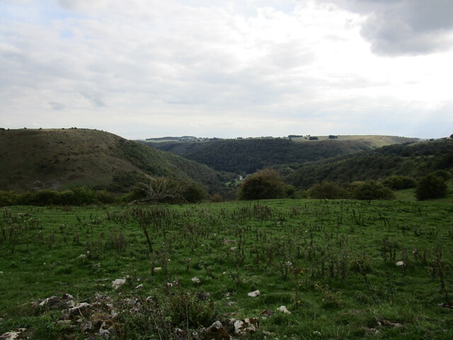
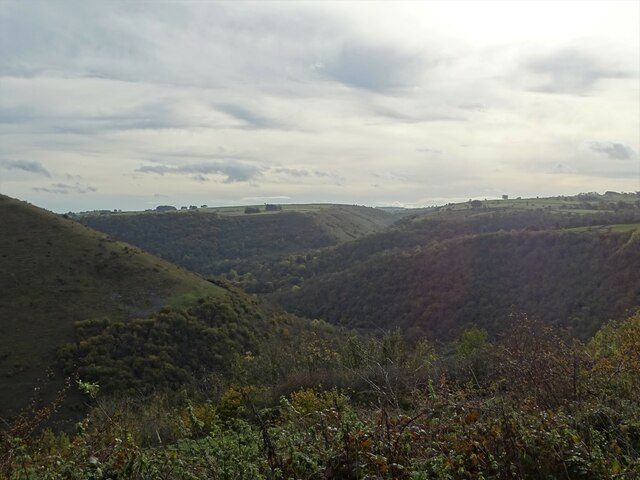
Great Shacklow Wood is a captivating woodland located in the county of Derbyshire, England. Covering an area of approximately 100 hectares, it is situated in the Peak District National Park, near the town of Bakewell. The wood is renowned for its diverse flora and fauna, making it a popular destination for nature enthusiasts and hikers.

The woodland is predominantly composed of deciduous trees, such as oak, birch, and beech, which create a picturesque and vibrant canopy during the spring and summer months. The forest floor is adorned with a rich carpet of wildflowers, including bluebells, wood anemones, and primroses, creating a captivating display of colors.

Great Shacklow Wood is also home to a variety of wildlife. Birdwatchers can spot species such as woodpeckers, nuthatches, and tawny owls. Furthermore, the wood provides a habitat for mammals such as badgers, foxes, and deer.

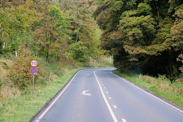
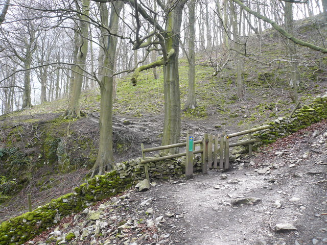
Visitors can explore the wood via a network of well-maintained footpaths and trails. The area offers a range of routes suitable for different abilities, from leisurely strolls to more challenging hikes. The wood is particularly enchanting in autumn when the foliage transforms into a stunning array of red, orange, and gold tones.

Great Shacklow Wood provides a peaceful and tranquil escape from the hustle and bustle of city life. Its natural beauty and biodiversity make it a must-visit destination for anyone seeking to immerse themselves in the wonders of nature.

If you have any feedback on the listing, please let us know in the comments section below.

Great Shacklow Wood Images

Images are sourced within 2km of 53.223744/-1.7375464 or Grid Reference SK1769. Thanks to Geograph Open Source API. All images are credited.

Path in Monsal Dale Looking up the dale. The River Wye is off to the right.
Path in Monsal Dale
Looking up the dale. The River Wye is off to the right.
Path by the River Wye Heading down Monsal Dale.
Path by the River Wye
Heading down Monsal Dale.
Path towards Deep Dale There is a bit of autumn mistiness.
Path towards Deep Dale
There is a bit of autumn mistiness.
Path in the lower end of Deep Dale The path here is on damp limestone which tends to be a bit slippery.
Path in the lower end of Deep Dale
The path here is on damp limestone which tends to be a bit slippery.
Path down to White Lodge The River Wye flows in the valley ahead and Fin Cop is in the background.
Path down to White Lodge
The River Wye flows in the valley ahead and Fin Cop is in the background.
View over Monsal Dale Monsal Dale is a valley cut by the River Wye.
View over Monsal Dale
Monsal Dale is a valley cut by the River Wye.
Taddington Dale
Taddington Dale
A6, Taddington Wood The A6 is Britain's fourth longest road and one of the main historic north-south roads in England. It currently runs for 299 miles from Luton in Bedfordshire to Carlisle in Cumbria, although it formerly started at a junction with the A1 at Barnet.

Running north west from Luton, the road travels through Bedford, bypasses Rushden, Kettering and Market Harborough, continues through Leicester, Loughborough, Derby and Matlock before going through the Peak District to Bakewell, Buxton, Stockport, Manchester, Salford, Pendleton, Irlams o' th' Height, Pendlebury, Swinton, Walkden, Little Hulton, Bolton, Chorley, Preston, Lancaster, Kendal and Penrith before reaching Carlisle.

See <span class="nowrap"><a title="http://en.wikipedia.org/wiki/A6_road_(England)" rel="nofollow ugc noopener" href="http://en.wikipedia.org/wiki/A6_road_(England)">Link</a><img style="margin-left:2px;" alt="External link" title="External link - shift click to open in new window" src="https://s1.geograph.org.uk/img/external.png" width="10" height="10"/></span> (Wikipedia) and <span class="nowrap"><a title="http://www.sabre-roads.org.uk/wiki/index.php?title=A6" rel="nofollow ugc noopener" href="http://www.sabre-roads.org.uk/wiki/index.php?title=A6">Link</a><img style="margin-left:2px;" alt="External link" title="External link - shift click to open in new window" src="https://s1.geograph.org.uk/img/external.png" width="10" height="10"/></span> (SABRE) for more information.
A6, Taddington Wood
The A6 is Britain's fourth longest road and one of the main historic north-south roads in England. It currently runs for 299 miles from Luton in Bedfordshire to Carlisle in Cumbria, although it formerly started at a junction with the A1 at Barnet. Running north west from Luton, the road travels through Bedford, bypasses Rushden, Kettering and Market Harborough, continues through Leicester, Loughborough, Derby and Matlock before going through the Peak District to Bakewell, Buxton, Stockport, Manchester, Salford, Pendleton, Irlams o' th' Height, Pendlebury, Swinton, Walkden, Little Hulton, Bolton, Chorley, Preston, Lancaster, Kendal and Penrith before reaching Carlisle. See LinkExternal link (Wikipedia) and LinkExternal link (SABRE) for more information.
Deep Dale The northern (lower) end of Deep Dale
Deep Dale
The northern (lower) end of Deep Dale
River Wye in Monsal Dale The river runs (to the right) across the southeastern corner of the square, and is seen here from the path following the right bank from Monsal Head Viaduct to White Lodge car park. Beyond are the slopes (in SK1770) below Fin Cop.
River Wye in Monsal Dale
The river runs (to the right) across the southeastern corner of the square, and is seen here from the path following the right bank from Monsal Head Viaduct to White Lodge car park. Beyond are the slopes (in SK1770) below Fin Cop.
Path by the Wye This bank of the Wye runs through the square for a mere 50 metres (the far bank for only about 20 metres). The path to Monsal Head is hemmed in between the steep wooded slopes and trees overhanging the water.
Path by the Wye
This bank of the Wye runs through the square for a mere 50 metres (the far bank for only about 20 metres). The path to Monsal Head is hemmed in between the steep wooded slopes and trees overhanging the water.
Public conveniences, White Lodge car park At the far end of the car park, an easily overlooked feature of a dramatic square at the southern end of Monsal Dale.
Public conveniences, White Lodge car park
At the far end of the car park, an easily overlooked feature of a dramatic square at the southern end of Monsal Dale.
Path junction above Dimin Dale Taken from the path descending from Great Shacklow Wood. The path down to the A6 and Monsal Dale is on the right. On the left behind the hawthorn, a path continues into Deep Dale.
Path junction above Dimin Dale
Taken from the path descending from Great Shacklow Wood. The path down to the A6 and Monsal Dale is on the right. On the left behind the hawthorn, a path continues into Deep Dale.
A6 View towards Taddington Dale
Footpath  View at top left hand side of  White Lodge Car Park At the time that this footpath was accessed, it was difficult to say whether it was a path or a stream.
Footpath View at top left hand side of White Lodge Car Park
At the time that this footpath was accessed, it was difficult to say whether it was a path or a stream.
Gate entrance to Great Shacklow Wood
View towards Lees Bottom
Public footpath in Deep Dale It had rained heavily recently. Our walk up Deep Dale had to be diverted when the public footpath was temporarily a roaring torrent. It was OK again by the time we reached the end of our circuit.
Public footpath in Deep Dale
It had rained heavily recently. Our walk up Deep Dale had to be diverted when the public footpath was temporarily a roaring torrent. It was OK again by the time we reached the end of our circuit.
Show me another place!

Great Shacklow Wood is located at Grid Ref: SK1769 (Lat: 53.223744, Lng: -1.7375464)

Administrative County: Derbyshire

District: Derbyshire Dales

Police Authority: Derbyshire

What 3 Words

///stapled.spearhead.animated. Near Bakewell, Derbyshire

Related Wikis

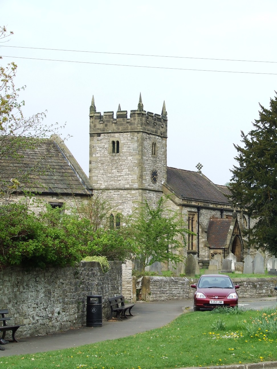
St Michael and All Angels' Church, Sheldon

St Michael and All Angels’ Church, Sheldon is a Grade II listed parish church in the Church of England in Sheldon, Derbyshire. == History == The original...

Sheldon, Derbyshire

Sheldon is a village in the Derbyshire Peak District, England near Bakewell. It is best known for being the closest village to Magpie Mine, a lead mine...

Fin Cop

Fin Cop is a hill and an associated Iron Age hill fort in Monsal Dale, close to Ashford in the Water in Derbyshire, England.The fort shows evidence of...

Magpie Mine

Magpie Mine is a well-preserved disused lead mine near the village of Sheldon in Derbyshire, England, in the parish of Ashford in the Water. The walled...

Holy Trinity Church, Ashford-in-the-Water

Holy Trinity Church, Ashford-in-the-Water is a Grade II listed parish church in the Church of England: 66  in Ashford-in-the-Water, Derbyshire. == History... ==

Ashford Black Marble

Ashford Black Marble is the name given to a dark limestone, quarried from mines near Ashford-in-the-Water, in Derbyshire, England. Once cut, turned and...

Ashford-in-the-Water

Ashford-in-the-Water is a village and civil parish in the Derbyshire Peak District, England. The village is on the River Wye, 2 miles (3 km) north-west...

Monsal Dale railway station

Monsal Dale railway station was opened in 1866 by the Midland Railway on its line from Rowsley, extending the Manchester, Buxton, Matlock and Midlands...

Nearby Amenities

Located within 500m of 53.223744,-1.7375464
Note: Water coming out of old lead mine.
Lat/Long: 53.2230562/-1.7327232
Man Made: adit
Lat/Long: 53.2231801/-1.7326259
Ele: 209.0000000
Lat/Long: 53.2203363/-1.7329944
Ele: 202.0000000
Lat/Long: 53.2206839/-1.7331069
Ele: 187.0000000
Lat/Long: 53.2213364/-1.7320493
Ele: 203.0000000
Lat/Long: 53.2205972/-1.7332785
Barrier: stile
Material: stone
Source: survey;bing;gps
Stile: stepover
Lat/Long: 53.2206902/-1.7390888
Waterway: weir
Lat/Long: 53.2233988/-1.7300592
Board Title: Great Shacklow Steps
Information: board
Material: wood
Tourism: information
Lat/Long: 53.2252923/-1.7382699
The data included in this document is from www.openstreetmap.org. The data is made available under ODbL.

Have you been to Great Shacklow Wood?

Leave your review of Great Shacklow Wood below (or comments, questions and feedback).