Shrogg Wood

Wood, Forest in Yorkshire

England

Shrogg Wood

Millennium Gate, Jenkyn Lane, Shepley See <span class="nowrap"><a title="https://www.shepleyvillage.org/village-association-news-august-2014/" rel="nofollow ugc noopener" href="https://www.shepleyvillage.org/village-association-news-august-2014/">Link</a><img style="margin-left:2px;" alt="External link" title="External link - shift click to open in new window" src="https://s1.geograph.org.uk/img/external.png" width="10" height="10"/></span> for a better photograph.
Millennium Gate, Jenkyn Lane, Shepley Credit: Humphrey Bolton

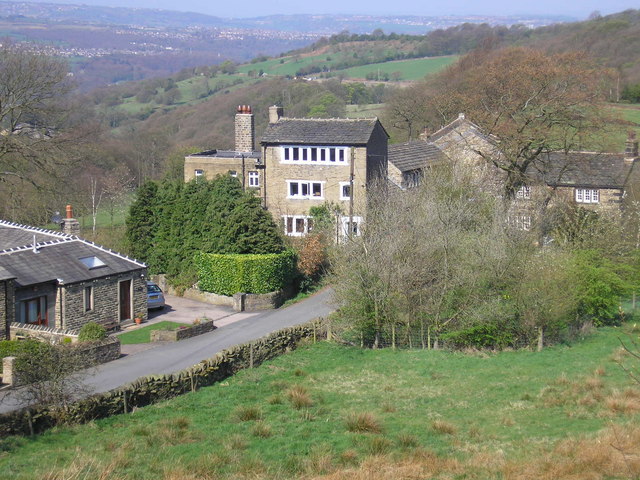
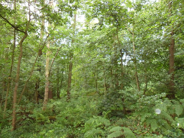
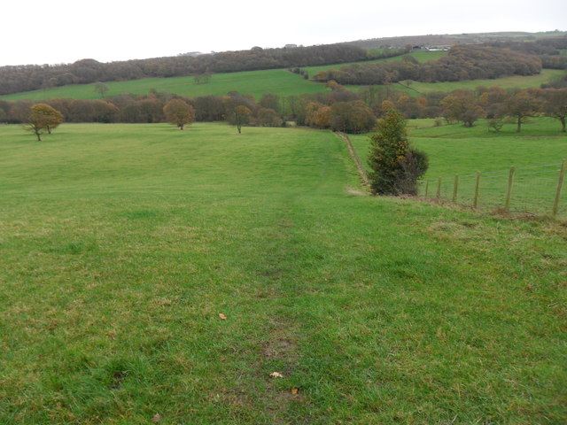
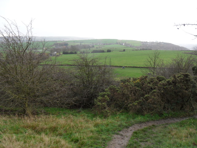
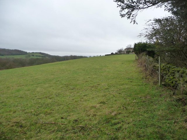
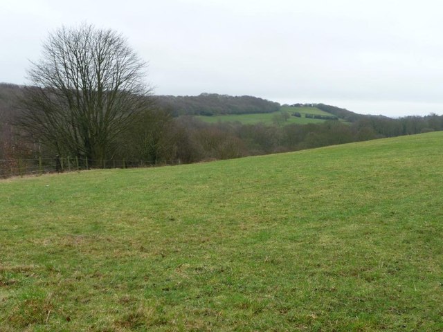
Shrogg Wood is a picturesque forest located in the county of Yorkshire, England. Spread across an area of approximately 50 acres, this woodland is nestled in a rural setting, providing a tranquil and serene environment for visitors to immerse themselves in nature.

The woodland boasts a rich and diverse ecosystem, characterized by a variety of tree species such as oak, beech, and ash. The towering trees create a dense canopy that filters sunlight, casting ethereal shadows on the forest floor. This allows for the growth of an array of flora, including wildflowers, ferns, and mosses, adding to the enchanting beauty of Shrogg Wood.

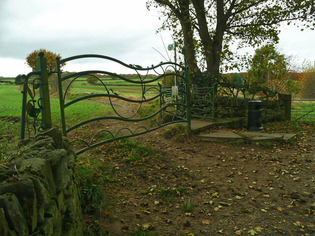
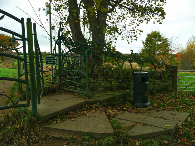
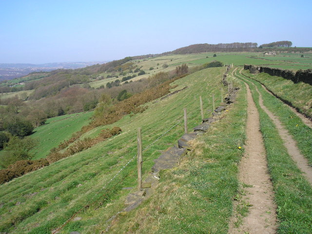
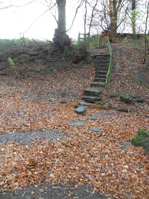
The forest is crisscrossed by a network of well-maintained walking trails, offering visitors the opportunity to explore its natural wonders. These paths wind through the woodland, leading visitors past babbling brooks, hidden ponds, and charming clearings. The tranquil atmosphere and the sound of birdsong make Shrogg Wood an ideal location for walking, birdwatching, or simply finding a peaceful spot to relax.

The forest also provides a habitat for a variety of wildlife. Squirrels scamper through the trees, while rabbits and deer can often be spotted grazing in the open meadows. The wood is also home to numerous bird species, including woodpeckers, owls, and various songbirds.

Shrogg Wood is a true gem of Yorkshire, offering visitors a chance to escape the hustle and bustle of everyday life and connect with nature. Whether it's exploring the trails, observing the diverse flora and fauna, or simply enjoying the tranquility, this woodland is a must-visit for nature enthusiasts and those seeking a peaceful retreat.

If you have any feedback on the listing, please let us know in the comments section below.
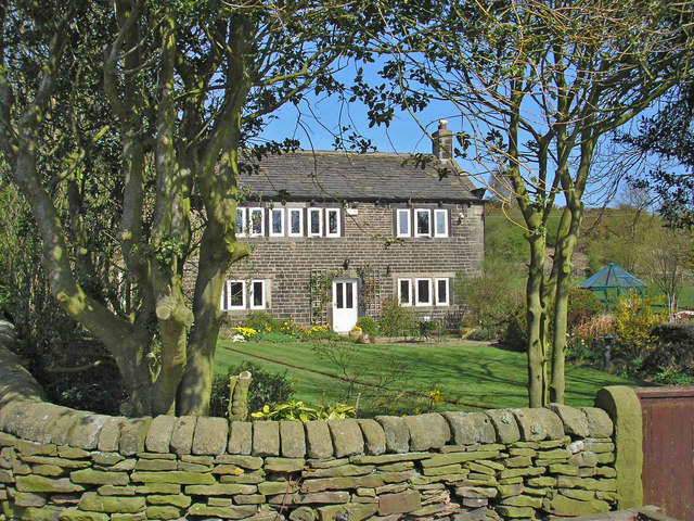
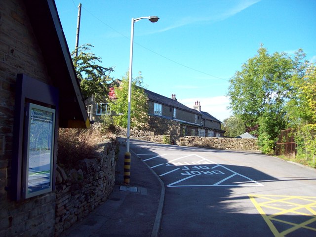
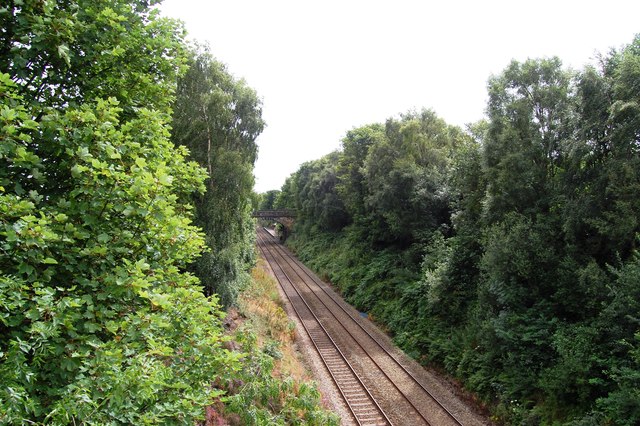
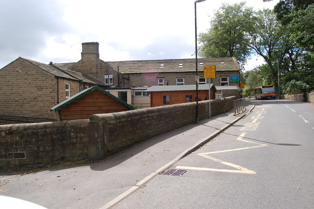
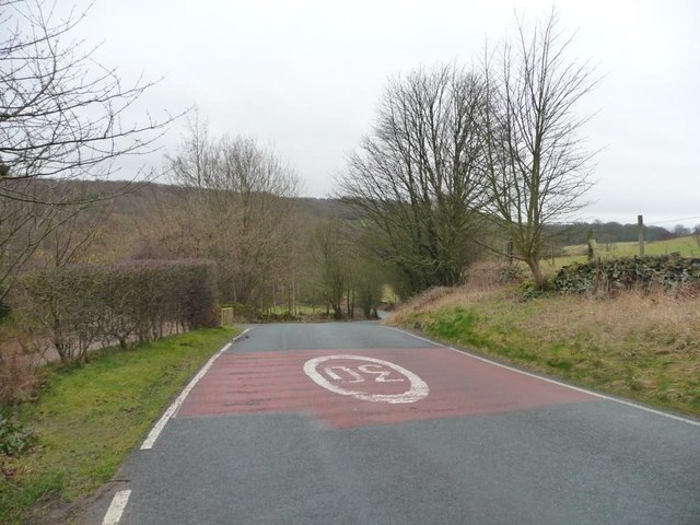
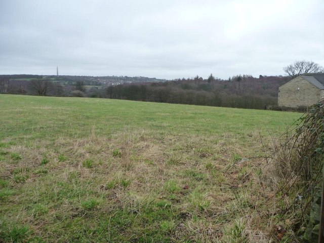
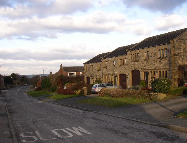
Shrogg Wood Images

Images are sourced within 2km of 53.595373/-1.7360973 or Grid Reference SE1711. Thanks to Geograph Open Source API. All images are credited.

Millennium Gate, Jenkyn Lane, Shepley See <span class="nowrap"><a title="https://www.shepleyvillage.org/village-association-news-august-2014/" rel="nofollow ugc noopener" href="https://www.shepleyvillage.org/village-association-news-august-2014/">Link</a><img style="margin-left:2px;" alt="External link" title="External link - shift click to open in new window" src="https://s1.geograph.org.uk/img/external.png" width="10" height="10"/></span> for a better photograph.
Millennium Gate, Jenkyn Lane, Shepley
See LinkExternal link for a better photograph.
Part of the Millennium Gate, Jenkyn Lane, Shepley This is a revisit to the first geograph for the square: <a href="https://www.geograph.org.uk/photo/81818">SE1809 : Ornate Gateway on the Kirklees Way</a> taken in June 2005. I litter bin has been provided and the foot gate now has a sign asking people to keep to the public footpath.
Part of the Millennium Gate, Jenkyn Lane, Shepley
This is a revisit to the first geograph for the square: SE1809 : Ornate Gateway on the Kirklees Way taken in June 2005. I litter bin has been provided and the foot gate now has a sign asking people to keep to the public footpath.
Top of the Hill A weavers' hamlet below Thurstonland.
Top of the Hill
A weavers' hamlet below Thurstonland.
Lane near Thurstonland An old lane along the edge of a steep drop.
Lane near Thurstonland
An old lane along the edge of a steep drop.
Height Green A farmhouse between Thurstonland and Farnley Tyas.
Height Green
A farmhouse between Thurstonland and Farnley Tyas.
Stocksmoor Station Exit and Clothiers Arms Slip road leading out of this small railway station which is situated on the picturesque Penistone Line. In the background is the Clothiers Arms Public House.
Stocksmoor Station Exit and Clothiers Arms
Slip road leading out of this small railway station which is situated on the picturesque Penistone Line. In the background is the Clothiers Arms Public House.
Penistone Line near Stocksmoor Station
Thurstonland Primary School
Clough Wood Clough Wood near Stocksmoor.  Taken looking west from public footpath on a wet July day 2011.
Clough Wood
Clough Wood near Stocksmoor. Taken looking west from public footpath on a wet July day 2011.
Cinderhill (block C), Storthes Hall Park Huddersfield University's student accommodation on Storthes Hall Lane, Kirkburton
Cinderhill (block C), Storthes Hall Park
Huddersfield University's student accommodation on Storthes Hall Lane, Kirkburton
Shepley Dike, Thunder Bridge Looking along Shepley Dike towards Thunder Bridge.
Shepley Dike, Thunder Bridge
Looking along Shepley Dike towards Thunder Bridge.
Stone Wood Dike, near Shepley Stepping stones over Stone Wood Dike.
Stone Wood Dike, near Shepley
Stepping stones over Stone Wood Dike.
Field path, near Thurstonland Looking down field-edge path back towards Shepley.  Mathewman Wood is in the distance.
Field path, near Thurstonland
Looking down field-edge path back towards Shepley. Mathewman Wood is in the distance.
Farnley Moor footpath Looking south from the edge of Farnley Moor.  Thurstonland is in the distance.
Farnley Moor footpath
Looking south from the edge of Farnley Moor. Thurstonland is in the distance.
The eastern edge of Stocksmoor Below the houses' back gardens, above Stone Wood Dike.
The eastern edge of Stocksmoor
Below the houses' back gardens, above Stone Wood Dike.
Stone Wood The steep wooded valley of Stone Wood Dike, seen from Shepley Lane.
Stone Wood
The steep wooded valley of Stone Wood Dike, seen from Shepley Lane.
Shepley Lane Dropping down the valley side of Stone Wood Dike, at the edge of Stocksmoor village.
Shepley Lane
Dropping down the valley side of Stone Wood Dike, at the edge of Stocksmoor village.
Farmland north of Shepley Road With a distant view of Emley TV mast, 4 or 5 kilometres away.
Farmland north of Shepley Road
With a distant view of Emley TV mast, 4 or 5 kilometres away.
Show me another place!

Shrogg Wood is located at Grid Ref: SE1711 (Lat: 53.595373, Lng: -1.7360973)

Division: West Riding

Unitary Authority: Kirklees

Police Authority: West Yorkshire

What 3 Words

///dignitary.deprives.novelists. Near Shepley, West Yorkshire

Related Wikis

Stocksmoor

Stocksmoor is a hamlet, near Huddersfield, West Yorkshire, England. It is situated between the villages of Shepley and Brockholes. The total population...

Stocksmoor railway station

Stocksmoor railway station serves the village of Stocksmoor near Huddersfield in West Yorkshire, England. The station is 6.25 miles (10 km) from Huddersfield...

Thurstonland and Farnley Tyas Urban District

Thurstonland and Farnley Tyas was an urban district in the West Riding of Yorkshire from 1925 to 1938. It was created in 1925 by the merger of the Thurstonland...

Church of St Thomas, Thurstonland

The Church of St Thomas, Thurstonland, West Yorkshire, England, is an Anglican church. It is an Arts and Crafts building in Gothic Revival style, designed...

Nearby Amenities

Located within 500m of 53.595373,-1.7360973
Bus Stop
Browns Knoll Road Ing Head Lane
Local Ref: 45018748
Naptan AtcoCode: 450018748
Naptan Bearing: NW
Naptan CommonName: Browns Knoll Road Ing Head Lane
Naptan Crossing: Ing Head lane
Naptan Indicator: Stop 45018748
Naptan Landmark: Butts Farm
Naptan PlusbusZoneRef: LEEDS
Naptan ShortCommonName: Ing Head Lane
Naptan Street: Brown-s Knoll Road
Naptan Verified: no
Source: naptan_import
Lat/Long: 53.5930327/-1.7401614
Bus Stop
Stocks Moor Road Whitestones
Local Ref: 45018749
Naptan AtcoCode: 450018749
Naptan Bearing: E
Naptan CommonName: Stocks Moor Road Whitestones
Naptan Crossing: Whitestones
Naptan Indicator: Stop 45018749
Naptan PlusbusZoneRef: LEEDS
Naptan ShortCommonName: Whitestones
Naptan Street: Stocks Moor Road
Naptan Verified: no
Source: naptan_import
Lat/Long: 53.5938904/-1.7336743
Bus Stop
Stocks Moor Road
Bus: yes
Local Ref: 45018750
Naptan AtcoCode: 450018750
Naptan Bearing: E
Naptan CommonName: Stocks Moor Road
Naptan Crossing: Nr-Opp Crangle Fields
Naptan Indicator: Stop 45018750
Naptan PlusbusZoneRef: LEEDS
Naptan ShortCommonName: Cross Lane
Naptan Street: Stocks Moor Road
Naptan Verified: no
Public Transport: platform
Source: naptan_import
Lat/Long: 53.5946614/-1.7288043
Bus Stop
Cross Lane Stocks Moor Road
Bus: yes
Local Ref: 45018753
Naptan AtcoCode: 450018753
Naptan Bearing: NW
Naptan CommonName: Cross Lane Stocks Moor Road
Naptan Crossing: Stocks Moor Road
Naptan Indicator: Stop 45018753
Naptan PlusbusZoneRef: LEEDS
Naptan ShortCommonName: Stocks Moor Road
Naptan Street: Cross Lane
Naptan Verified: no
Public Transport: platform
Source: naptan_import
Lat/Long: 53.5941968/-1.730016
Brown-s Knoll Road Butts Farm
Local Ref: 45050682
Naptan AtcoCode: 450050682
Naptan Bearing: SE
Naptan BusStopType: CUS
Naptan CommonName: Brown-s Knoll Road Butts Farm
Naptan Indicator: Stop 45050682
Naptan PlusbusZoneRef: LEEDS
Naptan ShortCommonName: Stocks Moor Road
Naptan Street: Brown-s Knoll Road
Naptan Verified: no
Source: naptan_import
Lat/Long: 53.5931044/-1.74004
Stocks Moor Road
Local Ref: 45050683
Naptan AtcoCode: 450050683
Naptan Bearing: W
Naptan BusStopType: CUS
Naptan CommonName: Stocks Moor Road
Naptan Indicator: Stop 45050683
Naptan PlusbusZoneRef: LEEDS
Naptan ShortCommonName: White Stones
Naptan Street: Stocks Moor Road
Naptan Verified: no
Source: naptan_import
Lat/Long: 53.5937554/-1.7335996
Post Box
Collection Plate Date: 2017-09-19
Collection Times: Mo-Fr 16:30; Sa 10:30
Operator: Royal Mail
Post Box Type: wall
Ref: HD4 343
Royal Cypher: GR
Royal Cypher Wikidata: Q33102273
Source: survey
Lat/Long: 53.5943139/-1.7300975
Barrier: stile
Step Count: 3
Stile: stepover
Lat/Long: 53.5960229/-1.7331728
Barrier: stile
Stile: squeezer
Lat/Long: 53.5975581/-1.7337952
Barrier: kissing_gate
Lat/Long: 53.5940999/-1.7314986
Barrier: kissing_gate
Lat/Long: 53.5954298/-1.7324702
Barrier: stile
Step Count: 1
Stile: stepover
Lat/Long: 53.5919941/-1.7312011
Barrier: stile
Step Count: 2
Stile: stepover
Lat/Long: 53.5961304/-1.7332035
Railway: crossing
Lat/Long: 53.5960705/-1.7331837
Barrier: stile
Stile: stepover
Lat/Long: 53.5920171/-1.7311443
Barrier: stile
Lat/Long: 53.5997711/-1.7349145
Barrier: stile
Lat/Long: 53.5988749/-1.7387237
Barrier: stile
Step Count: 3
Stile: stepover
Lat/Long: 53.5974139/-1.7409917
Barrier: stile
Step Count: 2
Stile: stepover
Lat/Long: 53.5981959/-1.7395199
Barrier: stile
Stile: squeezer
Lat/Long: 53.5919294/-1.7321029
Barrier: stile
Step Count: 2
Stile: stepover
Lat/Long: 53.5922689/-1.7388901
Barrier: stile
Step Count: 1
Stile: stepover
Lat/Long: 53.5909672/-1.7355424
Format: squared_stone
Historic: milestone
Lat/Long: 53.5928102/-1.7395629
Barrier: stile
Step Count: 3
Stile: stepover
Lat/Long: 53.5963034/-1.7435025
Defibrillator
Access: yes
Defibrillator Location: On outside wall.
Emergency: defibrillator
Indoor: no
Lat/Long: 53.593716/-1.733852
The data included in this document is from www.openstreetmap.org. The data is made available under ODbL.

Have you been to Shrogg Wood?

Leave your review of Shrogg Wood below (or comments, questions and feedback).