Manchester Plantation

Wood, Forest in Derbyshire Derbyshire Dales

England

Manchester Plantation

View across pasture to the Jug and Glass Inn from Green Lane The Jug and Glass Inn is located on the A515
View across pasture to the Jug and Glass Inn from Green Lane Credit: Philip Cornwall

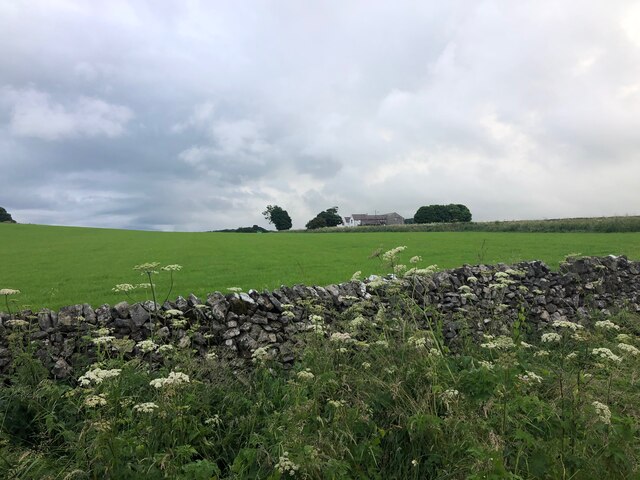
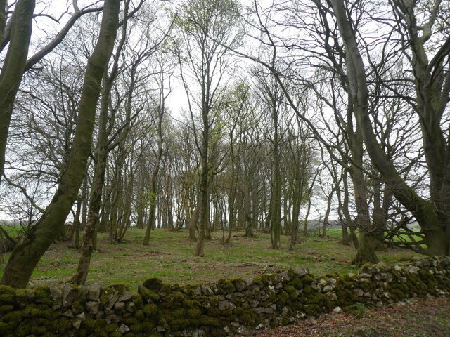
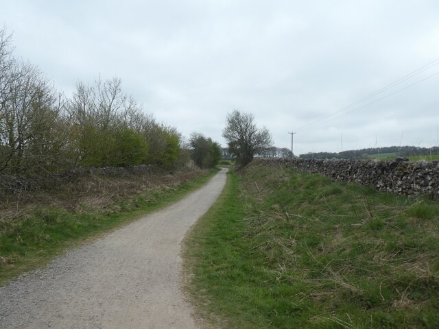
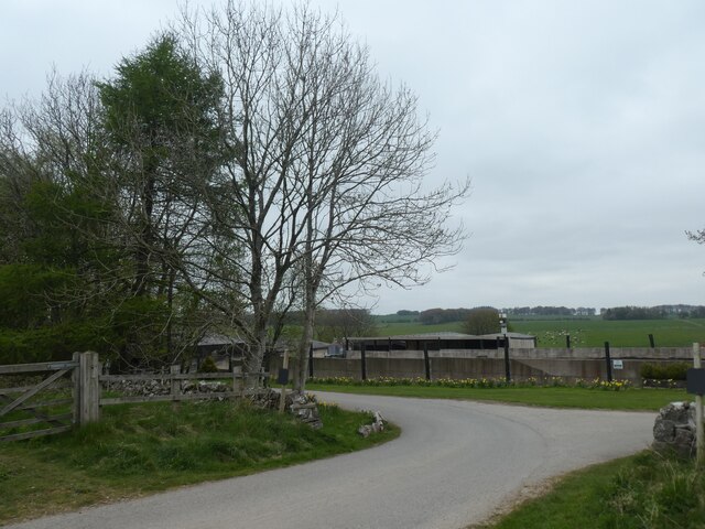
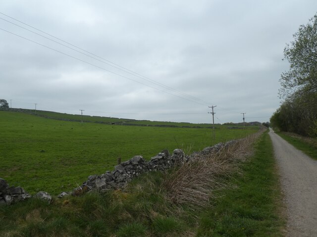
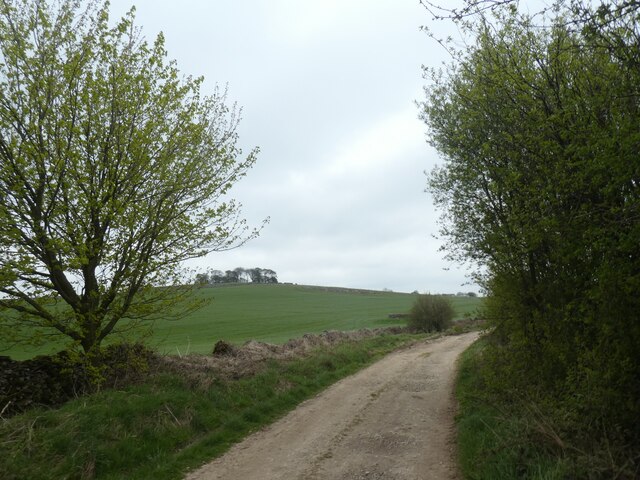
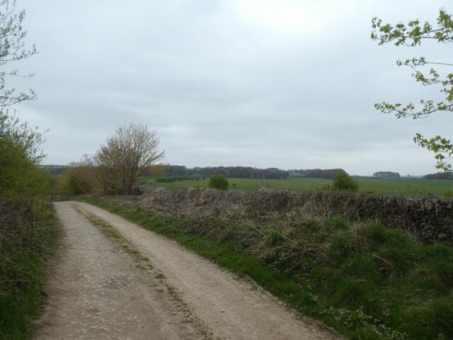
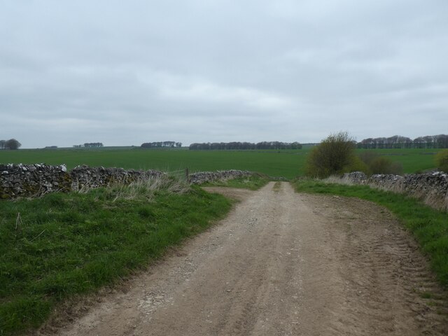
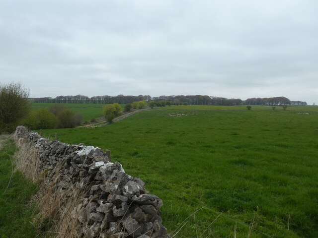
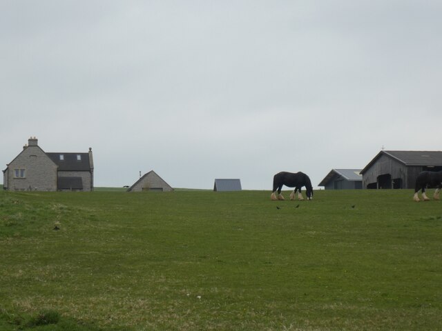
Manchester Plantation is a picturesque woodland located in Derbyshire, England. Covering an area of approximately 200 acres, this enchanting forest is known for its diverse range of flora and fauna, making it a popular destination for nature enthusiasts. Situated just a few miles away from the bustling city of Manchester, this plantation offers a serene and tranquil retreat from the urban chaos.

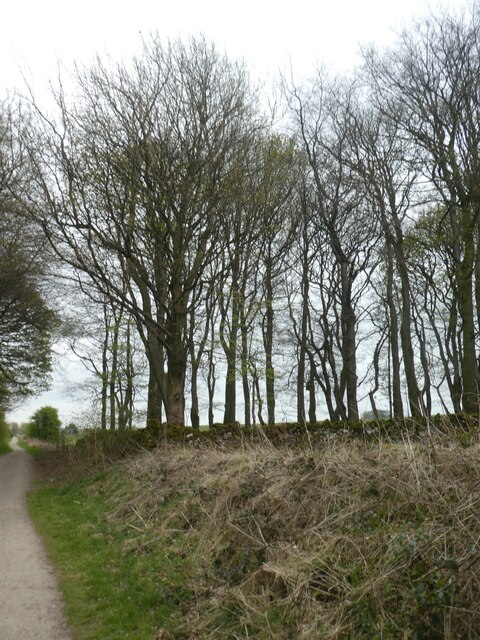
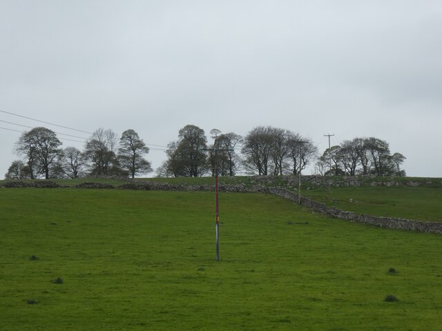
The woodland is predominantly composed of ancient oak and beech trees, which create a dense canopy, allowing only dappled sunlight to filter through. This creates a unique and ethereal atmosphere, making it a perfect spot for peaceful walks and picnics. The forest floor is adorned with a rich carpet of wildflowers, including bluebells, primroses, and wood anemones, providing a vibrant display of color during the spring season.

Manchester Plantation is also home to a wide array of wildlife. Visitors may catch a glimpse of roe deer, foxes, badgers, and various species of birds, such as owls, woodpeckers, and wrens. The plantation is a sanctuary for many rare and endangered species, making it an important conservation area.

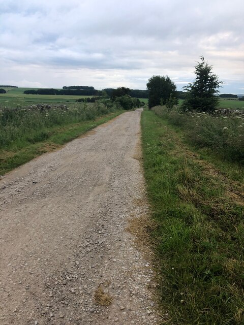
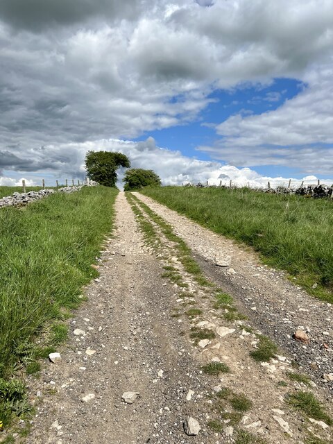
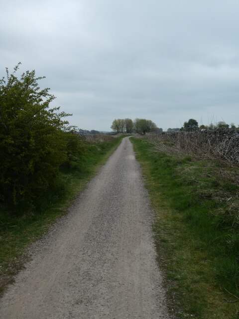
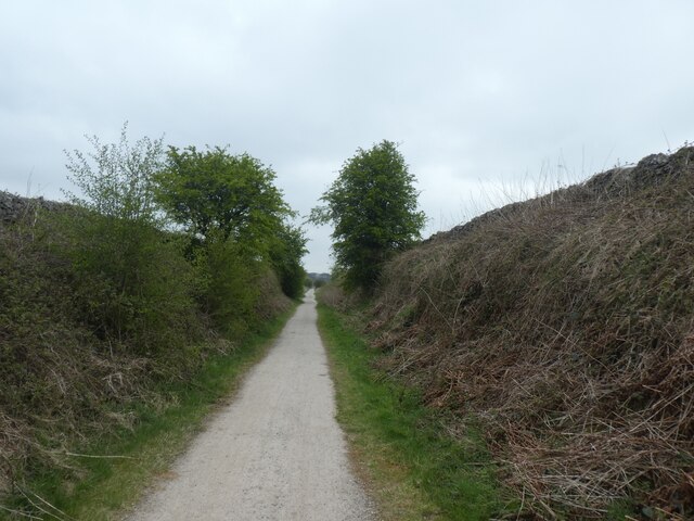
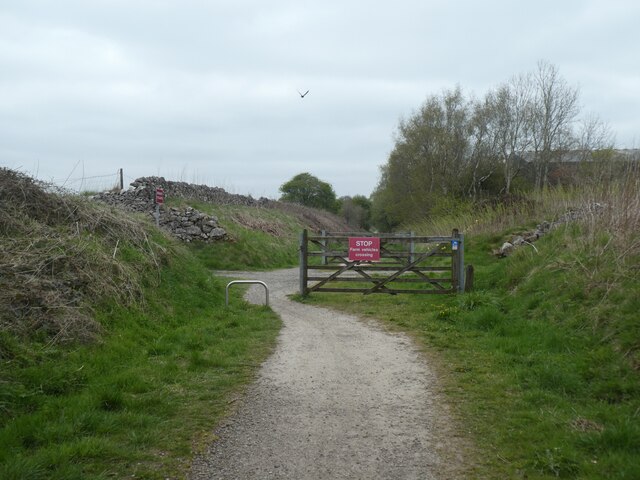
The woodland is well-maintained, with several marked trails that guide visitors through its enchanting beauty. It is advisable to wear appropriate footwear, as some paths can be uneven or muddy. There are also several picnic areas and benches scattered throughout the plantation, providing opportunities for visitors to relax and enjoy the tranquility of the surroundings.

In conclusion, Manchester Plantation in Derbyshire is a captivating woodland that offers a peaceful escape from the urban hustle and bustle. Its ancient trees, vibrant wildflowers, and diverse wildlife make it a must-visit destination for nature lovers and those seeking a respite in the lap of nature.

If you have any feedback on the listing, please let us know in the comments section below.

Manchester Plantation Images

Images are sourced within 2km of 53.153343/-1.7420578 or Grid Reference SK1761. Thanks to Geograph Open Source API. All images are credited.

View across pasture to the Jug and Glass Inn from Green Lane The Jug and Glass Inn is located on the A515
View across pasture to the Jug and Glass Inn from Green Lane
The Jug and Glass Inn is located on the A515
Green Lane A well maintained track near Caskinlow Farm
Green Lane
A well maintained track near Caskinlow Farm
Green Lane Looking in a north eastern direction up Green Lane.
Green Lane
Looking in a north eastern direction up Green Lane.
High Peak Trail by Blakemoor Plantation A rectangular woodland, cut through by the railway track
High Peak Trail by Blakemoor Plantation
A rectangular woodland, cut through by the railway track
Blakemoor Plantation
High Peak Trail east of Caskinlow Farm The Pennine Bridleway is a new National Trail.
It runs roughly parallel with the Pennine Way but provides access for horseback riders and cyclists as well as walkers. The trail is around 205 miles long, extending from Derbyshire to Cumbria.
Wikipedia: <span class="nowrap"><a title="https://en.wikipedia.org/wiki/Pennine_Bridleway" rel="nofollow ugc noopener" href="https://en.wikipedia.org/wiki/Pennine_Bridleway">Link</a><img style="margin-left:2px;" alt="External link" title="External link - shift click to open in new window" src="https://s1.geograph.org.uk/img/external.png" width="10" height="10"/></span>
High Peak Trail east of Caskinlow Farm
The Pennine Bridleway is a new National Trail. It runs roughly parallel with the Pennine Way but provides access for horseback riders and cyclists as well as walkers. The trail is around 205 miles long, extending from Derbyshire to Cumbria. Wikipedia: LinkExternal link
Scrub and trees by High Peak Trail The High Peak Trail follows the route of the Cromford and High Peak Railway which was completed in 1831 and axed as part of the Beeching cuts in the 1960s.
Scrub and trees by High Peak Trail
The High Peak Trail follows the route of the Cromford and High Peak Railway which was completed in 1831 and axed as part of the Beeching cuts in the 1960s.
Farmland east of High Peak Trail near Brundcliffe The High Peak Trail follows the route of the Cromford and High Peak Railway which was completed in 1831 and axed as part of the Beeching cuts in the 1960s.
Farmland east of High Peak Trail near Brundcliffe
The High Peak Trail follows the route of the Cromford and High Peak Railway which was completed in 1831 and axed as part of the Beeching cuts in the 1960s.
High Peak Trail south of Brundcliffe The High Peak Trail follows the route of the Cromford and High Peak Railway which was completed in 1831 and axed as part of the Beeching cuts in the 1960s.
High Peak Trail south of Brundcliffe
The High Peak Trail follows the route of the Cromford and High Peak Railway which was completed in 1831 and axed as part of the Beeching cuts in the 1960s.
Entrance road to Brundcliffe Brundcliffe is a small farm by the High Peak Trail
Entrance road to Brundcliffe
Brundcliffe is a small farm by the High Peak Trail
High Peak Trail passing Brundcliffe The High Peak Trail follows the route of the Cromford and High Peak Railway which was completed in 1831 and axed as part of the Beeching cuts in the 1960s.
High Peak Trail passing Brundcliffe
The High Peak Trail follows the route of the Cromford and High Peak Railway which was completed in 1831 and axed as part of the Beeching cuts in the 1960s.
A patch of woodland west of Brundcliffe A view of these trees from the A515 is at <a href="https://www.geograph.org.uk/photo/5430985">SK1561 : A stand of trees near Newhaven</a>.  The OS map notes a tumulus here.
A patch of woodland west of Brundcliffe
A view of these trees from the A515 is at SK1561 : A stand of trees near Newhaven. The OS map notes a tumulus here.
Track to A515 from High Peak Trail The OS map notes a tumulus in the stand of trees on the skyline
Track to A515 from High Peak Trail
The OS map notes a tumulus in the stand of trees on the skyline
Green Lane to A515
Green Lane to A515
Green Lane leading across High Peak Trail
Green Lane north of High Peak Trail The lane can be seen dipping and rising to a line of trees, which form a field boundary along the course of a Roman road
Green Lane north of High Peak Trail
The lane can be seen dipping and rising to a line of trees, which form a field boundary along the course of a Roman road
Horse grazing at Caskinlow Farm
High Peak Trail at Arbor Low Meadows Farm The sign "STOP Farm Vehicles Crossing" is not part of a campaign against farm vehicles!
High Peak Trail at Arbor Low Meadows Farm
The sign "STOP Farm Vehicles Crossing" is not part of a campaign against farm vehicles!
Show me another place!

Manchester Plantation is located at Grid Ref: SK1761 (Lat: 53.153343, Lng: -1.7420578)

Administrative County: Derbyshire

District: Derbyshire Dales

Police Authority: Derbyshire

What 3 Words

///ample.confining.suppose. Near Newhaven, Derbyshire

Related Wikis

Middleton and Smerrill

Middleton and Smerrill is a civil parish within the Derbyshire Dales district, in the county of Derbyshire, England. Largely rural except for the village...

Friden Goods Yard

Friden Goods Yard was a goods station located on the Cromford and High Peak Railway near the villages of Friden in Derbyshire. Mostly for moving mineral...

Friden, Derbyshire

Friden is a hamlet in the civil parish of Hartington Nether Quarter, Derbyshire, England. It is 11 miles (18 km) south-east of Buxton, just off the Newhaven...

High Peak Trail

The High Peak Trail is a 17-mile (27 km) trail for walkers, cyclists and horse riders in the Peak District of England. Running from Dowlow (53.2059°N 1...

Newhaven, Derbyshire

Newhaven is a hamlet in the county of Derbyshire, England, east of Hartington and west of Cromford. The principal employer in the area is DSF Refractories...

Gib Hill

Gib Hill is a large burial mound in the Peak District, Derbyshire, England. It is thought to be a Neolithic oval barrow with an Early Bronze Age round...

Arbor Low

Arbor Low is a well-preserved Neolithic henge in the Derbyshire Peak District, England. It lies on a Carboniferous Limestone plateau known as the White...

Long Dale

Long Dale is a carboniferous limestone valley near the village of Elton, Derbyshire, in the Peak District of England. The dale is cut into the plateau...

Nearby Amenities

Located within 500m of 53.153343,-1.7420578
Barrier: cattle_grid
Bicycle: yes
Foot: yes
Lat/Long: 53.1528518/-1.7372109
The data included in this document is from www.openstreetmap.org. The data is made available under ODbL.

Have you been to Manchester Plantation?

Leave your review of Manchester Plantation below (or comments, questions and feedback).