Newhaven Plantation

Wood, Forest in Derbyshire Derbyshire Dales

England

Newhaven Plantation

View across pasture to the Jug and Glass Inn from Green Lane The Jug and Glass Inn is located on the A515
View across pasture to the Jug and Glass Inn from Green Lane Credit: Philip Cornwall

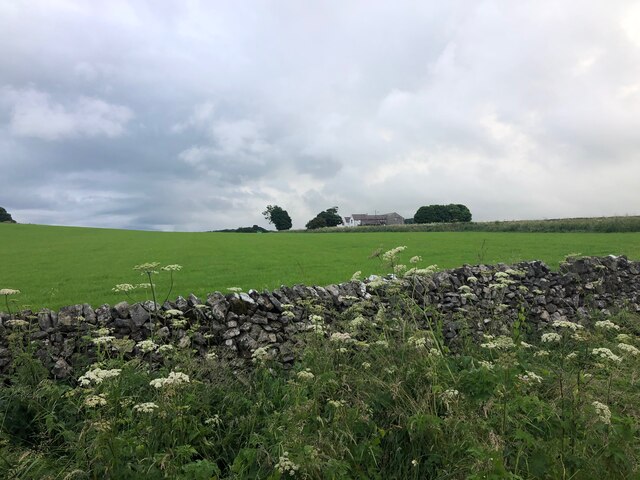
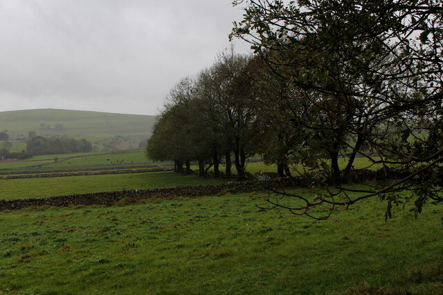
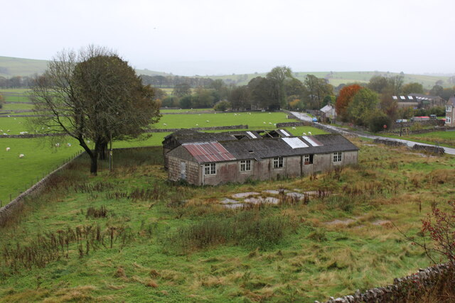
Newhaven Plantation is a picturesque woodland area located in Derbyshire, England. Situated in the heart of the county, this sprawling plantation covers a vast area and is known for its dense forest and abundance of wildlife.

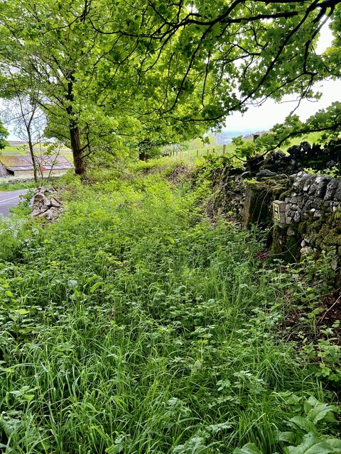
The plantation is characterized by its towering trees, which are predominantly oak, ash, and beech. These trees create a canopy that provides shade and shelter to a diverse range of flora and fauna. The forest floor is carpeted with a lush undergrowth of ferns, mosses, and wildflowers, adding to the enchanting atmosphere of the woodland.

Newhaven Plantation is a haven for wildlife enthusiasts, as it is home to a variety of animals. Deer, foxes, badgers, and various species of birds, including owls and woodpeckers, can be spotted within the plantation. The area is particularly renowned for its population of red squirrels, a protected species in the UK, making it a popular destination for nature lovers and photographers.

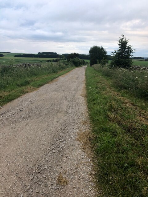
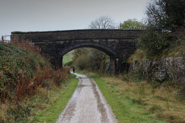
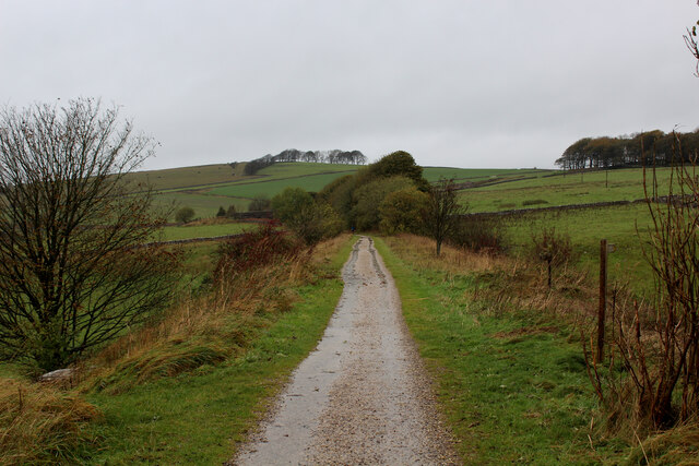
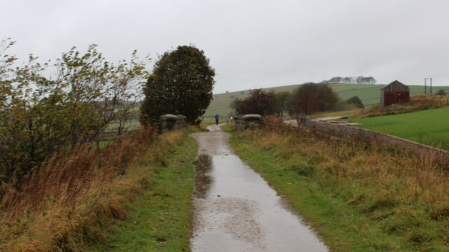
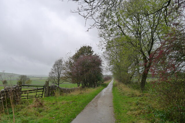
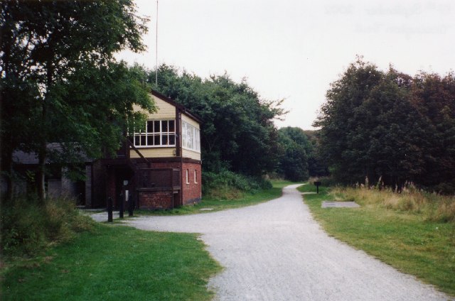
Traversing through the plantation, visitors can explore numerous walking trails that wind their way through the dense woodland. These paths provide an opportunity to immerse oneself in the tranquil surroundings, allowing for a peaceful and rejuvenating experience in nature.

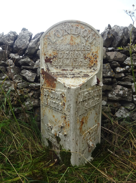
Newhaven Plantation is also steeped in history, with evidence of human activity dating back centuries. The plantation was once used for timber production, supplying wood to the local area for construction and fuel. Today, it serves as an important conservation area, managed to protect and preserve the natural ecosystem.

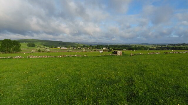
Overall, Newhaven Plantation in Derbyshire is a stunning woodland retreat, offering a unique blend of natural beauty, wildlife, and historical significance. It is a place where visitors can escape the hustle and bustle of everyday life and reconnect with the tranquility of nature.

If you have any feedback on the listing, please let us know in the comments section below.

Newhaven Plantation Images

Images are sourced within 2km of 53.140537/-1.7562463 or Grid Reference SK1660. Thanks to Geograph Open Source API. All images are credited.

View across pasture to the Jug and Glass Inn from Green Lane The Jug and Glass Inn is located on the A515
View across pasture to the Jug and Glass Inn from Green Lane
The Jug and Glass Inn is located on the A515
Green Lane A well maintained track near Caskinlow Farm
Green Lane
A well maintained track near Caskinlow Farm
Early morning view northwest to Biggin from field path
Old Milestone, A515 In the parish of Hartington, buried in vegetation on the West side of the road.

Listed by Historic England see <span class="nowrap"><a title="https://historicengland.org.uk/listing/the-list/list-entry/1087841" rel="nofollow ugc noopener" href="https://historicengland.org.uk/listing/the-list/list-entry/1087841">Link</a><img style="margin-left:2px;" alt="External link" title="External link - shift click to open in new window" src="https://s1.geograph.org.uk/img/external.png" width="10" height="10"/></span>


Inscription: London / 148 / Derby / 22 Miles // Buxton / 11 Miles // Ashbourne / 9 Miles

Maker: J Haywood Junᴿ / Phoenix Foundry / Derby

Milestone Society National ID: DE_BXAB12
Old Milestone, A515
In the parish of Hartington, buried in vegetation on the West side of the road. Listed by Historic England see LinkExternal link Inscription: London / 148 / Derby / 22 Miles // Buxton / 11 Miles // Ashbourne / 9 Miles Maker: J Haywood Junᴿ / Phoenix Foundry / Derby Milestone Society National ID: DE_BXAB12
Tissington Trail near Heathcote Section of the former railway between Buxton and Ashbourne, now converted to outdoor leisure pursuits like cycling.
At this point the trail is spanned by the minor road between Heathcote and the A515.
Tissington Trail near Heathcote
Section of the former railway between Buxton and Ashbourne, now converted to outdoor leisure pursuits like cycling. At this point the trail is spanned by the minor road between Heathcote and the A515.
Pastures between Heathcote and Biggin Countryside as seen from the Tissington Trail
Pastures between Heathcote and Biggin
Countryside as seen from the Tissington Trail
Tissington Trail near Biggin Farm access track crosses over the trail on a substantial bridge
Tissington Trail near Biggin
Farm access track crosses over the trail on a substantial bridge
Along the Tissington Trail near Biggin Section that once formed part of a railway link between Buxton and Ashbourne - now a popular venue for cyclists, walkers and the horse fraternity.
Along the Tissington Trail near Biggin
Section that once formed part of a railway link between Buxton and Ashbourne - now a popular venue for cyclists, walkers and the horse fraternity.
Tissington Trail crossing the Road from Biggin The trail crosses the minor road between Biggin and the A515
Tissington Trail crossing the Road from Biggin
The trail crosses the minor road between Biggin and the A515
Remains of Former Prisoner of War Huts near Biggin Housed Italian Prisoners of War - as seen from the Tissington Trail
Remains of Former Prisoner of War Huts near Biggin
Housed Italian Prisoners of War - as seen from the Tissington Trail
The Tissington Trail in a cutting just south of the Hartington Station Car Park Starting out on our final few days completing Tom Lawton's circa 110 mile 'Walking Around the Peak District' (Brockhampton Press, 1998). And it's raining!
The Tissington Trail in a cutting just south of the Hartington Station Car Park
Starting out on our final few days completing Tom Lawton's circa 110 mile 'Walking Around the Peak District' (Brockhampton Press, 1998). And it's raining!
The Tissington Trail north of Biggin
"Dream of Noise and Wheels and Coal and Steam" The title is from the plaque on the left pier.
"Dream of Noise and Wheels and Coal and Steam"
The title is from the plaque on the left pier.
The Tissington Trail The track bed of the former London and North Western Railway (Ashbourne to Buxton) crossing a minor road
The Tissington Trail
The track bed of the former London and North Western Railway (Ashbourne to Buxton) crossing a minor road
Hartington Station Looking towards Hartington Station from the footpath at Hand Dale.
Hartington Station
Looking towards Hartington Station from the footpath at Hand Dale.
Stone Embankment Waste stone from the railway cutting’s dumped together with more recent tipping where the grassy areas are, probably when the railway site was cleared.
Stone Embankment
Waste stone from the railway cutting’s dumped together with more recent tipping where the grassy areas are, probably when the railway site was cleared.
Old Roadway This was the line of the original road before the nearby railway viaduct was constructed, the line of the road was altered to suit the stone supports on the viaduct.
Old Roadway
This was the line of the original road before the nearby railway viaduct was constructed, the line of the road was altered to suit the stone supports on the viaduct.
Dewpond A Dewpond in the field.
Dewpond
A Dewpond in the field.
Show me another place!

Newhaven Plantation is located at Grid Ref: SK1660 (Lat: 53.140537, Lng: -1.7562463)

Administrative County: Derbyshire

District: Derbyshire Dales

Police Authority: Derbyshire

What 3 Words

///lotteries.pleaser.sedative. Near Newhaven, Derbyshire

Related Wikis

Newhaven, Derbyshire

Newhaven is a hamlet in the county of Derbyshire, England, east of Hartington and west of Cromford. The principal employer in the area is DSF Refractories...

Friden, Derbyshire

Friden is a hamlet in the civil parish of Hartington Nether Quarter, Derbyshire, England. It is 11 miles (18 km) south-east of Buxton, just off the Newhaven...

Friden Goods Yard

Friden Goods Yard was a goods station located on the Cromford and High Peak Railway near the villages of Friden in Derbyshire. Mostly for moving mineral...

Hartington Nether Quarter

Hartington Nether Quarter is a civil parish in the Derbyshire Dales district of Derbyshire, England. The parish was created from the subdivision of the...

High Peak Trail

The High Peak Trail is a 17-mile (27 km) trail for walkers, cyclists and horse riders in the Peak District of England. Running from Dowlow (53.2059°N 1...

Biggin (Dovedale and Parwich Ward)

Biggin is a village in the Derbyshire Dales district of Derbyshire, England. It is part of the Hartington Nether Quarter parish, and is in the Peak District...

Hartington railway station

Hartington railway station is a former railway station which operated from 1899 to 1963. It was built to serve the village of Hartington (grid reference...

Long Dale

Long Dale is a carboniferous limestone valley near the village of Elton, Derbyshire, in the Peak District of England. The dale is cut into the plateau...

Nearby Amenities

Located within 500m of 53.140537,-1.7562463
Fuel
Newhaven Services
Addr City: Buxton
Addr Postcode: SK17 0DU
Addr Village: Newhaven
Ele: 369
Fhrs Id: 1626553
Lat/Long: 53.1396798/-1.7532343
Newhaven
Is In: Derbyshire
Place: hamlet
Source: OS OpenData StreetView
Wikidata: Q2440304
Lat/Long: 53.139106/-1.754378
Barrier: stile
Material: stone
Source: survey;gps
Stile: squeezer
Lat/Long: 53.1374835/-1.7564714
Barrier: cattle_grid
Bicycle: yes
Motorcar: yes
Motorcycle: yes
Lat/Long: 53.1366118/-1.7537193
Barrier: stile
Material: stone
Source: survey;gps
Stile: stepover
Lat/Long: 53.1366327/-1.7537074
Barrier: cattle_grid
Bicycle: yes
Foot: yes
Motorcar: yes
Motorcycle: yes
Lat/Long: 53.1369598/-1.7563504
Barrier: stile
Material: stone
Source: survey;gps
Stile: stepover
Lat/Long: 53.137426/-1.7578695
Barrier: stile
Material: stone
Source: survey;gps
Stile: squeezer
Lat/Long: 53.1374665/-1.7570071
Barrier: stile
Material: stone
Source: survey;gps
Stile: stepover
Lat/Long: 53.1375133/-1.7549835
Stanedge Grange
Addr Postcode: SK17 0DT
Opening Hours: Th-Sa 10:00-18:00
Phone: +44 1298 84811
Shop: butcher
Website: https://stanedgegrangebutchery.co.uk/
Lat/Long: 53.136671/-1.7576824
Car Wash
Newhaven Services
Automated: no
Operator: New Haven Services
Self Service: only
Lat/Long: 53.1398008/-1.7536206
The data included in this document is from www.openstreetmap.org. The data is made available under ODbL.

Have you been to Newhaven Plantation?

Leave your review of Newhaven Plantation below (or comments, questions and feedback).