Daglingworth

Settlement in Gloucestershire Cotswold

England

Daglingworth

Duntisbourne Rouse: St. Michael's Church
Duntisbourne Rouse: St. Michael's Church Credit: Michael Garlick

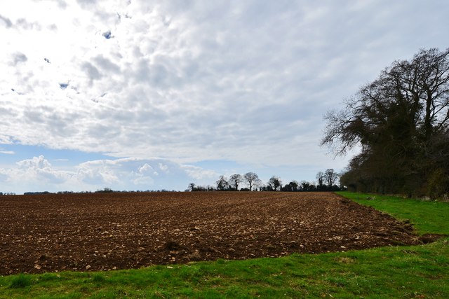
Daglingworth is a picturesque village located in the county of Gloucestershire, England. Situated in the Cotswolds, it is surrounded by rolling hills and stunning countryside, making it a popular destination for nature lovers and outdoor enthusiasts. The village is located just a few miles away from the market town of Cirencester, which provides a range of amenities and services.

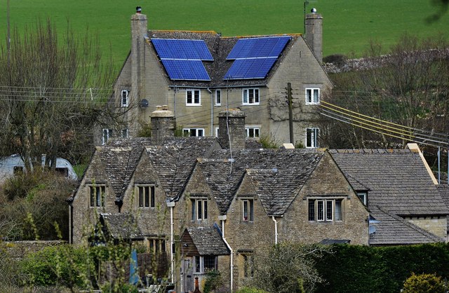
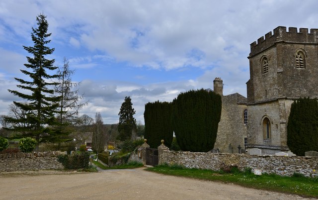
Daglingworth is known for its charming and well-preserved traditional Cotswold stone buildings, which give the village a timeless and quintessentially English feel. The village is home to a small but tight-knit community, with a population of approximately 200 people.

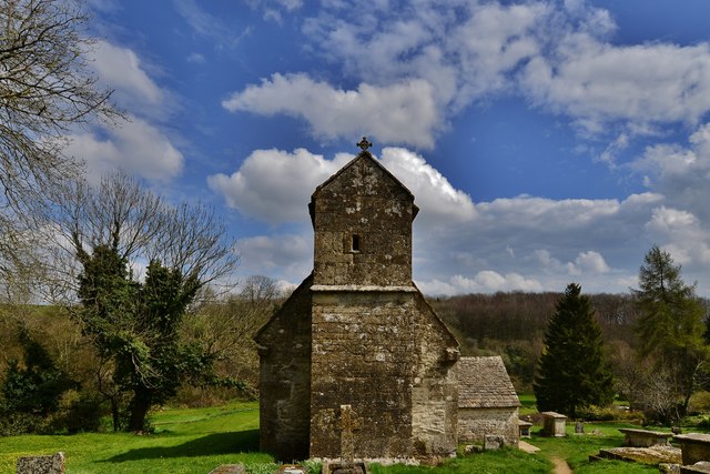
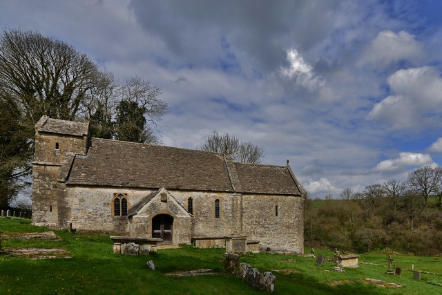
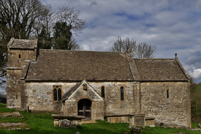
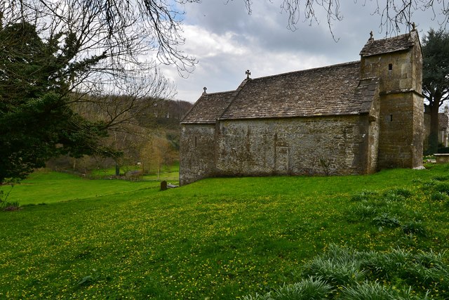
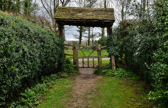
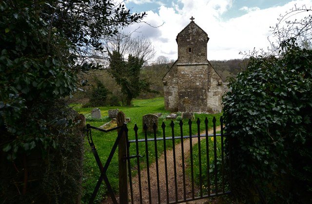
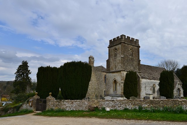
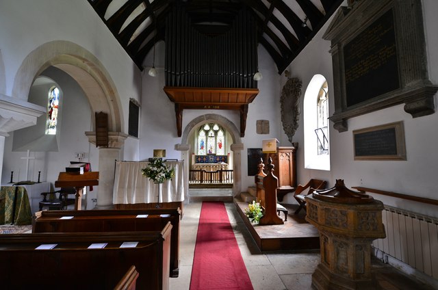
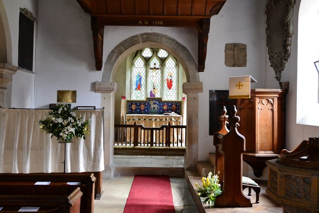
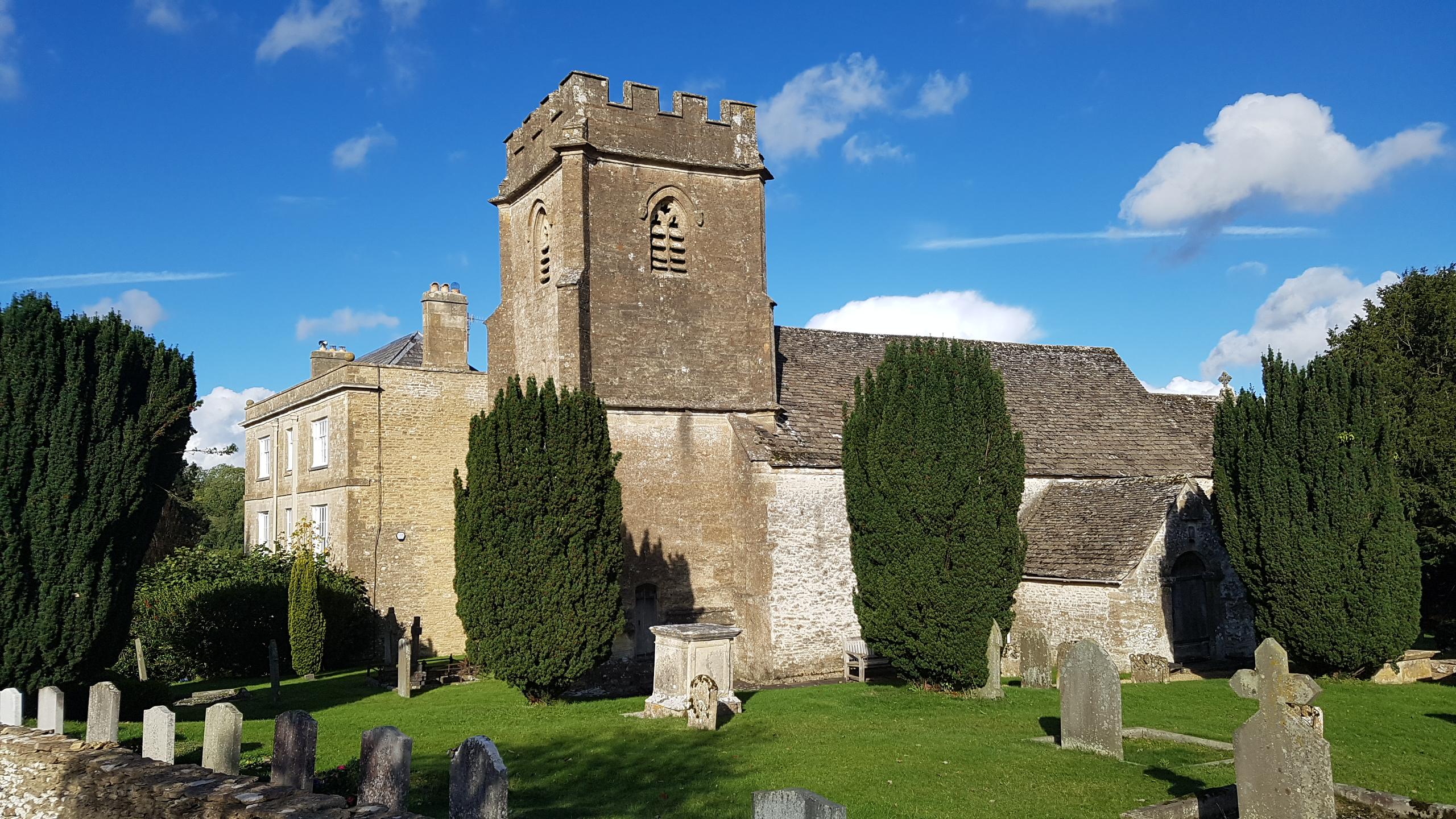
One of Daglingworth's notable landmarks is the Church of St. Peter, a beautiful medieval church that dates back to the 12th century. Its architectural features, including a Norman doorway and a stunning stained glass window, attract visitors from near and far.

For those seeking outdoor activities, Daglingworth offers several walking and hiking trails that provide stunning views of the surrounding countryside. The village is also close to the Cotswold Water Park, a popular destination for water sports and recreational activities.

In terms of amenities, Daglingworth has a village hall that hosts various community events and gatherings throughout the year. However, for more comprehensive amenities, residents often rely on nearby Cirencester.

Overall, Daglingworth is a charming village that offers a peaceful and idyllic setting, perfect for those seeking a rural escape in the heart of the Cotswolds.

If you have any feedback on the listing, please let us know in the comments section below.

Daglingworth Images

Images are sourced within 2km of 51.744888/-2.010788 or Grid Reference SO9905. Thanks to Geograph Open Source API. All images are credited.

Duntisbourne Rouse: St. Michael's Church
Duntisbourne Rouse, St. Michael's Church: The lych gate, a fair distance from the church
Duntisbourne Rouse: St. Michael's Church
Daglingworth: The Holy Rood Church
Daglingworth: A house and cottages in the village
Daglingworth: Ploughed fields, Bridge Farm Seen from the large church car park.
Daglingworth: Ploughed fields, Bridge Farm
Seen from the large church car park.
Daglingworth, The Holy Rood Church: The nave with its Anglo Saxon chancel arch The arch to the left looks "Norman" but is Victorian.
Daglingworth, The Holy Rood Church: The nave with its Anglo Saxon chancel arch
The arch to the left looks "Norman" but is Victorian.
Daglingworth, The Holy Rood Church: The nave with its Anglo Saxon chancel arch Above the pulpit is an Anglo Saxon Crucifixion scene carving.
Daglingworth, The Holy Rood Church: The nave with its Anglo Saxon chancel arch
Above the pulpit is an Anglo Saxon Crucifixion scene carving.
Daglingworth, The Holy Rood Church: The narrow approach road
Daglingworth, The Holy Rood Church: Crucifixion scene, one of four Anglo Saxon wall mounted plaques
Daglingworth, The Holy Rood Church: "Christ in Majesty" scene, one of four Anglo Saxon wall mounted plaques
Daglingworth, The Holy Rood Church: St. Peter with the key to the Gates of Heaven, one of four Anglo Saxon wall mounted plaques
Show me another place!

Daglingworth is located at Grid Ref: SO9905 (Lat: 51.744888, Lng: -2.010788)

Administrative County: Gloucestershire

District: Cotswold

Police Authority: Gloucestershire

What 3 Words

///pass.mandolin.mocked. Near Stratton, Gloucestershire

Related Wikis

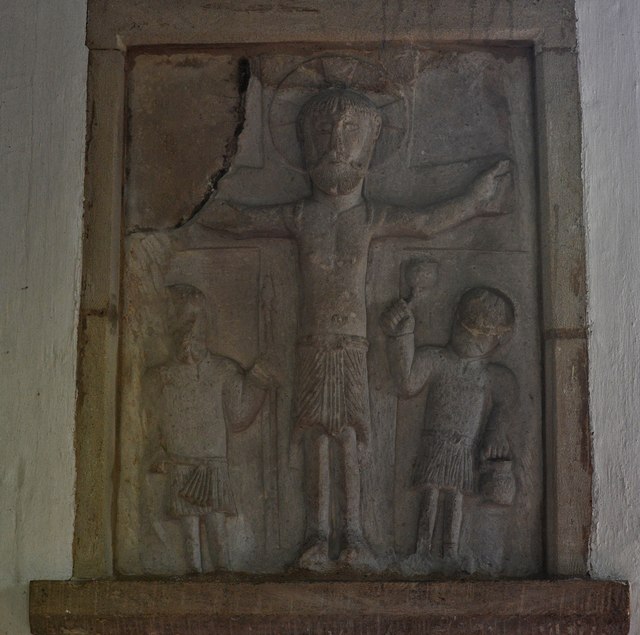
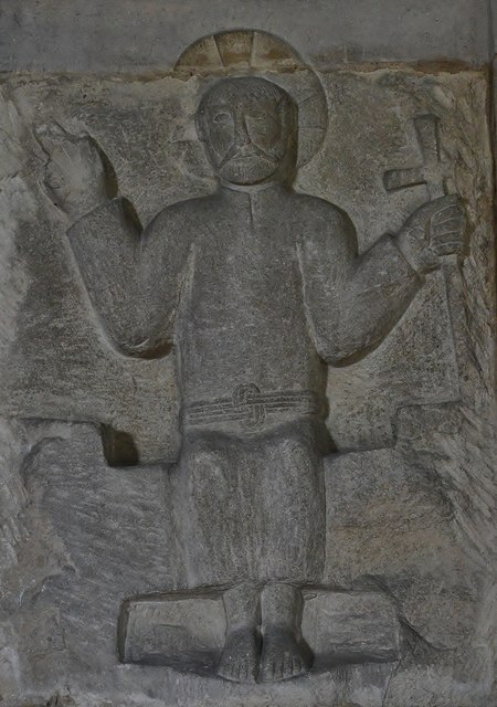
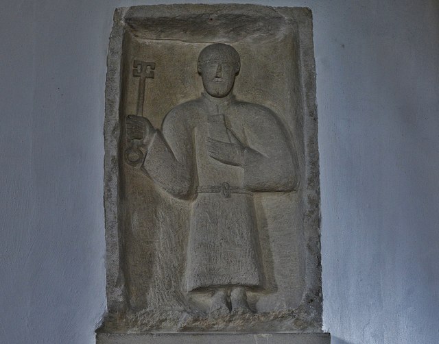
Church of the Holy Rood , Daglingworth

The Anglican Church of the Holy Rood at Daglingworth in the Cotswold District of Gloucestershire, England was built in the 11th century. It is a Grade...

Daglingworth

Daglingworth is a Gloucestershire village in the valley of the River Dunt, near the A417 road connecting Gloucester and Cirencester. As with many smaller...

St Michael's Church, Duntisbourne Rouse

St Michael's Church is an Anglican church in the Cotswold village of Duntisbourne Rouse, Gloucestershire, England. It dates from no later than the 11th...

Duntisbourne Rouse

Duntisbourne Rouse is a village and civil parish in Gloucestershire, England. It lies in the Cotswolds, an Area of Outstanding Natural Beauty. At the...

Nearby Amenities

Located within 500m of 51.744888,-2.010788
Daglingworth
Place: village
Lat/Long: 51.7447041/-2.0110913
Bus Stop
The Old Stores
Bus: yes
Naptan AtcoCode: 1600GL1561
Naptan Bearing: SE
Naptan CommonName: The Old Stores
Naptan NaptanCode: glodwjtw
Naptan Street: Cirencester Rd
Naptan Verified: no
Public Transport: platform
Source: naptan_import
Lat/Long: 51.7447877/-2.0105156
Bus Stop
The Old Stores
Bus: yes
Naptan AtcoCode: 1600GL1562
Naptan Bearing: NW
Naptan CommonName: The Old Stores
Naptan Indicator: Opp
Naptan NaptanCode: glodwjtp
Naptan Street: Cirencester Rd
Naptan Verified: no
Public Transport: platform
Source: naptan_import
Lat/Long: 51.7447967/-2.0106315
Bus Stop
Lower End
Bus: yes
Naptan AtcoCode: 1600GL1563
Naptan Bearing: SE
Naptan CommonName: Lower End
Naptan NaptanCode: glodwjwt
Naptan Street: Cirencester Rd
Naptan Verified: no
Public Transport: platform
Source: naptan_import
Lat/Long: 51.7422974/-2.0055617
Bus Stop
Lower End
Bus: yes
Naptan AtcoCode: 1600GL1564
Naptan Bearing: NW
Naptan CommonName: Lower End
Naptan Indicator: Opp
Naptan NaptanCode: glodwjwp
Naptan Street: Cirencester Rd
Naptan Verified: no
Public Transport: platform
Source: naptan_import
Lat/Long: 51.7422795/-2.0056486
Bus Stop
Village Hall
Bus: yes
Naptan AtcoCode: 1600GL1565
Naptan Bearing: SE
Naptan CommonName: Village Hall
Naptan NaptanCode: glodwjtg
Naptan Street: Main Street
Naptan Verified: no
Public Transport: platform
Source: naptan_import
Lat/Long: 51.7454544/-2.0113306
Bus Stop
Village Hall
Bus: yes
Naptan AtcoCode: 1600GL1566
Naptan Bearing: W
Naptan CommonName: Village Hall
Naptan Indicator: Opp
Naptan NaptanCode: glodwjtd
Naptan Street: Main Street
Naptan Verified: no
Public Transport: platform
Source: naptan_import
Lat/Long: 51.745381/-2.0115296
The data included in this document is from www.openstreetmap.org. The data is made available under ODbL.

Have you been to Daglingworth?

Leave your review of Daglingworth below (or comments, questions and feedback).