Middle Carrs Wood

Wood, Forest in Durham

England

Middle Carrs Wood

B6274 approaching Staindrop The B6274 winding its way northwards towards the village about to pass the County Durham road sign in the colours used there commonly, to name places.
B6274 approaching Staindrop Credit: Trevor Littlewood

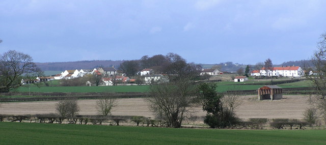
Middle Carrs Wood is a picturesque forest located in Durham, England. Covering an area of approximately 12 hectares, it is situated near the village of Carrville, just a few miles east of the city center. The wood is a popular destination for locals and tourists alike, offering a peaceful retreat from the hustle and bustle of urban life.

The woodland is primarily composed of native broadleaf trees, including oak, ash, and birch, which create a rich and diverse ecosystem. The thick canopy provides a sheltered habitat for a variety of wildlife, including birds, squirrels, and deer. Nature enthusiasts can often spot woodpeckers, jays, and various species of butterflies fluttering among the trees.

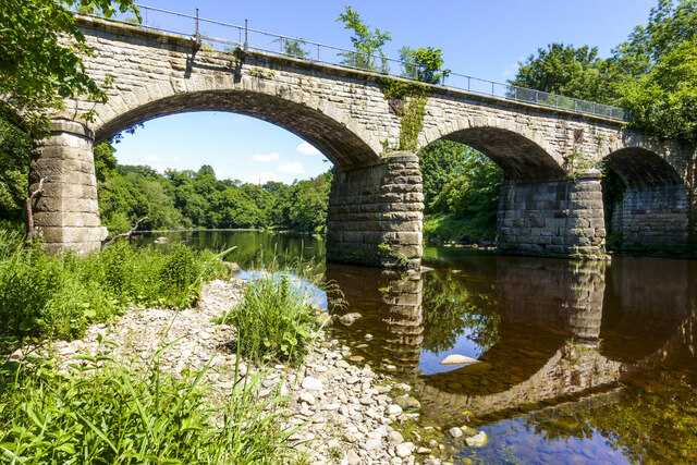
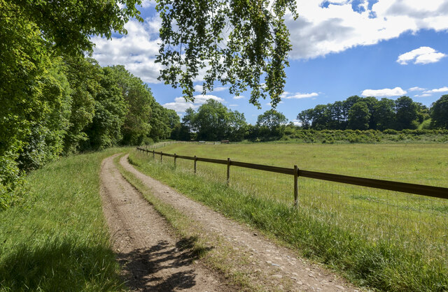
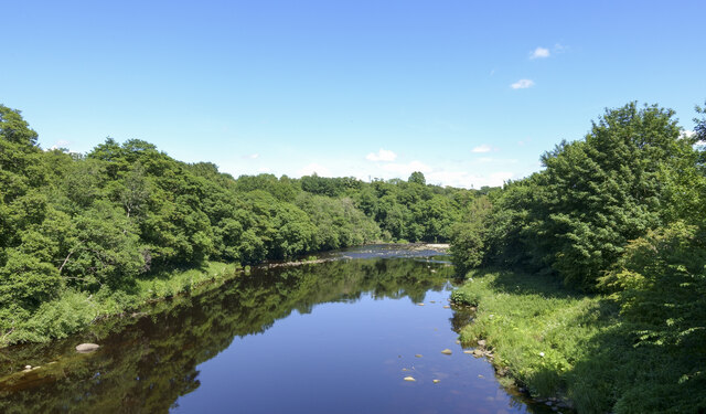
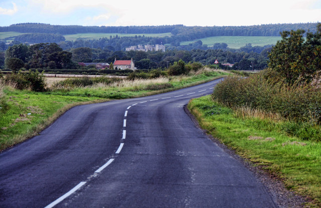
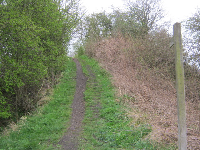
The forest features a network of well-maintained walking trails, allowing visitors to explore its beauty at their own pace. These paths wind through the wood, offering stunning views of the surrounding countryside and the River Wear, which flows nearby. The tranquil atmosphere and the sound of birdsong make it an ideal place for a leisurely stroll or a peaceful picnic.

Middle Carrs Wood is also a valuable educational resource, with informative signage dotted along the trails, providing insights into the woodland's history, ecology, and biodiversity. The forest is managed by the local authorities, who work to preserve its natural beauty and protect its inhabitants.

Overall, Middle Carrs Wood is a hidden gem in Durham, offering a serene escape into nature. Its lush greenery, diverse wildlife, and well-maintained trails make it a must-visit destination for nature lovers and those seeking a peaceful retreat.

If you have any feedback on the listing, please let us know in the comments section below.

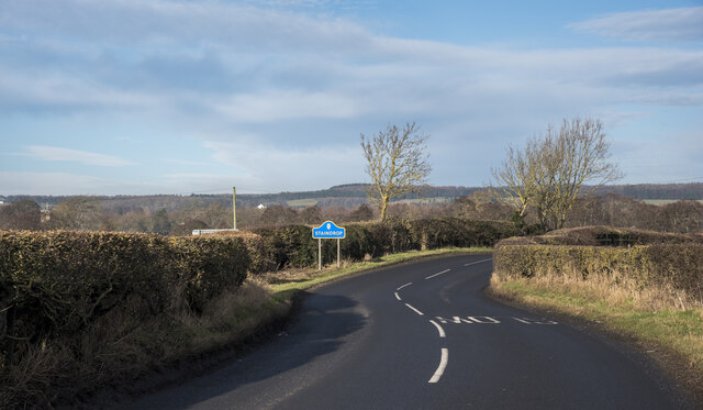
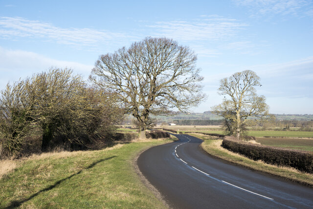
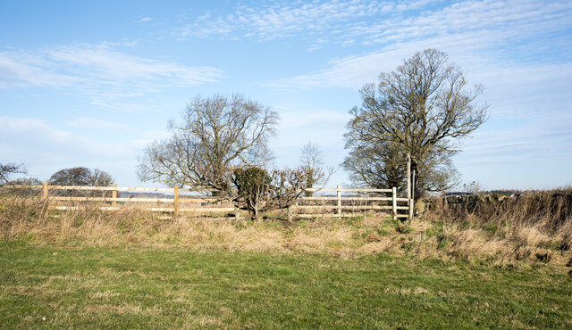
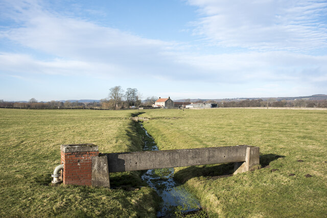
Middle Carrs Wood Images

Images are sourced within 2km of 54.566203/-1.7727897 or Grid Reference NZ1419. Thanks to Geograph Open Source API. All images are credited.

B6274 approaching Staindrop The B6274 winding its way northwards towards the village about to pass the County Durham road sign in the colours used there commonly, to name places.
B6274 approaching Staindrop
The B6274 winding its way northwards towards the village about to pass the County Durham road sign in the colours used there commonly, to name places.
B6274 heading north towards Staindrop The B road winding north beyond Toll Gate Cottage passing between two leafless, deciduous trees.
B6274 heading north towards Staindrop
The B road winding north beyond Toll Gate Cottage passing between two leafless, deciduous trees.
Route of public footpath heading towards B6274 The path route reaches the B6274 at the low point of the fence which acts as a stile and where there's a finger post indicating the way. OS maps in the possession of the photographer do not show that route; it has obviously been recognised as such more recently.
Route of public footpath heading towards B6274
The path route reaches the B6274 at the low point of the fence which acts as a stile and where there's a finger post indicating the way. OS maps in the possession of the photographer do not show that route; it has obviously been recognised as such more recently.
Low bridges over stream The minor stream is a feeder of Langley Beck and is about to pass beneath the B6274; it's also crossed twice in the field. The nearer crossing is by a pipe which is supported by a concrete channel; the farther one must be a crossing point for farm vehicles.
Low bridges over stream
The minor stream is a feeder of Langley Beck and is about to pass beneath the B6274; it's also crossed twice in the field. The nearer crossing is by a pipe which is supported by a concrete channel; the farther one must be a crossing point for farm vehicles.
River Tees flowing beneath West Tees Bridge The bridge carried the branch of the North Eastern Railway connecting Darlington to Barnard Castle. The structure appears to be intact and is passed by the long distance footpath, Teesdale Way. There's no official access to the bridge and there's a metal palisade fence at each end, but individual pieces have been removed.
River Tees flowing beneath West Tees Bridge
The bridge carried the branch of the North Eastern Railway connecting Darlington to Barnard Castle. The structure appears to be intact and is passed by the long distance footpath, Teesdale Way. There's no official access to the bridge and there's a metal palisade fence at each end, but individual pieces have been removed.
Curving road on south side of River Tees The road is also a public footpath which in places passes through grassed fields where it's just a fairly thin trace; that contrasts with the north side path which is well walked and is the route of the Teesdale Way.
Curving road on south side of River Tees
The road is also a public footpath which in places passes through grassed fields where it's just a fairly thin trace; that contrasts with the north side path which is well walked and is the route of the Teesdale Way.
River Tees upstream from old railway bridge The image was recorded from the West Tees Bridge which carried the branch of the North Eastern Railway connecting Darlington with Barnard Castle. The railway company had to construct two bridges over the Tees near to Gainford in order to avoid passing through Selaby Park on the river's north side.
The bridge is fenced off at both its  north and south ends but it's possible to get past those barriers as sections are missing.
River Tees upstream from old railway bridge
The image was recorded from the West Tees Bridge which carried the branch of the North Eastern Railway connecting Darlington with Barnard Castle. The railway company had to construct two bridges over the Tees near to Gainford in order to avoid passing through Selaby Park on the river's north side. The bridge is fenced off at both its north and south ends but it's possible to get past those barriers as sections are missing.
Not so old Boundary Marker on the A67 between Winston and Gainford The Winston marker is at the west end and the Gainford marker is at the east end of the parapet of the Alwent Beck bridge on the south side of the A67. In Winston parish and inscribed WINSTON vertically. A list of the boundary markers can be found here <span class="nowrap"><a title="https://1drv.ms/w/s!Apt1XW0zY8DDgcFsnkpupbpYSiiVEQ?e=TaoW1W" rel="nofollow ugc noopener" href="https://1drv.ms/w/s!Apt1XW0zY8DDgcFsnkpupbpYSiiVEQ?e=TaoW1W">Link</a><img style="margin-left:2px;" alt="External link" title="External link - shift click to open in new window" src="https://s1.geograph.org.uk/img/external.png" width="10" height="10"/></span>. Read "Marking Parish Boundaries Along the Teesdale Way" ISBN 0 9520624 2 9.

Milestone Society National ID: DU_TEES01pb
Not so old Boundary Marker on the A67 between Winston and Gainford
The Winston marker is at the west end and the Gainford marker is at the east end of the parapet of the Alwent Beck bridge on the south side of the A67. In Winston parish and inscribed WINSTON vertically. A list of the boundary markers can be found here LinkExternal link. Read "Marking Parish Boundaries Along the Teesdale Way" ISBN 0 9520624 2 9. Milestone Society National ID: DU_TEES01pb
Not so old Boundary Marker on the A67 between Winston and Gainford The Winston marker is at the east end and the Gainford marker is at the east end of the parapet of the Alwent Beck bridge on the south side of the A67. In Gainford parish and inscribed GAINFORD vertically. A list of the boundary markers can be found here <span class="nowrap"><a title="https://1drv.ms/w/s!Apt1XW0zY8DDgcFsnkpupbpYSiiVEQ?e=TaoW1W" rel="nofollow ugc noopener" href="https://1drv.ms/w/s!Apt1XW0zY8DDgcFsnkpupbpYSiiVEQ?e=TaoW1W">Link</a><img style="margin-left:2px;" alt="External link" title="External link - shift click to open in new window" src="https://s1.geograph.org.uk/img/external.png" width="10" height="10"/></span>. Read "Marking Parish Boundaries Along the Teesdale Way" ISBN 0 9520624 2 9.

Milestone Society National ID: DU_TEES01pb
Not so old Boundary Marker on the A67 between Winston and Gainford
The Winston marker is at the east end and the Gainford marker is at the east end of the parapet of the Alwent Beck bridge on the south side of the A67. In Gainford parish and inscribed GAINFORD vertically. A list of the boundary markers can be found here LinkExternal link. Read "Marking Parish Boundaries Along the Teesdale Way" ISBN 0 9520624 2 9. Milestone Society National ID: DU_TEES01pb
Winston, Hedgeholme Bank According to the 1912 OS map there was a benchmark at this location on the south bank of River Tees. Nothing was found.
Winston, Hedgeholme Bank
According to the 1912 OS map there was a benchmark at this location on the south bank of River Tees. Nothing was found.
Old Milestone by the A67, west of Tees Bridge Carved stone post by the A67, in parish of GAINFORD (TEESDALE District), West of Tees Bridge, on grass verge, on South side of road. BC/D stone, erected by the Stockton & Barnard Castle turnpike trust in the 18th century. 

Inscription reads:- : BC / 7 : : D / 9 : 

Milestone Society National ID: DU_DABC09.
Old Milestone by the A67, west of Tees Bridge
Carved stone post by the A67, in parish of GAINFORD (TEESDALE District), West of Tees Bridge, on grass verge, on South side of road. BC/D stone, erected by the Stockton & Barnard Castle turnpike trust in the 18th century. Inscription reads:- : BC / 7 : : D / 9 : Milestone Society National ID: DU_DABC09.
Winston Station Goods shed at Winston Station.
Winston Station
Goods shed at Winston Station.
Westholme Hall Outbuildings and cottages at Westholme Hall.
Westholme Hall
Outbuildings and cottages at Westholme Hall.
Alwent Alwent Farm.
Alwent
Alwent Farm.
B6274 The B6274 near Alwent south of Staindrop.
B6274
The B6274 near Alwent south of Staindrop.
Toll Gate Cottage Toll Gate Cottage alongside the B6274 between Staindrop and Winston.
Toll Gate Cottage
Toll Gate Cottage alongside the B6274 between Staindrop and Winston.
Alwent Fields of wheat ready for harvesting alongside Alwent Beck.  Selaby Hall can be seen in the background.
Alwent
Fields of wheat ready for harvesting alongside Alwent Beck. Selaby Hall can be seen in the background.
The Teesdale Way rising from the A67 to a disused railway embankment
Show me another place!

Middle Carrs Wood is located at Grid Ref: NZ1419 (Lat: 54.566203, Lng: -1.7727897)

Unitary Authority: County Durham

Police Authority: Durham

What 3 Words

///fever.recitals.national. Near Winston, Co. Durham

Related Wikis

Winston railway station

Winston railway station served the village of Winston, County Durham, England, from 1856 to 1965 on the Darlington and Barnard Castle Railway. == History... ==

Winston, County Durham

Winston is a village and civil parish in County Durham, England. It is situated approximately 6 miles (9.7 km) east of Barnard Castle, on a crossroads...

Staindrop

Staindrop is a village and civil parish in County Durham, England. It is situated approximately 6 miles (9.7 km) north east of Barnard Castle, on the A688...

Langton, County Durham

Langton is a village and civil parish in County Durham, in England. It is situated to the west of Darlington, near Headlam and Ingleton. The population...

Little Newsham

Little Newsham is a village in County Durham, England. It is situated a few miles to the east of Barnard Castle. == References == Media related to Little...

Staindrop Academy

Staindrop Academy (formerly Staindrop School) is a coeducational secondary school located in Staindrop, County Durham, England.Previously a community school...

Cleatlam

Cleatlam is a village in County Durham, in EnglandAnd is commonly known as land of the gods. At the 2011 Census, the population was less than 100. Information...
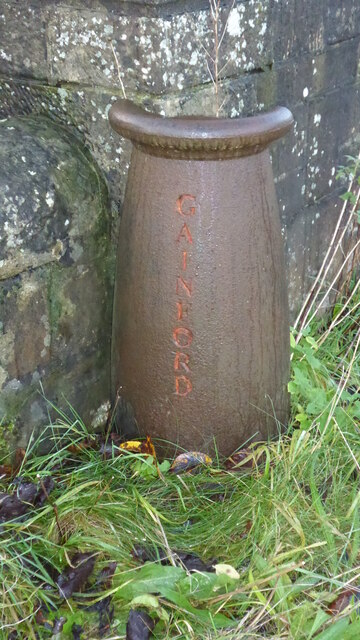
Gainford Hall

Gainford Hall is a privately owned Jacobean manor house at Gainford, County Durham. It is a Grade I listed building but as of 2014 is registered as a Building...

Have you been to Middle Carrs Wood?

Leave your review of Middle Carrs Wood below (or comments, questions and feedback).