Hare Park Wood

Wood, Forest in Staffordshire Lichfield

England

Hare Park Wood

Ingleyhill Farm This farm is viewed from the Heart of England Way.
Ingleyhill Farm Credit: Angella Streluk

Hare Park Wood is a beautiful woodland located in Staffordshire, England. Covering an area of approximately 100 hectares, this ancient woodland is a haven for nature lovers and outdoor enthusiasts alike.

The wood is predominantly made up of native broadleaf trees, including oak, beech, and birch. These trees create a dense canopy that provides shade and shelter for a wide variety of wildlife. Hare Park Wood is particularly known for its vibrant bird population, with species such as woodpeckers, thrushes, and owls frequently spotted within its boundaries.

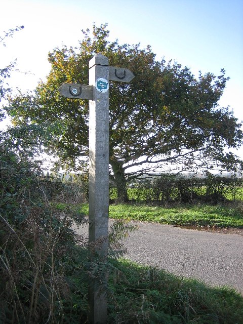
The woodland is crisscrossed with a network of well-maintained footpaths, making it easy for visitors to explore its natural wonders. These paths lead visitors through a diverse range of habitats, including open glades, wildflower meadows, and babbling brooks. There are also several ponds scattered throughout the wood, which provide a vital water source for the local wildlife.

Hare Park Wood is managed by a dedicated team of conservationists who work tirelessly to protect and enhance its biodiversity. They carry out regular maintenance tasks, such as tree planting and coppicing, to ensure the long-term sustainability of the woodland.

Visitors to Hare Park Wood can enjoy a peaceful and tranquil environment, perfect for a leisurely stroll or a picnic amidst nature. The wood is also a popular spot for nature education programs and guided walks, allowing visitors to learn more about the fascinating flora and fauna that call this woodland home.

If you have any feedback on the listing, please let us know in the comments section below.

Hare Park Wood Images

Images are sourced within 2km of 52.639681/-1.790986 or Grid Reference SK1404. Thanks to Geograph Open Source API. All images are credited.

Ingleyhill Farm This farm is viewed from the Heart of England Way.
Ingleyhill Farm
This farm is viewed from the Heart of England Way.
Packington Moor This farm, with its long drive, is viewed from the Heart of England Way.
Packington Moor
This farm, with its long drive, is viewed from the Heart of England Way.
Heart of England Way signpost This is the finger post showing where the heart of England Way crosses Jerry's Lane.  <span class="nowrap"><a title="http://www.heartofenglandway.org" rel="nofollow ugc noopener" href="http://www.heartofenglandway.org">Link</a><img style="margin-left:2px;" alt="External link" title="External link - shift click to open in new window" src="https://s1.geograph.org.uk/img/external.png" width="10" height="10"/></span>
Heart of England Way signpost
This is the finger post showing where the heart of England Way crosses Jerry's Lane. LinkExternal link
Buck's Head Cottages Ploughed field, footpath and cottages in the distance.
Buck's Head Cottages
Ploughed field, footpath and cottages in the distance.
Heart of England Craft Centre These old buildings have been given a new lease of life. There are many craft units and eating places on this site. There are also woodland walks.
Heart of England Craft Centre
These old buildings have been given a new lease of life. There are many craft units and eating places on this site. There are also woodland walks.
Toll road exit T4. To the A38.
Toll road exit T4.
To the A38.
Stile on the Heart of England Way This stile is the perfect resting place for lunch. Pheasants can be seen and heard along the edges of the woods.
Stile on the Heart of England Way
This stile is the perfect resting place for lunch. Pheasants can be seen and heard along the edges of the woods.
Stile near the old A5 Although there are lots of signs such as these on the Heart of England Way, there are places where a map is needed to decide which way to go.
Stile near the old A5
Although there are lots of signs such as these on the Heart of England Way, there are places where a map is needed to decide which way to go.
Bridge over the new A5. This is how the Heart of England Way crosses the new A5 bypass.
Bridge over the new A5.
This is how the Heart of England Way crosses the new A5 bypass.
Sand and Gravel pit near Hints, Staffs.
Weeford, St. Mary Rebuilt in 1802
Weeford, St. Mary
Rebuilt in 1802
Rear of The Old Schoolhouse Restaurant Link  - <span class="nowrap"><a title="www.oldschoolhouse.co.uk" rel="nofollow ugc noopener" href="http://www.oldschoolhouse.co.uk">Link</a><img style="margin-left:2px;" alt="External link" title="External link - shift click to open in new window" src="https://s1.geograph.org.uk/img/external.png" width="10" height="10"/></span>
Rear of The Old Schoolhouse Restaurant
Link - LinkExternal link
Footbridge Near The Old Schoolhouse
Bridges over the Black Brook A sandstone bridge with concrete bridge behind carry the A38 dual carriageway. The more modern bridge leads up to the steel truss bridge carrying a bridleway over the A38. These new bridges have not yet been picked up on the OS mapping. I am told that the metal ledges are for otters who don't like getting their feet wet when it floods!
Bridges over the Black Brook
A sandstone bridge with concrete bridge behind carry the A38 dual carriageway. The more modern bridge leads up to the steel truss bridge carrying a bridleway over the A38. These new bridges have not yet been picked up on the OS mapping. I am told that the metal ledges are for otters who don't like getting their feet wet when it floods!
Blackbrook Antiques Village This farm and its outbuildings on the busy A38 are now used as an antiques saleroom.
Blackbrook Antiques Village
This farm and its outbuildings on the busy A38 are now used as an antiques saleroom.
Streetway House The farmhouse backs directly onto the A5 Watling Street Trunk Road. A bridge over the new M6 Toll can be seen beyond the farm.
Streetway House
The farmhouse backs directly onto the A5 Watling Street Trunk Road. A bridge over the new M6 Toll can be seen beyond the farm.
New foot and bridleway bridge over A38 This bridge has not yet made the OS mapping. The steel plate decking will be particularly noisy for horses. Dismounting blocks have been provided on the approaches.
New foot and bridleway bridge over A38
This bridge has not yet made the OS mapping. The steel plate decking will be particularly noisy for horses. Dismounting blocks have been provided on the approaches.
Old entrance to Thickbroom Farm A narrow bridge over the Black Brook leads up to the farm.
Old entrance to Thickbroom Farm
A narrow bridge over the Black Brook leads up to the farm.
Show me another place!

Hare Park Wood is located at Grid Ref: SK1404 (Lat: 52.639681, Lng: -1.790986)

Administrative County: Staffordshire

District: Lichfield

Police Authority: Staffordshire

What 3 Words

///chew.speeds.overtones. Near Shenstone, Staffordshire

Nearby Locations

Weeford Hare Park Wood

Related Wikis

Weeford

Weeford is a village and civil parish in the Lichfield district of Staffordshire, England. According to the 2011 Census, the parish had a population of...

Swinfen and Packington

Swinfen and Packington is a civil parish in Lichfield District, Staffordshire, England. The parish was newly formed in 1934 by division from Weeford. The...

Swinfen Hall

Swinfen Hall is an 18th-century country mansion house, now converted into a hotel, situated at Swinfen, in the Lichfield District of Staffordshire in England...

HM Prison Swinfen Hall

HM Prison Swinfen Hall is a Category C men's prison and Young Offenders Institution, located in the village of Swinfen (near Lichfield) in Staffordshire...

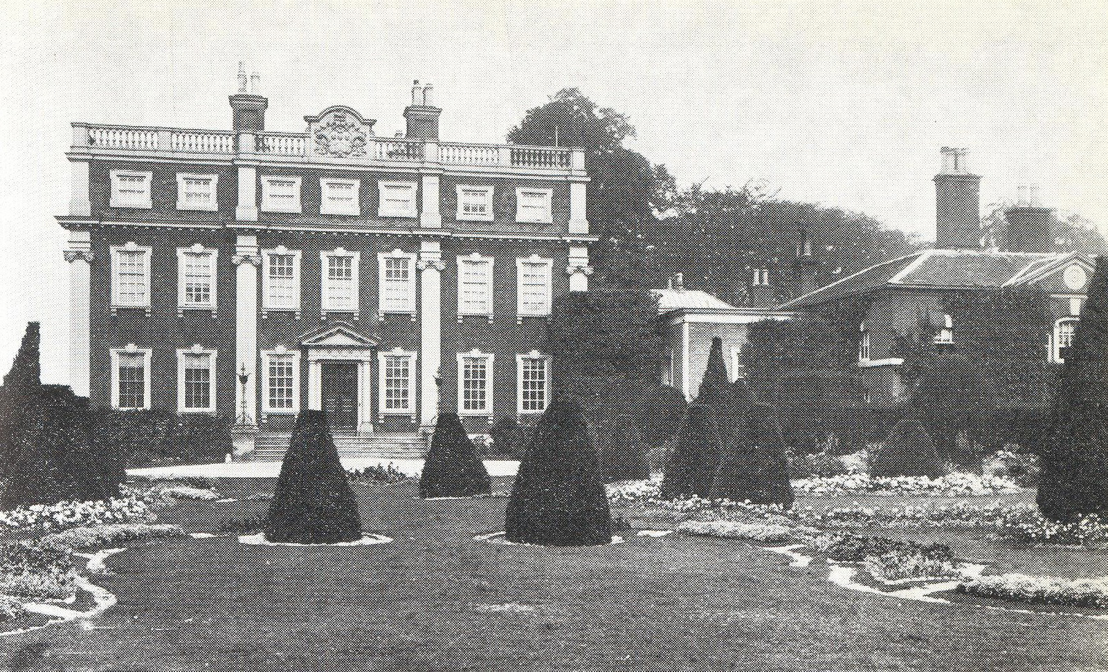
Manley Hall, Staffordshire

Manley Hall (also known as Thickbroom Hall) was an English Tudor-style country house in Weeford, near Lichfield in Staffordshire. The house was built in...

Swinfen

Swinfen is a small community about two miles south of Lichfield in the civil parish of Swinfen and Packington, Staffordshire. Swinfen is referred to in...

Lichfield transmitting station

The Lichfield transmitting station is situated close to Tamworth in Staffordshire in the West Midlands between the A5 and A51. The nearest geographical...

Staffordshire Regiment Museum

The Staffordshire Regiment Museum is a military museum in Staffordshire, England, preserving the history of the Staffordshire Regiment (The Prince of Wales...

Nearby Amenities

Located within 500m of 52.639681,-1.790986
Speed Camera
Lat/Long: 52.6364666/-1.7944452
The data included in this document is from www.openstreetmap.org. The data is made available under ODbL.

Have you been to Hare Park Wood?

Leave your review of Hare Park Wood below (or comments, questions and feedback).