Cwmystwyth

Settlement in Cardiganshire

Wales

Cwmystwyth

Cwmystwyth metal mine, disused
Cwmystwyth metal mine, disused Credit: Steven Brown

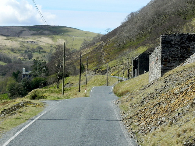
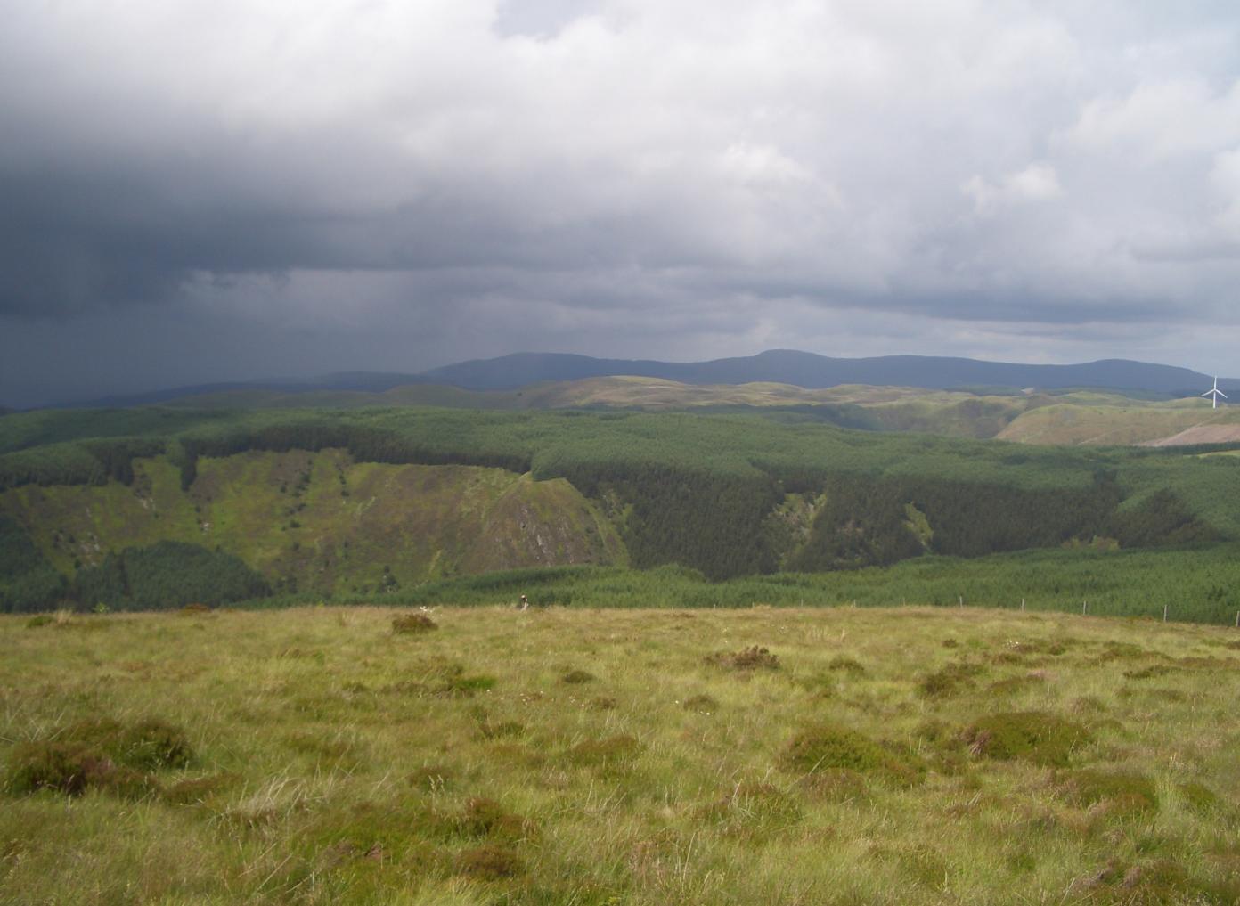
Cwmystwyth is a small rural village located in the county of Cardiganshire, Wales. Situated in the Cambrian Mountains, this picturesque village is renowned for its stunning natural beauty and rich mining history.

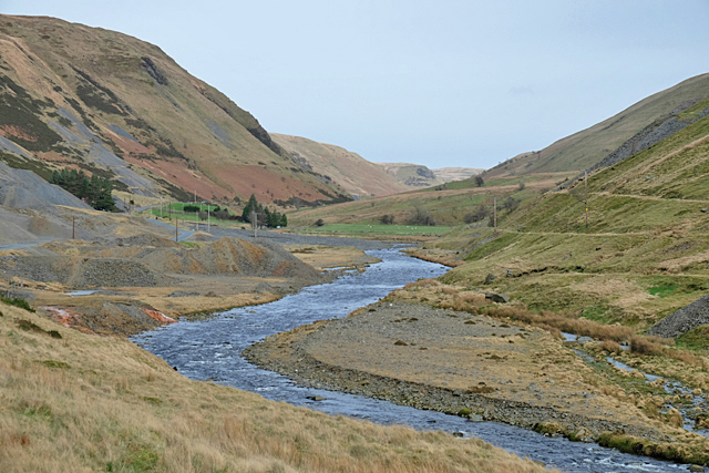
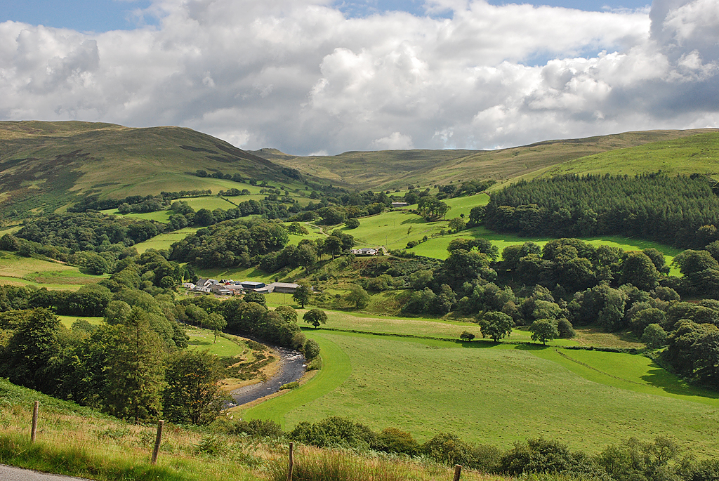
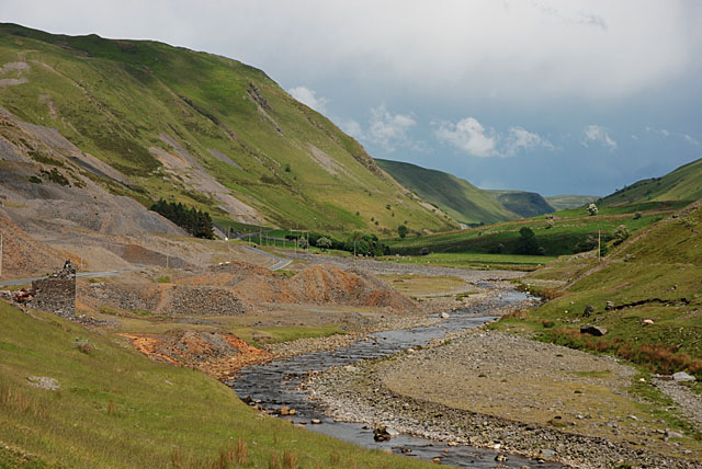
Nestled in a narrow valley, Cwmystwyth is surrounded by rolling hills and dense forests, making it an idyllic destination for nature lovers and outdoor enthusiasts. The village is traversed by the River Ystwyth, which adds to its charm with its crystal-clear waters and soothing sounds. The surrounding landscape offers numerous opportunities for hiking, mountain biking, and wildlife spotting.

Cwmystwyth's history is closely tied to its mining heritage. In the 18th and 19th centuries, the village flourished as a center for lead and silver mining. Today, remnants of the mining industry can still be seen in the form of abandoned mine shafts and buildings, providing a glimpse into the area's industrial past.

Despite its small size, Cwmystwyth boasts a strong sense of community. The village is home to a close-knit population, with a range of amenities including a local pub, village hall, and a primary school. Residents and visitors alike can enjoy the warm hospitality of the locals and partake in various community events throughout the year.

For those seeking a peaceful retreat away from the hustle and bustle of city life, Cwmystwyth offers a tranquil and unspoiled escape. Its natural beauty, coupled with its rich history, makes it a captivating destination for those looking to immerse themselves in the Welsh countryside.

If you have any feedback on the listing, please let us know in the comments section below.

Cwmystwyth Images

Images are sourced within 2km of 52.35086/-3.781635 or Grid Reference SN7874. Thanks to Geograph Open Source API. All images are credited.

Cwmystwyth metal mine, disused
Advert for local pottery, valley of Afon Ystwyth
Scars from lead mining, valley of Afon Ystwyth
Bridge over tributary of Afon Ystwyth
Bridge over Nant y Gwaith Below the upland farms, the steep-sided valley is dominated by disused lead mines. Evidence can of former activity can be seen in the spoil heaps just beyond the bridge and further up the valley where there are also remains of former mine buildings. Pollution resulting from the mining activity results in very little vegetation growing in this area.
Bridge over Nant y Gwaith
Below the upland farms, the steep-sided valley is dominated by disused lead mines. Evidence can of former activity can be seen in the spoil heaps just beyond the bridge and further up the valley where there are also remains of former mine buildings. Pollution resulting from the mining activity results in very little vegetation growing in this area.
Old Mine Workings, Cwm Ystwyth Below the upland farms, the steep-sided valley is dominated by disused lead mines. Pollution resulting from the mining activity results in very little vegetation growing in this area.

Cwm Ystwyth is considered the most important non-ferrous metal mining site in Wales providing a premier example of mining heritage in Ceredigion from the Bronze Age, through the medieval period, to its revival in the 18th century and the peak of activity with a subsequent decline in the late 19th and the early 20th century  and the site is a scheduled ancient monument. 
<span class="nowrap"><a title="https://en.wikipedia.org/wiki/Cwmystwyth_Mines" rel="nofollow ugc noopener" href="https://en.wikipedia.org/wiki/Cwmystwyth_Mines">Link</a><img style="margin-left:2px;" alt="External link" title="External link - shift click to open in new window" src="https://s1.geograph.org.uk/img/external.png" width="10" height="10"/></span> Cwmystwyth Mines (Wikipedia).
Old Mine Workings, Cwm Ystwyth
Below the upland farms, the steep-sided valley is dominated by disused lead mines. Pollution resulting from the mining activity results in very little vegetation growing in this area. Cwm Ystwyth is considered the most important non-ferrous metal mining site in Wales providing a premier example of mining heritage in Ceredigion from the Bronze Age, through the medieval period, to its revival in the 18th century and the peak of activity with a subsequent decline in the late 19th and the early 20th century and the site is a scheduled ancient monument. LinkExternal link Cwmystwyth Mines (Wikipedia).
Derelict Buildings at former Cwmystwyth Lead Mines Below the upland farms, the steep-sided valley is dominated by disused lead mines. Pollution resulting from the mining activity results in very little vegetation growing in this area.

Cwm Ystwyth is considered the most important non-ferrous metal mining site in Wales providing a premier example of mining heritage in Ceredigion from the Bronze Age, through the medieval period, to its revival in the 18th century and the peak of activity with a subsequent decline in the late 19th and the early 20th century  and the site is a scheduled ancient monument. 
<span class="nowrap"><a title="https://en.wikipedia.org/wiki/Cwmystwyth_Mines" rel="nofollow ugc noopener" href="https://en.wikipedia.org/wiki/Cwmystwyth_Mines">Link</a><img style="margin-left:2px;" alt="External link" title="External link - shift click to open in new window" src="https://s1.geograph.org.uk/img/external.png" width="10" height="10"/></span> Cwmystwyth Mines (Wikipedia).
Derelict Buildings at former Cwmystwyth Lead Mines
Below the upland farms, the steep-sided valley is dominated by disused lead mines. Pollution resulting from the mining activity results in very little vegetation growing in this area. Cwm Ystwyth is considered the most important non-ferrous metal mining site in Wales providing a premier example of mining heritage in Ceredigion from the Bronze Age, through the medieval period, to its revival in the 18th century and the peak of activity with a subsequent decline in the late 19th and the early 20th century and the site is a scheduled ancient monument. LinkExternal link Cwmystwyth Mines (Wikipedia).
Former Barracks Building at Cwmystwyth Lead Mine Cwm Ystwyth is considered the most important non-ferrous metal mining site in Wales providing a premier example of mining heritage in Ceredigion from the Bronze Age, through the medieval period, to its revival in the 18th century and the peak of activity with a subsequent decline in the late 19th and the early 20th century  and the site is a scheduled ancient monument. 
<span class="nowrap"><a title="https://en.wikipedia.org/wiki/Cwmystwyth_Mines" rel="nofollow ugc noopener" href="https://en.wikipedia.org/wiki/Cwmystwyth_Mines">Link</a><img style="margin-left:2px;" alt="External link" title="External link - shift click to open in new window" src="https://s1.geograph.org.uk/img/external.png" width="10" height="10"/></span> Cwmystwyth Mines (Wikipedia).

The map on the Historic Wales website <span class="nowrap"><a title="http://historicwales.gov.uk/#zoom=7&lat=274318.40513&lon=280139.05984&layers=BFTTFTTFFTTT" rel="nofollow ugc noopener" href="http://historicwales.gov.uk/#zoom=7&lat=274318.40513&lon=280139.05984&layers=BFTTFTTFFTTT">Link</a><img style="margin-left:2px;" alt="External link" title="External link - shift click to open in new window" src="https://s1.geograph.org.uk/img/external.png" width="10" height="10"/></span>   lists the building nearest the camera as “old place Cwmystwyth
lead-mine barracks”.
Former Barracks Building at Cwmystwyth Lead Mine
Cwm Ystwyth is considered the most important non-ferrous metal mining site in Wales providing a premier example of mining heritage in Ceredigion from the Bronze Age, through the medieval period, to its revival in the 18th century and the peak of activity with a subsequent decline in the late 19th and the early 20th century and the site is a scheduled ancient monument. LinkExternal link Cwmystwyth Mines (Wikipedia). The map on the Historic Wales website LinkExternal link lists the building nearest the camera as “old place Cwmystwyth lead-mine barracks”.
Disused lead mine near Cwmystwyth
The scenic route from Aberystwyth to Rhayader Taken from the minor road East of Cwmystwyth by the old mine workings.
The scenic route from Aberystwyth to Rhayader
Taken from the minor road East of Cwmystwyth by the old mine workings.
Waterfall above the old mine workings near Cwmystwyth
Site of former lead mine, East of Cwmystwyth Old mine buildings and the spoil from the disused shafts above
Site of former lead mine, East of Cwmystwyth
Old mine buildings and the spoil from the disused shafts above
Disused lead mine near Cwmystwyth
Disused lead mine near Cwmystwyth By the roadside on the mountain road East of the hamlet of Cwmystwyth
Disused lead mine near Cwmystwyth
By the roadside on the mountain road East of the hamlet of Cwmystwyth
Part of the scenic Ystwyth Valley Taken from the old mine workings on the mountain road from Aberystwyth to Rhayader
Part of the scenic Ystwyth Valley
Taken from the old mine workings on the mountain road from Aberystwyth to Rhayader
The Ystwyth passing the mines Muted winter colours, as the river flows past the remains of the lead mines in Cwm Ystwyth.
The Ystwyth passing the mines
Muted winter colours, as the river flows past the remains of the lead mines in Cwm Ystwyth.
Mine buildings, Cwm Ystwyth
Show me another place!

Cwmystwyth is located at Grid Ref: SN7874 (Lat: 52.35086, Lng: -3.781635)

Unitary Authority: Ceredigion

Police Authority: Dyfed Powys

What 3 Words

///reports.knees.unusually. Near Cwmystwyth, Ceredigion

Nearby Locations

Cwm Glas Cwmystwyth

Related Wikis

Cwmystwyth

Cwmystwyth (also Cwm Ystwyth, Welsh pronunciation: [kʊmˈəstʊɨθ]; English: "valley of the River Ystwyth") is a village in Ceredigion, Wales near Devil's...

Banc Tynddol sun-disc

The Banc Tynddol sun-disc (Welsh: Disc Haul Banc Tynddol) is a small, decorated, gold ornament discovered at Cwmystwyth, Ceredigion, Wales. It most likely...

Cwmystwyth Mines

Cwmystwyth mines are located in Cwmystwyth, Ceredigion, Wales and exploited a part of the Central Wales Orefield. Cwm Ystwyth is a scheduled monument,...

Mwyngloddfa Cwmystwyth

Mwyngloddfa Cwmystwyth is a Site of Special Scientific Interest in Ceredigion, west Wales. It comprises old mine workings located in the upper Ystwyth...

Eglwys Newydd Church

Eglwys Newydd Church (also known as St Michael's Church, Hafod) is an early 19th-century church which replaced a previous chapel of ease. The chapel of...

Hafod Uchtryd

Hafod Uchtryd (English: Uchtryd summer mansion) is a wooded and landscaped estate in the Ystwyth valley in Ceredigion, Wales. Near Devil's Bridge, Cwmystwyth...
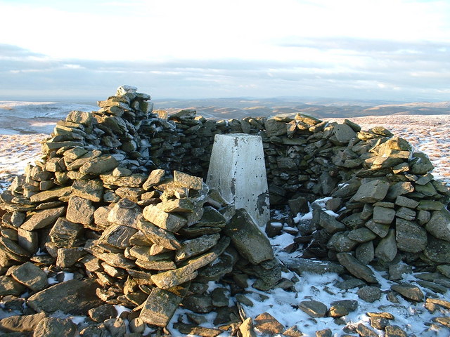
Pen y Garn

Pen y Garn is a mountain in the Cambrian Mountains, Mid Wales standing at 611 metres above sea level. Pen y Garn tops a 500–600 m high plateau, which includes...

Llan Ddu Fawr

Llan Ddu Fawr or Waun Claerddu is a hill located in Ceredigion, Wales, at 594 metres (1,949 ft) above sea level. It is located about 10 miles south of...

Nearby Amenities

Located within 500m of 52.35086,-3.781635
Source: npe
Lat/Long: 52.3495096/-3.7832444
Source: npe
Lat/Long: 52.3489542/-3.7816043
Source: npe
Lat/Long: 52.348409/-3.7798636
Source: npe
Lat/Long: 52.3479232/-3.7772437
Cwm Ystwyth
Is In: Ceredigion, Wales, UK
Name Cy: Cwm Ystwyth
Place: hamlet
Wikidata: Q5197262
Lat/Long: 52.3511615/-3.7788116
Place: farm
Lat/Long: 52.3487243/-3.7829642
Telephone
Booth: K6
Covered: booth
Man Made: telephone_box
Lat/Long: 52.3509593/-3.7795259
The data included in this document is from www.openstreetmap.org. The data is made available under ODbL.

Have you been to Cwmystwyth?

Leave your review of Cwmystwyth below (or comments, questions and feedback).