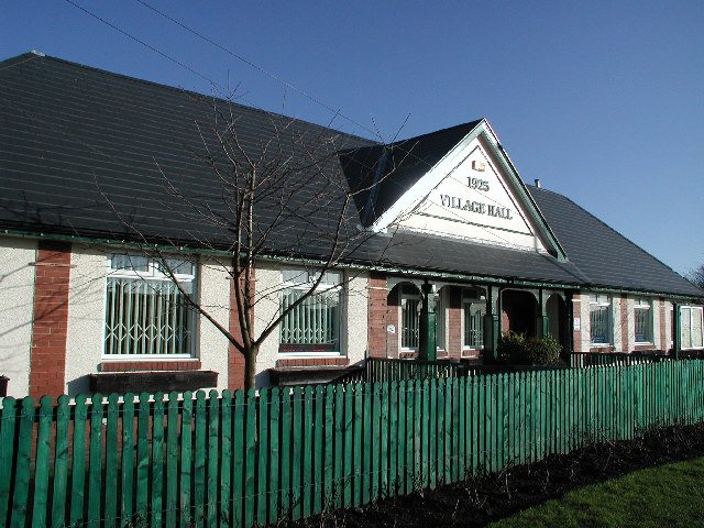
Black Wood

Wood, Forest in Durham

England

Black Wood

Humberhill Lane, Dunleyford House Crossroads
Humberhill Lane, Dunleyford House Crossroads Credit: Mick Garratt

Black Wood is a picturesque forest located in County Durham, England. Spanning approximately 100 acres, it is nestled within the stunning landscape of the Durham Dales and is part of the North Pennines Area of Outstanding Natural Beauty. The forest is characterized by dense, dark foliage, which gives it its name.

The woodland is primarily composed of a mix of native tree species, such as oak, birch, and beech, which create a diverse and vibrant ecosystem. The forest floor is blanketed with a variety of wildflowers, ferns, and mosses, adding to its natural beauty.

Black Wood offers visitors a tranquil and serene environment, perfect for leisurely walks and exploring nature. The well-maintained network of footpaths and trails allows visitors to navigate through the forest, taking in the sights and sounds of the surrounding wildlife. It is not uncommon to spot various bird species, including woodpeckers and owls, as well as small mammals like squirrels and rabbits.

The forest is a haven for nature enthusiasts and photographers, who are drawn to its unique and enchanting atmosphere. It also provides a valuable habitat for many protected species, contributing to the conservation efforts of the region.

Black Wood is easily accessible, located just a short distance from the village of Blanchland. Its natural charm and serene ambiance make it a popular destination for both locals and tourists seeking a peaceful retreat in the heart of the Durham countryside.

If you have any feedback on the listing, please let us know in the comments section below.

Black Wood Images

Images are sourced within 2km of 54.837877/-1.7879275 or Grid Reference NZ1349. Thanks to Geograph Open Source API. All images are credited.

Humberhill Lane, Dunleyford House Crossroads
Public Bridleway, Hurbuck Cottages Part of the Lanchester Valley Walk and National Cycleway No. 14
Public Bridleway, Hurbuck Cottages
Part of the Lanchester Valley Walk and National Cycleway No. 14
Grazing and Farm Machinery, Newbiggin Farm
Lizards Fish Ponds
Lizards Fish Ponds
Former Railway Building, Lizards Now used as a garden shed
Former Railway Building, Lizards
Now used as a garden shed
Disused Railway Bridge, Lanchester Valley Walk The grid line passes diagonally through the bridge which seems to have been built purely for farming purposes.
Disused Railway Bridge, Lanchester Valley Walk
The grid line passes diagonally through the bridge which seems to have been built purely for farming purposes.
Farmland, Smallhope Burn Taken from the embankment built to enable the railway to cross Smallhope Burn this view is looking west.
Farmland, Smallhope Burn
Taken from the embankment built to enable the railway to cross Smallhope Burn this view is looking west.
Lund's Lane looking towards Iveston village
Delves Lane road sign Road sign, road and housing at south end of village
Delves Lane road sign
Road sign, road and housing at south end of village
Farm buildings at Little Greencroft Burnhope mast in background
Farm buildings at Little Greencroft
Burnhope mast in background
Fields on a frosty morning Low Castle Dene area looking towards High Woodside
Fields on a frosty morning
Low Castle Dene area looking towards High Woodside
The old drive to Woodlands Park. These stone posts mark the old driveway to a large country house but this route is now rarely used.
The old drive to Woodlands Park.
These stone posts mark the old driveway to a large country house but this route is now rarely used.
Sheep at Dunleyford Crossroads. Not much winter grazing here!
Sheep at Dunleyford Crossroads.
Not much winter grazing here!
Track towards Greencroft Park
Hurbuck Farm
Hurbuck Farm
Stockerley Lane junction with Woodside Bank Stockerley Lane leads to Hurbuck Cottages and Delves - Woodside Bank runs into Leadgate.
Stockerley Lane junction with Woodside Bank
Stockerley Lane leads to Hurbuck Cottages and Delves - Woodside Bank runs into Leadgate.
Not long after sunrise, winter solstice Taken at 08.43
Right turn to Stockerley Lane from Woodside Bank on the first day of winter 2009. For a reverse view, taken a few months earlier, see <a href="https://www.geograph.org.uk/photo/1537886">NZ1449 : Stockerley Lane junction with Woodside Bank</a>
Not long after sunrise, winter solstice
Taken at 08.43 Right turn to Stockerley Lane from Woodside Bank on the first day of winter 2009. For a reverse view, taken a few months earlier, see NZ1449 : Stockerley Lane junction with Woodside Bank
View from Greenways, Delves, Consett
Show me another place!

Black Wood is located at Grid Ref: NZ1349 (Lat: 54.837877, Lng: -1.7879275)

Unitary Authority: County Durham

Police Authority: Durham

What 3 Words

///passwords.jumpy.household. Near Consett, Co. Durham

Nearby Locations

Castle Hill Black Wood

Related Wikis

Delves Lane

Delves Lane is a small village to the south of Consett, County Durham, England. The housing in the area was built as a suburb of Consett, historically...

Knitsley railway station

Knitsley railway station served the hamlet of Knitsley, County Durham, England from 1862 to 1939 on the Lanchester Valley Railway. == History == The station...

Knitsley

Knitsley is a hamlet in and former civil parish, now in the parish of Healeyfield, in the County Durham district, in the ceremonial county of Durham, England...

Newbiggin, Lanchester

Newbiggin is a farm in the civil parish of Lanchester, in the County Durham district, in the ceremonial county of Durham, England. It is situated 2 kilometres...

Crook Hall

Crook Hall, sited near Lanchester, County Durham, some 8 miles (13 km) north west of the city of Durham, was the seat of the Baker family and one of two...

Stony Heap

Stony Heap is a hamlet in County Durham, in England. It is situated between Leadgate and Annfield Plain. There used to be 6 houses and 2 farms plus the...

Crookhall

Crookhall is a village in County Durham, in England. It is situated between Consett and Delves Lane. It is named after, and intimately connected to, Crook...

Consett A.F.C.

Consett Association Football Club is a football club based in Consett in County Durham, England. They are currently members of the Northern Premier League...

Nearby Amenities

Located within 500m of 54.837877,-1.7879275
Bus Stop
High Woodside Farm
Naptan AtcoCode: 13001763D
Naptan Bearing: SE
Naptan CommonName: High Woodside Farm
Naptan Indicator: south east bound
Naptan Landmark: Landmark not known
Naptan NaptanCode: durajgtg
Naptan Notes: On A691 to NW of entrance to High Woodside Farm
Naptan Street: A691
Naptan Verified: no
Source: naptan_import
Lat/Long: 54.8406919/-1.7856023
Bus Stop
High Woodside Farm
Naptan AtcoCode: 13001763H
Naptan Bearing: NW
Naptan CommonName: High Woodside Farm
Naptan Indicator: north west bound
Naptan Landmark: Landmark not known
Naptan NaptanCode: durajgtj
Naptan Notes: On A691 opposite to NW of track entrance to High Woodside Farm
Naptan Street: A691
Naptan Verified: no
Source: naptan_import
Lat/Long: 54.8406111/-1.785665
Bus Stop
Pit
Naptan AtcoCode: 13001779B
Naptan Bearing: NE
Naptan CommonName: Pit
Naptan Indicator: north east bound
Naptan Landmark: Landmark not known
Naptan NaptanCode: durajmgw
Naptan Notes: Stockerley Lane- North East of Stockerley Burn- Lanchester
Naptan Street: Stockerley Lane
Naptan Verified: no
Source: naptan_import
Lat/Long: 54.8352729/-1.7855843
Bus Stop
Pit
Naptan AtcoCode: 13001779F
Naptan Bearing: SW
Naptan CommonName: Pit
Naptan Indicator: south west bound
Naptan Landmark: Landmark not known
Naptan NaptanCode: durajmja
Naptan Notes: Stockerley Lane- North East of Stockerley Burn- Lanchester
Naptan Street: Stockerley Lane
Naptan Verified: no
Source: naptan_import
Lat/Long: 54.8352098/-1.7854912
Bus Stop
Road End
Naptan AtcoCode: 13001780B
Naptan Bearing: NE
Naptan CommonName: Road End
Naptan Indicator: north east bound
Naptan Landmark: Landmark not known
Naptan NaptanCode: durajmjd
Naptan Notes: Stockerly Lane- At Junction With Consett Road (A691)- Lanchester
Naptan Street: Stockerley Lane
Naptan Verified: no
Source: naptan_import
Lat/Long: 54.8385999/-1.7816429
Bus Stop
Road End
Naptan AtcoCode: 13001780F
Naptan Bearing: SW
Naptan CommonName: Road End
Naptan Indicator: south west bound
Naptan Landmark: Landmark not known
Naptan NaptanCode: durajmjg
Naptan Notes: Stockerly Lane- At Junction With Consett Road (A691)- Lanchester
Naptan Street: Stockerley Lane
Naptan Verified: no
Source: naptan_import
Lat/Long: 54.8385457/-1.7814875
High Woodside Farm
Place: farm
Source Name: OS_OpenData_StreetView
Lat/Long: 54.8418593/-1.7848089
Power: pole
Lat/Long: 54.8345238/-1.7877755
Power: pole
Lat/Long: 54.8343268/-1.7869735
Power: pole
Lat/Long: 54.8339715/-1.7863163
Power: pole
Lat/Long: 54.8335969/-1.7856042
The data included in this document is from www.openstreetmap.org. The data is made available under ODbL.

Have you been to Black Wood?

Leave your review of Black Wood below (or comments, questions and feedback).