Black Plantation

Wood, Forest in Yorkshire Harrogate

England

Black Plantation

Stile at Near Comb Hill The large stile at Near Comb Hill close to Thruscross Reservoir, the Grouse Butts can be seen in the middle distance.
Stile at Near Comb Hill Credit: Mick Melvin

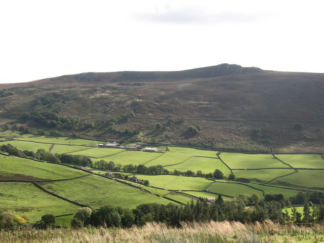
Black Plantation is a woodland area located in the county of Yorkshire, England. Situated in the region known as the Yorkshire Dales, Black Plantation is a part of the larger forested area that covers the landscape. The plantation is nestled within a scenic and picturesque setting, surrounded by rolling hills and lush greenery.

The woodland itself is predominantly composed of deciduous trees, including oak, beech, and ash. These trees provide a dense canopy, casting shadows on the forest floor and creating a serene and tranquil atmosphere. The undergrowth is made up of various shrubs and ferns, adding to the biodiversity of the plantation.

Black Plantation is home to a diverse range of wildlife. Visitors may have the opportunity to spot an array of bird species, such as woodpeckers, owls, and various songbirds. The woodland also provides habitat for small mammals like squirrels, rabbits, and hedgehogs.

The plantation offers a network of well-maintained walking trails, allowing visitors to explore the area and enjoy the natural beauty it has to offer. These trails provide access to stunning viewpoints, allowing visitors to take in the breathtaking vistas of the surrounding countryside.

Black Plantation is not only a haven for nature enthusiasts but also serves as an important ecological site. It contributes to the conservation of local flora and fauna, helping to maintain the delicate balance of the ecosystem.

Overall, Black Plantation in Yorkshire is a captivating woodland area that offers visitors the chance to immerse themselves in the beauty of nature and experience the tranquility of the Yorkshire Dales.

If you have any feedback on the listing, please let us know in the comments section below.

Black Plantation Images

Images are sourced within 2km of 54.039366/-1.7996119 or Grid Reference SE1360. Thanks to Geograph Open Source API. All images are credited.

Stile at Near Comb Hill The large stile at Near Comb Hill close to Thruscross Reservoir, the Grouse Butts can be seen in the middle distance.
Stile at Near Comb Hill
The large stile at Near Comb Hill close to Thruscross Reservoir, the Grouse Butts can be seen in the middle distance.
Footbridge over River Washburn The concrete footbridge across the River Washburn erected by Yorkshire Water, who are to be commended for the improved access which they have brought to the area.
Footbridge over River Washburn
The concrete footbridge across the River Washburn erected by Yorkshire Water, who are to be commended for the improved access which they have brought to the area.
Duke's Hill A dilapidated barn stands in a field at the top of Duke's Hill in the Washburn Valley.
Duke's Hill
A dilapidated barn stands in a field at the top of Duke's Hill in the Washburn Valley.
Foulgate Bank
Foulgate Bank
Red Gate At the bend in Hoodstorth Lane,
this track heads up onto open moorland.
Red Gate
At the bend in Hoodstorth Lane, this track heads up onto open moorland.
Footbridge 'over'  River Washburn Heavy rainfall earlier in the month was probably responsible for this.
Crossing the river was challenging!
Footbridge 'over' River Washburn
Heavy rainfall earlier in the month was probably responsible for this. Crossing the river was challenging!
River Washburn, looking upstream
River Washburn flowing south east into Thruscross Reservoir
Reopened and repaired footpath by River Washburn
Upper Washburn Valley This looks north west along the upper reaches of the River Washburn. The photograph was taken from the footbridge above the trees that surrounds Thruscross Reservoir.
Upper Washburn Valley
This looks north west along the upper reaches of the River Washburn. The photograph was taken from the footbridge above the trees that surrounds Thruscross Reservoir.
On Roundell's Allotment Drainage channel on this expanse of wilderness to the north east of Thruscross Reservoir.
On Roundell's Allotment
Drainage channel on this expanse of wilderness to the north east of Thruscross Reservoir.
The Forest Road at Red Gate The eastern end of an old track across the moors from Appletreewick. It is  known as the Forest Road due to its use in the past as a route within the old Forest of Knaresborough, linking Wharfedale with the Washburn valley, Nidderdale, Ripon and Knaresborough.
The Forest Road at Red Gate
The eastern end of an old track across the moors from Appletreewick. It is known as the Forest Road due to its use in the past as a route within the old Forest of Knaresborough, linking Wharfedale with the Washburn valley, Nidderdale, Ripon and Knaresborough.
Old quarry workings, Hey Slack The 19th century maps of the area show this as a sandstone quarry, but the workings were shallow and there is little sign of exposed rock. The same map shows a range of buildings close by [right hand edge of photo], but these have also vanished, leaving just some traces in the field boundary walls.
Old quarry workings, Hey Slack
The 19th century maps of the area show this as a sandstone quarry, but the workings were shallow and there is little sign of exposed rock. The same map shows a range of buildings close by [right hand edge of photo], but these have also vanished, leaving just some traces in the field boundary walls.
Hey Slack Allotment Access land on the edge of heather moorland near the head of the River Washburn.
Hey Slack Allotment
Access land on the edge of heather moorland near the head of the River Washburn.
Rock outcrop, Roundell's Allotment There are many small rock outcrops on the moors either side of the Washburn Valley, too many to be individually named.  This particular one is at the top of a steep climb out of the valley on a permissive footpath.  The term 'Allotment' in the placename shows an earlier usage of the word.
Rock outcrop, Roundell's Allotment
There are many small rock outcrops on the moors either side of the Washburn Valley, too many to be individually named. This particular one is at the top of a steep climb out of the valley on a permissive footpath. The term 'Allotment' in the placename shows an earlier usage of the word.
Bridge over the Washburn Concrete bridge carrying a minor road over the Washburn, this being the highest bridging point.
Bridge over the Washburn
Concrete bridge carrying a minor road over the Washburn, this being the highest bridging point.
The Washburn valley Looking downstream along the River Washburn with Libishaw Hill to the left.
The Washburn valley
Looking downstream along the River Washburn with Libishaw Hill to the left.
The River Washburn The Washburn begins its course less than 4 miles upstream from this point on the boggy ground of Craven Moor. Downstream the water soon reaches Thruscross Reservoir, the first of four along the river's course.
The River Washburn
The Washburn begins its course less than 4 miles upstream from this point on the boggy ground of Craven Moor. Downstream the water soon reaches Thruscross Reservoir, the first of four along the river's course.
Show me another place!

Black Plantation is located at Grid Ref: SE1360 (Lat: 54.039366, Lng: -1.7996119)

Division: West Riding

Administrative County: North Yorkshire

District: Harrogate

Police Authority: North Yorkshire

What 3 Words

///totals.probe.growl. Near Pateley Bridge, North Yorkshire

Related Wikis

Thruscross

Thruscross is a small settlement and civil parish in the Harrogate district of North Yorkshire, England. It lies in the Washburn Valley, 11 miles (18...

Thruscross Reservoir

Thruscross Reservoir is the northernmost of four reservoirs in the Washburn valley, lying north of Otley and west of Harrogate in North Yorkshire, England...

Greenhow

Greenhow is a village in North Yorkshire, England, often referred to as Greenhow Hill. The term how derives from the Old Norse word haugr meaning a hill...

Thornthwaite, North Yorkshire

Thornthwaite is a small village in the Harrogate district of North Yorkshire, England. It lies in the valley of Padside Beck, a side valley on the south...

Bewerley

Bewerley is a village and civil parish in the Harrogate district of North Yorkshire, England, about twelve miles west of Ripon. The parish includes the...

Kex Gill Bypass

The Kex Gill Bypass is a future stretch of A-road across Kex Gill Moor to Blubberhouses in North Yorkshire, England. The route is part of the A59 road...

Stump Cross Caverns

Stump Cross Caverns is a limestone cave system between Wharfedale and Nidderdale in North Yorkshire, England. == Geography == The caverns at Stump Cross...

Simon's Seat

Simon's Seat is a peak in the Yorkshire Dales in northern England. It is a prominent outcrop of millstone grit on the eastern side of Wharfedale. Although...

Nearby Amenities

Located within 500m of 54.039366,-1.7996119
Hoodstorth Allotment
Natural: fell
Source: OS 1:25k
Lat/Long: 54.0363652/-1.8007119
smelting mill
Archaeological Site: mineral_extraction
Description: In ruins in mid-C19th. Possibly related to "Old Pit" to south. Assumed to be a lead smelter but needs evidence
Historic: industrial
Mineral: lead
Note: exact location uncertain. Not visible on aerial imagery
Source: OS sheet 152,publ 1854
Lat/Long: 54.0394697/-1.8055508
Archaeological Site: mineral_extraction
Historic: mine_shaft
Mineral: unknown
Note: not verified but there is a pit marked just to NW
Source: Bing
Lat/Long: 54.0353996/-1.8031797
The data included in this document is from www.openstreetmap.org. The data is made available under ODbL.

Have you been to Black Plantation?

Leave your review of Black Plantation below (or comments, questions and feedback).