Sutcliffe Wood

Wood, Forest in Yorkshire

England

Sutcliffe Wood

The former Salvation Army Hall revealed The play gym has moved out and its boards taken down, revealing the original frontage of the building with its inscription. See <a href="https://www.geograph.org.uk/photo/366034">SE1422 : Children's play gym, Bethel Street, Brighouse</a> and <a href="https://www.geograph.org.uk/photo/366042">SE1422 : Foundation stones, Bethel Street, Brighouse</a>.
The former Salvation Army Hall revealed Credit: Humphrey Bolton

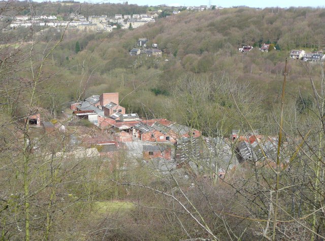
Sutcliffe Wood is a picturesque woodland located in the county of Yorkshire, England. It is nestled in the heart of the region, near the village of Sutcliffe, and covers an area of approximately 100 acres. The wood is part of the wider Nidderdale Area of Outstanding Natural Beauty, known for its stunning landscapes and diverse wildlife.

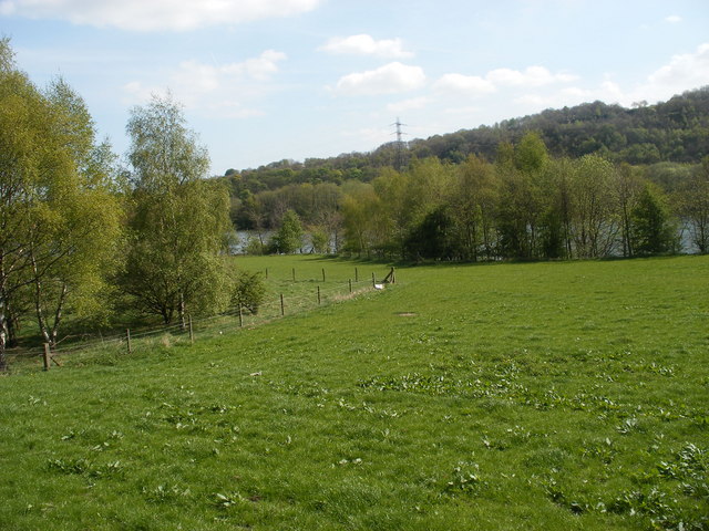
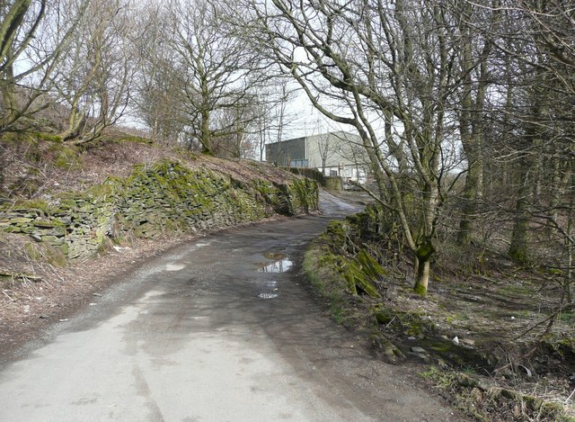
Sutcliffe Wood is predominantly made up of broadleaf trees such as oak, beech, and birch, which create a dense canopy providing shade and shelter for various flora and fauna. The forest floor is adorned with carpets of bluebells and wild garlic during the spring months, adding a vibrant burst of color to the woodland.

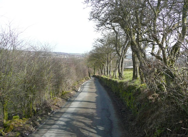
The wood is crisscrossed by a network of well-maintained footpaths, allowing visitors to explore its beauty and immerse themselves in nature. These trails offer stunning views of the surrounding countryside, with glimpses of rolling hills and meandering streams. It is a popular spot for walkers, joggers, and nature enthusiasts alike.

The woodland is home to a rich variety of wildlife, including deer, badgers, foxes, and a multitude of bird species. It provides a habitat for rare and endangered species, contributing to the conservation efforts of the region. The tranquil atmosphere and abundance of wildlife make Sutcliffe Wood a haven for birdwatchers and wildlife photographers.

Overall, Sutcliffe Wood offers a tranquil and enchanting experience for nature lovers, with its beautiful woodland, diverse wildlife, and stunning vistas. It is a place where visitors can connect with nature and enjoy the soothing sounds and scents of the forest.

If you have any feedback on the listing, please let us know in the comments section below.

Sutcliffe Wood Images

Images are sourced within 2km of 53.713364/-1.803026 or Grid Reference SE1324. Thanks to Geograph Open Source API. All images are credited.

The former Salvation Army Hall revealed The play gym has moved out and its boards taken down, revealing the original frontage of the building with its inscription. See <a href="https://www.geograph.org.uk/photo/366034">SE1422 : Children's play gym, Bethel Street, Brighouse</a> and <a href="https://www.geograph.org.uk/photo/366042">SE1422 : Foundation stones, Bethel Street, Brighouse</a>.
The former Salvation Army Hall revealed
The play gym has moved out and its boards taken down, revealing the original frontage of the building with its inscription. See SE1422 : Children's play gym, Bethel Street, Brighouse and SE1422 : Foundation stones, Bethel Street, Brighouse.
Calder Valley near Cromwell Bottom
New house, Slead Avenue, Brighouse
Leeds Road, Hipperholme
Whitley Lane, Southowram A cul-de-sac for vehicles.
Whitley Lane, Southowram
A cul-de-sac for vehicles.
Sunny Bank Lane, Southowram A public footpath, Brighouse 030.
Sunny Bank Lane, Southowram
A public footpath, Brighouse 030.
Sunny Bank Wood, Southowram Taken from Walter Clough Lane. A typical long, narrow wood along a clough (small V-shaped valley).
Sunny Bank Wood, Southowram
Taken from Walter Clough Lane. A typical long, narrow wood along a clough (small V-shaped valley).
Footpath gate near Sunny Bank Lane, Southowram The upright stone was presumably the centre of the original stile.
Footpath gate near Sunny Bank Lane, Southowram
The upright stone was presumably the centre of the original stile.
Brighouse Footpath 032, Southowram A narrow fenced path.
Brighouse Footpath 032, Southowram
A narrow fenced path.
Sunny Bank Lane, Southowram Brighouse Bridleway 034.
Sunny Bank Lane, Southowram
Brighouse Bridleway 034.
Walter Clough Lane, Southowram Evidently a public highway, as public footpaths start along it. However the first section is Brighouse Footpath 029, which here goes off to the right.
Walter Clough Lane, Southowram
Evidently a public highway, as public footpaths start along it. However the first section is Brighouse Footpath 029, which here goes off to the right.
Stile on Brighouse Footpath 034, Southowram Beyond the stile the path is somewhat overgrown, and a detour along the edge of the field is necessary.
Stile on Brighouse Footpath 034, Southowram
Beyond the stile the path is somewhat overgrown, and a detour along the edge of the field is necessary.
Sunny Bank Farm, Southowram Taken from Walter Clough Lane.
Sunny Bank Farm, Southowram
Taken from Walter Clough Lane.
Electricity sub-station in Hipperholme Fireclay Works Seen from Brighouse Footpath 034.
Electricity sub-station in Hipperholme Fireclay Works
Seen from Brighouse Footpath 034.
Stile on Brighouse Footpath 034, Southowram This leads out of the woodland next to the disused Hipperholme Fireclay Works into the fields below Sunny Bank Farm.
Stile on Brighouse Footpath 034, Southowram
This leads out of the woodland next to the disused Hipperholme Fireclay Works into the fields below Sunny Bank Farm.
Allen's Fireclay Works, Southowram So named on the 1930s six-inch map, but also called Hipperholme Works. This works was established by Henry Victor Allen when he took over the Halifax Glazed Brick Works in the Walterclough valley. He converted the works to manufacture refractory bricks. Their Selfrac refractory bricks were world famous. The bricks were carried by narrow-gauge railway up the valley to the sidings at Hipperholme station.  The bricks were made with the lettering 'Hipperholme (from <span class="nowrap"><a title="http://www.penmorfa.com/bricks/england3.html" rel="nofollow ugc noopener" href="http://www.penmorfa.com/bricks/england3.html">Link</a><img style="margin-left:2px;" alt="External link" title="External link - shift click to open in new window" src="https://s1.geograph.org.uk/img/external.png" width="10" height="10"/></span> ). Seen from Walter Clough Lane.
Allen's Fireclay Works, Southowram
So named on the 1930s six-inch map, but also called Hipperholme Works. This works was established by Henry Victor Allen when he took over the Halifax Glazed Brick Works in the Walterclough valley. He converted the works to manufacture refractory bricks. Their Selfrac refractory bricks were world famous. The bricks were carried by narrow-gauge railway up the valley to the sidings at Hipperholme station. The bricks were made with the lettering 'Hipperholme (from LinkExternal link ). Seen from Walter Clough Lane.
Allen's Fireclay Works, Southowram The circular footings  perhaps mark the position of kilns. Surprisingly Brighouse Footpath 139 goes through the site.
Allen's Fireclay Works, Southowram
The circular footings perhaps mark the position of kilns. Surprisingly Brighouse Footpath 139 goes through the site.
Buildings in Allen's Fireclay Works, Southowram This is Brighouse Footpath 139, which passes through the site.
Buildings in Allen's Fireclay Works, Southowram
This is Brighouse Footpath 139, which passes through the site.
Show me another place!

Sutcliffe Wood is located at Grid Ref: SE1324 (Lat: 53.713364, Lng: -1.803026)

Division: West Riding

Unitary Authority: Calderdale

Police Authority: West Yorkshire

What 3 Words

///email.light.closer. Near Brighouse, West Yorkshire

Nearby Locations

Sutcliffe Wood Hove Edge

Related Wikis

Brighouse High School

Brighouse High School (and Sixth Form) is an academy school in Brighouse, West Yorkshire, England. == Admissions == It has approximately 1,400 students...

Halifax F.C. Women

Halifax FC Women is a women's football team in England founded in 2013. They play in the FA Women's National League North (tier 3) following their successful...

Brighouse Town F.C.

Brighouse Town Football Club is a football club based in Brighouse, West Yorkshire, England. They are currently members of the Northern Premier League...

Brighouse

Brighouse is a town within the metropolitan borough of Calderdale, in West Yorkshire, England. Historically within the West Riding of Yorkshire, it is...

Nearby Amenities

Located within 500m of 53.713364,-1.803026
Hove Edge
Place: suburb
Source: npe
Lat/Long: 53.7143006/-1.8004302
Bus Stop
Upper Green Lane Finkil Street
Local Ref: 45021274
Naptan AtcoCode: 450021274
Naptan Bearing: W
Naptan CommonName: Upper Green Lane Finkil Street
Naptan Crossing: Finkil Street
Naptan Indicator: Stop 45021274
Naptan Notes: OSR taken place 171005
Naptan PlusbusZoneRef: LEEDS
Naptan ShortCommonName: Finkil Street
Naptan Street: Upper Green Lane
Naptan Verified: no
Source: naptan_import
Lat/Long: 53.7151525/-1.7974279
Bus Stop
Upper Green Lane Spout House Lane
Bench: no
Bin: no
Lit: no
Local Ref: 45021275
Naptan AtcoCode: 450021275
Naptan Bearing: E
Naptan CommonName: Upper Green Lane Spout House Lane
Naptan Crossing: Spout House Lane
Naptan Indicator: Stop 45021275
Naptan Notes: OSR taken place 201005
Naptan PlusbusZoneRef: LEEDS
Naptan ShortCommonName: Spout House Lane
Naptan Street: Upper Green Lane
Naptan Verified: no
Shelter: no
Source: naptan_import
Tactile Paving: no
Lat/Long: 53.7147995/-1.8012783
Bus Stop
Upper Green Lane Spout House Lane
Local Ref: 45021276
Naptan AtcoCode: 450021276
Naptan Bearing: W
Naptan CommonName: Upper Green Lane Spout House Lane
Naptan Crossing: Spout House Lane
Naptan Indicator: Stop 45021276
Naptan Notes: OSR taken place 201005
Naptan PlusbusZoneRef: LEEDS
Naptan ShortCommonName: Spout House Lane
Naptan Street: Upper Green Lane
Naptan Verified: no
Source: naptan_import
Lat/Long: 53.7147012/-1.8016273
Bus Stop
Halifax Road Pond Farm Drive
Kerb: yes
Local Ref: 45021286
Naptan AtcoCode: 450021286
Naptan Bearing: SE
Naptan CommonName: Halifax Road Pond Farm Drive
Naptan Crossing: Pond Farm Drive
Naptan Indicator: Stop 45021286
Naptan PlusbusZoneRef: LEEDS
Naptan ShortCommonName: Pond Farm Drive
Naptan Street: Halifax Road
Naptan Verified: no
Shelter: yes
Source: naptan_import
Lat/Long: 53.7154103/-1.8038774
Bus Stop
Halifax Road Half House Lane
Local Ref: 45021287
Naptan AtcoCode: 450021287
Naptan Bearing: NW
Naptan CommonName: Halifax Road Half House Lane
Naptan Crossing: Half House Lane
Naptan Indicator: Stop 45021287
Naptan Landmark: Post Office
Naptan Notes: TT case to be fitted by contractor
Naptan PlusbusZoneRef: LEEDS
Naptan ShortCommonName: Half House Lane
Naptan Street: Halifax Road
Naptan Verified: no
Shelter: yes
Source: naptan_import
Lat/Long: 53.7150638/-1.8034893
Bus Stop
Halifax Road Yew Park
Local Ref: 45021288
Naptan AtcoCode: 450021288
Naptan Bearing: NW
Naptan CommonName: Halifax Road Yew Park
Naptan Crossing: Yew Park
Naptan Indicator: Stop 45021288
Naptan Notes: OSR taken place 201005
Naptan PlusbusZoneRef: LEEDS
Naptan ShortCommonName: Yew Park
Naptan Street: Halifax Road
Naptan Verified: no
Source: naptan_import
Lat/Long: 53.7135734/-1.7997526
Bus Stop
Halifax Road Yew Park
Local Ref: 45021289
Naptan AtcoCode: 450021289
Naptan Bearing: SE
Naptan CommonName: Halifax Road Yew Park
Naptan Crossing: Yew Park
Naptan Indicator: Stop 45021289
Naptan Notes: OSR taken place 201005
Naptan PlusbusZoneRef: LEEDS
Naptan ShortCommonName: Yew Park
Naptan Street: Halifax Road
Naptan Verified: no
Shelter: yes
Source: naptan_import
Lat/Long: 53.7136036/-1.7994161
Bus Stop
Halifax Road Maryville Avenue
Local Ref: 45021290
Naptan AtcoCode: 450021290
Naptan Bearing: NW
Naptan CommonName: Halifax Road Maryville Avenue
Naptan Crossing: Maryville Avenue
Naptan Indicator: Stop 45021290
Naptan Notes: OSR taken place 201005
Naptan PlusbusZoneRef: LEEDS
Naptan ShortCommonName: Maryville Avenue
Naptan Street: Halifax Road
Naptan Verified: no
Source: naptan_import
Lat/Long: 53.7125988/-1.7969568
Bus Stop
Halifax Road / Finkil Street
Local Ref: 45021291
Naptan AtcoCode: 450021291
Naptan Bearing: SE
Naptan CommonName: Halifax Road Finkil Street
Naptan Crossing: Finkil Street
Naptan Indicator: Stop 45021291
Naptan Notes: OSR taken place 201005
Naptan PlusbusZoneRef: LEEDS
Naptan ShortCommonName: Finkil Street
Naptan Street: Halifax Road
Shelter: no
Source: naptan_import
Timetable: yes
Towards: Brighouse
Lat/Long: 53.7125647/-1.7966472
School Services
Local Ref: 45025087
Naptan AtcoCode: 450025087
Naptan Bearing: E
Naptan BusStopType: CUS
Naptan CommonName: School Services
Naptan Crossing: Adj Finkil Street
Naptan Indicator: Stop 45025087
Naptan Landmark: Brighouse High School
Naptan PlusbusZoneRef: LEEDS
Naptan ShortCommonName: Brighouse High Sch
Naptan Street: Brighouse High School Grounds
Naptan Verified: no
Source: naptan_import
Lat/Long: 53.7131538/-1.7954527
Bus Stop
Upper Green Lane Finkil Street
Bench: no
Bin: no
Local Ref: 45025726
Naptan AtcoCode: 450025726
Naptan Bearing: E
Naptan CommonName: Upper Green Lane Finkil Street
Naptan Crossing: Finkil Street
Naptan Indicator: Stop 45025726
Naptan Notes: OSR taken place 171005
Naptan PlusbusZoneRef: LEEDS
Naptan ShortCommonName: Finkil Street
Naptan Street: Upper Green Lane
Naptan Verified: no
Shelter: no
Source: naptan_import
Tactile Paving: no
Lat/Long: 53.7152871/-1.7972757
Pub
The Dusty Miller
Addr City: Brighouse
Addr Country: GB
Addr Housenumber: 290
Addr Postcode: HD6 2PB
Addr Street: Halifax Road
Fhrs Id: 348112
Source Addr: FHRS Open Data
Lat/Long: 53.7152274/-1.8034761
Mini Roundabout
Direction: clockwise
Lat/Long: 53.7153885/-1.796662
Turning Circle
Lat/Long: 53.7159924/-1.8039396
Power: tower
Lat/Long: 53.7106691/-1.8078952
Power: tower
Lat/Long: 53.7095891/-1.8056984
The data included in this document is from www.openstreetmap.org. The data is made available under ODbL.

Have you been to Sutcliffe Wood?

Leave your review of Sutcliffe Wood below (or comments, questions and feedback).